
Where Flight Simulation Enthusiasts Gather from Around the World!
AVSIM Library - Search Results

| Category: Flight Simulator X - AFCAD Files | |
| CYLW - Kelowna International Airport / Kelowna, British Columbia, Canada |

|
Images related to this file:
File Description:
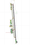
CYLW - Kelowna International Airport / Kelowna, British Columbia, Canada
This airport update was made with the latest version of ADE (Airport Design Editor) and made for FSX as a replacement for the stock (default) airport. I found that most stock airports in FSX lack a decent amount of character and realism and I've done my best to correct that wherever possible. I've made several additions to the airport which are listed below. All these enchancements are as close to the real airport as I can get with stock library objects. I've used satellite images, terminal photos and maps throughout the whole process so building locations are as accurate as possible. Happy landings in the beautiful Canada!
Features:
*Expanded parking apron
*Main terminal building with it's 8 gates some with jetways
*Seperate parking aprons for GA traffic
*Runway accurately expanded to 8,900ft to reflect 2008 runway project
*Hangar and other airport buildings added
*Airport vehicles and objects throughout the airport
*Main road in front of airport added with static vehicles
*Parking lots with static vehicles
*Airport fire station with fire trucks
*Static de-icing vehicles & runway plow
*2 Helipads
(Next up: CYWG Winnipeg Intl Airport)
| Filename: | CYLW__Kelowna_International_Airport__Kelowna_Briti.zip |
| License: | Freeware |
| Added: | 22nd July 2012, 15:13:45 |
| Downloads: | 1,128 |
| Author: | Jaison Diaz |
| Size: | 10.38 KB |
| Category: Flight Simulator X - Panels | |
| RDP AutoPilot Gauge and Mods for Just Flight HS748 |
|
Images related to this file:
File Description:

This project was born out of necessity to improve a very fun and an amazing aircraft, the Just Flight HS748. The objectives were to depict out of sight, hard to reach or sensitive information in an easier to read alternative. The lower panel is not based on any real panel or gauge, it was simply designed as so by me for easier reading of pertinent flight data. Whilst the top panel, is designed to replicate as close as possible, including how it functions, the 3D panel available on Just Flight HS748.
These include:
+ Autopilot and its various dependencies.
+ Elevator, Aileron and Rudder Trim, and their information.
+ NAV1 and NAV 2, with a DME (Only available for NAV1).
+ Flight Director Trim.
+ Outside and Total Air Temperature in Celsius and Fahrenheit.
+ Aircraft Heading and Vertical Speed ft/min.
+ Autopilot Vertical Speed numbers from the Autpilot VS wheel in Degrees and ft/min.
+ Pilot Input Heading and Course (Only for NAV1).
+ KOHLSMAN Setting, or Barometer in Millibars or inHg.
+ Left and Right Pitot switches.
+ GPS Icon for easier access.
+ Radios Icon.
+ Nav and GPS switch.
+ Indicated Aircraft Airspeed.
+ Indicated Altitude(Feets).
| Filename: | RDP_AutoPilot_Gauge_and_Mods_for_Just_Flight_HS748.zip |
| License: | Freeware |
| Added: | 26th February 2017, 08:07:59 |
| Downloads: | 406 |
| Author: | Ricardo de Paula |
| Size: | 1.31 MB |
| Category: Flight Simulator X - Scenery | |
| Bhutan Airports and Paro Valley |
|
Images related to this file:
File Description:
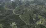
This project adds and updates all of the airports of Bhutan. Bathpalathang (VQBT) and Gelephu (VQGP) are added, Yongphulla (VQ10) is updated and recoded as VQTY, and Paro (VQPR) is fully updated to reflect current satellite imagery. These are all fully functioning AI airports as well. Special attention was given to the entire Paro Valley, and numerous road/river vectors were updated around Gelephu. Accurate coastlines, lakes, road and river data, as well as corrected landclass are provided based on the latest available satellite imagery. They are optimized to fit seamlessly with FTX Vector's roads/water, but they should be fully functional in all FSX configurations.
GA-encoded flight plans for the Buddha Air/Kathmandu charter are provided to enhance service to Paro. NASA SRTM Global 3 arc second terrain mesh is also included for all of Bhutan. Updates were created or rebuilt in a manner which carefully aligned airport data with current satellite imagery, when available. Scenery was created using Airport Design Editor X v1.61.5298, SBuilderX 3.13, and the FSX Object Placement Tool. Scenery objects were added and modified from stock FSX scenery to resemble as closely as possible the actual airports.
| Filename: | Bhutan_Airports_and_Paro_Valley.zip |
| License: | Freeware |
| Added: | 19th January 2015, 06:09:17 |
| Downloads: | 11,417 |
| Author: | Carlyle Sharpe |
| Size: | 21.4 MB |
| Category: Flight Simulator X - Scenery | |
| AI Ship Traffic for US East Coast V1 |
|
Images related to this file:
File Description:
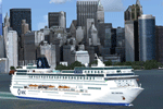
This package contains AI ship traffic files for the US East Coast to be used with my packages "63 AI Ships and AI Ship Traffic for Europe and South America" and "75 AI Ships and AI Ship Traffic". With the three packages installed you will have a total of 138 ships travelling along the US East Coast from Fort Lauderdale to the Gulf of St. Lawrence.
The ships visit among other places Fort Lauderdale, Freeport, Jacksonville, Savannah, Charleston, Wilmington, Norfolk, Baltimore, Philadelphia, New York, Boston, Portland, Providence, Halifax, Saint Pierre et Miquelon and more.
To make this package work you must first download and install in this sequence:
"63 AI Ships and AI Ship Traffic for Europe and South America",
"75 AI Ships and AI Ship Traffic", and
"Patch for 75 AI Ships and AI Ship Traffic" (If you install this patch you do not need the "Patch for 63 AI Ships and AI Ship Traffic")
This package has been developed with contributions from among others Jean-Pierre Fillion, Didier "Lagaffe" Puentes and "Robystar". I would like to thank these three as well as everybody who have encouraged and supported the project or participated in the beta testing.
| Filename: | AI_Ship_Traffic_for_US_East_Coast_V1.zip |
| License: | Freeware |
| Added: | 1st September 2013, 08:47:12 |
| Downloads: | 8,381 |
| Author: | Henrik Nielsen |
| Size: | 1.08 MB |
| Category: Flight Simulator X - Scenery | |
| HALA - Hawassa Intl. - Hawassa, Ethiopia |
|
Images related to this file:
File Description:
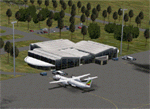
This project adds the booming city of Hawassa, Ethiopia, creates the new international airport (HALA), moves (and rebuilds) the downtown airport (recoded to HALX), and includes AI flight plans for the Ethiopian Airlines service that began April 2016. Tested in both the default FSX: Acceleration and with FTX Global/Vector, accurate coastlines, lakes, road data, and SRTMGL1 (30m) mesh, as well as corrected landclass are provided based on the latest available satellite imagery. The Hawassa International Airport was created using information from the current satellite footprint and the promotional video from Ethiopian Airports Enterprise (EAE). Although there is still very little published data on the airport, it is fully functional.
Updates were created or rebuilt in a manner which carefully aligns airport data with current satellite imagery. Scenery was created using Airport Design Editor X v1.70.6042, SBuilderX 3.13, and the FSX Object Placement Tool. Scenery objects were added and modified from stock FSX scenery to resemble as closely as possible the actual airports. The FSX apron lights included are from the set created by Jim Dhaenens. Thanks to Ron Blehm for bringing this part of the world to my attention.
| Filename: | HALA__Hawassa_Intl___Hawassa_Ethiopia.zip |
| License: | Freeware |
| Added: | 20th July 2016, 09:06:40 |
| Downloads: | 1,020 |
| Author: | Carlyle Sharpe |
| Size: | 10.41 MB |
| Category: Flight Simulator X - Scenery | |
| Aeroworks Railroad Valley 2013 |
|
Images related to this file:
File Description:
Railroad Valley is our oldest scenery project and by far the largest. It was originally released for FS2000 and version 2 was used in the Battle of the Airlines 2003 online race. It is a follow on to our series of fictional airports and surrounding areas that we call Flight Centers, such as our popular Malibu Flight Center 2. Included in the package is our centerpiece - Flight Center 3 at Echo Canyon and Flight Center 4 at Lunar Lake. Flight center 3 is our prime military headquarters, and functions as an aircraft manufacturing and flight test center all in one. It's much like a combined version of Edwards AFB and Palmdale Air Force Plant 42 in real life. Flight Center 4 is loosely based off of the High-technology Aerospace Warfare Center (or HAWC) from the earliest Dale Brown novels. The bases lie roughly 50 miles north of Area 51, Groom Lake, Nevada, and are just outside of the Nevada Test Site and the Nellis Air Force Range. In addition there are many other airports and flying locales too numerous to mention here. Full documentation contained within. Uses over 100 custom scenery macros specifically created for this release. Scenery and macros by Jason L. Terry. Additional Macros by Joshua B Nyhus.
| Filename: | Aeroworks_Railroad_Valley_2013.zip |
| License: | Freeware |
| Added: | 27th September 2013, 20:40:07 |
| Downloads: | 436 |
| Author: | Jason L. Terry |
| Size: | 29.71 MB |
| Category: Flight Simulator X - Scenery | |
| TLPC George F. L. Charles Airport Castries, Saint Lucia |
|
File Description:
George F. L. Charles Airport (TLPC) is a small airport in Saint Lucia, mostly serving the caribbean Islands. It is the airport that is situated in the north of the island in the capital city of Castries.
It serves quite a few regional airlines mainly operating turbo props like the dash8, ATR and smaller types, but has handled bigger types in the past such as MD82 (BWIA) and B722 (AMERIJET). Since stopped because of noise complaints. (SIGHS)
This is my first attempt at scenery design. I was motivated to build this scenery because I grew up near the airport and always enjoyed flying in there Whether in real or in the sim.
Since FSX, there`s been no scenery built for it and I could not stand the default scenery. So almost two years ago, not knowing a thing about scenery design and where to start, I embarked on this project. It is by no means perfect, but I think it is better than what is on offer. There are no custom ground textures cause I have not worked it out yet, maybe in a later update. The buildings where all made with Google Sketchup8 free version and converted with ModelConverterX and added to FSX with Instant Scenery 2. ENJOY.
| Filename: | TLPC_George_F_L_Charles_Airport_Castries_Saint_Lucia.zip |
| License: | Freeware |
| Added: | 14th April 2013, 13:01:54 |
| Downloads: | 1,696 |
| Author: | Finbar Lesmond |
| Size: | 13.12 MB |
| Category: Flight Simulator X - Scenery | |
| 80 AI Ships and AI Ship Traffic |
|
Images related to this file:
File Description:
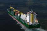
This package contains 80 new AI Ships including cruise ships, frigates, patrol vessels, LNG tankers, fishing boats, bulk carriers, and sail ships. Several of these have heli pads with hard surface and most have lights, small animations, and smoke and wake effects. This package also contains new AI shipping routes for most of the world, but in particular for the North American continent including Greenland and the Great Lakes. Ships visit among other places Toronto, Chicago, Duluth, Trois Rivieres, Vancouver, Valdez, Anchorage, Una Alaska, Boston, New York, Miami, Panama, Caracas, St.Thomas, St.Croix, Saint Martin, Natal, Fortaleza, Belem, Rio de Janeiro, Buenos Aires, Ushuaia, Los Angeles, San Francisco, Seattle, Singapore, Jakarta, Wenzhou, Arkhangelsk, Murmansk, Cork, Oslo, Bergen, Lagos, Dakar, the Galapagos, Antarctica, Nuuk, Sisimut, and many more.
This package will work in both P3D and FSX. It has been tested with several freeware and payware sceneries and default. This package requires prior installation of the other ship packages by Henrik Nielsen to achieve full benefit with the more the 520 ships included in the project to date. Models, effects, and textures by Knud Kristoffersen, Milton Shupe, Manfred Siedler, Jean-Pierre Fillion, Erwin Welker, Bernardo Barroso, and Henrik Nielsen.
| Filename: | 80_AI_Ships_and_AI_Ship_Traffic.zip |
| License: | Freeware |
| Added: | 28th June 2015, 01:44:59 |
| Downloads: | 5,428 |
| Author: | Henrik Nielsen |
| Size: | 101.4 MB |
| Category: Flight Simulator X - Scenery | |
| Iguassu Falls - Save The Planet |
|
Images related to this file:
File Description:
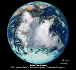
The Iguassu Falls, Itaipu Hydroelectric Power Plant, Foz do Iguassu City and Land Class Package for FSX
Save The Planet is my version of the Iguassu Falls, Itaipu Dam, bridges and landclass scenery for FSX.
Differently from my other version for MSFS 2004, I created a mesh of 5 meter resolution for Iguassu Falls area
to give me some idea how I could proceed. So, I decided to use on this addon
an image background avaliable at server (VirtualEarthSatellite). Thanks Microsoft.
Non-Airport Scenery - ICAO (SBFI). coming soon at www.Terra-Brasilis.org
Portuguese: Cataratas do Iguassu,
Spanish: Cataratas del Iguazu are waterfalls of the Iguassu River located on the border of the Brazilian state of Parana (in the Southern
Region) and the Argentinian Province of Misiones.
The Falls are shared between the Iguazu National Park (Argentina) and Iguacu
National Park (Brazil). The parks were designated UNESCO World Heritage Sites.
The Itaipu Hydroelectric Power Plant is located in the Parana River, in the stretch of the frontier between Brazil and Paraguay, 14 km north of the Friendship Bridge.
The area of the project extends from Foz do Iguassu, in Brazil, and Ciudad del Este, in Paraguay, in the south, up to Guaira (Brazil) and the Guaira Falls (Paraguay), in the north.
Enjoy FSX Iguassu Falls Scenery!
| Filename: | Iguassu_Falls__Save_The_Planet.zip |
| License: | Freeware |
| Added: | 9th December 2010, 01:57:00 |
| Downloads: | 2,848 |
| Author: | Cicero Costa |
| Size: | 31.71 MB |
| Category: Flight Simulator X - Scenery | |
| Gold Coast Airport (YBCG) |
|
File Description:
The Gold Coast Airport (formerly known as Coolangatta) is a busy international airport located some 100 ks south of Brisbane and 850 ks north of Sydney. This scenery contains and accurate depiction of the terminal, control tower, hangers and the very distinctive lighthouse at Coolangatta (with beacon) plus night lighting of the apron. In addition many buildings have been added to Coolangatta and Surfers some of which are original but many are stock buildings. The scenery has been reduced in complexity to attempt to be reasonably frame rate friendly. All models are GMAX or FSDS3.0. Extensive coastline changes has added beaches as far south as Byron Bay and the canal network behind Surfers Paradise, Bond Uni, Currumbin and Coolangatta. Recent upgrades of the airport to a 2500 metre runway have been reflected as well as a widened apron. Therefore it may look a little different from the current Google Earth image but it is accurate. The airport will now handle direct flights from Asia and typical planes landing might include Airbus 343 or similar wide bodied aircraft.
| Filename: | Gold_Coast_Airport_YBCG.zip |
| License: | Freeware |
| Added: | 12th July 2007, 15:08:44 |
| Downloads: | 6,175 |
| Author: | John Ross |
| Size: | 12.16 MB |


© 2001-2026 AVSIM Online
All Rights Reserved
Privacy Policy |