
Where Flight Simulation Enthusiasts Gather from Around the World!
AVSIM Library - Search Results

| Category: Flight Simulator X - Aircraft Repaints, Textures and Modifications | |
| Deer Valley Flying Club Curtiss Jenny JN4D |

|
Images related to this file:
File Description:

Works in both FSX and FS2004 - Aircraft: Curtiss Jenny JN4D Texture Set. Manufacturer Default FS2004 Microsoft aircraft
Livery: Deer Valley Flying Club or DVFC. Created by: Ford Tri-Motor Project Team. Web address: http://www.ford-tri-motor.net
Representing: DVFC or Deer Valley Flying Club - Now in their 11th year, Deer Valley Flying Club is dedicated to flight simulator enthusiasts with a focus more on General Aviation rather then Airline Operations - They are NOT a VA. This is one of over 50 NEW Curtiss Jenny texture sets now available for free at the Ford-Tri-Motor Project site. Accessable via the "Other Aircraft" button on the web site. http://www.ford-tri-motor.net or direct link http://www.ford-tri-motor.net/curtiss-jenny.htm The site also has a copy of the open source Microsoft Default aircraft + a 3 texture pack for Both FS2004 and FSX. Also 2 different Paint Kits available for those that want to experiment with their own repaints. And of course Over 50 other FREE repaints for your entertainment.
| Filename: | Deer_Valley_Flying_Club_Curtiss_Jenny_JN4D.zip |
| License: | Freeware, limited distribution |
| Added: | 22nd August 2014, 16:53:28 |
| Downloads: | 43 |
| Author: | Garry J. Smith and Edward C. Moore |
| Size: | 1.42 MB |
| Category: Flight Simulator X - AFCAD Files | |
| CYxs Prince Geroge - British Columbia, Canada |
|
File Description:
I have completely reconstructed CYXS using ADE (v1.40), Google Earth satellite images and current airport chart. Runways have been repositioned and runway 15/33 extended from 7400 ft to 11450 ft. ILS has been added to runway 33. Roads, parking areas and new buildings added. Aprons readjusted. Automated jetways added. Parking for AI aircraft and refueling truck added. Additional scenery objects have been added and to view these will require you to install additional files as described below. Airport views are from the roof of the control tower.
Latest News: YXS - The New Transpacific Logisitics Alternative
The Runway Expansion Project has transformed runway 15/33 from 7,400 ft. to 11,450 ft., complete with centre line (LED) lighting, dual ILS navigational systems and a dedicated de-icing refueling pad for wide body aircraft. Once completed, the Runway Expansion Project will allow the PGAA to market the airport as a new transpacific logistics alternative, providing carriers the opportunity to make Prince George a destination of choice for refueling and transshipment of cargo
| Filename: | CYxs_Prince_Geroge__British_Columbia_Canada.zip |
| License: | Freeware |
| Added: | 5th November 2009, 02:16:13 |
| Downloads: | 747 |
| Author: | Robert Catherall |
| Size: | 878.39 KB |
| Category: Flight Simulator X - Scenery | |
| FSX_MeSA_G08 |
|
File Description:
FSX Mesh South America Project:
This terrain mesh file is a part of a whole project covering all the Continent
of South America and some islands, divided in tiles identified in a map by its
column (letters) and rows (numbers).
Those files were multi-LOD compiled from 90m SRTM2 source data, reprocessed
with 3DEM to remove voids and spikes, providing a 76.4m (LOD9) horizontal
resolution topography intended for use only in FSX updated with SP1.
Although not well documented, to improve performance, the updated FSX loads DEM
files in threads and only the closer terrain (about 5-10 NM from the point of view)
is rendered in high detail, while at far distances FSX shows up its default low
resolution mesh, when there is not a third part terrain mesh compiled in all
others intermediate level of details (multi-LOD).
THIS FILE:
FSX_MeSA_G08 (Column G x Row 08)
covers the area inside the boundaries:
N = 22º 30' S; S = 28º 7.5' S;
W = 45º 0' W; E = 37º 30' W;
AUTHORS:
Hely Heck Junior - Magrao ( [email protected] )
and Jose Lobo ( [email protected] )
| Filename: | FSX_MeSA_G08.zip |
| License: | Freeware |
| Added: | 15th June 2007, 15:04:47 |
| Downloads: | 1,132 |
| Author: | Hely Heck Jr. and José Lôbo |
| Size: | 12 MB |
| Category: Flight Simulator X - Scenery | |
| FSX_MeSA_H04 |
|
File Description:
FSX Mesh South America Project:
This terrain mesh file is a part of a whole project covering all the Continent
of South America and some islands, divided in tiles identified in a map by its
column (letters) and rows (numbers).
Those files were multi-LOD compiled from 90m SRTM2 source data, reprocessed
with 3DEM to remove voids and spikes, providing a 76.4m (LOD9) horizontal
resolution topography intended for use only in FSX updated with SP1.
Although not well documented, to improve performance, the updated FSX loads DEM
files in threads and only the closer terrain (about 5-10 NM from the point of view)
is rendered in high detail, while at far distances FSX shows up its default low
resolution mesh, when there is not a third part terrain mesh compiled in all
others intermediate level of details (multi-LOD).
THIS FILE:
FSX_MeSA_H04 (Column H x Row 04)
covers the area inside the boundaries:
N = 0º 0' S; S = 5º 37.5' S;
W = 37º 30' W; E = 30º 0' W;
AUTHORS:
Hely Heck Junior - Magrao ( [email protected] )
and Jose Lobo ( [email protected] )
| Filename: | FSX_MeSA_H04.zip |
| License: | Freeware |
| Added: | 15th June 2007, 15:07:51 |
| Downloads: | 944 |
| Author: | Hely Heck Jr. and José Lôbo |
| Size: | 3.56 MB |
| Category: Flight Simulator X - Scenery | |
| FSX_MeSA_H05 |
|
File Description:
FSX Mesh South America Project:
This terrain mesh file is a part of a whole project covering all the Continent
of South America and some islands, divided in tiles identified in a map by its
column (letters) and rows (numbers).
Those files were multi-LOD compiled from 90m SRTM2 source data, reprocessed
with 3DEM to remove voids and spikes, providing a 76.4m (LOD9) horizontal
resolution topography intended for use only in FSX updated with SP1.
Although not well documented, to improve performance, the updated FSX loads DEM
files in threads and only the closer terrain (about 5-10 NM from the point of view)
is rendered in high detail, while at far distances FSX shows up its default low
resolution mesh, when there is not a third part terrain mesh compiled in all
others intermediate level of details (multi-LOD).
THIS FILE:
FSX_MeSA_H05 (Column H x Row 05)
covers the area inside the boundaries:
N = 5º 37.5' S; S = 11º 15' S;
W = 37º 30' W; E = 30º 0' W;
AUTHORS:
Hely Heck Junior - Magrao ( [email protected] )
and Jose Lobo ( [email protected] )
| Filename: | FSX_MeSA_H05.zip |
| License: | Freeware |
| Added: | 15th June 2007, 15:08:10 |
| Downloads: | 943 |
| Author: | Hely Heck Jr. and José Lôbo |
| Size: | 22.93 MB |
| Category: Flight Simulator X - Scenery | |
| FSX_MeSA_H06 |
|
File Description:
FSX Mesh South America Project:
This terrain mesh file is a part of a whole project covering all the Continent
of South America and some islands, divided in tiles identified in a map by its
column (letters) and rows (numbers).
Those files were multi-LOD compiled from 90m SRTM2 source data, reprocessed
with 3DEM to remove voids and spikes, providing a 76.4m (LOD9) horizontal
resolution topography intended for use only in FSX updated with SP1.
Although not well documented, to improve performance, the updated FSX loads DEM
files in threads and only the closer terrain (about 5-10 NM from the point of view)
is rendered in high detail, while at far distances FSX shows up its default low
resolution mesh, when there is not a third part terrain mesh compiled in all
others intermediate level of details (multi-LOD).
THIS FILE:
FSX_MeSA_H06 (Column H x Row 06)
covers the area inside the boundaries:
N = 11º 15' S; S = 16º 52.5' S;
W = 37º 30' W; E = 30º 0' W;
AUTHORS:
Hely Heck Junior - Magrao ( [email protected] )
and Jose Lobo ( [email protected] )
| Filename: | FSX_MeSA_H06.zip |
| License: | Freeware |
| Added: | 15th June 2007, 15:19:51 |
| Downloads: | 997 |
| Author: | Hely Heck Jr. and José Lôbo |
| Size: | 1.61 MB |
| Category: Flight Simulator X - Scenery | |
| Mesh South America / MeSA E03 |
|
File Description:
FSX Mesh South America Project:
This terrain mesh file is a part of a whole project covering all the Continent
of South America and some islands, divided in tiles identified in a map by its
column (letters) and rows (numbers).
Those files were multi-LOD compiled from 90m SRTM2 source data, reprocessed
with 3DEM to remove voids and spikes, providing a 76.4m (LOD9) horizontal
resolution topography intended for use only in FSX updated with SP1.
Although not well documented, to improve performance, the updated FSX loads DEM
files in threads and only the closer terrain (about 5-10 NM from the point of view)
is rendered in high detail, while at far distances FSX shows up its default low
resolution mesh, when there is not a third part terrain mesh compiled in all
others intermediate level of details (multi-LOD).
THIS FILE:
FSX_MeSA_E03 (Column E x Row 03)
covers the area inside the boundaries:
N = 5º 37,5' N; S = 0º 0' S;
W = 60º 0' W; E = 52º 30' W;
| Filename: | Mesh_South_America__MeSA_E03.zip |
| License: | Freeware |
| Added: | 13th June 2007, 21:41:26 |
| Downloads: | 1,255 |
| Author: | Hely Heck Jr. and José Lôbo |
| Size: | 83.82 MB |
| Category: Flight Simulator X - Scenery | |
| Branson Airport KBBG--New Airport, Scenery, and Flight Plans |
|
Images related to this file:
File Description:
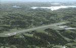
This project adds a new, detailed Branson Airport KBBG (Missouri) to FSX, which opened in May 2009, and is a privately developed commercial airport. The construction of the airport, which involved the flattening of several Ozark Mountains, is claimed to be the largest earthmoving project in Missouri history. As a result, the airport actually sits on a manmade plateau, surrounded by rolling hills. The airport uses the ICAO identifier BBG, however, the airlines use the IATA code BKG. The airport is served by AirTran, Frontier, and ExpressJet (Branson AirExpress), and is located in hilly terrain. Aircraft equipped with a terrain avoidance warning system may experience system activation on final approach. Birds are in the vicinity of the airport. AFCAD with sloping terrain created using Airport Design Editor X v1.47.07, and the hilltops were cleared and flattened and roads were added using SBuilderX 3.13. The terminal, hangar, FBO, and cars were added and modified from stock FSX scenery, using the FSX Object Tool, to resemble as closely as possible the actual airport.
| Filename: | Branson_Airport_KBBGNew_Airport_Scenery_and_Flight.zip |
| License: | Freeware |
| Added: | 5th August 2010, 01:08:33 |
| Downloads: | 2,004 |
| Author: | Carlyle Sharpe |
| Size: | 6.02 MB |
| Category: Flight Simulator X - Aircraft Repaints, Textures and Modifications | |
| FSX/P3D AirAsiaX (9M-XXV) Thomas Ruth A330-300 Texture |
|
Images related to this file:
File Description:

AirAsiaX (9M-XXV) Texture for the Thomas Ruth A330-300 model. This texture is a part of my project to attempt to re-texture the Thomas Ruth A330s with 4096*4096 HD Textures. Special thanks to Oniel Black for helping with the slats textures. Feel free to join the JetRepaintsSG group on Facebook for more of my repaint works! Installation instructions have been included in the file. Made by Muhammad Akmal Farhan, Requires the full model to be installed.
| Filename: | FSXP3D_AirAsiaX_9MXXV_Thomas_Ruth_A330300_Texture.zip |
| License: | Freeware |
| Added: | 14th June 2024, 13:45:08 |
| Downloads: | 64 |
| Author: | Muhammad Akmal Farhan |
| Size: | 17.6 MB |
| Category: Flight Simulator X - Aircraft Repaints, Textures and Modifications | |
| FSX/P3D Korean Air (HL8228) Thomas Ruth A330-200 Texture |
|
Images related to this file:
File Description:

Korean Air (HL8228) Texture for the Thomas Ruth A330-200 model. This texture is a part of my project to attempt to re-texture the Thomas Ruth A330s with 4096*4096 HD Textures. Special thanks to Oniel Black for helping with the slats textures. Feel free to join the JetRepaintsSG group on Facebook for more of my repaint works! Installation instructions have been included in the file. Made by Muhammad Akmal Farhan, Requires the full model to be installed.
| Filename: | FSXP3D_Korean_Air_HL8228_Thomas_Ruth_A330200_Textu.zip |
| License: | Freeware |
| Added: | 15th June 2024, 20:18:56 |
| Downloads: | 213 |
| Author: | Muhammad Akmal Farhan |
| Size: | 17.79 MB |


© 2001-2026 AVSIM Online
All Rights Reserved
Privacy Policy |