
Where Flight Simulation Enthusiasts Gather from Around the World!
AVSIM Library - Search Results

| Category: Flight Simulator X - Aircraft Repaints, Textures and Modifications | |
| Air Bagan ATR72-200 |

|
File Description:
ISDT ATR72-200 repaint for Air Bagan by Phyo Pyae Sone.
The airline was established in June 2004 and started operations on November 15, 2004.
Its first international service was flown from Yangon to Bangkok on 15 May 2007, and the second to Singapore from 7 September 2007.
Air Bagan fleet consist of 2 ATR42-320s,1 ATR72-212,1 ATR72-500,2 Fokker 100s and 1 Airbus A310-200 which is currently stored at RGN.
Air Bagan is currently operating average of 25 sectors daily serving 20 major domestic destinations from Yangon and 5 minor domestic destinations from MDL as well as twice a week regional service to Chiang Mai, Thailand.
It is the first domestic airline to offer Frequent Flyer Program,first domestic airline to use online reservation system and first domestic airline to business class and lounge facilities.
Please view readme file for installation.
| Filename: | Air_Bagan_ATR72200.zip |
| License: | Freeware |
| Added: | 14th December 2012, 09:41:38 |
| Downloads: | 192 |
| Author: | Phyo Pyae Sone |
| Size: | 6.39 MB |
| Category: Flight Simulator X - Scenery | |
| VYYY Yangon Intl Airport Mingaladon V3.0 |
|
File Description:
Yangon International Airport "MINGALADON" in Burma, Myanmar, will be able to accommodate bigger aircrafts and handle more passengers when work on extending its runway and upgrading its facilities is completed. The completion of the runway extension will enable Boeing 747 and Airbus 380 airplanes to use the airport. The work on extending the runway from 8100 feet to 11,200 feet began October 2004. FPS-friendly version 3.0 with already extended runway, taxiways and new taxisigns. First of all we corrected the airport location to the real one. With Myanmar Air Force area, Helipads and even more parkings for civilian airplanes. This scenery was produced based on pictures of satellites. Many Thanks go to the teams of HOUSE-RP in Burma, FSX Planner, SceneGenX, SBuilder X, Open Ports Scanner, AFXBgDownloader, FSUIPC and Google Earth. This scenery is only for FSX, for FS2004 please download vyyy_v2.zip. By HOUSE-RP, Switzerland and Burma
| Filename: | VYYY_Yangon_Intl_Airport_Mingaladon_V30.zip |
| License: | Freeware, limited distribution |
| Added: | 28th October 2007, 19:21:14 |
| Downloads: | 1,228 |
| Author: | HOUSE-RP, Robby Pauletto |
| Size: | 18.29 KB |
| Category: Flight Simulator X - Aircraft Repaints, Textures and Modifications | |
| 10th Anniversary 9/11 Tribute Boeing 747-8i |
|
Images related to this file:
File Description:
This will only work on the PMDG 747-8X. That means you must first own the 747-400x and buy the -8 expansion. This is the only aircraft this size and textures allowing this project to succeed so there will not be anymore of this version and it's only for the 747-8x.
This paint took me literally hundreds of hours. It's the hardest yet most rewarding effort I've ever done in a paint. It's the 10th Anniversary 9/11 Tribute. It has EVERY name of all that died that day. The names of the WTC victims are on the fuselage. The names of the Pentagon casualties are on the Right side tail. The engines have the aircraft broken down from flight crew and passengers. Keep in mind there are 4 sides to paint in the kit but 8 sides of a 4 engine plane in the sim. Therefore there are two of each and nothing anyone can do about.
Dedicated to all those that are missing their loved ones, all that died that day (and injured), and all the brave men and women that risked their lives and paid the highest of prices.
| Filename: | 10th_Anniversary_911_Tribute_Boeing_7478i.zip |
| License: | Freeware |
| Added: | 9th September 2011, 09:57:54 |
| Downloads: | 794 |
| Author: | Dan Prunier |
| Size: | 6.87 MB |
| Category: Flight Simulator X - Aircraft Repaints, Textures and Modifications | |
| PIA Boeing 747-367 |
|
Images related to this file:
File Description:
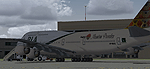
FSX PIA Boeing 747-367, registration AP-BGG. Pakistan International Airlines B747-367 Megatop Jumbo, AP-BGG, titled "Kaghan - Mountain Paradise". Contains photoreal tail, accurately placed titles and door surround repainted to match the actual airplane. Engines repainted with large yellow stickers on the left side of the casing to match the actual airplane. Being one of the later model 747-300 aircraft to roll off the assembly line, AP-BGG has a different style wingroot and no wingtip antennas as compared to other classic 747s, and the relevant model has been included. Repainted on the Project Open Sky 747v4 Advanced model. Contains ground service vehicles, stairs, tow truck, catering trucks, luggage loaders and containers painted in standard PIA colors. Luggage containers specially repainted to give a more realistic look. Registration of the aircraft painted on the bottom of the left wing, as on the real airplane. Panel updated to include utility gauge and tow truck gauge. Updated model and fde. Complete pack, requires no external downloads. Textures in high quality 32 bit format to conserve quality. Repaint by Irfan Khan and Ahmed Ahsen, exclusively from Virtual PIA.
| Filename: | PIA_Boeing_747367.zip |
| License: | Freeware |
| Added: | 17th April 2010, 18:16:56 |
| Downloads: | 536 |
| Author: | Irfan Khan, Ahmed Ahsen |
| Size: | 17.75 MB |
| Category: Flight Simulator X - AFCAD Files | |
| CYLW - Kelowna International Airport / Kelowna, British Columbia, Canada |
|
Images related to this file:
File Description:
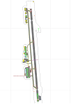
CYLW - Kelowna International Airport / Kelowna, British Columbia, Canada
This airport update was made with the latest version of ADE (Airport Design Editor) and made for FSX as a replacement for the stock (default) airport. I found that most stock airports in FSX lack a decent amount of character and realism and I've done my best to correct that wherever possible. I've made several additions to the airport which are listed below. All these enchancements are as close to the real airport as I can get with stock library objects. I've used satellite images, terminal photos and maps throughout the whole process so building locations are as accurate as possible. Happy landings in the beautiful Canada!
Features:
*Expanded parking apron
*Main terminal building with it's 8 gates some with jetways
*Seperate parking aprons for GA traffic
*Runway accurately expanded to 8,900ft to reflect 2008 runway project
*Hangar and other airport buildings added
*Airport vehicles and objects throughout the airport
*Main road in front of airport added with static vehicles
*Parking lots with static vehicles
*Airport fire station with fire trucks
*Static de-icing vehicles & runway plow
*2 Helipads
(Next up: CYWG Winnipeg Intl Airport)
| Filename: | CYLW__Kelowna_International_Airport__Kelowna_Briti.zip |
| License: | Freeware |
| Added: | 22nd July 2012, 15:13:45 |
| Downloads: | 1,129 |
| Author: | Jaison Diaz |
| Size: | 10.38 KB |
| Category: Flight Simulator X - Panels | |
| RDP AutoPilot Gauge and Mods for Just Flight HS748 |
|
Images related to this file:
File Description:

This project was born out of necessity to improve a very fun and an amazing aircraft, the Just Flight HS748. The objectives were to depict out of sight, hard to reach or sensitive information in an easier to read alternative. The lower panel is not based on any real panel or gauge, it was simply designed as so by me for easier reading of pertinent flight data. Whilst the top panel, is designed to replicate as close as possible, including how it functions, the 3D panel available on Just Flight HS748.
These include:
+ Autopilot and its various dependencies.
+ Elevator, Aileron and Rudder Trim, and their information.
+ NAV1 and NAV 2, with a DME (Only available for NAV1).
+ Flight Director Trim.
+ Outside and Total Air Temperature in Celsius and Fahrenheit.
+ Aircraft Heading and Vertical Speed ft/min.
+ Autopilot Vertical Speed numbers from the Autpilot VS wheel in Degrees and ft/min.
+ Pilot Input Heading and Course (Only for NAV1).
+ KOHLSMAN Setting, or Barometer in Millibars or inHg.
+ Left and Right Pitot switches.
+ GPS Icon for easier access.
+ Radios Icon.
+ Nav and GPS switch.
+ Indicated Aircraft Airspeed.
+ Indicated Altitude(Feets).
| Filename: | RDP_AutoPilot_Gauge_and_Mods_for_Just_Flight_HS748.zip |
| License: | Freeware |
| Added: | 26th February 2017, 08:07:59 |
| Downloads: | 406 |
| Author: | Ricardo de Paula |
| Size: | 1.31 MB |
| Category: Flight Simulator X - Scenery | |
| AI Ship Traffic for US East Coast V1 |
|
Images related to this file:
File Description:
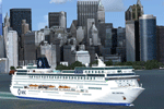
This package contains AI ship traffic files for the US East Coast to be used with my packages "63 AI Ships and AI Ship Traffic for Europe and South America" and "75 AI Ships and AI Ship Traffic". With the three packages installed you will have a total of 138 ships travelling along the US East Coast from Fort Lauderdale to the Gulf of St. Lawrence.
The ships visit among other places Fort Lauderdale, Freeport, Jacksonville, Savannah, Charleston, Wilmington, Norfolk, Baltimore, Philadelphia, New York, Boston, Portland, Providence, Halifax, Saint Pierre et Miquelon and more.
To make this package work you must first download and install in this sequence:
"63 AI Ships and AI Ship Traffic for Europe and South America",
"75 AI Ships and AI Ship Traffic", and
"Patch for 75 AI Ships and AI Ship Traffic" (If you install this patch you do not need the "Patch for 63 AI Ships and AI Ship Traffic")
This package has been developed with contributions from among others Jean-Pierre Fillion, Didier "Lagaffe" Puentes and "Robystar". I would like to thank these three as well as everybody who have encouraged and supported the project or participated in the beta testing.
| Filename: | AI_Ship_Traffic_for_US_East_Coast_V1.zip |
| License: | Freeware |
| Added: | 1st September 2013, 08:47:12 |
| Downloads: | 8,383 |
| Author: | Henrik Nielsen |
| Size: | 1.08 MB |
| Category: Flight Simulator X - Scenery | |
| Bhutan Airports and Paro Valley |
|
Images related to this file:
File Description:
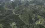
This project adds and updates all of the airports of Bhutan. Bathpalathang (VQBT) and Gelephu (VQGP) are added, Yongphulla (VQ10) is updated and recoded as VQTY, and Paro (VQPR) is fully updated to reflect current satellite imagery. These are all fully functioning AI airports as well. Special attention was given to the entire Paro Valley, and numerous road/river vectors were updated around Gelephu. Accurate coastlines, lakes, road and river data, as well as corrected landclass are provided based on the latest available satellite imagery. They are optimized to fit seamlessly with FTX Vector's roads/water, but they should be fully functional in all FSX configurations.
GA-encoded flight plans for the Buddha Air/Kathmandu charter are provided to enhance service to Paro. NASA SRTM Global 3 arc second terrain mesh is also included for all of Bhutan. Updates were created or rebuilt in a manner which carefully aligned airport data with current satellite imagery, when available. Scenery was created using Airport Design Editor X v1.61.5298, SBuilderX 3.13, and the FSX Object Placement Tool. Scenery objects were added and modified from stock FSX scenery to resemble as closely as possible the actual airports.
| Filename: | Bhutan_Airports_and_Paro_Valley.zip |
| License: | Freeware |
| Added: | 19th January 2015, 06:09:17 |
| Downloads: | 11,432 |
| Author: | Carlyle Sharpe |
| Size: | 21.4 MB |
| Category: Flight Simulator X - Scenery | |
| HALA - Hawassa Intl. - Hawassa, Ethiopia |
|
Images related to this file:
File Description:
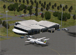
This project adds the booming city of Hawassa, Ethiopia, creates the new international airport (HALA), moves (and rebuilds) the downtown airport (recoded to HALX), and includes AI flight plans for the Ethiopian Airlines service that began April 2016. Tested in both the default FSX: Acceleration and with FTX Global/Vector, accurate coastlines, lakes, road data, and SRTMGL1 (30m) mesh, as well as corrected landclass are provided based on the latest available satellite imagery. The Hawassa International Airport was created using information from the current satellite footprint and the promotional video from Ethiopian Airports Enterprise (EAE). Although there is still very little published data on the airport, it is fully functional.
Updates were created or rebuilt in a manner which carefully aligns airport data with current satellite imagery. Scenery was created using Airport Design Editor X v1.70.6042, SBuilderX 3.13, and the FSX Object Placement Tool. Scenery objects were added and modified from stock FSX scenery to resemble as closely as possible the actual airports. The FSX apron lights included are from the set created by Jim Dhaenens. Thanks to Ron Blehm for bringing this part of the world to my attention.
| Filename: | HALA__Hawassa_Intl___Hawassa_Ethiopia.zip |
| License: | Freeware |
| Added: | 20th July 2016, 09:06:40 |
| Downloads: | 1,022 |
| Author: | Carlyle Sharpe |
| Size: | 10.41 MB |
| Category: Flight Simulator X - Scenery | |
| Iguassu Falls - Save The Planet |
|
Images related to this file:
File Description:
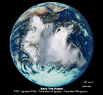
The Iguassu Falls, Itaipu Hydroelectric Power Plant, Foz do Iguassu City and Land Class Package for FSX
Save The Planet is my version of the Iguassu Falls, Itaipu Dam, bridges and landclass scenery for FSX.
Differently from my other version for MSFS 2004, I created a mesh of 5 meter resolution for Iguassu Falls area
to give me some idea how I could proceed. So, I decided to use on this addon
an image background avaliable at server (VirtualEarthSatellite). Thanks Microsoft.
Non-Airport Scenery - ICAO (SBFI). coming soon at www.Terra-Brasilis.org
Portuguese: Cataratas do Iguassu,
Spanish: Cataratas del Iguazu are waterfalls of the Iguassu River located on the border of the Brazilian state of Parana (in the Southern
Region) and the Argentinian Province of Misiones.
The Falls are shared between the Iguazu National Park (Argentina) and Iguacu
National Park (Brazil). The parks were designated UNESCO World Heritage Sites.
The Itaipu Hydroelectric Power Plant is located in the Parana River, in the stretch of the frontier between Brazil and Paraguay, 14 km north of the Friendship Bridge.
The area of the project extends from Foz do Iguassu, in Brazil, and Ciudad del Este, in Paraguay, in the south, up to Guaira (Brazil) and the Guaira Falls (Paraguay), in the north.
Enjoy FSX Iguassu Falls Scenery!
| Filename: | Iguassu_Falls__Save_The_Planet.zip |
| License: | Freeware |
| Added: | 9th December 2010, 01:57:00 |
| Downloads: | 2,849 |
| Author: | Cicero Costa |
| Size: | 31.71 MB |


© 2001-2026 AVSIM Online
All Rights Reserved
Privacy Policy |