
Where Flight Simulation Enthusiasts Gather from Around the World!
AVSIM Library - Search Results

| Category: Flight Simulator X - Scenery | |
| Juancho E. Irausquin Airport, TNCS, Caribbean island of Saba |

|
File Description:
This airport is shown as SABA in FSX. Juancho E. Irausquin Airport (IATA: SAB, ICAO: TNCS) is the only airport on the Caribbean island of Saba. It is well known among professional pilots for the way in which airplanes must approach or take off from the airport.
| Filename: | Juancho_E_Irausquin_Airport_TNCS_Caribbean_island_.zip |
| License: | Freeware |
| Added: | 19th May 2011, 21:21:36 |
| Downloads: | 3,154 |
| Author: | Anwar Gonzalez |
| Size: | 3.87 KB |
| Category: Flight Simulator X - Scenery | |
| Long Island Mac Arthur Airport, Islip, New York (KISP) |
|
File Description:
This scenery is built for FSX. This scenery was created with Abacus EZ Scenery. You will need the RWY12 Libraries installed as well as a few EZ scenery libraries. This scenery adds many many things, including a terminal replacement, parking spots, and vehicles, GA Hangars, and more.
| Filename: | Long_Island_Mac_Arthur_Airport_Islip_New_York_KISP.zip |
| License: | Freeware, limited distribution |
| Added: | 15th March 2008, 17:02:28 |
| Downloads: | 1,364 |
| Author: | Brandon DePalo and Ray Lunning / Watsup Sceneries |
| Size: | 3.93 MB |
| Category: Flight Simulator X - AFCAD Files | |
| FSSB - Bird Island, Seychelles (Default with AIG Seychelles landclass) |
|
Images related to this file:
File Description:

This is part of the tenth round of airports issued by Alpha India Group. AIG Ground creates high quality Afcads for both FS2004 and for FSX default and Add On Scenery airports. Our airports are created drawing on the best available resources and aim to simulate the real world airport as closely as possible but also to ensure good levels of traffic with realistic parking and good flow of traffic around the airport.
Please read and follow installation instructions in the Readme file carefully, as these do vary.
Visit us at www.alpha-india.net for more information.
| Filename: | FSSB__Bird_Island_Seychelles_Default_with_AIG_Seyc.zip |
| License: | Freeware |
| Added: | 6th September 2010, 10:14:58 |
| Downloads: | 1,690 |
| Author: | Kai P. Kamjunke & Alpha India Group |
| Size: | 161.82 KB |
| Category: Flight Simulator X - Scenery | |
| NTGP - Puka-Puka Airport - Puka-Puka Island, French Polynesia |
|
File Description:
Puka-Puka Airport (NTGP), French Polynesia.
| Filename: | NTGP__PukaPuka_Airport__PukaPuka_Island_French_Pol.zip |
| License: | Freeware |
| Added: | 14th December 2015, 09:07:22 |
| Downloads: | 890 |
| Author: | Christian Svensson / Didisoft |
| Size: | 3.28 MB |
| Category: Flight Simulator X - Scenery | |
| The Bounty Island "Pitcairn" coordinates S 25.03'14 "W 130.06'16" |
|
File Description:
Pitcairn is an island of the Pacific Ocean, the second largest in the British territory of the Pitcairn Islands and the only inhabited area; On it is the capital, Adamstown. The surface area is 4.6 km². On this flap of land, located 2200 km east of Tahiti, settled in Bounty's ammunition in 1790. Geographic coordinates S 25 ° 03'14 "W 130 ° 06'16". My scenario shows exactly where the Bounty ship threw anchor. In the attached package you will find readme to install the scenery
| Filename: | The_Bounty_Island_Pitcairn_coordinates_S_250314_W_.zip |
| License: | Freeware |
| Added: | 31st August 2017, 18:51:53 |
| Downloads: | 244 |
| Author: | Pasquale Marrulli |
| Size: | 1.85 KB |
| Category: Flight Simulator X - Scenery | |
| KPVD, Theodore Francis Green State Airport, Providence, Rhode Island |
|
Images related to this file:
File Description:
Complete new setup, done with ADE, from top-down images. T.F. Green Airport is 6 miles south of Providence. It is a public international airport, categorized by the FAA as a small hub primary commercial service facility.
| Filename: | KPVD_Theodore_Francis_Green_State_Airport_Providen.zip |
| License: | Freeware |
| Added: | 24th November 2017, 17:25:20 |
| Downloads: | 1,269 |
| Author: | Tim van Ringen |
| Size: | 727.13 KB |
| Category: Flight Simulator X - Scenery | |
| St. Kitts Island - Federation of Saint Kitts and Nevis |
|
Images related to this file:
File Description:
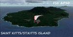
A representation of St. Kitts using photo-real scenery along with hand placed autogen. Robert L. Bradshaw International Airport is an international airport located just northeast of Basseterre, on the island of Saint Kitts, serving the nation of Saint Kitts and Nevis.
New construction started late 2004. Up to 6 wide bodied jets can now be accommodated on the tarmac. The airport can accommodate commercial jumbo jets and handles scheduled non-stop jet flights to Canada and the United States, as well as numerous regional commuter flights from within the Caribbean area. For the best results of this scenery, PWSceneries Volume 5 has to be installed. Features included are custom photo scenery covering the entire island, hand placed autogen, detailed 3D Objects and custom buildings. Works in FSX and P3D.
| Filename: | St_Kitts_Island___Federation_of_Saint_Kitts_and_Ne.zip |
| License: | Freeware |
| Added: | 24th September 2015, 10:57:42 |
| Downloads: | 827 |
| Author: | Kenje Thomas & Jamalje Bassue |
| Size: | 105.56 MB |
| Category: Flight Simulator X - Sounds | |
| Yemen Callsigns |
|
File Description:
Three callsigns for Yemenia, Alyemda (North Yemen), and Yemen Government (Yemeni). Requires EditVoicePack X for FSX. This satisfies a little retro AI ATC hole. Voicepack modifications by Michael Pearson.
| Filename: | Yemen_Callsigns.zip |
| License: | Freeware |
| Added: | 7th March 2015, 14:57:24 |
| Downloads: | 279 |
| Author: | Michael Pearson |
| Size: | 2.99 KB |
| Category: Flight Simulator X - Scenery | |
| Bimini, The Bahamas (MYBS) |
|
Images related to this file:
File Description:
Both North and South Bimini islands landclass, shorelines and water, as well as the South Bimini Airport, have been redone per Google Earth images. This is NOT photo scenery.
| Filename: | Bimini_The_Bahamas_MYBS.zip |
| License: | Freeware |
| Added: | 7th March 2010, 12:08:16 |
| Downloads: | 2,677 |
| Author: | Art Poole |
| Size: | 314.96 KB |
| Category: Flight Simulator X - Miscellaneous Files | |
| Easysatpix 0.9 |
|
Images related to this file:
File Description:

This is a update of our version published at avsim.com on 31st of March 2011.
The regional coverage has been extended. In addition to Europe you can now retrieve weather-maps for the North America and North Atlantic. Other regions (Asia, Australia, Middle Eat, South & Central America such as Africa coming soon).
Easysatpix retrieves free and public data from the Internet such as:
* Satellite Images (IR, VIS, SAT Analysis)
* Weather Analysis Charts (Surface Weather, Significant Weather, Temperatures, Precipitation, Weather Depiction)
* Wind and Hazards Charts (Upper Winds Charts, Jetstream, Icing, Turbulence, Storm Prediction & Warning)
* METAR & TAF (latest & last 4 houres)
* SIGMETS (for several regions)
* NATS (North Atlantic tracks (Maps 6 raw)
* NOTAMS
* Briefing Video for Europe, Asia, N America (Aviation Weather today)
| Filename: | Easysatpix_09.zip |
| License: | Freeware |
| Added: | 28th June 2011, 09:36:21 |
| Downloads: | 719 |
| Author: | Wilhelm Drotleff |
| Size: | 198.78 KB |
© 2001-2026 AVSIM Online
All Rights Reserved
Privacy Policy |