
Where Flight Simulation Enthusiasts Gather from Around the World!
AVSIM Library - Search Results

| Category: Flight Simulator X - AFCAD Files | |
| MZBZ - Philip S. W. Goldson International Airport / Belize City, Belize (v2.0) |

|
Images related to this file:
File Description:

This airport update was made with the latest version of ADE (Airport Design Editor) and made for FSX as a replacement for the stock (default) airport. I've made several changes to the airport which are listed below. All these enchancements are as close to the real airport as I can get with stock library objects. I've used satellite images, terminal photos and maps throughout the whole process so building locations are as accurate as possible. Happy landings in Belize, scuba diving heaven!
Features:
*Expanded parking apron
*Terminal building with parking for commercial aircraft
*Assigned parking for Maya Island Air flights
*Ramp extension construction
*Runway 7/25 expanded to 9,695ft
*Taxiway corrections
*Autogen exclusion for trees that occupy field in stock scenery (no other files needed)
*Palm trees and vegetation
*Airport hangars and static aircraft
*Airport vehicles and objects
*Parking lot with static vehicles
*Birds in proximity to airfield
(For more information on Endeavourai please visit our site at endeavourai.com or our forums at http://endeavourai.boards.net/)
| Filename: | MZBZ__Philip_S_W_Goldson_International_Airport__Be.zip |
| License: | Freeware |
| Added: | 21st August 2012, 23:13:12 |
| Downloads: | 1,175 |
| Author: | Jaison Diaz / Endeavour ai |
| Size: | 96.25 KB |
| Category: Flight Simulator X - Scenery | |
| YNUL Nullagine, Western Australia |
|
File Description:
YNUL Nullagine - Shire of East Pilbara with added ORBX textures. Nullagine is serviced by a gravel airstrip. This facility provides a vital air link. RFDS, Police, and local charter operators all rely on this airstrip for the provision of vital services to the communities. Nullagine is an old goldrush town in Western Australia's Pilbara region. It is located on the Nullagine River 296 km south-east of Port Hedland and 1,364 km north-north-east of Perth on the old Great Northern Highway. The town originated from gold being discovered in the area in 1886 by a prospector, N.W. Cooke. The population increased sharply as a result and by the mid 1890s the community wanted to have a town declared. Lots were surveyed and released in 1897 and the state government gazetted the town in 1899. Nullagine comes from the Aboriginal name of a nearby river, the Ngullagine river; the meaning of the word is unknown. Besides gold other minerals were mined in the area including diamonds and other gemstones. Between 1895 and 1914 the town boomed and contained a number of general stores, three hotels, eight stamp mills and a population of over 3,000. Its population was 1,500 prior to World War II. Now, with the decline of gold mining, only about 200 remain. However the town still attracts fossickers and prospectors who visit the surrounding area, which is particularly rich in minerals such as agate, asbestos, antimony, beryl, chalcedony, copper, jade, jasper, manganese, tiger eye and wolfram. The town is also the place of the Yirrangadji Aboriginal Community. The Martu people make up the bulk of this population. REQUIRES Blencowe_LibraryKit.zip
REQUIRES blencowe_librarykit_309494.zip (Available HERE)
| Filename: | YNUL_Nullagine_Western_Australia.zip |
| License: | Freeware |
| Added: | 28th February 2013, 14:00:15 |
| Downloads: | 293 |
| Author: | Alan Blencowe |
| Size: | 5.72 MB |
| Category: Flight Simulator X - Aircraft Repaints, Textures and Modifications | |
| Qantas Consolidated PBY-5 5 paints |
|
Images related to this file:
File Description:
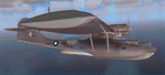
Five repaints for the Aerosoft PBY-5 Catalina in the colors of PBY-5's operated by Qantas on the 'Double Sunrise Service' between Western Australia and Ceylon between 1943 and 1945.
In 1943, Royal Australian Air Force personnel were seconded to operate Catalinas under the banner of Qantas. The plan called for flights between Perth, Western Australia, and RAF Base Koggala in southern Ceylon (now Sri Lanka). The flights were the longest non-stop air route of any airline, over 3,500 nautical miles (6,480 km) across the Indian Ocean. Navigating without the aid of radio, the crews relied solely on rudimentary navigation by compass and stars during the trip.
Only Catalinas had that kind of range, so five PBY-5 flying boats were converted to make them suitable for the trip.
They received camouflage paint, with a RAAF roundel on the fuselage, but also a civilian registration, since they were officialy operated by Qantas, and they were named after the stars they would be using for navigation:
Vega Star (G-AGFL/FP221 - tail code 1)
Altair Star (G-AGFM/FP244 - tail code 2)
Rigel Star (G-AGID/JX575 - tail code 3)
Antares Star (G-AGIE/JX577 - tail code 4)
Spica Star (G-AGKS/JX287 - tail code 5)
Taking between 27 and 33 hours, with departure timed so that the flight crossed Japanese occupied territory during darkness, the crews would observe the sunrise twice, which led to the service being known as "The Double Sunrise". The flight route flown was along the coast from Perth to Exmouth then setting out towards Cocos (Keeling) Island or Christmas Island (though neither was actually sighted during the flight) and onto Kogalla, a journey of approximately 3,580 nautical miles (6,630 km). After the success of the initial flights, it was decided to run a weekly service, with some services flying over Rottnest Island and then taking a direct line to Kogalla. As part of the Australia-England air route there was a surface component from Kogalla to Karachi that added considerable time to the service. This was later replaced by the Double Sunrise service, with Karachi to England flown by BOAC. Air crews would change in Kogalla taking the next plane in either direction minimising the time taken to complete the journey.
Though stripped of all non-essential equipment, including de-icing equipment and insulation, the average takeoff weight was 15,900 to 16,000 kg; this included 9,040 liters of fuel, which gave the Catalina a range of 3,600 nautical miles (6,700 km). The service made 271 crossings, delivered over 4,500 kg of mail and carried 860 passengers, including among them British MP Edith Summerskill and the journalist Keith Murdoch. 'The Secret Order of The Double Sunrise' was an illustrated certificate given to passengers aboard the flying boats of the Australia-England air link, to attest they had been airborne for more than 24 hours.
After the war the five modified Catalinas that had flown The Double Sunrise service were scuttled.
Repaints by Jan Kees Blom, based on the paintkit by Aerosoft
| Filename: | Qantas_Consolidated_PBY5_5_paints.zip |
| License: | Freeware |
| Added: | 13th July 2018, 20:38:43 |
| Downloads: | 178 |
| Author: | Jan Kees Blom |
| Size: | 49.87 MB |
| Category: Flight Simulator X - Aircraft Repaints, Textures and Modifications | |
| Boeing C-75 Stratoliner "Navajo" |
|
Images related to this file:
File Description:
This repaint is for the FSX version 1.1 JBK Boeing 307 Stratoliner and is in dds format.
In early 1942, the USAAF impressed all five of TWA's SA-307B Stratoliners, making modifications to extend their range, using them as VIP transports under the C-75 designation. These aircraft served until 1944 in the Air Transport Command with their TWA crews. They were rebuilt that year as SA-307B-1s and returned to TWA.
Navajo (c/n 2001) was impressed as 42-88627. In Feb 1942, surveyed the Air Transport Command southern route from Washington DC to Cairo via Natal Brasil. The following month carried Generals Marshall, Eisenhower, Clark, Col. Vandenberg, Admiral Towers, Averill Harriman, and Harry Hopkins, across the North Atlantic to England on a VIP "all brass" flight. Returned to TWA in July 1944 and rebuilt as SA-307B-1 N19909.
| Filename: | Boeing_C75_Stratoliner_Navajo.zip |
| License: | Freeware |
| Added: | 29th December 2016, 07:30:47 |
| Downloads: | 134 |
| Author: | Willy McCoy |
| Size: | 15.77 MB |
| Category: Flight Simulator X - Scenery | |
| Tatoi Airbase (LGTT) |
|
Images related to this file:
File Description:
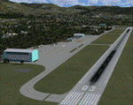
Tatoi AB is located north of Athens and is the home of the Air Training Comand of the Hellenic Air Force as well as all the Academys for basic training of all officer ranks of aircrew and ground crew for the Air Force. The Air force Museum is also based there with a substantial collection of historical static exhibits. Tatoi is also home of three Aeroclubs, the Athens Aeroclub, the Mesogion Aeroclub and Dekeleia Aeroclub as well as the Athens gliding club.
This addon will substantially revamp the scenery for LGTT as well as move the airport to its correct location. All buildings are custom made to represent the actual ones as closely as possible, based on existing photographs as well as my own experiences of being a member of the Athens Aeroclub and currently training there for my PPL.
| Filename: | Tatoi_Airbase_LGTT.zip |
| License: | Freeware |
| Added: | 25th June 2010, 22:10:09 |
| Downloads: | 3,503 |
| Author: | Vassilios Dimoulas |
| Size: | 13.5 MB |
| Category: Flight Simulator X - Aircraft Repaints, Textures and Modifications | |
| Lockheed Martin F-35A RNLAF 311 "Bald Eagle" Sqn update |
|
Images related to this file:
File Description:
Lockheed Martin F-35A for FSX by Dino Cattaneo in (yet fictional) RNLAF livery. My sixth paint resembles a future 311 Sqn livery, located at Volkel AB, The netherlands. This repaint is an update to my previously uploaded 311 Sqn repaint, with some minor changes in the tail section and engine nozzle. 311 Squadron is an old occupant of Volkel airbase soil. The squadron logo represents a North-American bald eagle in attack position. The predator bird is know for it's agility and fabulous hunting skills. Combine that with the squadrons task and aircraft flown in history (all fighters) and you will soon conclude to the squadrons motto; "Ut Aquila Praedans", which translates to "Hunting like the eagle". You need the excellent payware Lockheed Martin F-35A by Dino Cattaneo in order to use this repaint. Enjoy!
| Filename: | Lockheed_Martin_F35A_RNLAF_311_Bald_Eagle_Sqn_upda.zip |
| License: | Freeware |
| Added: | 17th August 2010, 00:44:32 |
| Downloads: | 168 |
| Author: | Rene Spaan |
| Size: | 19.44 MB |
| Category: Flight Simulator X - Aircraft Repaints, Textures and Modifications | |
| Cessna 195 Businessliner (N999MH) |
|
Images related to this file:
File Description:
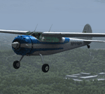
N999MH, (Strangely, no date for when it was built) left sunny California to live at Compton Abbas Airfield, Wiltshire (EGHA) The owner, Detiger Elizabeth, (I'm intrigued by that name)a member of The Air Squadron UNA, won't thank me for bringing this up: "25 October 2003. "After a normal start, the pilot taxied his tail wheel aircraft across the grass towards the holding area for Runway 26. The weather was good with a light north-westerly surface wind. Two other aircraft were stationary, holding for the runway, and the pilot of N999MH failed to see one of these aircraft.The right wing of N999MH struck the propeller of one of these aircraft, G-AYEV." Oops!
As per usual, only download this paint if you possess a bona fide copy of Alabeo's C195 Businessliner 'cos you know it ain't right otherwise. ;-)
| Filename: | Cessna_195_Businessliner_N999MH.zip |
| License: | Freeware |
| Added: | 7th April 2014, 18:56:21 |
| Downloads: | 383 |
| Author: | Ron Attwood |
| Size: | 17.13 MB |
| Category: Flight Simulator X - Scenery | |
| EGHA Compton Abbas |
|
File Description:
All additional Buildings were placed using default objects.
AI traffic uses default aircraft which was scheduled by hand using the TrafficDatabaseBuilder from the SDK tools provided by FSX Deluxe.
Any additional roads and modified Landclass & water features were created using FSX-KML.
This package adds the apron , Hangars, clubhouse and the fueling station has been moved to the correct spot between the hangars.
Some of the local roads have been added to allow road access to the airfield.
The main wooded areas have been added to the North and south of the airfield and cropland defined surrounding the immediate area although FSX insists on putting trees on some steeper slopes.
I have also included 3 of the villages nearby , Compton Abbas, Ashmore and Fontmell Magna .
It also provides parking spots and ATC interaction along with some AI traffic.
Hope you like it :)
| Filename: | EGHA_Compton_Abbas.zip |
| License: | Freeware, limited distribution |
| Added: | 1st October 2007, 17:08:37 |
| Downloads: | 1,887 |
| Author: | Len Hickman |
| Size: | 17.45 KB |
| Category: Flight Simulator X - Scenery | |
| KDAY - Dayton International Airport - Vandalia, Ohio |
|
Images related to this file:
File Description:
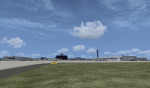
The Dayton International Airport, located 11 miles north of Dayton in Vandalia, Ohio, is a medium sized commercial airport serving nearly three million passengers annually with daily nonstop service to about twenty destinations.
This scenery includes a custom terminal building, moving jetways, and an AFX file with accurate parking assignments. Also modeled is the new air traffic control tower, terminal parking garage, the Fed Ex building, the PSA Airlines headquarters and maintenance hanger, the former Emery Worldwide cargo sort facility, the airport hotel, and hangers for fixed base operators Stevens Aviation and Wright Brothers Aero.
More than a thousand objects have been added to enhance detail around the airport using Flight 1's excellent instant scenery program. AI Traffic has been tested to ensure efficient flow. The landclass file has also been adjusted to better reflect the real airport.
| Filename: | KDAY__Dayton_International_Airport__Vandalia_Ohio.zip |
| License: | Freeware |
| Added: | 2nd December 2012, 22:32:37 |
| Downloads: | 1,571 |
| Author: | Matt Parr |
| Size: | 5.78 MB |
| Category: Flight Simulator X - Scenery | |
| LFMA - Aix les Milles |
|
File Description:
Welcome to Aix Les Milles Airport.
Situated in the south coast of France, only few miles North East of Marignane (Marseille Provence - LFML). This is a great option for all G.A aircrafts to visit as well as Helicopters/Medical with their own base and it's even large enough to welcome the famous Alphajets from the "Patrouille de France".:)
The airport is used by those who wants to spend a great week end in the very well known city called Aix En provence and discover the beauty of Provence.
I have enhanced the entire airport with all buildings, proper taxi marking of aprons, taxisigns, Glider area/parking lot, Heli area including the medical one, replaced the tower at its own place, a military parking for the Alpha jets (Novembre West apron) and added...the LFMA VFR chart!!!
Enjoy!
| Filename: | LFMA__Aix_les_Milles.zip |
| License: | Freeware |
| Added: | 1st May 2009, 00:14:01 |
| Downloads: | 1,975 |
| Author: | Daniel Louvet |
| Size: | 1.29 MB |


© 2001-2026 AVSIM Online
All Rights Reserved
Privacy Policy |