
Where Flight Simulation Enthusiasts Gather from Around the World!
AVSIM Library - Search Results

| Category: Flight Simulator X - Scenery | |
| RAF Blyton - Lincolnshire, England |

|
File Description:
RAF Blyton is a former Royal Air Force airfield,located 4.8 miles (7.7 km) north east of Gainsborough, and 9.6 miles (15.4 km) of south Scunthorpe, Lincolnshire, England.
It was built in 1942 and was heavily used during the Second World War and conformed to the usual 'A' Class airfield formation ie 3 runways laid out in the rough shape of an A.
The 3 runways were 09/27 & 14/32 at a length of 4200ft by 150ft wide and the main 03/21 for was the usual 6000ft by 150ft. Third party add-on's will be required - see readme.txt file for details.
| Filename: | RAF_Blyton__Lincolnshire_England.zip |
| License: | Freeware |
| Added: | 31st October 2015, 12:24:42 |
| Downloads: | 207 |
| Author: | Terry Boissel |
| Size: | 18.27 KB |
| Category: Flight Simulator X - Scenery | |
| RAF Harwell 1944 - Oxfordshire, England |
|
File Description:
RAF Harwell is a former Royal Air Force station in former Berkshire, near the village of Harwell, located 4.8 miles (7.7 km) south east of Wantage, Oxfordshire and 17 miles (27 km) north west of Reading.
The bulk of the Station lay within Chilton parish; about a third was in East Hendred; and the smallest portion was in Harwell. The first Commanding Officer, upon being asked what the name of the new airfield should be, responded that it should be named after the parish in which his house lay – and this happened to be Harwell.
| Filename: | RAF_Harwell_1944__Oxfordshire_England.zip |
| License: | Freeware |
| Added: | 26th April 2016, 14:33:34 |
| Downloads: | 128 |
| Author: | Terry Boissel |
| Size: | 642.7 KB |
| Category: Flight Simulator X - Scenery | |
| X3SF- Snitterfield - Warwickshire, England |
|
File Description:
RAF Snitterfield (ICAO x3SF) is a former Royal Air Force station located west of Snitterfield, Warwickshire, England, 3.3 miles (5.3 km) north of Stratford-upon-Avon and 4.6 miles (7.4 km) south-east of Henley-in-Arden, Warwickshire.
RAF Snitterfield was operational during the Second World War, the airfield was a class A airfield and had around 30 aircraft dispersals. The airfield was finished around June 1942 and cost around £1,147,000 and opened in 1943 and with the cessation of hostilities the Air Ministry having no further use for the Station it closed in 1946.
Source: Wikipedia.
| Filename: | X3SF_Snitterfield__Warwickshire_England.zip |
| License: | Freeware |
| Added: | 14th May 2016, 11:42:00 |
| Downloads: | 108 |
| Author: | Terry Boissel |
| Size: | 1.54 MB |
| Category: Flight Simulator X - Scenery | |
| Lake Mekinac - Quebec bush scenery |
|
File Description:
This scenery is fictitious and created for the pleasure of all. All the objects are already included in FSX and no other library was used. Lake Mékinac base is separated in two and can accept pilots from both sides of the shore. At about 55 miles North West of Quebec, it is easily approachable.Must have before installing the Aerovirtuel bush flying sceneries:
1-Quebec Elevation 38m (LOD10) Gilles Gauthier sur http://avsim.com/ 5 files.
2-Quebec Scenery - Lakes and Rivers (1/5) http://avsim.com/ 5 files and one fix
3-Quebec Scenery - Addition of Roads http://avsim.com/
| Filename: | Lake_Mekinac__Quebec_bush_scenery.zip |
| License: | Freeware, limited distribution |
| Added: | 10th November 2007, 22:17:18 |
| Downloads: | 868 |
| Author: | Denis Dupuis |
| Size: | 615.9 KB |
| Category: Flight Simulator X - Scenery | |
| Hope, BC (for FSX Deluxe) |
|
File Description:
This rendition of the Hope Airfield was compiled by referring to number of photographs and satellite images and driving by the airstrip a couple of times. This scenery is for the FSX Deluxe addition with no additional addon scenery for this airport loaded.
Nearly all objects are library objects from FSX Deluxe.
I have added the the small farms and acreages that exist in real life north of the airfield. Hope has the longest grass runway in Canada. It also is home of the Vancouver Soaring Association. It’s a busy little airfield when the thermals are good.
| Filename: | Hope_BC_for_FSX_Deluxe.zip |
| License: | Freeware, limited distribution |
| Added: | 27th March 2009, 10:44:30 |
| Downloads: | 946 |
| Author: | Will Jones |
| Size: | 2.63 MB |
| Category: Flight Simulator X - Aircraft Repaints, Textures and Modifications | |
| Thomson Airways Boeing 737-800 |
|
Images related to this file:
File Description:
Thomson Airways is the largest charter Airline in the World. Operating from 22 airports in the UK to holiday destinations in Europe, North/South America, Africa, Asia and The Caribbean.
This is a repaint in the new livery which has a darker blue on the fuselage and tail, and drops the 'fly.com' from the logo. (based on the repaint of First Choice Airways 757 G-OOBA).
repaint is by Ben Thomson and the model is the original Project OpenSky 737-800W with full animations and features. These textures are in 32 bit. Created for FSX but works with FS9, see readme.
| Filename: | Thomson_Airways_Boeing_737800.zip |
| License: | Freeware |
| Added: | 27th December 2009, 17:47:30 |
| Downloads: | 812 |
| Author: | Ben Thomson, Project Opensky |
| Size: | 6.91 MB |
| Category: Flight Simulator X - Aircraft Repaints, Textures and Modifications | |
| Thomson Airways Boeing 767-300ER |
|
Images related to this file:
File Description:
Thomson Airways is the largest charter Airline in the World. Operating from 22 airports in the UK to holiday destinations in Europe, North/South America, Africa, Asia and The Caribbean.
This is a repaint in the new livery which has a darker blue on the fuselage and tail, and drops the'fly.com' from the logo. (based on the repaint of First Choice Airways 757 G-OOBA).
repaint is by Ben Thomson and the model is the original Project OpenSky 767-300ER (GE engines) with full animations and features. These textures are in 32 bit. Created for FSX but works with FS9, see readme.
| Filename: | Thomson_Airways_Boeing_767300ER.zip |
| License: | Freeware |
| Added: | 27th December 2009, 17:48:05 |
| Downloads: | 823 |
| Author: | Ben Thomson, Project Opensky |
| Size: | 10.54 MB |
| Category: Flight Simulator X - AFCAD Files | |
| ZUUU - Shuangliu Intl Airport - Chengdu, China |
|
Images related to this file:
File Description:
Chengdu Shuangliu International Airport is a major airport serving Chengdu, the capital of Sichuan province, China. It is located in the north of Shuangliu County, about 16 kilometres (10 mi) southwest of downtown Chengdu. Shuangliu Airport is the hub for Air China, Chengdu Airlines and Sichuan Airlines. From Europe KLM operates a direct flight from Amsterdam.
As per 9 August 2012 the new terminal 2 has openend which will handle all domestic flights. Terminal 1 will handle both international and domestic flights.
Using ADEx 1.55, aeronautical maps and Google Earth all these changes have been built into the default FSX airport.
| Filename: | ZUUU__Shuangliu_Intl_Airport__Chengdu_China.zip |
| License: | Freeware |
| Added: | 21st April 2013, 11:41:24 |
| Downloads: | 2,219 |
| Author: | Menno C. Robert |
| Size: | 1.12 MB |
| Category: Flight Simulator X - Scenery | |
| Mach Loop Markers: Fast Jets |
|
Images related to this file:
File Description:
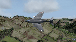
A series of markers around the famous "Mach Loop" in Wales to help sim flyers find and fly the
route.
The Mach Loop is a series of valleys in the United Kingdom in west-central Wales, notable for
their use as low-level training areas for fast aircraft. The system of valleys lies 13 km (8
mi) east of Barmouth between the towns of Dolgellau to the north and Machynlleth to the south,
from the latter of which it takes its name.
It is usually flown in an anti-clockwise direction.
Works in FSX and P3D.
| Filename: | Mach_Loop_Markers_Fast_Jets.zip |
| License: | Freeware |
| Added: | 10th October 2022, 14:02:20 |
| Downloads: | 86 |
| Author: | Peter J Forster |
| Size: | 2.31 MB |
| Category: Flight Simulator X - Scenery | |
| RAF Topcliffe - Yorkshire, England |
|
File Description:
RAF Topcliffe (ICAO: EGXZ) is a Royal Air Force station in North Yorkshire, England. It is a satellite station serving in the role of a Relief Landing Ground for Tucano aircraft of the Central Flying School (CFS) based nearby at RAF Linton-on-Ouse (one of two, the other being Dishforth Airfield). As such, no RAF personnel are based permanently at the airfield and airfield services are provided by personnel assigned to RAF Linton-on-Ouse.
Topcliffe is also used by the Air Training Corps as a motor glider airfield for Gliding induction courses and Gliding scholarships.
| Filename: | RAF_Topcliffe__Yorkshire_England.zip |
| License: | Freeware |
| Added: | 1st January 2016, 17:50:08 |
| Downloads: | 405 |
| Author: | Terry Boissel |
| Size: | 1.34 MB |


© 2001-2026 AVSIM Online
All Rights Reserved
Privacy Policy |