
Where Flight Simulation Enthusiasts Gather from Around the World!
AVSIM Library - Search Results

| Category: Flight Simulator X - Utilities | |
| FS Earth 5.0 for Google Earth |

|
File Description:
This program acts as an interface between Flight Simulator X and Google Earth, letting to follow a flight in real time, over the satellite images generated by Google Earth. Flights can be saved, and many options are available for fine tuning the performance, as well as the map's style (zoom, tilt, orientation). Works on a single computer running FSX and Google Earth all together or, for best experience, can be used on two networked computers running respectively FSX (master) and Google Earth (slave). AI and Multiplayer traffic is also displayed in Google Earth, with course prediction and other information. Requires Flight Simulator X and Google Earth. The program running in trial mode works only around Anchorage, Alaska, (PANC / ANC) for a maximum of five minutes per flight session. Version 5.0 has improved compatibility with latest releases of Google Earth and several additional improvements. A version for FS2004 is available also.
| Filename: | FS_Earth_50_for_Google_Earth.zip |
| License: | Shareware, time limited |
| Added: | 19th July 2007, 00:46:27 |
| Downloads: | 1,104 |
| Author: | Luciano Napolitano |
| Size: | 2.44 MB |
| Category: Flight Simulator X - Scenery | |
| VYYY Yangon Intl Airport Mingaladon V3.0 |
|
File Description:
Yangon International Airport "MINGALADON" in Burma, Myanmar, will be able to accommodate bigger aircrafts and handle more passengers when work on extending its runway and upgrading its facilities is completed. The completion of the runway extension will enable Boeing 747 and Airbus 380 airplanes to use the airport. The work on extending the runway from 8100 feet to 11,200 feet began October 2004. FPS-friendly version 3.0 with already extended runway, taxiways and new taxisigns. First of all we corrected the airport location to the real one. With Myanmar Air Force area, Helipads and even more parkings for civilian airplanes. This scenery was produced based on pictures of satellites. Many Thanks go to the teams of HOUSE-RP in Burma, FSX Planner, SceneGenX, SBuilder X, Open Ports Scanner, AFXBgDownloader, FSUIPC and Google Earth. This scenery is only for FSX, for FS2004 please download vyyy_v2.zip. By HOUSE-RP, Switzerland and Burma
| Filename: | VYYY_Yangon_Intl_Airport_Mingaladon_V30.zip |
| License: | Freeware, limited distribution |
| Added: | 28th October 2007, 19:21:14 |
| Downloads: | 1,228 |
| Author: | HOUSE-RP, Robby Pauletto |
| Size: | 18.29 KB |
| Category: Flight Simulator X - Original Aircraft | |
| JELAIR - Spaceshuttle Orbiter Enterprise - v2008-05-22 |
|
File Description:
!!! NEW ZIP-FILE !!! If you had trouble with the previous zip-file (if it didn't unzip at all, or if files where missing after unzipping, etc) you should get this one instead. The filenames have been changed to make sure it unzips on all systems --- About this addon: The approach&landing test spaceshuttle orbiter "Enterprise". This is the orbiter-vehicle NASA used to test the landing phase with before launching the first spaceshuttle into space. It has no 3-D model, but a detailed FDE based on available information. It has panel and sound included. It has addon-scenery for Kennedy Space Center included. It can fly a fully automated flight from lift-off to wheel-stop from anywhere in the FSX-world (the last 22 miles of gliding unpowered approach-phase is fairly realistically simulated, but the lift-off and flight uses slew and engine-power)
| Filename: | JELAIR__Spaceshuttle_Orbiter_Enterprise__v20080522.zip |
| License: | Freeware |
| Added: | 22nd May 2008, 21:13:13 |
| Downloads: | 2,909 |
| Author: | Jacob Larsen |
| Size: | 3.45 MB |
| Category: Flight Simulator X - Miscellaneous Files | |
| FSX A321 Workaround for Shockwave 3d – Redux lights |
|
File Description:
FSX A321 landing or taxi lights only in shockwave Redux.
Workaround for Shockwave 3d – Redux lights in the default A320. (an easter egg!)
When you install the Shockwave 3d lights (both the plain version and the Redux version) you will end up with a plane that can not land with it’s lights on without having it’s gear down.
Luckily, there is a taxi light switch on the overhead panel that works.
Therefore by removing the “lights out when gear up command” by the shockwave gauge, lights won’t go out when gear is up any more.
Now you’ll have to switch the gear lights (not the landing lights!) off by clicking the taxi lights switch on the overhead, and the taxi (gear) lights actually go out, while the landing lights stay on (and vice versa, and you also can have both on or off at the same time)
| Filename: | FSX_A321_Workaround_for_Shockwave_3d__Redux_lights.zip |
| License: | Freeware |
| Added: | 23rd March 2008, 00:32:29 |
| Downloads: | 1,165 |
| Author: | Joost Visser |
| Size: | 911.71 KB |
| Category: Flight Simulator X - Missions | |
| On To Tibet..Landing at Paro -The Mission-Episode I |
|
File Description:
" Dog weather!!!!, why did I get into this!!!!! I should have stayed with my dog in Bali!!!!! a Tzunami is better than this!!!!"....words spoken by your pilot as she gets nervous and hands the plane to you!!!!!!!!!!!!!!!!.....--"What?? you cry out...now you give me the darn plane!!!!! what´s the matter with you Sonia?? you said you were going to land, woman!!!!!!!.......
Yes...this is how the Mission starts as the Beechcraft begins its approach to Paro, Bhutan...............weather?, yup.....lousy as the sky of hell!!! and low down in that gully called Paro is your destination....
If you get through Episode I (not a great chance) you then fly out to the forbidden land of Tibet..........be good and Budda´s finger will be your guide....
"Hang-shi-lu-mai Tsung Tsung", like the old masters used to say ( before they had coke!!).
| Filename: | On_To_TibetLanding_at_Paro_The_MissionEpisode_I.zip |
| License: | Freeware, limited distribution |
| Added: | 14th April 2009, 20:56:09 |
| Downloads: | 1,804 |
| Author: | Gera Godoy Canova |
| Size: | 7.99 MB |
| Category: Flight Simulator X - Aircraft Repaints, Textures and Modifications | |
| Fravin C150L Prop Textures 8-Pack (for FSX SP2) |
|
Images related to this file:
File Description:
For FSX SP2 users only. A propeller texture 8-pack for the FS2004 Fravin C150L. These prop textures come with different colored prop blade tips in order to match them with the paint scheme of the airplane you wish to use them on. Red, yellow, green, blue, purple, orange, red white and blue (Go Team America!), and of course... just plain plain for your plane. These prop textures solve the opaque FS2004 props seen in FSX SP2. They are as transparent as I could make them... one more notch down on the scale and they'd dissappear completely. They also work on many other FS2004 aircraft used in FSX SP2, as long as you remember to rename the file to the same name as the prop file you are replacing. A prop for a zillion different planes in one handy place! Cool beans! By Tom Tiedman
| Filename: | Fravin_C150L_Prop_Textures__8Pack_for_FSX_SP2.zip |
| License: | Freeware |
| Added: | 21st May 2010, 02:42:46 |
| Downloads: | 217 |
| Author: | Tom Tiedman |
| Size: | 1.05 MB |
| Category: Flight Simulator X - Utilities | |
| FS Earth 5.2 for Google Earth and FSX |
|
Images related to this file:
File Description:
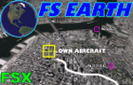
This program acts as a link between Flight Simulator X and Google Earth, letting to follow a flight in real time, over the satellite images generated by Google Earth. Flights can be saved, and many options are available for fine tuning the performance, as well as the map's style (zoom, tilt, orientation). Works on a single computer running FSX and Google Earth all together or, for best experience, can be used on two networked computers running respectively FSX (master) and Google Earth (slave). AI and Multiplayer traffic is also displayed in Google Earth, with course prediction and other information. Requires Flight Simulator X and Google Earth. The program running in trial mode works only around Anchorage, Alaska, (PANC / ANC) for a maximum of five minutes per flight session. Version 5.2 has new aircraft icons & labels and improves the compatibility with Windows Vista. A version for FS2004 is available also.
| Filename: | FS_Earth_52_for_Google_Earth_and_FSX.zip |
| License: | Shareware, time limited |
| Added: | 3rd May 2010, 07:38:23 |
| Downloads: | 2,701 |
| Author: | Luciano Napolitano |
| Size: | 3.46 MB |
| Category: Flight Simulator X - AFCAD Files | |
| Redwing Airport (2N6), NJ |
|
File Description:
Located 01 miles S of Jobstown, New Jersey on 53 acres of land, Redwing Airport is a small dual turf strip that hosts both single engine craft and gliders. No services are provided to transient aircraft, you can park over near the hangars (no visible tie downs). The Runway 11/29 edge lights are adjustable low-high in real life but for the sim I've set them at medium. Trees are summer ONLY.
Scenery constructed with use of satellite images/streetview, the author has not been there in person.
This scenery is meant to be used in conjunction with MegaScenery Earth New Jersey/Delaware 002. It is not required, but apron use is minimized to allow satellite scenery to show through as much as possible, and objects are placed based on the MSE textures - lack of it may make scenery look out of place.
| Filename: | Redwing_Airport_2N6_NJ.zip |
| License: | Freeware |
| Added: | 15th October 2010, 15:34:10 |
| Downloads: | 329 |
| Author: | Drew Sikora |
| Size: | 527.92 KB |
| Category: Flight Simulator X - AFCAD Files | |
| Weidel Private Airport (2NJ3) NJ |
|
File Description:
Located 03 miles W of Pennington, New Jersey, Weidel/Private/ Airport is a private turf strip. No transient services are offered. Trees are summertime ONLY. A fence completely borders the runway and there are 30ft trees on one approach and 30ft power lines immediately before the runway threshold on the other end, offering some casually challenging approaches. You can pull off the runway to park near the barn if you must rest briefly before heading out again.
Scenery constructed with use of satellite images/streetview, the author has not been there in person.
This scenery is meant to be used in conjunction with MegaScenery Earth New Jersey/Delaware 001. It is not required, but apron use is minimized to allow satellite scenery to show through as much as possible, and objects are placed based on the MSE textures - lack of it may make scenery look out of place.
| Filename: | Weidel_Private_Airport_2NJ3_NJ.zip |
| License: | Freeware |
| Added: | 29th October 2010, 03:37:26 |
| Downloads: | 204 |
| Author: | Drew Sikora |
| Size: | 421.43 KB |
| Category: Flight Simulator X - AFCAD Files | |
| Inductotherm Airport (3NJ6), NJ |
|
File Description:
Located 01 miles E of Rancocas, New Jersey, Inductotherm Airport is a private airstrip. No storage is offered for transient aircraft, although there is ample room on the tarmac if you wish to park there. You can also start from a parking spot - wingspans greater than 50 feet must start on the runway. 100LL fuel available by stopping near the fuel tank, Jet-A fuel available by landing near the fuel truck. Trees are summertime ONLY.
Scenery constructed with use of satellite images/streetview, the author has not been there in person.
This scenery is meant to be used in conjunction with MegaScenery Earth New Jersey/Delaware 002. It is not required, but apron use is minimized to allow satellite scenery to show through as much as possible, and objects are placed based on the MSE textures - lack of it may make scenery look out of place.
| Filename: | Inductotherm_Airport_3NJ6_NJ.zip |
| License: | Freeware |
| Added: | 25th November 2010, 14:18:37 |
| Downloads: | 187 |
| Author: | Drew Sikora |
| Size: | 1.16 MB |


© 2001-2026 AVSIM Online
All Rights Reserved
Privacy Policy |