
Where Flight Simulation Enthusiasts Gather from Around the World!
AVSIM Library - Search Results

| Category: Flight Simulator X - Scenery | |
| Mesh South America / MeSA D12 |

|
File Description:
FSX Mesh South America Project:
This terrain mesh file is a part of a whole project covering all the Continent
of South America and some islands, divided in tiles identified in a map by its
column (letters) and rows (numbers).
Those files were multi-LOD compiled from 90m SRTM2 source data, reprocessed
with 3DEM to remove voids and spikes, providing a 76.4m (LOD9) horizontal
resolution topography intended for use only in FSX updated with SP1.
Although not well documented, to improve performance, the updated FSX loads DEM
files in threads and only the closer terrain (about 5-10 NM from the point of view)
is rendered in high detail, while at far distances FSX shows up its default low
resolution mesh, when there is not a third part terrain mesh compiled in all
others intermediate level of details (multi-LOD).
THIS FILE:
FSX_MeSA_D12 (Column D x Row 12)
covers the area inside the boundaries:
N = 45º 0' S; S = 50º 37.5' S;
W = 67º 30' W; E = 60º 0' W;
AUTHORS:
Hely Heck Junior - Magrao ( [email protected] )
and Jose Lobo ( [email protected] )
TerraBrasilis: www.terra-brasilis.org
| Filename: | Mesh_South_America__MeSA_D12.zip |
| License: | Freeware |
| Added: | 13th June 2007, 15:28:04 |
| Downloads: | 1,146 |
| Author: | Hely Heck Jr. and José Lôbo |
| Size: | 5.54 MB |
| Category: Flight Simulator X - Scenery | |
| Mesh South America / MeSA D13 |
|
File Description:
FSX Mesh South America Project:
This terrain mesh file is a part of a whole project covering all the Continent
of South America and some islands, divided in tiles identified in a map by its
column (letters) and rows (numbers).
Those files were multi-LOD compiled from 90m SRTM2 source data, reprocessed
with 3DEM to remove voids and spikes, providing a 76.4m (LOD9) horizontal
resolution topography intended for use only in FSX updated with SP1.
Although not well documented, to improve performance, the updated FSX loads DEM
files in threads and only the closer terrain (about 5-10 NM from the point of view)
is rendered in high detail, while at far distances FSX shows up its default low
resolution mesh, when there is not a third part terrain mesh compiled in all
others intermediate level of details (multi-LOD).
THIS FILE:
FSX_MeSA_D13 (Column D x Row 13)
covers the area inside the boundaries:
N = 50º 37.5' S; S = 56º 15' S;
W = 67º 30' W; E = 60º 0' W;
AUTHORS:
Hely Heck Junior - Magrao ( [email protected] )
and Jose Lobo ( [email protected] )
TerraBrasilis: www.terra-brasilis.org
| Filename: | Mesh_South_America__MeSA_D13.zip |
| License: | Freeware |
| Added: | 13th June 2007, 16:38:14 |
| Downloads: | 1,124 |
| Author: | Hely Heck Jr. and José Lôbo |
| Size: | 4.79 MB |
| Category: Flight Simulator X - Scenery | |
| Mesh- South America MeSA_E06 |
|
File Description:
FSX Mesh South America Project:
This terrain mesh file is a part of a whole project covering all the Continent
of South America and some islands, divided in tiles identified in a map by its
column (letters) and rows (numbers).
Those files were multi-LOD compiled from 90m SRTM2 source data, reprocessed
with 3DEM to remove voids and spikes, providing a 76.4m (LOD9) horizontal
resolution topography intended for use only in FSX updated with SP1.
Although not well documented, to improve performance, the updated FSX loads DEM
files in threads and only the closer terrain (about 5-10) NM from the point of view)
is rendered in high detail, while at far distances FSX shows up its default low
resolution mesh, when there is not a third part terrain mesh compiled in all
others intermediate level of details (multi-LOD).
THIS FILE:
FSX_MeSA_E06 (Column E x Row 06)
covers the area inside the boundaries:
N = 11º 15' S; S = 16º 52.5' S;
W = 60º 0' W; E = 52º 30' W;
AUTHORS:
Hely Heck Junior - Magrao ( [email protected] )
and Jose Lobo ( [email protected] )
TerraBrasilis: www.terra-brasilis.org
| Filename: | Mesh_South_America_MeSA_E06.zip |
| License: | Freeware |
| Added: | 14th June 2007, 01:40:40 |
| Downloads: | 877 |
| Author: | Hely Heck Jr. and José Lôbo |
| Size: | 70.05 MB |
| Category: Flight Simulator X - Scenery | |
| Mesh-South America MeSA_E10 |
|
File Description:
FSX Mesh South America Project:
This terrain mesh file is a part of a whole project covering all the Continent
of South America and some islands, divided in tiles identified in a map by its
column (letters) and rows (numbers).
Those files were multi-LOD compiled from 90m SRTM2 source data, reprocessed
with 3DEM to remove voids and spikes, providing a 76.4m (LOD9) horizontal
resolution topography intended for use only in FSX updated with SP1.
Although not well documented, to improve performance, the updated FSX loads DEM
files in threads and only the closer terrain (about 5-10 NM from the point of view)
is rendered in high detail, while at far distances FSX shows up its default low
resolution mesh, when there is not a third part terrain mesh compiled in all
others intermediate level of details (multi-LOD).
THIS FILE:
FSX_MeSA_E10 (Column E x Row 10)
covers the area inside the boundaries:
N = 33º 45' S; S = 39º 22,5' S;
W = 60º 0' W; E = 52º 30' W;
AUTHORS:
Hely Heck Junior - Magrao ( [email protected] )
and Jose Lobo ( [email protected] )
TerraBrasilis: www.terra-brasilis.org
| Filename: | MeshSouth_America_MeSA_E10.zip |
| License: | Freeware |
| Added: | 14th June 2007, 13:59:05 |
| Downloads: | 943 |
| Author: | Hely Heck Jr. and José Lôbo |
| Size: | 21.54 MB |
| Category: Flight Simulator X - Scenery | |
| Mesh-South America MeSA_F04 |
|
File Description:
FSX Mesh South America Project:
This terrain mesh file is a part of a whole project covering all the Continent
of South America and some islands, divided in tiles identified in a map by its
column (letters) and rows (numbers).
Those files were multi-LOD compiled from 90m SRTM2 source data, reprocessed
with 3DEM to remove voids and spikes, providing a 76.4m (LOD9) horizontal
resolution topography intended for use only in FSX updated with SP1.
Although not well documented, to improve performance, the updated FSX loads DEM
files in threads and only the closer terrain (about 5-10 NM from the point of view)
is rendered in high detail, while at far distances FSX shows up its default low
resolution mesh, when there is not a third part terrain mesh compiled in all
others intermediate level of details (multi-LOD).
THIS FILE:
FSX_MeSA_F04 (Column F x Row 04)
This file covers the area inside the boundaries:
N = 0º 0' S; S = 5º 37.5' S;
W = 52º 30' W; E = 45º 0' W;
AUTHORS:
Hely Heck Junior - Magrao ( [email protected] )
and Jose Lobo ( [email protected] )
TerraBrasilis: www.terra-brasilis.org
| Filename: | MeshSouth_America_MeSA_F04.zip |
| License: | Freeware |
| Added: | 14th June 2007, 14:01:32 |
| Downloads: | 973 |
| Author: | Hely Heck Jr. and José Lôbo |
| Size: | 68.63 MB |
| Category: Flight Simulator X - Scenery | |
| Mesh-South America MeSA_G04 |
|
File Description:
FSX Mesh South America Project:
This terrain mesh file is a part of a whole project covering all the Continent
of South America and some islands, divided in tiles identified in a map by its
column (letters) and rows (numbers).
Those files were multi-LOD compiled from 90m SRTM2 source data, reprocessed
with 3DEM to remove voids and spikes, providing a 76.4m (LOD9) horizontal
resolution topography intended for use only in FSX updated with SP1.
Although not well documented, to improve performance, the updated FSX loads DEM
files in threads and only the closer terrain (about 5-10 NM from the point of view)
is rendered in high detail, while at far distances FSX shows up its default low
resolution mesh, when there is not a third part terrain mesh compiled in all
others intermediate level of details (multi-LOD).
THIS FILE:
FSX_MeSA_G04 (Column G x Row 04)
covers the area inside the boundaries:
N = 0º 0' S; S = 5º 37.5' S;
W = 45º 0' W; E = 37º 30' W;
AUTHORS:
Hely Heck Junior - Magrao ( [email protected] )
and Jose Lobo ( [email protected] )
TerraBrasilis: www.terra-brasilis.org
| Filename: | MeshSouth_America_MeSA_G04.zip |
| License: | Freeware |
| Added: | 15th June 2007, 00:10:58 |
| Downloads: | 867 |
| Author: | Hely Heck Jr. and José Lôbo |
| Size: | 35.9 MB |
| Category: Flight Simulator X - Scenery | |
| Chicago Midway Airport V2 |
|
File Description:
This is my second version of Chicago Midway Airport in Chicago IL for FSX. This version was created with Airport Design Editor 1.30, which was designed exclusively for use with FSX. The following improvements have been made: 1. All commercial and GA aircraft will park at their assigned spots. All gates for all airlines are included. 2. The vehicle paths have been redesigned, which should eliminate the problem of airport vehicles using taxiways, which can cause taxiing airplanes to come to a standstill and cause traffic to back up. 3. When in tower view, the view will be from the roof of the control tower, thanks to Airport Design Editor. 4. Crosswind runways have been activated, which will open more runways to airline traffic. This is an optional feature, and will be explained in the Readme file. 5. Several fuel trucks have been added, and should serve departing aircraft quickly. 6. Settings have been changed in ADE so that all jetways will display as long as Scenery Density in FSX is set at Normal or higher. Please be aware that this scenery is for use with FSX only. It will not work with FS9.
| Filename: | Chicago_Midway_Airport__V2.zip |
| License: | Freeware, limited distribution |
| Added: | 30th June 2008, 08:50:03 |
| Downloads: | 4,811 |
| Author: | Patrick Finch |
| Size: | 39.13 KB |
| Category: Flight Simulator X - Scenery | |
| 2016 Kigali Intl (HRYR) Rwanda |
|
Images related to this file:
File Description:
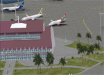
This sequel to the 2009 Kigali Intl (HRYR) Rwanda scenery (by Jacques Botha and Frits Beyer) brings it up to date with the current layout and enables full compliance with FTX Global/Vector and FSX. Buildings are added and adjusted to their real-world locations, and the new taxiway and south apron are added according to the May 2016 satellite imagery. In addition to real-world gate locations, custom apron markings are added along with apron lighting. The landclass around Kigali is also updated, and SRTMGL1 (30m) mesh is included. This scenery can be complemented by the Goma (FZNA) and Gisenyi (HRYG) scenery (FSX_FZNA-HRYG_CS.zip), and GA flightplans are included to supplement the commercial traffic at Kigali and provide more activity at FZNA and HRYG.
Updates were created or rebuilt in a manner which carefully aligns airport data with current satellite imagery. Scenery was created using Airport Design Editor X v1.70.6042, SBuilderX 3.13, and the FSX Object Placement Tool. Scenery objects were added and modified from stock FSX scenery to resemble as closely as possible the actual airports. The FSX apron lights included are from the set created by Jim Dhaenens.
| Filename: | 2016_Kigali_Intl_HRYR_Rwanda.zip |
| License: | Freeware |
| Added: | 4th August 2016, 21:10:09 |
| Downloads: | 3,385 |
| Author: | Carlyle Sharpe, Jacques Botha, and Frits Beyer |
| Size: | 17.12 MB |
| Category: Flight Simulator X - Scenery | |
| HALA - Hawassa Intl. - Hawassa, Ethiopia |
|
Images related to this file:
File Description:
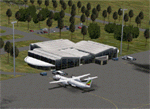
This project adds the booming city of Hawassa, Ethiopia, creates the new international airport (HALA), moves (and rebuilds) the downtown airport (recoded to HALX), and includes AI flight plans for the Ethiopian Airlines service that began April 2016. Tested in both the default FSX: Acceleration and with FTX Global/Vector, accurate coastlines, lakes, road data, and SRTMGL1 (30m) mesh, as well as corrected landclass are provided based on the latest available satellite imagery. The Hawassa International Airport was created using information from the current satellite footprint and the promotional video from Ethiopian Airports Enterprise (EAE). Although there is still very little published data on the airport, it is fully functional.
Updates were created or rebuilt in a manner which carefully aligns airport data with current satellite imagery. Scenery was created using Airport Design Editor X v1.70.6042, SBuilderX 3.13, and the FSX Object Placement Tool. Scenery objects were added and modified from stock FSX scenery to resemble as closely as possible the actual airports. The FSX apron lights included are from the set created by Jim Dhaenens. Thanks to Ron Blehm for bringing this part of the world to my attention.
| Filename: | HALA__Hawassa_Intl___Hawassa_Ethiopia.zip |
| License: | Freeware |
| Added: | 20th July 2016, 09:06:40 |
| Downloads: | 1,021 |
| Author: | Carlyle Sharpe |
| Size: | 10.41 MB |
| Category: Flight Simulator X - Aircraft Repaints, Textures and Modifications | |
| USAF Douglas C-124A 3rd Strategic Support Squadron |
|
Images related to this file:
File Description:
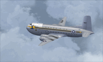
This is a repaint of the Douglas C-124A in USAF colors. The freeware Douglas C-124 for FSX by Jens Kristensen (JBK) is needed for this repaint. C-124s were operated by the Strategic Support Squadron (SSS), which came under the umbrella of the Air Force's strong arm of the sky - the Strategic Air Command (SAC). This C-124A, serial 49-247, was part of the 3rd SSS nicknamed the "Globesters". This squadron was activated in 1950, and based at Hunter AFB, in Georgia. By February 1951 the Globesters had 13 C-124s in their squadron. The squadron was transfered to Barksdale AFB in Louisiana in 1953. They stayed there until 1961, when they got disbanded. Textures are 32bit DDS. This repaint was tested on FSX-SE. It should also work on FSX, and P3Dv1-3.
| Filename: | USAF_Douglas_C124A_3rd_Strategic_Support_Squadron.zip |
| License: | Freeware |
| Added: | 12th November 2019, 17:39:53 |
| Downloads: | 73 |
| Author: | Ted Giana |
| Size: | 5.06 MB |


© 2001-2026 AVSIM Online
All Rights Reserved
Privacy Policy |