
Where Flight Simulation Enthusiasts Gather from Around the World!
AVSIM Library - Search Results

| Category: Flight Simulator X - Scenery | |
| Unalakleet Alaska V3.0 |

|
Images related to this file:
File Description:
Made famous on the Discovery Channel in the program Flying Wild Alaska , this is Unalakleet airport.Completely custom built with animated smoke and a reworked AFCAD.Works best with FSX SP2 or Acceleration installed.This airport works with ultimate terrain Alaska and the default FSX scenery.If you have Ultimate Terrain Alaska installed put this airport higher up in your priority list.More parking for traffic and beacon was upgraded.Thanks to jim Dhaenens for the beacon.No more crash if you got crash detection on,fix and working,sorry for that.
| Filename: | Unalakleet_Alaska_V30.zip |
| License: | Freeware |
| Added: | 19th May 2011, 01:13:42 |
| Downloads: | 4,669 |
| Author: | Frits Beyer and Jacques Botha |
| Size: | 2.37 MB |
| Category: Flight Simulator X - Scenery | |
| USA West Mountain Landclass |
|
File Description:
The Landclass File is a stand alone scenery, you can use it with the FS Standart Scenery or other Landclass files like Cloud9, FS Genesis etc.
Now you will see rocky mountain Landclasses in the USA.
Green mountains are now past!! You get now the feeling to fly over high mountains and not over green hills.
The best results you get with FS Global or another good mesh like My World X
Installation:
Extract to the folder of FSX and activate the scenery in FSX
| Filename: | USA_West_Mountain_Landclass.zip |
| License: | Freeware |
| Added: | 15th March 2008, 09:51:35 |
| Downloads: | 2,374 |
| Author: | Markus Balz |
| Size: | 148.57 KB |
| Category: Flight Simulator X - Aircraft Repaints, Textures and Modifications | |
| Boeing 737-200ADV, V1.32 Update |
|
Images related to this file:
File Description:
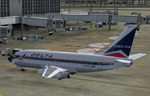
V1.32 (bugfix) update to the TinMouse II Boeing 737-200 add-on. Universal update for both FS9 and FSX versions.
Update only, requires install of full version V1.30 and the V1.31 update prior to installing this update. Fixes FSX bug that caused loss of communications with FSUIPC when panel resize or switch between windowed/full-screen mode occurred. Other minor bug fixes and improvements. Visit the TinMouse forum here on AVSIM for support and information.
| Filename: | Boeing_737200ADV_V132_Update.zip |
| License: | Freeware, limited distribution |
| Added: | 7th January 2011, 21:32:22 |
| Downloads: | 14,942 |
| Author: | Bob Scott, Richard Probst |
| Size: | 3.56 MB |
| Category: Flight Simulator X - Aircraft Repaints, Textures and Modifications | |
| Qantas (soccer c/s) Boeing 747-400 (VH-OEB) |
|
Images related to this file:
File Description:
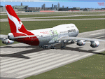
This FSX repaint represents the PMDG 747-400 Queen of the Skies and a special paint scheme applied to VH-OEB for Australia's bid of hosting the World Cup in 2018 or 2022. (Recently the 2018 bid was withdrawn).
The aircraft was hand painted using the PMDG paintkit and features DDS DXT5 textures and updated night textures which increase the illumination of the fuselage and tail at night.
PMDG 747-400 for FSX required. See readme for important installation instructions and enjoy the repaint.
| Filename: | Qantas_soccer_cs_Boeing_747400_VHOEB.zip |
| License: | Freeware |
| Added: | 11th July 2010, 17:40:40 |
| Downloads: | 648 |
| Author: | Mark Aldridge |
| Size: | 1.67 MB |
| Category: Flight Simulator X - Scenery Design | |
| Animated Flags |
|
Images related to this file:
File Description:
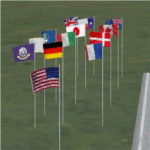
This scenery addon has been developed on Win 7 for FSX Flight Simulator SP1 or SP2. It has also been tested with Microsoft Acceleration, but compatibility is not guaranteed by the author.
The package provides a little collection of animated flags for scenery designers and FS users who do understand the handling of folders and files for FSX. The animated flag models have been developed with GMAX. Along with the textures the package includes the model (mdl) and bgl files. The XML files for the individual placement of a flag into a FSX scenery are included as well.
The documentation contains a step by step description on how to place the flag into the FSX scenery, on a position of your choice. In order to paint your own individual animated flag, the Appendix B of the documentation describes in detail on how to do it. However, a basic experience on how to work with graphical tools like Photoshop, GIMP, Paint Shop Pro etc. is required to paint the extures/colors for a new flag. For credits look at the pdf documentation inside the zip file. By Dietmar Loleit
| Filename: | Animated_Flags.zip |
| License: | Freeware |
| Added: | 17th October 2014, 22:59:25 |
| Downloads: | 661 |
| Author: | Dietmar Loleit |
| Size: | 5.98 MB |
| Category: Flight Simulator X - Scenery | |
| Mesh South America / MeSA A02 |
|
File Description:
FSX Mesh South America Project:
This terrain mesh file is a part of a whole project covering all the Continent of South America and some islands, divided in tiles identified in a map by its column (letters) and rows (numbers).
Those files were multi-LOD compiled from 90m SRTM2 source data, reprocessed with 3DEM to remove voids and spikes, providing a 76.4m (LOD9) horizontal resolution topography intended for use only in FSX updated with SP1.
Although not well documented, to improve performance, the updated FSX loads DEM files in threads and only the closer terrain (about 5 NM from the point of view) is rendered in high detail, while at far distances FSX shows up its default low resolution mesh, when there is not a third part terrain mesh compiled in all others intermediate level of details (multi-LOD).
THIS FILE:
FSX_MeSA_A02
Column A x Row 02
This file covers the area inside the boundaries:
N = 11º 15' N; S = 5º 37,5' N;
W = 90º 0' W; E = 82º 30' W;
AUTHORS:
Hely Heck Junior - Magrao ( [email protected] )
and Jose Lobo ( [email protected] )
TerraBrasilis: www.terra-brasilis.org
| Filename: | Mesh_South_America__MeSA_A02.zip |
| License: | Freeware |
| Added: | 11th June 2007, 00:02:15 |
| Downloads: | 1,592 |
| Author: | Hely Heck Jr. and José Lôbo |
| Size: | 10.95 MB |
| Category: Flight Simulator X - Scenery | |
| Mesh South America / MeSA A03 |
|
File Description:
FSX Mesh South America Project:
This terrain mesh file is a part of a whole project covering all the Continent of South America and some islands, divided in tiles identified in a map by its column (letters) and rows (numbers).
Those files were multi-LOD compiled from 90m SRTM2 source data, reprocessed with 3DEM to remove voids and spikes, providing a 76.4m (LOD9) horizontal resolution topography intended for use only in FSX updated with SP1.
Although not well documented, to improve performance, the updated FSX loads DEM files in threads and only the closer terrain (about 5 NM from the point of view) is rendered in high detail, while at far distances FSX shows up its default low resolution mesh, when there is not a third part terrain mesh compiled in all others intermediate level of details (multi-LOD).
THIS FILE:
FSX_MeSA_A03
Column A x Row 03
This file covers the area inside the boundaries:
N = 5º 37,5' N; S = 0º 0' S;
W = 90º 0' W; E = 82º 30' W;
AUTHORS:
Hely Heck Junior - Magrao ( [email protected] )
and José Lôbo ( [email protected] )
TerraBrasilis: www.terra-brasilis.org
| Filename: | Mesh_South_America__MeSA_A03.zip |
| License: | Freeware |
| Added: | 11th June 2007, 00:02:40 |
| Downloads: | 1,419 |
| Author: | Hely Heck Jr. and José Lôbo |
| Size: | 1.52 MB |
| Category: Flight Simulator X - Scenery | |
| Mesh South America / MeSA A01 |
|
File Description:
FSX Mesh South America Project:
This terrain mesh file is a part of a whole project covering all the Continent of South America and some islands, divided in tiles identified in a map by its column (letters) and rows (numbers).
Those files were multi-LOD compiled from 90m SRTM2 source data, reprocessed with 3DEM to remove voids and spikes, providing a 76.4m (LOD9) horizontal resolution topography intended for use only in FSX updated with SP1.
Although not well documented, to improve performance, the updated FSX loads DEM files in threads and only the closer terrain (about 5 NM from the point of view)is rendered in high detail, while at far distances FSX shows up its default low resolution mesh, when there is not a third part terrain mesh compiled in all others intermediate level of details (multi-LOD).
THIS FILE: FSX_MeSA_A01
(Column A x Row 01)
This file covers the area inside the boundaries:
N = 16º 52,5' N; S = 11º 15' N;
W = 90º 0' W; E = 82º 30' W;
AUTHORS:
Hely Heck Junior - Magrao ( [email protected] )
and Jose Lobo ( [email protected] )
TerraBrasilis: www.terra-brasilis.org
| Filename: | Mesh_South_America__MeSA_A01.zip |
| License: | Freeware |
| Added: | 11th June 2007, 00:03:00 |
| Downloads: | 1,958 |
| Author: | Hely Heck Jr. and José Lôbo |
| Size: | 49.55 MB |
| Category: Flight Simulator X - Scenery | |
| Mesh South America / MeSA B01 |
|
File Description:
FSX Mesh South America Project:
This terrain mesh file is a part of a whole project covering all the Continent of South America and some islands, divided in tiles identified in a map by its column (letters) and rows (numbers).
Those files were multi-LOD compiled from 90m SRTM2 source data, reprocessed with 3DEM to remove voids and spikes, providing a 76.4m (LOD9) horizontal resolution topography intended for use only in FSX updated with SP1.
Although not well documented, to improve performance, the updated FSX loads DEM files in threads and only the closer terrain (about 5-10 NM from the point of view) is rendered in high detail, while at far distances FSX shows up its default low resolution mesh, when there is not a third part terrain mesh compiled in all others intermediate level of details (multi-LOD).
THIS FILE: FSX_MeSA_B01 (Column B x Row 01)
This file covers the area inside the boundaries:
N = 16º 52,5' N; S = 11º 15' N;
W = 82º 30' W; E = 75º 0' W;
AUTHORS:
Hely Heck Junior - Magrao ( [email protected] )
and Jose Lobo ( [email protected] )
TerraBrasilis: www.terra-brasilis.org
| Filename: | Mesh_South_America__MeSA_B01.zip |
| License: | Freeware |
| Added: | 11th June 2007, 15:56:55 |
| Downloads: | 1,400 |
| Author: | Hely Heck Jr. and José Lôbo |
| Size: | 1.53 MB |
| Category: Flight Simulator X - Scenery | |
| Mesh South America / MeSA B06 |
|
File Description:
FSX Mesh South America Project:
This terrain mesh file is a part of a whole project covering all the Continent of South America and some islands, divided in tiles identified in a map by its column (letters) and rows (numbers).
Those files were multi-LOD compiled from 90m SRTM2 source data, reprocessed with 3DEM to remove voids and spikes, providing a 76.4m (LOD9) horizontal resolution topography intended for use only in FSX updated with SP1.
Although not well documented, to improve performance, the updated FSX loads DEM files in threads and only the closer terrain (about 5-10 NM from the point of view) is rendered in high detail, while at far distances FSX shows up its default low resolution mesh, when there is not a third part terrain mesh compiled in all others intermediate level of details (multi-LOD).
THIS FILE:
FSX_MeSA_B06 (Column B x Row 06)
This file covers the area inside the boundaries:
N = 11º 15' S; S = 16º 52,5' S;
W = 82º 30' W; E = 75º 0' W;
AUTHORS:
Hely Heck Junior - Magrao ( [email protected] )
and Jose Lobo ( [email protected] )
TerraBrasilis: www.terra-brasilis.org
| Filename: | Mesh_South_America__MeSA_B06.zip |
| License: | Freeware |
| Added: | 11th June 2007, 22:10:10 |
| Downloads: | 1,422 |
| Author: | Hely Heck Jr. and José Lôbo |
| Size: | 12.99 MB |


© 2001-2026 AVSIM Online
All Rights Reserved
Privacy Policy |