
Where Flight Simulation Enthusiasts Gather from Around the World!
AVSIM Library - Search Results

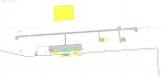
| Category: Flight Simulator X - AFCAD Files | |
| MTPP - Toussaint Louverture International Airport / Port-au-Prince, Haiti |

|
Images related to this file:
File Description:
MTPP - Toussaint Louverture International Airport / Port-au-Prince, Haiti
This airport update was made with the latest version of ADE (Airport Design Editor) and made for FSX as a replacement for the stock (default) airport. I found that most stock airports in FSX lack a decent amount of character and realism and this area in particular was dreadful! The stock airport was rather inaccurate. I've made several additions to the airport which are listed below. All these enchancements are as close to the real airport as I can get with stock library objects. I've used satellite images, terminal photos and maps throughout the whole process so building locations are as accurate as possible. Happy landings in Haiti!
Features:
*Expanded parking apron
*Seperate parking aprons for GA traffic
*Main terminal building with its 3 jetways
*Cargo area
*Hangars and other airport buildings added
*Airport vehicles and objects throughout the airport
*Corrected runway length and numbering
*Corrected taxiway signs
*Birds near the airport
*More ships and smaller fishing vessels added to the Port-au-Prince bay
*Fishing marina added in the bay
*Main road in front of airport added with static vehicles
*Parking lots with static vehicles
*Vegetation in front of airport
| Filename: | MTPP__Toussaint_Louverture_International_Airport__.zip |
| License: | Freeware |
| Added: | 15th July 2012, 06:44:51 |
| Downloads: | 1,163 |
| Author: | Jaison Diaz |
| Size: | 10.19 KB |
| Category: Flight Simulator X - Scenery | |
| YCDN Corunna Downs Station and Old Corunna Downs RAAF (Closed) |
|
File Description:
Corunna Downs heritage listed RAAF Base was a secret airfield located in scrub and spinifex country, about 16 kms south west of Marble Bar, the hottest part of the "The Pilbara" area of Western Australia. Not a very ideal place to have a tent city. Today there are very few reminders of the once busy airfield. One can see some crumbling foundations and half filled post holes. 73 OBU operated the Corunna Downs airfield which comprised two intersecting bitumen runways, now regressed and graded occasionally. One ran approximately north-south, 5,000 feet in length while the other ran approximately east-west, 7,000 feet in length. Both runways were approximately 150 feet wide. A 50 foot wide taxiway linked the northern end of the north-south runway to the western end of the east-west runway. Approximately 20 camouflaged revetments to disperse aircraft to minimise bomb damage were constructed at Corunna Downs. Permission is required for landing and there may be vegetation on the strip if not graded recently. No cones or windsock so be careful. Corunna Downs Homestead is also heritage listed and consists of graded strips and homestead complex. Start points are at the homestead and the RAAF base is to the west. REQUIRES Blencowe_LibraryKit.zip
REQUIRES blencowe_librarykit_309494.zip (Available HERE)
| Filename: | YCDN_Corunna_Downs_Station_and_Old_Corunna_Downs_R.zip |
| License: | Freeware |
| Added: | 25th February 2013, 08:59:42 |
| Downloads: | 281 |
| Author: | Alan Blencowe |
| Size: | 4.92 MB |
| Category: Flight Simulator X - AFCAD Files | |
| Windward Farms Airport (4NJ0), NJ |
|
File Description:
Located 02 miles NW of Rosemont, New Jersey, Windward Farms Airport is a private turf strip. Like most small private turf strips this one can prove to be slightly challenging when it comes to taking off and landing - especially in a crosswind. The runway threads between two separate stands of trees to either side, and 1/4 of the Runway 11 left side is hedged by small trees and bushes. While the published dimensions for this strip are 3500x150 feet, in reality the usable runway space is really 3000x100 feet due to vegetation. This airport as rendered in FSX does not have an actual runway surface, so when you land you will be landing on actual terrain. There isn't a noticeable slope but it can be bumpy so use caution! Edge lighting is provided for the runway, although night landings/takeoffs are not recommended. There are no services provided by this airfield. After landing why not taxi over to the hangar and feed the sheep grazing in the pasture?
Scenery constructed with use of satellite images/streetview/aerial photos - the author has not been there in person.
This scenery is meant to be used in conjunction with MegaScenery Earth New York 007. It is not required, but apron use is minimized to allow satellite scenery to show through as much as possible, and objects are placed based on the MSE textures - lack of it may make scenery look out of place.
| Filename: | Windward_Farms_Airport_4NJ0_NJ.zip |
| License: | Freeware |
| Added: | 1st February 2011, 10:29:23 |
| Downloads: | 201 |
| Author: | Drew Sikora |
| Size: | 563.16 KB |
| Category: Flight Simulator X - Scenery | |
| Ireland VFR Small Airports part 1 |
|
File Description:
Ireland VFR Small Airports Part 1.
This scenery includes 5 small airports in Ireland. EIDL Donegal is in the far North West, EIAB Abbeyshrule is located in the centre of Ireland. EIKL Kilkenny is located in the South East and Newcastle can be found on the East coast. EITM is a small grass strip to the north West of Dublin. Donegal and Abbeyshrule have paved runways whilst the others consist of small grass strips.
The scenery includes animals, vegetation and rural objects. It also includes sound effects, animations, some high definition people, and aircraft painted using real Irish aircraft photos. Many of the airports include open hangers and buildings modelled from real photographs. Although Donegal is the only one with ILS, full night textures are included for all the airports.
Many of the files are stand alone and can be switched on or off according to user preference. The scenery can be used as a standalone, however it also uses objects from my other scenery addons.
The scenery has been tested with FSXA only and is designed to complement vfr photographic scenery. It will also work with the FSX default terrain, however all objects have been placed using ordinance survey data and may therefore appear misplaced in the default.
Full installation instructions are included in the Readme file.
I hope you enjoy using the airports as much as I enjoyed making them.
| Filename: | Ireland_VFR_Small_Airports_part_1.zip |
| License: | Freeware |
| Added: | 21st December 2011, 00:18:25 |
| Downloads: | 4,975 |
| Author: | George Keogh |
| Size: | 51.33 MB |
| Category: Flight Simulator X - Scenery | |
| hythevillage_pier.zip |
|
File Description:
Hythe Village and Pier
Hythe Village [Town] nestles between the edge of Southampton Water and the New Forest, some 500 yards west of the ‘American Base – RAF Hythe’; the surrounding area is known as ‘The Waterside’. Hythe, with its waterfront, boasts incredible views across Southampton Water, while the village [town] centre, with its Georgian High Street, offers a range of shops, services, traffic-free precincts and parking facilities. Nearby is ‘Hythe Marina’, to be found on Southampton Water's southern shore; it’s a unique development of a 206 berth marina, together with waterside homes, shops, restaurants, bars and a boutique hotel.There is also a passenger ferry which sails back-and-forth from Hythe Pier to the City of Southampton every 30 minutes. Before Hythe Pier was built, ferry and other boats arriving at Hythe had to use a gravel hard ramp which ran from the land out to the low tide point in Southampton Water. Walking along the hard gravel was not easy and travellers often got very wet. Various ideas to improve the situation were suggested at the time and construction of Hythe Pier was eventually started in October 1879 and officially opened on the 1st January 1881. Many World War II heroes departed from this pier on D-Day in June 1944.The pier itself stretches some 640 meters into Southampton Water and is one of the ten longest piers in the British Isles. In 1922, a narrow gauge electric railway opened in order to take passengers the full length of the Pier. This railway, with its original engine and rolling stock, is the oldest operating electric pier train in the world and is still operational to this day – playing an important part in the local transportation system between Hythe and Southampton.
Scenery Features
* Bus Shelter
* Ferry Ticket Collectors (On pier landing platform)
* Ferry Ticket Office
* High Street Shops
* Hotspur House
* Hythe Library & Car Park
* Hythe Pier
* Hythe Pier Landing Platform
* Hythe Promenade
* Library Road & Shops
* Lidl Superstore & Car Park
* People (Static & animated)
* Pier Railway & Safety Railings
* Pier Train (Parked at village end of pier)
* Lord Nelson Public House
* Prospect Place Park
* Public Toilets
* Seashells Lounge Bar & Restaurant
* St. John's Church & Cemetery
* Street Lighting
* Streets & Roadways
* ‘The Marsh’ & New Road
* Vegetation (Trees, bushes)
* Vehicles (Buses & cars)
* Waitrose Supermarket & Car Park
* WWII Remembrance Plaque (Prospect Place)
Special Effects
* Animated Birds (seagulls-close to village & pier)
* Chimney Smoke
* Night, Dusk & Dawn Lighting Effects
* Seagull Cry Sounds
| Filename: | hythevillage_pierzip.zip |
| License: | Freeware |
| Added: | 21st November 2025, 12:42:28 |
| Downloads: | 68 |
| Author: | Barrie Semmens |
| Size: | 16.37 MB |
| Category: Flight Simulator X - Scenery Design | |
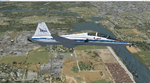
| (Version 2.0) KEFD -Ellington 2025 Refresh FSX (Circa 2006-2010)- Johnson Space Center Houston |
|
Images related to this file:
File Description:
Version 2.0 covers landclass across the entire greater Houston area, with a large increase in LOD. This version significantly tightens up and improves the landclass from version 1.0, and adds a vast amount of scenery objects that brings the Bay Area-KEFD area into the modern era. This improves and adds a highly accurate runway 17 approach with accurate placement of buildings and scenery around the year 2011-modern day. In addition, includes several new files including a new airport/helipad via Houston Clear lake regional airport, T41 La Porte Municipal and surrounding shipping ports, Kemah Boardwalk, and a giant improvement to Johnson Space Center Houston. Rundway 35 and Runway 22 landclass is significantly increased, and more accurate as well. You can fly an accurate VFR approach or set up an ILS for any one of KEFD's runways with ease with this improvement.List of Version 2.0 additions and changes: - I added a ton of scenery objects and tightened up the landclass at Johnson Space Center Houston- NASA Control Center--- Added Talon Park with T38s (via static objects)--- Added Gemeni V rocket and 747 for the shuttle transporter--- And a whole bunch of vegetation, new buildings, and tour buses.- Added Kemah boardwalk and several boat docks- Removed a TON of highrise textures and replaced with medium and large city suburb landclass.- Added Clear Lake regional Hospital with helipad and surrounding scenery by Walter Reed Park- Added El Jardin or "Bayport Container port" with several scenery objects and significantly tightened up landclass.-- Looks great when setting up ILS approach for RWY 22- Tightened up Bay Area BLVD landclass, "adding" University of Houston Clear Lake"-- UHCL was semi already present, just made it more pronounced.- Made Red Bluff road landclass super recognizable!-- Red Bluff road is used to set up VFR approach and or field break for RWY 22 and RWY 17 R.----- Its common to see private jets and the USAF doing a break along Red Bluff road.- Added First Baptist Church, and water tower to Pasadena Convention center- Made Fairmont Parkway pronounced with landclass- Added Houston Port Authority at Morgan's Point--- Another Landmark for the RWY 22 ILS approach, NASA religiously uses this to line up the 10 mile ILS.- Tightened up landclass at Village Grove East and along Fairmont Parkway- Added a TON of scenery objects and landclass corrections for approach of RWY 17 L and 17 R.---- Added Home Depot, Lowes, Walmart Super center, Guitar center etc.---- added South Main Baptist Church--- Bondy Jr High, Turner Elementary, and Pasadena Memorial High School--- Added Saint Luke's Hospital--- Added Hampton Inn Suites and HCA rehab hospital--- Added a ton to the container facility behind best buy and storage facility--- Added smaller churches on RWY 17 approach--- Added a ton of scenery at the base of RWY 17 R, i.e., concrete plant, containers, trucks-- Added gas stations on the corner of beltway 8 and genoa red bluff-- Significantly changed and tightened up landclass at the base of RWY 22 and RWY 17 L and 17 R-- Made several roads and Beltway pronounced------ This decision looks AWESOME at night, really adds demarcation to the roads.**All of this makes the RWY 17 approach super recognizable** RWY 22 approach landclass is much more accurate.- Significantly changed and tightened up landclass near southbelt ellington and interstate 45.- Added Grace Church-- I wanted to do San Jacinto College south, but seemed over kill at that point.- SIGNIFICANTLY tightened up landclass for RWY 35 approach and near baybrook mall.-- Along I45- Added TDECU stadium at the University of Houston Main Campus---- So you can practice flybys for Cougar games!- Added the Battleship at San Jacinto Monument- I also "borrowed" T41 La Porte Municipal's tower camera to make a SWEET view of KEFD.- I included landclass for Sealy Texas this time, as well as my significant enhancements of Austin, Texas greater area as well (optional, but recommended!)---------------------------------------------------------------------------Version 1.0 originally added:- Added the Johnson Space Center Houston, which is now greatly enhanced and blended.- San Jacinto Community College-Central- Pasadena Convention Center- Pasadena Water Treatment Facility- NASA Bouncy Lab- Pasadena Shopping center, now greatly enhanced and blended.- Baybrook Mall and other shopping spots.- Significant Landclass improvements across the entire greater Houston Area File also includes landclass and scenery improvements for the greater Austin, Texas Area (optional), KIAH, KDWH, and Sealy, Texas. Each of these projects combined covers roughly 15,000 square miles of landclass improvement. Allowing you to fly entirely from Houston to Austin, or Houston to San Antonio in accurate landclass. -Enjoy!DJN
| Filename: | Version_20_KEFD_Ellington_2025_Refresh_FSX_Circa_2.zip |
| License: | Freeware |
| Added: | 12th October 2025, 16:15:47 |
| Downloads: | 66 |
| Author: | Dan Nelson |
| Size: | 277.28 MB |
© 2001-2026 AVSIM Online
All Rights Reserved
Privacy Policy |