
Where Flight Simulation Enthusiasts Gather from Around the World!
AVSIM Library - Search Results

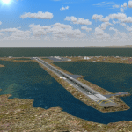
| Category: Flight Simulator X - AFCAD Files | |
| PABV - Birchwood Airport - Alaska, USA |

|
Images related to this file:
File Description:
This is a complete re-work of the airport based on the 2012 plans. Added runway 2R/20L. Created with Airport Design Editor by ScruffyDuck Software using current FAA documentation and Google Earth measurements, this package offers a replacement for FSX's stock airport. All these enhancements are as close to the real airport as I can get with stock library objects.
| Filename: | pabv_afcad.zip |
| License: | Freeware |
| Added: | 27th August 2014, 14:11:34 |
| Downloads: | 225 |
| Author: | Wayne Roberts |
| Size: | 8 KB |
| Category: Flight Simulator X - Scenery | |
| KWT - Kwethluk Airport - Alaska, USA |
|
Images related to this file:
File Description:
Kwethluk Airport has one gravel surfaced runway (18/36) measuring 3,198 by 75 ft. (975 by 23 m). The airport was relocated from its former site at coordinates 60°48.26'N 161°26.72'W which had a 1,750 by 35 ft runway (6/24) and a 5,000 x 500 ft seaplane landing area. The construction plans for 2005 moved the aircraft parking area to Runway 18/36 and removed runway 6/24.
Created with Airport Design Editor 9x by ScruffyDuck Software using current FAA documentation and Google Earth measurements, this package offers a replacement for FSX's stock airport. All these enhancements are as close to the real airport as I can get with stock library objects and custom buildings.
| Filename: | kwtairport.zip |
| License: | Freeware |
| Added: | 31st December 2014, 01:32:07 |
| Downloads: | 571 |
| Author: | Wayne Roberts |
| Size: | 251 KB |
| Category: Flight Simulator X - Scenery | |
| A85 - Kwigillingok Airport - Alaska, USA |
|
Images related to this file:
File Description:
Kwigillingok Airport (IATA: KWK, ICAO: PAGG, FAA LID: GGV, formerly A85) is owned by the Native Village of Kwigillingok and is a public-use airport located one mile (two kilometres) northwest of the central business district of Kwigillingok, in the Bethel Census Area of the U.S. state of Alaska. There is also a nearby seaplane landing area known as Kwigillingok Seaplane Base (FAA LID: KWK).Runway 15/33 was increased from 1,835 feet and 40 feet wide to 3,300 feet and 60 feet wide. Runway 4/22 was added along with custom models. All changes were made based on the 2014 construction plans.
Created with Airport Design Editor 9x by ScruffyDuck Software using current FAA documentation and Google Earth measurements, this package offers a replacement for FSX's stock airport. All these enhancements are as close to the real airport as I can get with stock library objects and custom buildings.
| Filename: | a85airport.zip |
| License: | Freeware |
| Added: | 5th January 2015, 00:26:44 |
| Downloads: | 688 |
| Author: | Wayne Roberts |
| Size: | 374 KB |
| Category: Flight Simulator X - Scenery | |
| 9Z8 - Lovelock Airport - Alaska USA |
|
Images related to this file:
File Description:
Added runway 7/25 along with taxiways, increased parking apron and custom buildings. Changes are based on 2013 construction plans.
Created with Airport Design Editor 9x by ScruffyDuck Software using current FAA documentation and Google Earth measurements, this package offers a replacement for FSX's stock airport. All these enhancements are as close to the real airport as I can get with stock library objects and custom buildings.
| Filename: | 9z8airport.zip |
| License: | Freeware |
| Added: | 11th January 2015, 08:01:39 |
| Downloads: | 593 |
| Author: | Wayne Roberts |
| Size: | 314 KB |
| Category: Flight Simulator X - Scenery | |
| IGT - Nightmute Airport - Alaska, USA |
|
Images related to this file:
File Description:
The airport islocated southeast of the central business district of the vellage of Nightmute.Nightmute is located on Nelson Island near Toksook Bay. The two villages connect by snowmachine trail in winter.
Runway 2/20 was changed to 3/21. Changed the length of Runway 3/21 from 50 feet wide and a legth of 1,600 feet to 75 feet wide and 3,200 feet long.Added Runway 11/29 along with custom models.Changes are based on construction plans dated 2005.
Created with Airport Design Editor by ScruffyDuck Software using current FAA documentation and Google Earth's measurements, this package offers a replacement for FSX's stock airport. All these enhancements are as close to the real airport as I can get with stock library objects and custom buildings.
| Filename: | igtairport.zip |
| License: | Freeware |
| Added: | 3rd February 2015, 09:12:14 |
| Downloads: | 653 |
| Author: | Wayne Roberts |
| Size: | 220 KB |
| Category: Flight Simulator X - AFCAD Files | |
| PAOT - Wien Meml - Kotzebue, Alaska |
|
Images related to this file:
File Description:
This AFCAD of the airport Wien Meml - Kotzebue (PAOT), Alaska, fixes some issues for Scenery Solution's UTX Alaska users who want to use mesh and texture resolutions better than 38 m and 1 m, respectively. Unfortunately this discloses some additional problems with lagoons surrounding runway 09/27. Some of the ponds had been elevated over apron level, the fence Microsoft had drawn around the airport ran through (elevated) water and so on. Runway 27 has no direct connection to the mainland like it is realized by UTX and furthermore a lot of water polygons (including the lagoons) had 'forgotten' shore line vectors. Included corrections are: fixed main waterpolygons around the airport (according to Google Maps), fixed airport layout, including aprons, GA parking, additional airport buildings (default FSX objects), fixed Runway designators (now 09/27 resp. 18/36 instead of 08/26 and 17/37, Nov. 2013), added shoreline vectors (compatible to UTX textures) and some more.
Again, THIS AFCAD IS INTENDED FOR USERS OF UTX ALASKA ONLY and will likely look horrible in other environments as it partially amends missing features only.
| Filename: | paot_adex_ab.zip |
| License: | Freeware, limited distribution |
| Added: | 3rd February 2014, 14:30:10 |
| Downloads: | 400 |
| Author: | Axel Birsul |
| Size: | 1.09 MB |
| Category: Flight Simulator X - Scenery | |
| PABE - Bethel Airport - Alaska, USA |
|
Images related to this file:
File Description:
Bethel Airport is a state owned, public use airport located three nautical miles (6 km) southwest of the central business district of Bethel.
Construction began September 21, 1941, and the airfield was activated July 4, 1942; it is also known as Bethel Air Base. It was used by Air Transport Command as auxiliary airfield for Lend-Lease aircraft being flown to Siberia. The facility was transferred to Eleventh Air Force, then to Alaskan Air Command in 1945; it became the joint-use Bethel Airport. It was used for construction of AC&W Bethel Air Force Station in mid 1950s. Full jurisdiction was turned over to Alaska Government in 1958.
Added and adjusted aprons and buildings. Also added additional parking. Added runway 1R/19L.Re-numbered runways to conform with AirNav data.
Created with Airport Design Editor 9x by ScruffyDuck Software using current FAA documentation and Google Earth measurements, this package offers a replacement for FSX's stock airport. All these enhancements are as close to the real airport as I can get with stock library objects and custom buildings.
| Filename: | pabeairport.zip |
| License: | Freeware |
| Added: | 5th December 2014, 13:35:35 |
| Downloads: | 962 |
| Author: | Wayne Roberts |
| Size: | 98 KB |
| Category: Flight Simulator X - Scenery | |
| JZZ - Koliganek Airport - Alaska, USA |
|
Images related to this file:
File Description:
Koliganek Airport (IATA: KGK, ICAO: PAJZ, FAA LID: JZZ) is a state-owned, public-use airport located one nautical mile (1.85 km) east of the central business district of Koliganek,in the Dillingham Census Area of the U.S. state of Alaska. Scheduled airline service to Dillingham Airport is provided by Peninsula Airways (PenAir).The airport opened in 1997.
Increased length of runway 9/27 from 3,000 feet to 3,300 feet.Added runway 17/35 (3,300 feet and 75 feet wide). Changes were based on 2011 construction plans.
Created with Airport Design Editor 9x by ScruffyDuck Software using current FAA documentation and Google Earth measurements, this package offers a replacement for FSX's stock airport. All these enhancements are as close to the real airport as I can get with stock library objects and custom buildings.
| Filename: | jzzairport.zip |
| License: | Freeware |
| Added: | 25th December 2014, 01:15:29 |
| Downloads: | 586 |
| Author: | Wayne Roberts |
| Size: | 230 KB |
| Category: Flight Simulator X - Scenery | |
| PACK - Chefornak Airport - Alaska, USA |
|
Images related to this file:
File Description:
Chefornak Airport (IATA: CYF, ICAO: PACK, FAA LID: CFK) is a state-owned public-use airport in Chefornak,a city in the Bethel Census Area of the U.S. state of Alaska. The airport is on the Kinia River.
A new airstrip has been built further out from the village due to concerns with the current airstrip being near the school and pedestrian traffic, however, the runway must settle for several years before it is ready to be used. A new runway designated 5/23 was added.
| Filename: | packairport.zip |
| License: | Freeware |
| Added: | 17th October 2014, 01:26:08 |
| Downloads: | 649 |
| Author: | Wayne Roberts |
| Size: | 458 KB |
| Category: Flight Simulator X - AFCAD Files | |
| Z73 - Nelson Lagoon Airport, Alaska |
|
File Description:
Nelson Lagoon is on the Alaska Peninsula (located 500 miles from Anchorage), far beyond the areas typically reached by traveling anglers. The village has about 60 year-round residents (80 percent Alaskan natives, the majority Aleut) in 25 households. Nelson Lagoon is only accessible by boat or plane.
Changes were made based on 2000 construction plans and photos. Runway length was increased from 4,003 feet to 5,085 feet and surface changed to asphalt.
| Filename: | z73__afcad.zip |
| License: | Freeware |
| Added: | 8th June 2013, 14:32:28 |
| Downloads: | 207 |
| Author: | Wayne Roberts |
| Size: | 4 KB |
© 2001-2025 AVSIM Online
All Rights Reserved