
Where Flight Simulation Enthusiasts Gather from Around the World!
AVSIM Library - Search Results

| Category: Flight Simulator X - Scenery | |
| Limnos Ifestos Airport LGLM_1 |

|
Images related to this file:
File Description:
DUE TO AVSIM'S 500MB LIMITATION YOU NEED TO DOWNLOAD LGLM SCENERY IN TWO FILES. THE PRESENT
lglm Limnos airport_Installation folder_1 AND
lglm Limnos airport_Installation folder_2.
AFTER YOU UNZIP THEM INTO A SINGLE INSTALLATION FOLDER
OPEN THE INSTALLATION INSTRUCTIONS
Lemnos (or Limnos) is a Greek island, since ancient times, with a pure Greek population.
Due to the old volcanic activity, it was considered as the island of Hephaestus, the god of Fire. According to mythology, Zeus in a dispute with Hera threw his son Hephaestus from Olympus to the land of Lemnos. Hephaestus set up his workshop there and taught the art of metallurgy to the inhabitants of the island.
The lglm Limnos airport scenery was made over a period of 5 years and includes multiple moving parts, such as AI vehicles, moving people, night effects, air and sea traffic. Google earth was widely used for the 3D representation and the depiction of reality contains many fantastic additions to the airport and the surrounding area. An atmospheric scenery was created to provide a realistic flying experience in FSX.
You can also find a video of scenery capabilities in youtube:
https://youtu.be/y8q0dL5wb3Q
| Filename: | Limnos_Ifestos_Airport_LGLM_1.zip |
| License: | Freeware, limited distribution |
| Added: | 16th March 2023, 15:31:11 |
| Downloads: | 559 |
| Author: | Vangelis Vasilias |
| Size: | 100.66 MB |
| Category: Flight Simulator X - Scenery | |
| LGSK - Skiathos Airport, Greece |
|
Images related to this file:
File Description:
LGSK Skiathos Airport Greece.
Skiathos Island lies off the east coast of mainland Greece and is often referred to as 'Europe's St. Maarten' with landing aircraft skimming the beach and the nearby harbour. At 5341feet the runway is short and narrow and usually only captains are allowed to perform landings. Seasonal taffic includes Munich, Gatwick, Rome, Oslo and Stockholm, with scheduled flights to Athens.
This scenery has been designed to sit on the excellent photoreal scenery by Angelo Tassoglou, available here on Avsim, just search for 'Skiathos.zip'. Please note, it will not work with the default terrain. It also uses many objects from my LGKF Kefallinia scenery, also available here at Avsim.
The scenery features added vegetation, detailed airport buildings based on real photographs, animated windsocks, flags, road traffic, people, trees, waves, birds and air traffic. All the scenery files have been divided so they can be switched on or off according to user preference. It has been designed for and tested in DX9 and FSXA only.
Please enjoy and I hope you like my scenery as much as I enjoyed building it.
Required files:
skiathos.zip by Angelo Tassoglou
LGKF Kefallinia by George Keogh
| Filename: | LGSK__Skiathos_Airport_Greece.zip |
| License: | Freeware, limited distribution |
| Added: | 28th January 2013, 00:13:54 |
| Downloads: | 16,006 |
| Author: | George Keogh |
| Size: | 20.47 MB |
| Category: Flight Simulator X - Scenery | |
| EPWA WARSAW CHOPIN AIRPORT X DEMO |
|
Images related to this file:
File Description:

EPWA WARSAW CHOPIN AIRPORT X DEMO features an extremely detailed scenery of EPWA Chopin airport in Warsaw, Poland, fully compatible with FSX/FSX:SE/P3Dv1/P3Dv2/P3Dv3/P3Dv4 and FSW by Dovetail.
This product is a fully functional DEMO version of the commercial payware product. It features same airport layout as in the full version but with limited 3D objects and low resolution textures. Using this free demo ensures no problems with online (VATSIM, IVAO, multiplayer etc.) flying in case some users use the payware scenery and some don't.
Warsaw Chopin Airport (WAW / EPWA) is is an international airport located in Warsaw, Poland's capital, which handles just under 40% of the country's air passenger traffic. There are two crossing runways (2800m and 3690m), a number of hangars, a cargo terminal and a passenger terminal, completely rebuilt in 2008-2015.
The product is equipped with an automatic installer, which means that the scenery will be automatically added to the Flight Simulator Scenery Library. Please uninstall all previous versions of this airport you may have installed before. Please make also sure that no duplicated AFCAD files are installed.
Enjoy your virtual flying with Drzewiecki Design!
| Filename: | EPWA_WARSAW_CHOPIN_AIRPORT_X_DEMO.zip |
| License: | Freeware, limited distribution |
| Added: | 23rd August 2017, 01:34:06 |
| Downloads: | 2,330 |
| Author: | Drzewiecki Design |
| Size: | 23.42 MB |
| Category: Flight Simulator X - Aircraft Repaints, Textures and Modifications | |
| Consolidated PBY-5 TEAL ZK-AMP |
|
Images related to this file:
File Description:
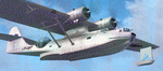
This folder contains a repaint for the Aerosoft PBY Catalina for FSX. Repaint by Jan Kees Blom, based on the repaint kit by Aerosoft. The Royal New Zealand Air Force had 56 Catalina's in all between 1943 and 1953. They were registered NZ4001-4056 inclusive and included 22 PBY-5s (mostly MklVAs) with the remainder being PB2B-1 s. All were flying boats, with no amphibian models being taken on charge.After the war only half a dozen or so of the best aircraft were maintained in service with No 5 Sqn (squadron code became KN-) and fitted with the latest search radar which had a large radome behind the cockpit. The remainder were put into storage. Two PB2B-ls were loaned to Tasman Empire Airways (TEAL) for short periods after the war, one (which became ZK-AMI) as a crew trainer, the other (ZK-AMP, former NZ4036) to survey a flying boat route from Fiji to Tahiti, later to become known as "The Coral Route" and used by TEAL's Solent flying boats. These two aircraft were eventually returned to the RNZAF before being scrapped.
| Filename: | Consolidated_PBY5_TEAL_ZKAMP.zip |
| License: | Freeware |
| Added: | 13th July 2018, 20:41:04 |
| Downloads: | 158 |
| Author: | Jan Kees Blom |
| Size: | 8.55 MB |
| Category: Flight Simulator X - Missions | |
| Battle of Midway 1942 V3.00 |
|
Images related to this file:
File Description:
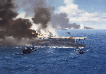
Just after having passed the Aviation Cadet Program and the E base (Elimination base), The first month we spent our time flying the primary trainers or N3N's better known as "Yellow Perils." Transferred to Wheeler air base (Honolulu) Its the first time that we see the new Horse of Battle of the Navy, the Douglass Sbd3 Dauntless, It was a beautiful plane for is time!. two mount later we receive our first instruction of the war, rejoining the U.S.S Yorktown. Here five exiting mission that will return you back in the skin of a couragous US NAVY Pilots or a IJN pilots. Make your flight plan, Check the wind and Calculate the wind drift and flight time whit your "E6b" navigation tool and wind tool in board of your plane. and prey to come back alive !. In this old time, all was made by hands. Good luck !. Here some new feature of Fsx Midway 1942 Mission v3.00: "Dummy carrier" replaced by Wonderful Yanco San I.J.N and U.S carrier ! two new exiting mission added, "Attack on Midway" and "First mission rejoining U.S.S Yorktown" Now you will fly accompanied by 2 ai wing man.
| Filename: | Battle_of_Midway_1942_V300.zip |
| License: | Freeware |
| Added: | 28th December 2011, 19:59:37 |
| Downloads: | 1,821 |
| Author: | Ronald Dandurand |
| Size: | 26.61 MB |
| Category: Flight Simulator X - Scenery | |
| Bhutan Airports and Paro Valley |
|
Images related to this file:
File Description:
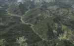
This project adds and updates all of the airports of Bhutan. Bathpalathang (VQBT) and Gelephu (VQGP) are added, Yongphulla (VQ10) is updated and recoded as VQTY, and Paro (VQPR) is fully updated to reflect current satellite imagery. These are all fully functioning AI airports as well. Special attention was given to the entire Paro Valley, and numerous road/river vectors were updated around Gelephu. Accurate coastlines, lakes, road and river data, as well as corrected landclass are provided based on the latest available satellite imagery. They are optimized to fit seamlessly with FTX Vector's roads/water, but they should be fully functional in all FSX configurations.
GA-encoded flight plans for the Buddha Air/Kathmandu charter are provided to enhance service to Paro. NASA SRTM Global 3 arc second terrain mesh is also included for all of Bhutan. Updates were created or rebuilt in a manner which carefully aligned airport data with current satellite imagery, when available. Scenery was created using Airport Design Editor X v1.61.5298, SBuilderX 3.13, and the FSX Object Placement Tool. Scenery objects were added and modified from stock FSX scenery to resemble as closely as possible the actual airports.
| Filename: | Bhutan_Airports_and_Paro_Valley.zip |
| License: | Freeware |
| Added: | 19th January 2015, 06:09:17 |
| Downloads: | 11,419 |
| Author: | Carlyle Sharpe |
| Size: | 21.4 MB |
| Category: Flight Simulator X - Aircraft Repaints, Textures and Modifications | |
| Modification of the power table for the Continental IO-520-F Cessna CU206G Stationair 6 II de CARENADO. |
|
Images related to this file:
File Description:

New update of flight dynamics settings.
Corrected the indicated speed error (KIAS) vs the true speed (KTAS) according to the data suggested in the pilot's operating manual (POH).
In some cases the position of the center of gravity unladen weight is corrected for a better weight and balance of the airplane.
Actual direct references from Pilot Operations Manual (POH) for specific details, Power,
Nose or pitch position and weight and balance settings, airplane geometry, piston or turbine engine data,
propeller and everything that refers to references, also the real references of the manufacturers of sea engines whatever the specific case.
This model in particular, I am sure that the gauges have a difference error between what the indicator of
manifold pressure and actual airplane reading, similar case to the PA34 Seneca II, the RPM tachometer needle marked 2500 and the
Maus cursor on the tachometer said there were 2200 rpm.
In this modification of the Cessna CU206G Stationair 6 II there is still an error that could not be adjusted to what it says in manual
pilot operation (POH) because it is a gauge error and not an adjustment error in the .air file.
When the error is corrected it will be published together with a new and improved VC.
| Filename: | Modification_of_the_power_table_for_the_Continenta.zip |
| License: | Freeware |
| Added: | 15th April 2020, 18:48:28 |
| Downloads: | 147 |
| Author: | Rafael Ledezma |
| Size: | 642.83 KB |
| Category: Flight Simulator X - Scenery | |
| RAF Oulton - Norfolk, England |
|
File Description:
I did this scenery for a gentlemen in Canada whose father served at the station during the war I've lost his details but hope he'll pick the scenery up when he searches on line.
RAF Oulton is a former Royal Air Force Satellite airfield located 3 miles (4.8 km) west of Aylsham, Norfolk and 12.5 miles (20.1 km) northwest of Norwich, Norfolk, England.
The airfield was built over 1939 and 1940 as a bomber airfield with T2 type hangars and grass runways, the facility operating as a satellite airfield of nearby RAF Horsham St. Faith between July 1940 and September 1942 after which it operated as a satellite airfield of RAF Swanton Morley.
In September 1943 Oulton was transferred from 2 Group to 3 Group and closed to flying for re-construction as a heavy bomber base with concrete runways, taxiways and parking areas. The work was completed in April 1944 and the airfield transferred to No. 100 Group RAF. Flying operations ceased at the end of July 1945, after which it was taken over by RAF Maintenance Command which used it to store de Havilland Mosquitos until November 1947.
Third Party add-on's will be required to gain the best effect - see the readme file.
| Filename: | RAF_Oulton___Norfolk_England.zip |
| License: | Freeware |
| Added: | 18th November 2015, 14:08:12 |
| Downloads: | 237 |
| Author: | Terry Boissel |
| Size: | 17.25 KB |
| Category: Flight Simulator X - Scenery | |
| Frankfurt Main Airport (EDDF) v7 - manual install package |
|
Images related to this file:
File Description:
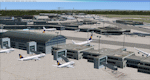
This major update represents EDDF in the December 2012 timeframe.
With the increasing development of the proposed Terminal 3 area now in use as extended apron parking, this update provides operational ramps for G and H gates including ramp parking for both airline and cargo aircraft, helicopter parking at gates H8 and H12, apron night lighting, vehicular traffic etc. In addition this update features a new Gmax custom fuel tank farm along with custom Frankfurt logos, the recently opened A-plus terminal (7 new gates including 4 A380 gates) in October 2012, a new Air Rail Center model and a new set of cargo offices/buildings that have been placed in the South Cargo area as well as the replacement of the standard FSX blast fences with a new Gmax fence model which adds even further realism to this scenery.
Also, a first time feature for this scenery, it now supports GSX (Ground Services for FSX). The G and H aprons have been customized to support GSX functionality with the correct positioning of the ground service vehicles and pushback operations based on scenery topology. The associated airport .ini file is supplied in this package.
Default FSX scenery is required. See readme/help file for more details.
| Filename: | Frankfurt_Main_Airport_EDDF_v7__manual_install_pac.zip |
| License: | Freeware |
| Added: | 23rd December 2012, 22:29:21 |
| Downloads: | 6,001 |
| Author: | Mark Aldridge |
| Size: | 13.82 MB |
| Category: Flight Simulator X - Scenery | |
| YTTI Troughton Island, Western Australia |
|
File Description:
YTTI Troughton Island - ShoreAir operates Troughton Island airstrip as an alternate to Mungalalu-Truscott. It has a 980m x 30m unsealed runway. Troughton Island sits 6 metres above sea level on a natural reef. Troughton is managed by two people who spend one month at a time on the island. During that time they are almost completely isolated from the outside world. Although they are isolated they are not alone; previous occupants of the island brought in quails and children's pythons that were once pets that escaped their cages during a cyclone. Now there is a healthy population of snakes living off the quails. Today Troughton Island is maintained as an emergency landing area for aircraft that are unable to reach Truscott. It also serves as a landing area if Truscott is inaccessible due to weather conditions. The Bureau of Meteorology has a weather station on Troughton island. Mungalalu-Truscott aerodrome supports all the FPSO (floating production storage and offloading facility) operations in the WA and NT waters of the Timor Sea, while the alternate aerodrome at Troughton Island is 20 nautical miles north of the main air route to Timor Sea facilities. REQUIRES Blencowe_LibraryKit.zip
REQUIRES blencowe_librarykit_309494.zip (Available HERE)
| Filename: | YTTI_Troughton_Island_Western_Australia.zip |
| License: | Freeware |
| Added: | 28th February 2013, 14:01:54 |
| Downloads: | 279 |
| Author: | Alan Blencowe |
| Size: | 2.37 MB |


© 2001-2026 AVSIM Online
All Rights Reserved
Privacy Policy |