
Where Flight Simulation Enthusiasts Gather from Around the World!
AVSIM Library - Search Results

| Category: Flight Simulator X - Scenery | |
| Mesh South America / MeSA D13 |

|
File Description:
FSX Mesh South America Project:
This terrain mesh file is a part of a whole project covering all the Continent
of South America and some islands, divided in tiles identified in a map by its
column (letters) and rows (numbers).
Those files were multi-LOD compiled from 90m SRTM2 source data, reprocessed
with 3DEM to remove voids and spikes, providing a 76.4m (LOD9) horizontal
resolution topography intended for use only in FSX updated with SP1.
Although not well documented, to improve performance, the updated FSX loads DEM
files in threads and only the closer terrain (about 5-10 NM from the point of view)
is rendered in high detail, while at far distances FSX shows up its default low
resolution mesh, when there is not a third part terrain mesh compiled in all
others intermediate level of details (multi-LOD).
THIS FILE:
FSX_MeSA_D13 (Column D x Row 13)
covers the area inside the boundaries:
N = 50º 37.5' S; S = 56º 15' S;
W = 67º 30' W; E = 60º 0' W;
AUTHORS:
Hely Heck Junior - Magrao ( [email protected] )
and Jose Lobo ( [email protected] )
TerraBrasilis: www.terra-brasilis.org
| Filename: | Mesh_South_America__MeSA_D13.zip |
| License: | Freeware |
| Added: | 13th June 2007, 16:38:14 |
| Downloads: | 1,126 |
| Author: | Hely Heck Jr. and José Lôbo |
| Size: | 4.79 MB |
| Category: Flight Simulator X - Scenery | |
| Mesh South America / MeSA D09 |
|
File Description:
FSX Mesh South America Project:
This terrain mesh file is a part of a whole project covering all the Continent
of South America and some islands, divided in tiles identified in a map by its
column (letters) and rows (numbers).
Those files were multi-LOD compiled from 90m SRTM2 source data, reprocessed
with 3DEM to remove voids and spikes, providing a 76.4m (LOD9) horizontal
resolution topography intended for use only in FSX updated with SP1.
Although not well documented, to improve performance, the updated FSX loads DEM
files in threads and only the closer terrain (about 5-10 NM from the point of view)
is rendered in high detail, while at far distances FSX shows up its default low
resolution mesh, when there is not a third part terrain mesh compiled in all
others intermediate level of details (multi-LOD).
THIS FILE:
FSX_MeSA_D09 (Column D x Row 09)
covers the area inside the boundaries:
N = 33º 45' S; S = 39º 22.5' S;
W = 67º 30' W; E = 60º 0' W;
AUTHORS:
Hely Heck Junior - Magrao ( [email protected] )
and Jose Lobo ( [email protected] )
TerraBrasilis: www.terra-brasilis.org
| Filename: | Mesh_South_America__MeSA_D09.zip |
| License: | Freeware |
| Added: | 13th June 2007, 12:36:59 |
| Downloads: | 1,261 |
| Author: | Hely Heck Jr. and José Lôbo |
| Size: | 52.3 MB |
| Category: Flight Simulator X - Scenery | |
| Mesh South America / MeSA D12 |
|
File Description:
FSX Mesh South America Project:
This terrain mesh file is a part of a whole project covering all the Continent
of South America and some islands, divided in tiles identified in a map by its
column (letters) and rows (numbers).
Those files were multi-LOD compiled from 90m SRTM2 source data, reprocessed
with 3DEM to remove voids and spikes, providing a 76.4m (LOD9) horizontal
resolution topography intended for use only in FSX updated with SP1.
Although not well documented, to improve performance, the updated FSX loads DEM
files in threads and only the closer terrain (about 5-10 NM from the point of view)
is rendered in high detail, while at far distances FSX shows up its default low
resolution mesh, when there is not a third part terrain mesh compiled in all
others intermediate level of details (multi-LOD).
THIS FILE:
FSX_MeSA_D12 (Column D x Row 12)
covers the area inside the boundaries:
N = 45º 0' S; S = 50º 37.5' S;
W = 67º 30' W; E = 60º 0' W;
AUTHORS:
Hely Heck Junior - Magrao ( [email protected] )
and Jose Lobo ( [email protected] )
TerraBrasilis: www.terra-brasilis.org
| Filename: | Mesh_South_America__MeSA_D12.zip |
| License: | Freeware |
| Added: | 13th June 2007, 15:28:04 |
| Downloads: | 1,148 |
| Author: | Hely Heck Jr. and José Lôbo |
| Size: | 5.54 MB |
| Category: Flight Simulator X - AFCAD Files | |
| KLEX - Blue Grass Airport - Lexington, Kentucky |
|
Images related to this file:
File Description:
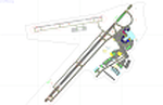
This airport update was made with the latest version of ADE (Airport Design Editor) and made for FSX as a replacement for the stock (default) airport. I've made several changes to the airport which are listed below. All these enchancements are as close to the real airport as I can get with stock library objects. I've used satellite images, terminal photos and maps throughout the whole process so building locations are as accurate as possible. Happy landings in charming Kentucky!
Features:
*Expanded parking apron
*Taxiways properly desginated
*Runway 8/26 renamed to 9/27 and moved to correct location as FSX had it completely wrong, appropriate taxiways have been repositioned and/or removed as well as per latest airport diagram
*Completely redesigned main terminal building with accurate airline assigned gates
*Seperate parking areaa for GA traffic
*Misc airport buildings added
*Airport vehicles and objects throughout the airport
*Fuel tanks and vehicles
*Fire station and vehicles
*De-icing trucks
*Static aircraft
*Autogen removed from a few areas around the airport as several buildings were popping up on airport property and a few trees were too close to runway
| Filename: | KLEX__Blue_Grass_Airport__Lexington_Kentucky.zip |
| License: | Freeware |
| Added: | 22nd December 2012, 00:03:01 |
| Downloads: | 599 |
| Author: | Jaison Diaz / Endeavour ai |
| Size: | 153.05 KB |
| Category: Flight Simulator X - Aircraft Repaints, Textures and Modifications | |
| Alaska State Troopers, Beechcraft Baron 58 |
|
Images related to this file:
File Description:
The Beechcraft Baron 58 Alaska State Troopers Repaint has several blue and red stripes going down the tail, coming to an end on the bottom of the plane. On the bottom the lines don't meet up perfectly, but its the best I can do. Just under the pilot window, there is writing saying, "ALASKA STATE TROOPERS" in very readable letters. For more information on the aircraft, or if you have an application that can convert pictures taken in FSX to .jpgs or if you just want to talk to me, email me personally at [email protected]. Or check out my YouTube videos, which include the aircraft at www.youtube.com/user/keyofawesomefan/ (I know about the username, don't ask).
No requirements except FSX, and the default aircraft, Beachcraft Baron 58.
Please do not fly the aircraft outside of Alaska, as it was made for Alaska only. The inspiration came from the National Geographic show, 'Alaska State Troopers' and the fact that I was bored on a Friday afternoon. Thanks, I hope you enjoy it. Special thanks to AVSIM for reading all this stuff, I know they have to. See you in the skies!
| Filename: | Alaska_State_Troopers_Beechcraft_Baron_58.zip |
| License: | Freeware |
| Added: | 28th December 2009, 12:04:49 |
| Downloads: | 398 |
| Author: | Ben Line |
| Size: | 4.11 MB |
| Category: Flight Simulator X - Scenery | |
| LGSK - Skiathos Airport, Greece |
|
Images related to this file:
File Description:
LGSK Skiathos Airport Greece.
Skiathos Island lies off the east coast of mainland Greece and is often referred to as 'Europe's St. Maarten' with landing aircraft skimming the beach and the nearby harbour. At 5341feet the runway is short and narrow and usually only captains are allowed to perform landings. Seasonal taffic includes Munich, Gatwick, Rome, Oslo and Stockholm, with scheduled flights to Athens.
This scenery has been designed to sit on the excellent photoreal scenery by Angelo Tassoglou, available here on Avsim, just search for 'Skiathos.zip'. Please note, it will not work with the default terrain. It also uses many objects from my LGKF Kefallinia scenery, also available here at Avsim.
The scenery features added vegetation, detailed airport buildings based on real photographs, animated windsocks, flags, road traffic, people, trees, waves, birds and air traffic. All the scenery files have been divided so they can be switched on or off according to user preference. It has been designed for and tested in DX9 and FSXA only.
Please enjoy and I hope you like my scenery as much as I enjoyed building it.
Required files:
skiathos.zip by Angelo Tassoglou
LGKF Kefallinia by George Keogh
| Filename: | LGSK__Skiathos_Airport_Greece.zip |
| License: | Freeware, limited distribution |
| Added: | 28th January 2013, 00:13:54 |
| Downloads: | 16,019 |
| Author: | George Keogh |
| Size: | 20.47 MB |
| Category: Flight Simulator X - AFCAD Files | |
| ORER - Erbil International airport - Erbil, Iraq |
|
Images related to this file:
File Description:
ORER - Erbil International Airport, Kurdistan, Iraq. The new airport and terminal building opened on March 3, 2010 and is as such not known in FSX. The airport is built next to the old airport, previously a military field. With its short 2,800 meter runway and temporary terminal buildings, there was a great need for a new airport, not just a new terminal. The new airport has one of the world's longest runways. 4,800 meters long, 75 meters wide and equipped for ILS CAT II operations.
Using ADEx 1.51, aeronautical maps all these changes have been built into the default FSX airport now making it on par with the present situation on paper. Right, on paper! Google Earth's images are too old (2004) to offer any help regarding buildings, vegetation and surrounding areas like offices, parkings and roads. With the help of blurry pictures found on the internet this is the best rendition for now. 99% correct.
For those interested a complete technical overview of the airport including approach plates is included in this package. Please read the readme carefully for proper installation!
| Filename: | ORER__Erbil_International_airport__Erbil_Iraq.zip |
| License: | Freeware |
| Added: | 7th August 2012, 20:51:42 |
| Downloads: | 3,915 |
| Author: | Menno C. Robert |
| Size: | 8.28 MB |
| Category: Flight Simulator X - AFCAD Files | |
| ORBI - Baghdad Intl Airport - Baghdad, Iraq |
|
Images related to this file:
File Description:
ORBI - Baghdad International Airport, Baghdad, Iraq
Slowly but surely the Baghdad international airport comes back to life. Although the airport is quite large, it is not yet used to its maximum. Some aprons still have no real use and thus are empty. Apron V, the presidential apron, is still present but might have been restructured by now.
Airlines like Austrian, Emirates, Etihad, Royal Jordanian and FlyDubai offer regular services to Baghdad.
Using ADEx 1.51 and the IRAQ AIP this AFCAD updates the default airport to what it is now on paper. Google Earth�´s images are too old to offer any help regarding buildings, vegetation and surrounding areas like offices, parkings, roads and apron V.
Gatenumbers have been updated, taxiways added and renamed, ILS 15R/33L has been removed, the military area is more detailed, taxiways are correctly sized and the overall quality of the airport increased.
For those interested, the complete IRAQ AIP is attached. It not only gives complete information about several Iraqi airports, it also holds approach plates of most of them. You will also find plates for ORSU, for which an AFCAD has been uploaded separately.
| Filename: | ORBI__Baghdad_Intl_Airport__Baghdad_Iraq.zip |
| License: | Freeware |
| Added: | 10th August 2012, 16:53:26 |
| Downloads: | 3,244 |
| Author: | Menno C. Robert |
| Size: | 14.54 MB |
| Category: Flight Simulator X - Miscellaneous Files | |
| ENBSeries for FSX |
|
File Description:
CORRECTED VERSION - Accidently included the wrong d3d9.dll in the previous upload, which messes up your textures. This one is the right one. My main goal in adjusting this ENBSeries file was to make sunny days look sunny and dark nights look dark, while maintaining a natural look to all things as much as possible (so no exaggerated bloom effects which you don't see at all in real life) I only changed the BLOOM and the COLOR CORRECTION options, nothing else. I have all the other options turned off anyway, since I don't have a very powerful computer. If you want to change options yourself you can read the 'readme_en.txt' for further information.
I included some screenshots to compare the default lightning to my custom made ENBSeries version (press the ZipDive! button to see them without downloading the whole package)
Install:
- Just copy the d3d9.dll and enbseries.ini to the FSX root folder.
- When in FSX you can press [SHIFT] + [F12] to turn the effect on or off. To remove, simply delete the 2 files from your FSX root folder.
| Filename: | ENBSeries_for_FSX.zip |
| License: | Freeware |
| Added: | 24th January 2016, 18:41:19 |
| Downloads: | 3,335 |
| Author: | Robin Heinis |
| Size: | 2.81 MB |
| Category: Flight Simulator X - AFCAD Files | |
| Layton's Airfield (28NJ), NJ |
|
File Description:
Layton's Field perhaps no longer exists in actual aviation databases - it's not, for example, listed over at skyvector.com. But you can find it via a Google search. It is coded 28NJ within FSX, although the real 28NJ is a heliport at the Taj Mahal in Atlantic City. It is a single grass turf strip 1692 feet in length and 60 feet wide. There are no services or parking available - if you want to practice touch and go turf landings that's about the extent of the usefulness of this airport. Even if you never use it, this will at least prevent you from flying over the location and seeing a default 3000 foot grass strip (with threshold markings, no less) sticking oddly out amongst the rest of the scenery.
Scenery constructed with use of satellite images/streetview, the author has not been there in person.
This scenery is meant to be used in conjunction with MegaScenery Earth New Jersey/Delaware 004. It is not required, but apron use is minimized to allow satellite scenery to show through as much as possible, and objects are placed based on the MSE textures - lack of it may make scenery look out of place.
| Filename: | Laytons_Airfield_28NJ_NJ.zip |
| License: | Freeware |
| Added: | 11th October 2010, 08:29:30 |
| Downloads: | 206 |
| Author: | Drew Sikora |
| Size: | 327.04 KB |


© 2001-2026 AVSIM Online
All Rights Reserved
Privacy Policy |