
Where Flight Simulation Enthusiasts Gather from Around the World!
AVSIM Library - Search Results

| Category: Flight Simulator X - AFCAD Files | |
| LIPZ - Venice Tessera Intl. Airport "Marco Polo" |

|
File Description:
Afcad file of LIPZ (Venice Tessera "Marco Polo") airport for FSX default scenery. In order to make the scenery as close as possible to the real airport the layout is based on the newest Jeppesen parking chart of LIPZ, on the Aeronautical Information Publication Italy and on photos of the real airport.
Main things that have been changed:
- RWY 4L/22R has been converted into main taxiway (as it is in the real LIPZ);
- runway strips and stopways have been added;
- Precision Approach Path Indicators with 3° slope have been added on both sides of RWY 4R/22L;
- according to ICAO documents, since RWY 4R/22L is a precision runway of the 3rd category the holding positions have been moved at 90 m and taxiways and apron links have been reduced to 23, 18 and 15 m;
- the approach lighting system has been modified to look as close as possible like the real one;
- parking codes have been added to match the latest airport timetable.
Note: In real life nearly 100% of the departures from RWY 4R (which is the runway in use during day almost all days of the year - RWY 22L is in use during night when the wind's direction changes) use SIDs based on the CHI VOR which means that even the airlines which fly to north once airborn won't turn left but right and make half circle in order to head north. I tried to make the aircraft fly like the real ones assigning right hand pattern to RWY 4R but seems that it doesn't work - aircraft that fly to north, after takeoff will turn left instead of turning right and making half circle.
| Filename: | LIPZ__Venice_Tessera_Intl_Airport_Marco_Polo.zip |
| License: | Freeware |
| Added: | 19th January 2007, 01:32:01 |
| Downloads: | 4,078 |
| Author: | Claudio A. Dobre / Skycolors Team |
| Size: | 303.91 KB |
| Category: Flight Simulator X - Scenery | |
| YKLN Kulin Town and YJLN Kulin, Jilakin Rock, Western Australia |
|
File Description:
YKLN Kulin Town and YJLN Kulin, Jilakin Rock. Kulin is located in the upper great southern Wheatbelt of Western Australia, the Shire of Kulin covers an area of 4,790 square kilometres. It encompasses the towns of Kulin, Pingaring, Dudinin, Jitarning, and Holt Rock. The Kulin economy is based on agriculture and was settled by pastoralists in 1905. The crosswind runway is actually 7 miles to the east at Jilakin Rock and slopes uphill to the east. For convenience, I have used fictitious YJLN. Jilakin Downs is a Dorper sheep stud farm and the home of the Kulin Bush Races. Dorpers are currently under a cloud in Western Australia as the local abatoirs claim their hair is contaminating the meat and won't accept them. "We welcome air traffic to our 2012 Kulin Bush Races Weekend. A crosswind airstrip is available, with a shuttle bus service to the Jilakin Track. GPS position is S32-39-95 E118-18-71 and the elevation is 950 feet. The strip is 7 nautical miles east of the town of Kulin. Camping and toilets are close to the strip so that you can camp near your plane.
Kulin airstrip is also available for landing and takeoff during the weekend, a shuttle bus is available to take you out to the race track. If this option is chosen please contact Barry West. Please contact Barry West for flying information on 9880 9021" www.kulin.wa.gov.au/tourism_and_local_events/kulin_bush_races/flying_visit.html REQUIRES Blencowe_LibraryKit.zip
REQUIRES blencowe_librarykit_309494.zip (Available HERE)
| Filename: | YKLN_Kulin_Town_and_YJLN_Kulin_Jilakin_Rock_Wester.zip |
| License: | Freeware |
| Added: | 28th February 2013, 13:52:31 |
| Downloads: | 225 |
| Author: | Alan Blencowe |
| Size: | 5.73 MB |
| Category: Flight Simulator X - Scenery | |
| RAF Honeybourne 1945 - Worcestershire, England |
|
File Description:
RAF Honeybourne was a Royal Air Force station located 0.6 miles (0.97 km) south of Honeybourne, Worcestershire, England and 4.6 miles (7.4 km) east of Evesham, Worcestershire, England.
The airfield was home to No. 24 Operational Training Unit RAF (OTU) which used Vickers Wellingtons and Armstrong Whitworth Whitleys from 15 March 1942 until July 1945 flying many operational bombing and leaflet dropping operations.
A number of units from Ferry Command were based here including a ferry training unit using Lockheed Hudsons and Bristol Beauforts.
The airfield was also temporarily home to No. 21 OTU flying Wellingtons from RAF Enstone from August 1945 for two months because the runways at their home base were being repaired. From October 1945 until 1946 107 Sub Storage Unit from No. 8 Maintenance Unit used the airfield for storing Wellingtons and General Aircraft Hamilcar gliders.
The role of the airfield after the war changed with the reduction of flying movements and with a slight change in what the units did on the airfield when No. 107 Sub Storage Unit from 1947 began to collect no longer needed Wellingtons which were then scrapped and taken to Weston Subedge goods yard (which was near to the south-western corner) where the railway would take them to the necessary destination.
In July 1948 the site was closed and much has reverted to farmland with runways being removed in 1968. Since then, the airside area has evolved into the Honeybourne Airfield Trading Estate with the five hangars being used for different purposes.
| Filename: | RAF_Honeybourne_1945__Worcestershire_England.zip |
| License: | Freeware |
| Added: | 3rd June 2016, 11:00:06 |
| Downloads: | 131 |
| Author: | Terry Boissel |
| Size: | 2.29 MB |
| Category: Flight Simulator X - Aircraft Repaints, Textures and Modifications | |
| B-24 USAAF 376th BG "Lady be Good" |
|
File Description:
Following an April 4, 1943 bombing raid on Naples, Italy, conducted by the 376th Bomb Group, the Lady Be Good of the 514th Bomb Squadron failed to return to base. After attempts to locate the plane, its nine crewmen were classified as MIA, and presumed dead, believed to have perished after crashing in the Mediterranean.
Almost 16 years later on Nov. 9, 1958, several British geologists were flying over the desolate, sun-baked Libyan Desert. At approximately 400 miles south of Soluch, they spotted an aircraft on the sand. A ground party that reached the site in March 1959 discovered the plane to be a B-24D. The "Lady Be Good" had been found.
Evidence at the site indicated that the crew had become lost in the dark on return from Naples and had flown over their base and southward into the desert. As their fuel supply became depleted, the nine men aboard had bailed out but had disappeared while attempting to walk northward to civilization.
Intensive searches were made for clues as to the fate of the crew, and in 1960 the remains of eight were found, one near the plane and the other seven far to the north. Five had trekked 78 miles across the tortuous sand before perishing and one had gone an amazing 109 miles. In addition, they had lived eight days rather than only two expected of men in this area with little or no water. The body of the ninth man was never found.
Repaint for the Alphasim B-24 by Jan Kees Blom.
| Filename: | B24_USAAF_376th_BG_Lady_be_Good.zip |
| License: | Freeware |
| Added: | 11th October 2008, 13:11:09 |
| Downloads: | 386 |
| Author: | Jan Kees Blom |
| Size: | 7.61 MB |
| Category: Flight Simulator X - Flight Plans | |
| Scenic Flight Through The Grand Canyon |
|
Images related to this file:
File Description:
FSX Flight Plan for a flight through the Grand Canyon. If you want some spectacular views and fun flying try out this flight plan. There are over 800 way points used that take you through most of the canyon. Two flights included. One going eastbound and the other going westbound. You will be flying in the default Cessna 172 with the autopilot connected. Just sit back and watch the scenery go by. Don't get too relaxed because there are a couple of turns that you will have to take control of the aircraft. Included in this package are two spectacular gauges by Karol Chlebowski for TFR flying and Pave Tack which enhance the sight seeing experience. Another option to download Version 2.1 of my mini panel which has all this functionality included and more.
| Filename: | Scenic_Flight_Through_The_Grand_Canyon.zip |
| License: | Freeware, limited distribution |
| Added: | 12th July 2011, 02:34:24 |
| Downloads: | 678 |
| Author: | Bill McClellan |
| Size: | 2.66 MB |
| Category: Flight Simulator X - Scenery | |
| Friday Harbor Airport (KFHR) and Lopez Island (S31) |
|
File Description:
This package was made using Airport Design Editor 9x (ADE9x). It has two airports, Fridar Harbor and Lopez island. Both airports are located in the pacific northwest. At Friday Harbor (The default FSX airport) I replaced all the default buildings with more accurate ones. I added static aircraft on the ramp and cars in the parking lot. I also added parking to the northeast. Kenmore air flies to Friday Harbor and so I added gates for it to. For Lopez island, I put hangers and a few aircraft. The airport has some missing taxiways I added. Your scenery complexity can not be set to very sparse or nothing will show up. Please read the readme for instructions on how to install. This download is for Flight Simulator X only.
| Filename: | Friday_Harbor_Airport_KFHR_and_Lopez_Island_S31.zip |
| License: | Freeware |
| Added: | 19th December 2011, 15:29:38 |
| Downloads: | 1,535 |
| Author: | Tyler Lawrence |
| Size: | 3.75 MB |
| Category: Flight Simulator X - Scenery | |
| NSA - Pine Gap Australia |
|
Images related to this file:
File Description:

Joint Defense Facility Pine Gap is a satellite tracking station in the Australian outback operated by the United States intelligence community. The location is strategically significant because it controls United States spy satellites as they pass over the one third of the globe which includes China, the Asian parts of Russia and the Middle East. Central Australia was chosen because it was too remote for spy ships passing in international waters to intercept the signal. The facility has been described as the ground control and processing station for geosynchronous satellites engaged in signals intelligence collection. JDF Pine Gap is ran by the CIA, NSA, and NRO and is a key location in the global ECHELON surveillance network. Includes a helipad startup location with YPGP ident. Scenery by Jason L. Terry.
| Filename: | NSA__Pine_Gap_Australia.zip |
| License: | Freeware |
| Added: | 16th August 2014, 11:01:35 |
| Downloads: | 544 |
| Author: | Jason L. Terry |
| Size: | 1.21 MB |
| Category: Flight Simulator X - Scenery | |
| CANMeshX - CAN_28 |
|
Images related to this file:
File Description:
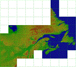
This is a LOD 5 (1216.05m per pixel) to LOD 11 (19m per pixel) terrain mesh scenery file. This terrain mesh is a work in progress, it was started more than two years ago and was never finished. While the files uploaded here have been checked thoroughly there may be errors. If you find any obvious errors please do let me know by email, my intention is to eventually finish this project as the difference in the before and after is astounding especially in areas where I have also included new coastlines. This mesh does cover some border areas of the United States of America too and eventually my intentions are to provide the same product coverage there including higher LOD levels where data is available. This is 1 of 40 files currently available.
| Filename: | CANMeshX__CAN_28.zip |
| License: | Freeware, limited distribution |
| Added: | 8th November 2015, 16:17:57 |
| Downloads: | 245 |
| Author: | Ben Clark |
| Size: | 115.32 KB |
| Category: Flight Simulator X - Scenery | |
| CANMeshX - CAN_131 |
|
Images related to this file:
File Description:
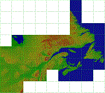
This is a LOD 5 (1216.05m per pixel) to LOD 11 (19m per pixel) terrain mesh scenery file. This terrain mesh is a work in progress, it was started more than two years ago and was never finished. While the files uploaded here have been checked thoroughly there may be errors. If you find any obvious errors please do let me know by email, my intention is to eventually finish this project as the difference in the before and after is astounding especially in areas where I have also included new coastlines. This mesh does cover some border areas of the United States of America too and eventually my intentions are to provide the same product coverage there including higher LOD levels where data is available. This is 1 of 40 files currently available.
| Filename: | CANMeshX__CAN_131.zip |
| License: | Freeware, limited distribution |
| Added: | 8th November 2015, 16:18:01 |
| Downloads: | 222 |
| Author: | Ben Clark |
| Size: | 981.82 KB |
| Category: Flight Simulator X - Scenery | |
| CANMeshX - CAN_185 |
|
Images related to this file:
File Description:
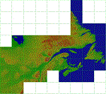
This is a LOD 5 (1216.05m per pixel) to LOD 11 (19m per pixel) terrain mesh scenery file. This terrain mesh is a work in progress, it was started more than two years ago and was never finished. While the files uploaded here have been checked thoroughly there may be errors. If you find any obvious errors please do let me know by email, my intention is to eventually finish this project as the difference in the before and after is astounding especially in areas where I have also included new coastlines. This mesh does cover some border areas of the United States of America too and eventually my intentions are to provide the same product coverage there including higher LOD levels where data is available. This is 1 of 40 files currently available.
| Filename: | CANMeshX__CAN_185.zip |
| License: | Freeware, limited distribution |
| Added: | 8th November 2015, 16:18:04 |
| Downloads: | 205 |
| Author: | Ben Clark |
| Size: | 2.06 MB |


© 2001-2026 AVSIM Online
All Rights Reserved
Privacy Policy |