
Where Flight Simulation Enthusiasts Gather from Around the World!
AVSIM Library - Search Results

| Category: Flight Simulator X - Scenery | |
| Lighthouses on either side of The English Channel Between Dover and Calais |

|
Images related to this file:
File Description:
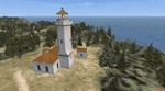
That freeware FSX scenery is adding lighthouses either side of the English Channel Between Dover and Calais. Such lighthouses are the one of the Gris-Nez Cape, France, the one of St Margaret (UK) and too a jetty lightouse for the harbor of Dover (idem). Comes with a French readme too.
| Filename: | Lighthouses_on_either_side_of_The_English_Channel_.zip |
| License: | Freeware |
| Added: | 16th July 2014, 16:35:48 |
| Downloads: | 546 |
| Author: | Gerard Guichard |
| Size: | 178.64 KB |
| Category: Flight Simulator X - Scenery | |
| EBNM 2008 |
|
File Description:
Temploux, Suarlée (EBNM) is an airfield with grass runways located near Namur, Belgium.
This scenery include detailed buildings, hangars & static aircrafts textures. 3 AI aircrafts are also included with special repaints (PA28_180, C172 and Yak52). Compatible with FSX SP2 & Acceleration, tested with DX 9.0c.
By Jean-Philippe Pierard & Emmanuel Pierard
| Filename: | EBNM_2008.zip |
| License: | Freeware, limited distribution |
| Added: | 19th September 2008, 12:27:00 |
| Downloads: | 3,056 |
| Author: | Jean-Philippe Pierard & Emmanuel Pierard |
| Size: | 6.39 MB |
| Category: Flight Simulator X - Scenery | |
| Reutte - LOIR V1.0 |
|
File Description:
Reutte (LOIR) is a small airfield in Tyrol in the western part of Austria. This file contains high detailed 3D buildings, seasonal textures, light effects, AI traffic, animated Windsocks and a wind-tee. This is the reworked Version of my FS2004-Scenery. All Service Packs and Updates are included
Enjoy!
| Filename: | Reutte__LOIR_V10.zip |
| License: | Freeware |
| Added: | 4th November 2007, 18:52:13 |
| Downloads: | 4,937 |
| Author: | Lechleitner Jürgen |
| Size: | 13.25 MB |
| Category: Flight Simulator X - Scenery | |
| Aran Islands Airports and Connemara Regional Airport |
|
File Description:
Aran Island Airports and Connemara Regional with Flightplans FSX.
FSX compatible only.
Includes: Fictional Flightplans for the three Aer Arann Islands BN2s, Changes to Parking in all four airports, Tower Frequency For All Four Airports, Objects Including Tractors, Hangers and Small Terminals.
Created using ADEX v01.47.07
Created from default scenery.
| Filename: | Aran_Islands_Airports_and_Connemara_Regional_Airpo.zip |
| License: | Freeware |
| Added: | 27th November 2010, 20:37:25 |
| Downloads: | 1,620 |
| Author: | Padraic O hEithir |
| Size: | 12.72 MB |
| Category: Flight Simulator X - Scenery | |
| Brunei International Airport v1.0 (WBSB) |
|
Images related to this file:
File Description:
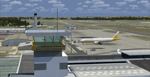
Brunei International Airport (Malay: Lapangan Terbang Antarabangsa Brunei; (Jawi) (IATA: BWN, ICAO: WBSB) is the primary airport in the nation of Brunei.
This scenery has been created with GMAX and SBuilderX. It also contains Rwy12 libraries listed in the readme file that really enhances the airport surroundings. Enjoy your flight!
| Filename: | Brunei_International_Airport_v10_WBSB.zip |
| License: | Freeware |
| Added: | 13th May 2012, 22:10:23 |
| Downloads: | 11,106 |
| Author: | Christophe Bouville |
| Size: | 20.82 MB |
| Category: Flight Simulator X - Miscellaneous Files | |
| Traffic on the road for Oslo V2 |
|
Images related to this file:
File Description:
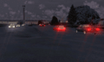
Irritated by the absence of live traffic on the road in the new Oslo V2.0 ( Aerosoft payware )I made this file to add car traffic on the road around the airport and make it more "life-like". Just 1 file to be added in the scenery folder of your Oslo V2.
| Filename: | Traffic_on_the_road_for_Oslo_V2.zip |
| License: | Freeware |
| Added: | 29th December 2013, 20:10:07 |
| Downloads: | 278 |
| Author: | Bigot Manuel |
| Size: | 2.81 KB |
| Category: Flight Simulator X - Scenery | |
| Tokyo Skytree |
|
Images related to this file:
File Description:
Tokyo Skytree is the 2nd tallest completed skyscraper in the world. Built in 2012, it is not included in the default FSX scenery. This addon places it into FSX. It has not been tested with other Tokyo sceneries, however it should still work.
Modeled with Blender and converted with ModelConverterX.
| Filename: | Tokyo_Skytree.zip |
| License: | Freeware |
| Added: | 16th November 2019, 22:05:14 |
| Downloads: | 725 |
| Author: | Jeremy Sletmen |
| Size: | 2.72 MB |
| Category: Flight Simulator X - Miscellaneous Files | |
| Solomon Islands 1943 AI Boat Traffic |
|
Images related to this file:
File Description:
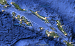
This project was inspired by Mark Schimmer's World War II-era Solomon Islands scenery, with routes are based on his outline. There are two US carrier groups, light carriers, destroyers, supply boats, PT boats, and IJN destroyer patrols. All ship models and textures are included, with permission from their respective authors.
| Filename: | Solomon_Islands_1943_AI_Boat_Traffic.zip |
| License: | Freeware |
| Added: | 26th October 2010, 22:48:31 |
| Downloads: | 1,219 |
| Author: | David Wilson-Okamura, Mike Barnes, Phil Crowther, Mark Fitch, Bruce Fitzgerald, Alberto Garcia, Ron Jeffers, and Ian Thatcher |
| Size: | 28.76 MB |
| Category: Flight Simulator X - AFCAD Files | |
| RJSI - Hanamaki Airport, Japan. |
|
File Description:
This is a redesign of RJSI - Hanamaki Airport, Japan. Google Maps and charts from yinlei.org have been used to provide the correct (as physically possible within FSX and ADE) position, size and type of runway, aprons and buildings. The immediate surrounding scenery has been included. ADE used to compile the design.
| Filename: | RJSI__Hanamaki_Airport_Japan.zip |
| License: | Freeware |
| Added: | 24th October 2017, 00:43:20 |
| Downloads: | 885 |
| Author: | Matthew Ward |
| Size: | 424.57 KB |
| Category: Flight Simulator X - AFCAD Files | |
| Greenwood Lake Airport (4N1), NJ |
|
File Description:
Located 01 miles E of West Milford, New Jersey on 150 acres of land, Greenwood Lake Airport is a public asphalt strip that services small to medium GA air traffic. The second runway that used to be there has been re-paved and now serves as extra aircraft parking. You can park anywhere on the closed runway, along the edge of the main tarmac where the terminal building is, or between any two white cones (50 foot max wingspan) that mark tie-down locations in the middle of the main tarmac. A helicopter start is provided as well. For parking, Small GA spaces are for craft with wingspans of less than 50 feet; Medium GA spaces are for craft with wingspans from 50-60 feet. The glide slope for Runway 24 has been adjusted up from 3.5 degrees to 4 degrees as in real life the runway sits higher than the ground the trees grow from so this will give you proper clearance on approach. Fuel is available by stopping near the tank on the main tarmac. Scenery constructed with use of satellite images/streetview/aerial photos - the author has not been there in person. This scenery is meant to be used in conjunction with MegaScenery Earth New York 005. It is not required, but apron use is minimized to allow satellite scenery to show through as much as possible, and objects are placed based on the MSE textures - lack of it may make scenery look out of place.
| Filename: | Greenwood_Lake_Airport_4N1_NJ.zip |
| License: | Freeware |
| Added: | 22nd July 2011, 03:59:26 |
| Downloads: | 479 |
| Author: | Drew Sikora |
| Size: | 1.98 MB |


© 2001-2026 AVSIM Online
All Rights Reserved
Privacy Policy |