
Where Flight Simulation Enthusiasts Gather from Around the World!
AVSIM Library - Search Results

| Category: Flight Simulator X - Aircraft Repaints, Textures and Modifications | |
| Modification of the power table for the Pratt & Whitney Canada – PT6A-140 Cessna C208B Grand Caravan EX. |

|
Images related to this file:
File Description:

New update of flight dynamics settings.
Corrected the indicated speed error (KIAS) vs the true speed (KTAS) according to the data suggested in the pilot's operating manual (POH).
In some cases the position of the center of gravity unladen weight is corrected for a better weight and balance of the airplane.
Actual direct references from Pilot Operations Manual (POH) for specific details, Power,
Nose or pitch position and weight and balance settings, airplane geometry, piston or turbine engine data,
propeller and everything that refers to references, also the real references of the manufacturers of sea engines whatever the specific case.
| Filename: | Modification_of_the_power_table_for_the_Pratt__Whi.zip |
| License: | Freeware |
| Added: | 22nd April 2020, 17:34:28 |
| Downloads: | 187 |
| Author: | Rafael Ledezma |
| Size: | 230.52 KB |
| Category: Flight Simulator X - Scenery | |
| RAF Burn |
|
File Description:
The Station opened in 1942 before closing in 1946, it hosted No. 431 Squadron, Royal Canadian Air Force as part of 4 Group RAF Bomber Command which formed at the airfield on 13 November 1942 flying Vickers Wellington Mark X aircraft while at Burn. On 15 July 1943 the squadron was transferred to RAF Tholthorpe and became part of No. 6 Group RCAF.
On 1 January 1944 No. 658 Squadron RAF moved to the airfield from RAF Clifton flying the Taylorcraft Auster III but left only seven days moving to RAF Doncaster but on 21 January 1944 the squadron returned, this time staying until 14 March 1944 when they moved to RAF Collyweston. The squadron was briefly joined on 31 December 1943 by 659 Squadron which moved to RAF Clifton the following day.
During its use the airfield was also used by No. 10 Aircrew Holding Unit RAF.
On 6 January 1944 No. 578 Squadron RAF squadron was relocated to RAF Burn from RAF Snaith. This Bomber Command squadron flew Handley Page Halifax Mk. III before disbanding on 15 April 1945 and the station was closed for flying operations in July 1945.
On the night of 30 March 1944, Pilot Officer Cyril Joe Barton took off from RAF Burn in Halifax LK797 for a raid on Nuremberg, and won a posthumous Victoria Cross for valour.
Shortly after flying was discontinued, the Royal Army Service Corps took over some facilities to store surplus equipment. ] Many of the buildings have been dismantled but all three runways remain intact and are used by Burn Gliding Club Ltd.
Source:Wikipedia
| Filename: | RAF_Burn.zip |
| License: | Freeware |
| Added: | 26th March 2017, 19:29:21 |
| Downloads: | 113 |
| Author: | Terry Boissel |
| Size: | 185.28 KB |
| Category: Flight Simulator X - AFCAD Files | |
| D25 - Manitowish Waters, Wisconsin. |
|
File Description:
This is a redesign of D25 - Manitowish Waters, Wisconsin. Google Maps and Skyvector have been used to provide the correct (as physically possible within FSX and ADE) position, size and type of runway, aprons and buildings. The immediate surrounding scenery has been included. ADE used to compile the design.
| Filename: | D25__Manitowish_Waters_Wisconsin.zip |
| License: | Freeware |
| Added: | 29th November 2017, 14:42:25 |
| Downloads: | 161 |
| Author: | Matthew Ward |
| Size: | 1.4 MB |
| Category: Flight Simulator X - AFCAD Files | |
| MPBO - Bocas Del Toro Airport, Panama. |
|
File Description:
This is a redesign of MPBO - Bocas Del Toro Airport, Panama. Google Maps has been used to provide the correct (as physically possible within FSX and ADE) position, size and type of runway, aprons and buildings. The immediate surrounding scenery has been included. ADE used to compile the design.
| Filename: | MPBO__Bocas_Del_Toro_Airport_Panama.zip |
| License: | Freeware |
| Added: | 25th November 2017, 19:41:59 |
| Downloads: | 436 |
| Author: | Matthew Ward |
| Size: | 1.58 MB |
| Category: Flight Simulator X - AFCAD Files | |
| 19TE - Cut and Shoot Airport, Conroe, Texas. |
|
File Description:
This is a redesign of 19TE - Cut and Shoot Airport, Conroe, Texas. Google Maps and Skyvector has been used to provide the correct (as physically possible within FSX and ADE) position, size and type of runway. The immediate surrounding scenery has been included. ADE used to compile the design.
| Filename: | 19TE__Cut_and_Shoot_Airport_Conroe_Texas.zip |
| License: | Freeware |
| Added: | 21st March 2018, 03:07:52 |
| Downloads: | 160 |
| Author: | Matthew Ward |
| Size: | 592.44 KB |
| Category: Flight Simulator X - Scenery | |
| EGJA Alderney |
|
Images related to this file:
File Description:
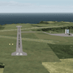
This is a better than default, re-creation of Alderney Airport located on the Island of Alderney in the Channel Islands.
All Runways, taxiways and buildings have been placed accurately using satellite imagery and up-to date charts.
This scenery requires 'Jim Dhaenens' lightobj.bgl for the apron lights.
| Filename: | EGJA_Alderney.zip |
| License: | Freeware |
| Added: | 3rd February 2019, 18:29:10 |
| Downloads: | 309 |
| Author: | David Jones |
| Size: | 436.54 KB |
| Category: Flight Simulator X - Scenery | |
| VFR Balice for FSX V1.1 |
|
File Description:
VFR Balice for FSX V1.1
This is the extended scenerie
VFR Balice for FSX V1.0 designed on
new ground textures of the old town
Krakow in the vicinity of EPKK Balice
(Poland)Additional objects made in the
scenery are listed in the sketch.
Designer: Lotar Tomczyk, Jakub Mista
| Filename: | VFR_Balice_for_FSX__V11.zip |
| License: | Freeware, limited distribution |
| Added: | 26th January 2020, 23:09:29 |
| Downloads: | 241 |
| Author: | Lotar Tomczyk, Jakub Mista |
| Size: | 93.75 MB |
| Category: Flight Simulator X - Missions | |
| BretagnePhareTour1.zip |
|
File Description:
Intermediate helicopter mission. A helicopter company located at LFRD airport provides tour services. Today's flight is a tour of several sites in the Brittany coastal region of France. This is tour one of three. This mission will require two additional downloads for scenery as outlined in the zip file.
| Filename: | BretagnePhareTour1zip.zip |
| License: | Freeware |
| Added: | 22nd October 2021, 18:06:18 |
| Downloads: | 82 |
| Author: | HeloMissionMan |
| Size: | 31.19 MB |
| Category: Flight Simulator X - Scenery | |
| Alfs UK Airfields Vol.4 |
|
Images related to this file:
File Description:

Two UK airfields for use with FSX generic scenery. The first is Booker (Wycombe Air Park) EGTB near High Wycombe. At the request for more up to date aircraft I have also made a second version, BookerPlus. The second airfield is Elmsett EGST which is 6nm WNW of Ipswich.
| Filename: | Alfs_UK_Airfields_Vol4.zip |
| License: | Freeware |
| Added: | 3rd May 2010, 11:32:54 |
| Downloads: | 3,675 |
| Author: | Alf Denham |
| Size: | 9.3 MB |
| Category: Flight Simulator X - Scenery | |
| KAUS Austin-Bergstrom International Airport. Austin, TX. |
|
File Description:
KAUS Austin-Bergstrom International Airport. Austin, TX. Corrected all gate numbers and airline parking for Southwest, American, Delta, Jet Blue, Continental, Frontier, Alaska, United and U.S. Airways. All scenery is visible and all Jetways work. Extras added to enhance airport. All gates are correct acording to KAUS website.
| Filename: | KAUS_AustinBergstrom_International_Airport_Austin_.zip |
| License: | Freeware |
| Added: | 11th November 2010, 00:53:33 |
| Downloads: | 1,806 |
| Author: | Rob Touchtone |
| Size: | 108.32 KB |


© 2001-2026 AVSIM Online
All Rights Reserved
Privacy Policy |