
Where Flight Simulation Enthusiasts Gather from Around the World!
AVSIM Library - Search Results

| Category: Flight Simulator X - Aircraft Repaints, Textures and Modifications | |
| Mountain Area Medical Airlift EC135 (MAMA) |

|
Images related to this file:
File Description:

The Mountain Area Medical Airlift (MAMA) flies one Eurocopter EC135 (N135N) based at the Asheville Regional Airport (KAVL) in the beautiful mountains of western North Carolina. MAMA has served western North Carolina since 1985 transporting over 15,000 patients. This re-paint requires the Nemeth Designs EC135 (Payware). Textures by Bradley Bormuth.
| Filename: | Mountain_Area_Medical_Airlift_EC135_MAMA.zip |
| License: | Freeware |
| Added: | 23rd October 2012, 05:49:20 |
| Downloads: | 149 |
| Author: | Bradley Bormuth |
| Size: | 1.09 MB |
| Category: Flight Simulator X - Scenery Design | |
| West Australian Landing Area Object Libraries |
|
File Description:
FSX West Australian Landing Area object libraries by Alan Blencowe created with GMAX and compiled with Library Creator XML last updated 13th January 2013. This is a dynamic file constantly being updated so check my website for airfields and files created after this date.
Thanks to Ole Egholm for permission to add his GMAX aircraft models where used. I have edited his name into the model bgls and edited the textures to simulate Royal Aero Club of WA aircraft of the 50's era.
This folder contains:
aeb_FSX_lib1 - 172 models of all sorts and descriptions with their required textures. If you are an airport Designer using software such as Airport Design Editor or SbuilderX, you will need the thumbnail kit from www.alanblencowe.com
| Filename: | West_Australian_Landing_Area_Object_Libraries.zip |
| License: | Freeware |
| Added: | 25th February 2013, 02:50:39 |
| Downloads: | 2,062 |
| Author: | Alan Blencowe |
| Size: | 14.9 MB |
| Category: Flight Simulator X - AFCAD Files | |
| 02UT - Lucin, Utah |
|
Images related to this file:
File Description:
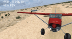
Simple scenery of the remote 02UT Lucin, UT dirt-strip airport in the Utah salt flats, military operations area west of the Great Salt Lake. The airport has only one aircraft based and features 2 main dirt runways. How is your bush flying? This scenery is dedicated to Ivo - you are an inspiration. Enjoy!
| Filename: | 02UT__Lucin_Utah.zip |
| License: | Freeware |
| Added: | 4th June 2013, 05:31:25 |
| Downloads: | 192 |
| Author: | AJ Cook |
| Size: | 9.07 KB |
| Category: Flight Simulator X - Scenery | |
| LPBG Bragança Airfield, Portugal - FSX SP2 |
|
File Description:
Detailed and photorealistic scenery of the LPBG Bragança Airfield, located in the northeast of Portugal. For FSX and not compatible with my other previous work. It includes an area of 20x20 km of terrain completely redrawn from scratch.
| Filename: | LPBG_Bragana_Airfield_Portugal__FSX_SP2.zip |
| License: | Freeware, limited distribution |
| Added: | 8th October 2008, 23:12:55 |
| Downloads: | 2,504 |
| Author: | José Maia |
| Size: | 2.03 MB |
| Category: Flight Simulator X - Missions | |
| MuranoLidoTour.zip |
|
File Description:
Beginner/Intermediate helicopter mission. Take passengers on an aerial tour of Murano and Lido in the Venice area of Italy. This mission will require an additional download for the Murano/Lido scenery as detailed in the zip file.
| Filename: | MuranoLidoTourzip.zip |
| License: | Freeware |
| Added: | 19th December 2020, 20:15:46 |
| Downloads: | 79 |
| Author: | HeloMissionMan |
| Size: | 20.01 MB |
| Category: Flight Simulator X - Scenery | |
| CYEY - Amos-Magny Airport - Quebec, Canada |
|
Images related to this file:
File Description:
FSX Scenery - Amos/Magny Airport (IATA: YEY, ICAO: CYEY) is located 5 nautical miles (9.3 km; 5.8 mi) west of Amos, Quebec, Canada. Amos is a small airport in northern Quebec near many good fishing spots. For your flying pleasure by John B. Loney, Jr.
| Filename: | CYEY__AmosMagny_Airport__Quebec_Canada.zip |
| License: | Freeware, limited distribution |
| Added: | 28th June 2015, 23:47:14 |
| Downloads: | 477 |
| Author: | John B. Loney, Jr. |
| Size: | 4.11 MB |
| Category: Flight Simulator X - Scenery | |
| CYQQ (2010) Version 2 for FS9, FSX and Prepar3D |
|
Images related to this file:
File Description:
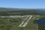
CYQQ (2010) portrays Canadian Forces Base Comox (Vancouver Island, British Columbia, Canada) (CYQQ), the Comox Valley Air Terminal and surrounding area. It is fully compatible with Ultimate Terrain Canada/Alaska for FS2004, Ultimate Terrain X - Canada for FSX and ORBX's FTX NA Blue. CYQQ (2010) includes over 100 "hand-crafted" buildings and other structures and 10 different vintage aircraft on static display, as well as aircraft and traffic files for a realistic AI scenario that causes a variety of military aircraft that come and go. (Use BC Regional AI - also available from this file library - for scheduled traffic.) Civilian AI is now routed so as not to transit military aprons.
Aside from the new approach lighting, generally, this new version is visually identical to its predecessor - even though quite different internally. As well, to the extent possible, it is compatible with Prepar3Dv2.
| Filename: | CYQQ_2010_Version_2_for_FS9_FSX_and_Prepar3D.zip |
| License: | Freeware, limited distribution |
| Added: | 20th June 2014, 11:39:47 |
| Downloads: | 11,035 |
| Author: | Don Grovestine |
| Size: | 33.19 MB |
| Category: Flight Simulator X - Scenery | |
| CYBA - Banff Airfield |
|
File Description:
Welcome to Beautiful Banff - CYBA :)
Banff is the largest town in Banff National Park, in Alberta's Rockies, Canada. It is also the first incorporated municipality located within a national park in Canada. At 1,463 m (4,800 ft), it is the town with the highest elevation in Canada.
It is surrounded by mountains, notably Mount Rundle, Sulphur Mountain, Mount Norquay, and Cascade Mountain and situated above Bow Falls near the junction of the Bow and Spray Rivers. Banff is located 126 km (78 mi) west of Calgary and 58 km (36 mi) east of Lake Louise, on the Trans-Canada Highway. The Town is a member of the Calgary Regional Partnership.
I have put a little " winter life" in this awesome airfield. 2 fuel parking, Helipad and more....
Hope you'll enjoy the scenery on final landing! ;)
No A.I set up!
| Filename: | CYBA__Banff_Airfield.zip |
| License: | Freeware |
| Added: | 11th March 2009, 01:08:10 |
| Downloads: | 1,845 |
| Author: | Daniel Louvet |
| Size: | 384.91 KB |
| Category: Flight Simulator X - Scenery | |
| West Virginia |
|
File Description:
LWM and VTP Scenery files of the entire state of West Virginia and sourrounding area, developed using AutoAsm, TerraScene2, and USGS Data. Default Ohio River meeses things up some but overall quite accurate. No other programs or files required.
| Filename: | West_Virginia.zip |
| License: | Freeware |
| Added: | 25th September 2008, 03:18:02 |
| Downloads: | 999 |
| Author: | Richard L Hill |
| Size: | 15.85 MB |
| Category: Flight Simulator X - Scenery | |
| Cosenza, Calabria, Italy, Photo Real |
|
File Description:
The scenery covers the area of Cosenza and Sila (Calabria, South Italy). The Photo Real Scenery is wide for around 3500 squared Kms. The airport of Lamezia Terme (ICAO code LICA) are found near to the scenery (see map). Otherwise the airport of Crotone (ICAO code LIBC) can be used.
Note for FS2004 user:
This scenery is compatible to 100% with the FS2004 but for the best results, use it in association with Pietro Mauri Italymesh2004.
| Filename: | Cosenza_Calabria_Italy_Photo_Real.zip |
| License: | Freeware |
| Added: | 19th December 2006, 03:16:03 |
| Downloads: | 11,613 |
| Author: | Fulvio Mazzokan |
| Size: | 97.02 MB |
© 2001-2026 AVSIM Online
All Rights Reserved
Privacy Policy |