
Where Flight Simulation Enthusiasts Gather from Around the World!
AVSIM Library - Search Results

| Category: Flight Simulator X - Scenery | |
| RCKU Enhanced |

|
File Description:
Chiayi Aero (RCKU) is located in south of Chiayi City, Taiwan. This Scenery File is for FSX to operate, and you need to install Flight Simulator X SDK, otherwise the building object will not appear. You can find the SDK in your FSX Disc1. This scenery file will enhance airport building objects and trees that the default scenery missed, every object was placed in nearly right position of the real world. To install the scenery, you just put the "RCKU.BGL" file in your "\Microsoft Flight Simulator X\Addon Scenery\scenery" folder. Enjoy it!
| Filename: | RCKU_Enhanced.zip |
| License: | Freeware |
| Added: | 27th February 2009, 19:30:01 |
| Downloads: | 1,201 |
| Author: | Paul Ting |
| Size: | 12.21 KB |
| Category: Flight Simulator X - Utilities | |
| SceneryConfigEditor v1.1.0 |
|
Images related to this file:
File Description:
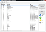
FSX/FS9 Scenery .cfg editor. Allows the user to check/alter their scenery .cfg for FS. Inbuilt error checking and status indication. Ability to add new scenery/delete scenery, form scenery into useful groups and enable/disable same.Gives three different views, editable cfg text editor,list view of installed scenery and group view. Drag and drop is enabled and a descriptive manual included. Users of previous versions are advised to upgrade to this version, as a number of bugs have been fixed and further features have been added
| Filename: | SceneryConfigEditor_v110.zip |
| License: | Freeware |
| Added: | 19th December 2011, 17:23:15 |
| Downloads: | 3,896 |
| Author: | Andrew Thornton |
| Size: | 3.74 MB |
| Category: Flight Simulator X - Scenery | |
| Ireland VFR Small Airports Landclass - Update |
|
File Description:
Ireland VFR Small Airports Landclass Files Update.
This scenery update is a set of landclass files for my following airports
EIKN Knock, EISG Sligo, EICM Galway, Connemara and Aran Islands and Ireland VFR Small Airports part 1. The files have been designed for users of the airports with FSX default scenery and hopefully should remove any errant FSX trees from the runway. The scenery has been tested with default scenery only and does not apply to users of photographic scenery.
Simply drop each file into your appropriate Airport scenery folder.
Please enjoy.
| Filename: | Ireland_VFR_Small_Airports_Landclass__Update.zip |
| License: | Freeware |
| Added: | 8th April 2012, 22:41:37 |
| Downloads: | 3,783 |
| Author: | George Keogh |
| Size: | 11.59 KB |
| Category: Flight Simulator X - AFCAD Files | |
| Atlantic City International Airport (KACY), NJ |
|
File Description:
Located 09 miles NW of Atlantic City, New Jersey on 5000 acres of land, Atlantic City International Airport is a major airport serving the southern portion of New Jersey. It is also one of the main gateways for tourists looking to vacation in nearby Atlantic City, famous for its boardwalks and casinos. This airport has been very heavily modeled with many surrounding buildings and all aprons properly placed. Gates are all properly located and labeled according to the terminal chart (there are, however, no jetways like in the default scenery). General Aviation parking is available in its proper area � all aircraft in the parking area (middle of the tarmac) have collision disabled. If you select Military Cargo parking you will start on one of the helipads in the Coast Guard section. If you select Military Combat parking you will start next to the line of F-16s on ready-alert over on the Air National Guard tarmac. You can also start on a helipad north of the airport. This airport also features completely custom taxiway line and edge lighting. Because this airport uses ATC, it suffers the same bug as my KEWR airport, which is that you cannot receive taxi in directions from ATC � to gate, parking or fuel. Almost all arriving AI aircraft will also disappear from the taxiway after radioing in to ATC and failing to receive taxi instructions to the gate/parking. All traffic and instructions taxiing out works fine. All gate parking spaces have fuel, as well as the military parking and north helipad. GA aircraft can get fuel by taxiing over to the fuel station north of the GA tarmac. Taxiing onto a closed runway (marked with an �X�) will cause a crash. Broken-down taxiways are not good for your undercarriage!
Scenery constructed with use of satellite images/streetview/aerial photos - the author has not been there in person.
This scenery is meant to be used in conjunction with MegaScenery Earth New Jersey/Delaware 003. It is not required, but apron use is minimized to allow satellite scenery to show through as much as possible, and objects are placed based on the MSE textures - lack of it may make scenery look out of place.
| Filename: | Atlantic_City_International_Airport_KACY_NJ.zip |
| License: | Freeware |
| Added: | 1st February 2011, 10:28:53 |
| Downloads: | 1,355 |
| Author: | Drew Sikora |
| Size: | 5.12 MB |
| Category: Flight Simulator X - Aircraft Repaints, Textures and Modifications | |
| FS2004/FSX Project Airbus Air Canada Rouge C-FYIY Airbus A319-114 (Liberal Party Of Canada Livery) |
|
File Description:
This was requested by Brent Warman on the Project Airbus Official Facebook Group. readme included
| Filename: | FS2004FSX_Project_Airbus_Air_Canada_Rouge_CFYIY_Ai.zip |
| License: | Freeware |
| Added: | 14th April 2025, 19:57:40 |
| Downloads: | 30 |
| Author: | Ryubunao1478 |
| Size: | 16.9 MB |
| Category: Flight Simulator X - Scenery | |
| Marshall Islands International Airport |
|
Images related to this file:
File Description:
Marshall Islands International Airport
I'm sharing this quick afcad/scenery I made for my world tour.
To install just put the PKMJ folder in youyr fsx main "addon scenery" and add it in your fsx scenery library.
| Filename: | Marshall_Islands_International_Airport.zip |
| License: | Freeware |
| Added: | 15th July 2012, 06:41:20 |
| Downloads: | 3,547 |
| Author: | Sagga Toure |
| Size: | 6.12 MB |
| Category: Flight Simulator X - Scenery | |
| Gloucestershire Airport |
|
File Description:
Gloucestershire Airport UK (EGBJ) for Microsoft Flight Simulator X (SP1).
This scenery was designed to be used with photographic scenery however a default scenery version also is included. Contains custom built Gmax buildings, taxiways and other objects.
| Filename: | Gloucestershire_Airport.zip |
| License: | Freeware, limited distribution |
| Added: | 31st May 2007, 12:28:25 |
| Downloads: | 4,057 |
| Author: | Terry Shields |
| Size: | 4.23 MB |
| Category: Flight Simulator X - AFCAD Files | |
| Peaslees Airstrip Airport (NJ25), New Jersey |
|
File Description:
Located 01 miles SW of Clarksboro, New Jersey on 8 acres of land, Peaslees Airstrip is a private turf field 2207' in length. The hard surface runway has been removed to allow for landings on terrain, so have your terrain mesh set as high as possible. The surrounding area of rural farmland and houses has been filled in to provide an encompassing ground environment with as few breaks to the horizon as possible. There are no services at this airport - if you arrive there is room past the hangar to park and tie down although no tie downs are available in real life, thus you can only start from this airport on the runway. The windsock is located approximately midfield of the runway, as in real life. A second hangar has been constructed nearby the current one, but MSE textures do not reflect this and it was not included. This airport is not lit and daytime VFR operations only are recommended.
Scenery constructed with use of satellite images/streetview/aerial photos - the author has not been there in person.
This scenery is meant to be used in conjunction with MegaScenery Earth New Jersey/Delaware 004. It is not required, but apron use is minimized to allow satellite scenery to show through as much as possible, and objects are placed based on the MSE textures - lack of it may make scenery look out of place.
| Filename: | Peaslees_Airstrip_Airport_NJ25_New_Jersey.zip |
| License: | Freeware |
| Added: | 20th August 2011, 19:56:22 |
| Downloads: | 160 |
| Author: | Drew Sikora |
| Size: | 1 MB |
| Category: Flight Simulator X - AFCAD Files | |
| Newark Liberty International Airport (EWR), NJ (Beta) |
|
File Description:
Located 03 miles S of Newark, New Jersey on 2027 acres of land, Newark Liberty International Airport is a major regional hub. Currently, this airport is fully modeled to match MegaScenery Earth ground textures. It is functional to the point where I feel comfortable releasing it, however it is a far cry from "complete". As a primarily General Aviation pilot, I do not have much use for this airport, however I do fly over it from time to time and prefer to see it blend in with MSE textures properly. If you are a frequent user of KEWR and its facilities, please consult the Known Issues section of the ReadMe to decide whether you wish to install this version. It might be worth adding it as a layer you can turn on when you're not using the airport but will be flying in the area and want it to blend in properly. I do plan to further develop this airport if I end up using it more often in the future.
Scenery constructed with use of satellite images/streetview and personal reference.
This scenery is meant to be used in conjunction with MegaScenery Earth New York 005. It is not required, but apron use is minimized to allow satellite scenery to show through as much as possible, and objects are placed based on the MSE textures - lack of it may make scenery look out of place.
| Filename: | Newark_Liberty_International_Airport_EWR_NJ_Beta.zip |
| License: | Freeware |
| Added: | 28th November 2010, 02:05:25 |
| Downloads: | 2,957 |
| Author: | Drew Sikora |
| Size: | 3.34 MB |
| Category: Flight Simulator X - AFCAD Files | |
| Cross Keys Airport (17N), NJ |
|
File Description:
Located 01 miles S of Cross Keys, New Jersey on 280 acres of land, Cross Keys Airport is a small General Aviation field privately owned by Cross Keys Airport Inc. In addition to servicing GA flights, the airport also hosts a paintball field and a sky diving operation to the north of the field. For this reason, all aircraft must remain south of the runway at all times. Any aircraft with a wingspan larger than 40 feet will need to park in the turf area west of the main apron - smaller GA aircraft can pick a spot from any of the open tiedown areas. 100LL (Blue) Fuel is available by stopping next to the fuel tank on the main apron. Although it doesn't exist in real life, a patch of concrete to the west of the main apron made for a good helipad, so I included one. It is not lit at night. Trees in the surrounding forest are summer trees ONLY.
Scenery constructed with use of Google Maps images, and vague recollection by the author who went sky diving there once.
This scenery is meant to be used in conjunction with MegaScenery Earth New Jersey/Delaware 004. It is not required, but apron use is minimized to allow satellite scenery to show through as much as possible, and objects are placed based on the MSE textures - lack of it may make scenery look out of place.
| Filename: | Cross_Keys_Airport_17N_NJ.zip |
| License: | Freeware |
| Added: | 7th October 2010, 03:27:53 |
| Downloads: | 246 |
| Author: | Drew Sikora |
| Size: | 719.13 KB |


© 2001-2026 AVSIM Online
All Rights Reserved
Privacy Policy |