
Where Flight Simulation Enthusiasts Gather from Around the World!
AVSIM Library - Search Results

| Category: Flight Simulator X - Scenery | |
| RAF Metheringham - Lincoln, Lincolnshire, England **FIX** |

|
File Description:
This is a fix which will sort out the scenery configuration error which prevented the scenery from showing.
Metheringham airfield is located two miles to the east of Metheringham village on the B1189. The airfield opened in October 1943 as a Class 'A' bomber airfield within 5 Group. The standard three intersecting concrete runways were provided as were two T2 hangars and a B1. One of the T2s was on the technical site to the south-west, which straddled the B1189 and the other was located off the eastern perimeter track. The bomb stores were to the north and between these and the north-west runway head stood the B1 hangar. The communal and accommodation sites were located in fields to the south and west. Metheringham was also equipped with FIDO fog dispersal equipment. The station closed in 1951 and very little remains of the station now although a small visitors centre with a little museum on site.
You will require third party add-ons - details in the included Read-me.txt file.
| Filename: | RAF_Metheringham__Lincoln_Lincolnshire_England__FI.zip |
| License: | Freeware |
| Added: | 15th November 2015, 14:25:30 |
| Downloads: | 206 |
| Author: | Terry Boissel |
| Size: | 95.84 KB |
| Category: Flight Simulator X - Scenery | |
| Gold Coast Airport (YBCG) |
|
File Description:
The Gold Coast Airport (formerly known as Coolangatta) is a busy international airport located some 100 ks south of Brisbane and 850 ks north of Sydney. This scenery contains and accurate depiction of the terminal, control tower, hangers and the very distinctive lighthouse at Coolangatta (with beacon) plus night lighting of the apron. In addition many buildings have been added to Coolangatta and Surfers some of which are original but many are stock buildings. The scenery has been reduced in complexity to attempt to be reasonably frame rate friendly. All models are GMAX or FSDS3.0. Extensive coastline changes has added beaches as far south as Byron Bay and the canal network behind Surfers Paradise, Bond Uni, Currumbin and Coolangatta. Recent upgrades of the airport to a 2500 metre runway have been reflected as well as a widened apron. Therefore it may look a little different from the current Google Earth image but it is accurate. The airport will now handle direct flights from Asia and typical planes landing might include Airbus 343 or similar wide bodied aircraft.
| Filename: | Gold_Coast_Airport_YBCG.zip |
| License: | Freeware |
| Added: | 12th July 2007, 15:08:44 |
| Downloads: | 6,177 |
| Author: | John Ross |
| Size: | 12.16 MB |
| Category: Flight Simulator X - Scenery | |
| FSX Grand Canyon North Rim Simulation |
|
Images related to this file:
File Description:
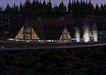
Welcome to the North Rim of the Grand Canyon!
This scenery is a mostly fictitious representation of what the North Rim might look like of it had been developed like the South rim. A new airport (KKPA, Kaibab Plateau Airport) is the centerpiece. It sits at 8,730 ft MSL so density altitude is a real issue. Runway 17/35 is 6,500ft long so biz jets can get in and out safely. A new resort sits atop the ridge to the east [Eagle's Nest]. There is a helipad for access. An NDB makes finding it easier [AZ95 220.9 kHz]. Or you can just follow the traffic on the access road that branches off from highway 67 just south of the airport. To the north I have added a gravel strip to Jacob Lake where 67 joins 89A. Runway 14/32 is 3000 ft long and sits at 7900 ft MSL. An NDB [AZ93 393 kHz] is included. At the south end of Highway 67 sits the North Rim Visitor Center. There is a helipad on the roof for those who like rotary wing challenges. The NDB is AZ94 at 423.4 kHz. The entire length of Highway 67 is represented with traffic going both ways. You will see
air traffic from KGCN at the South Rim and traffic between KKPA and Jacob Lake.
| Filename: | FSX_Grand_Canyon_North_Rim_Simulation.zip |
| License: | Freeware, limited distribution |
| Added: | 19th May 2021, 19:28:12 |
| Downloads: | 102 |
| Author: | Brett Delana |
| Size: | 16.26 MB |
| Category: Flight Simulator X - Aircraft Repaints, Textures and Modifications | |
| Air Niugini Boeing 707-300 (P2-ANB) |
|
Images related to this file:
File Description:

Repaint of the Captainsim 707 in Air Niugini livery with the 'SOUTH PACIFIC FESTIVAL OF ARTS 1980' text on the fuselage.
| Filename: | Air_Niugini_Boeing_707300_P2ANB.zip |
| License: | Freeware |
| Added: | 4th July 2014, 12:28:48 |
| Downloads: | 98 |
| Author: | CaptainSim / Jon Murchison |
| Size: | 6.07 MB |
| Category: Flight Simulator X - Aircraft Repaints, Textures and Modifications | |
| South African Airways "Pongola" Boeing 737-200 (ZS-SBL) |
|
Images related to this file:
File Description:

This is a repaint of South African Airways ZS-SBL "Pongola" B737-247 for Captain Sim's Boeing 737-200 Basepack Model.
| Filename: | South_African_Airways_Pongola_Boeing_737200_ZSSBL.zip |
| License: | Freeware |
| Added: | 18th December 2015, 23:36:40 |
| Downloads: | 392 |
| Author: | Alex FABER |
| Size: | 12.75 MB |
| Category: Flight Simulator X - Aircraft Repaints, Textures and Modifications | |
| South African Airways "Umkomaas" Boeing 737-200 (ZS-SBR) |
|
Images related to this file:
File Description:

This is a repaint of South African Airways ZS-SBR "Umkomaas" B737-244 for Captain Sim's Boeing 737-200 Basepack Model.
| Filename: | South_African_Airways_Umkomaas_Boeing_737200_ZSSBR.zip |
| License: | Freeware |
| Added: | 18th December 2015, 23:36:51 |
| Downloads: | 358 |
| Author: | Alex FABER |
| Size: | 12.96 MB |
| Category: Flight Simulator X - Scenery | |
| Athlone Power Station in Cape Town South Africa |
|
File Description:
Athlone Power Station in Cape town,not the real thing but it will improve your flying in Cape Town South Africa.
| Filename: | Athlone_Power_Station_in_Cape_Town_South_Africa.zip |
| License: | Freeware |
| Added: | 11th May 2008, 22:53:28 |
| Downloads: | 1,501 |
| Author: | Frits Beyer |
| Size: | 3.3 KB |
| Category: Flight Simulator X - Scenery | |
| Jeffreys Bay Airfield |
|
Images related to this file:
File Description:
Jeffrey's Bay airport in the Eastern Cape , South Africa made from custom models and textures.Nice for short hops to Port Elizabeth.
| Filename: | Jeffreys_Bay_Airfield.zip |
| License: | Freeware |
| Added: | 4th April 2011, 22:33:54 |
| Downloads: | 924 |
| Author: | Jacques Botha |
| Size: | 1.11 MB |
| Category: Flight Simulator X - AFCAD Files | |
| Stoe Creek Farm Airport (7NJ2), NJ |
|
File Description:
Located 01 miles S of Canton, New Jersey, Stoe Creek Farm is a private turf field 1725' in length. The runway is largely clear of obstructions although on approach for Runway 05 you will deal with 20-30' trees a few hundred feet back from the threshold and there are transmission towers along the approach corridor to Runway 23 you should watch out for. The runway does have edge lighting, although the windsock is not lit at night and daytime VFR is still recommended. There are no services for transient craft at this airfield. Since you will be landing on terrain, it is recommended that your mesh complexity is set as high as possible.
Scenery constructed with use of satellite images/streetview/aerial photos - the author has not been there in person.
This scenery is meant to be used in conjunction with MegaScenery Earth New Jersey/Delaware 004. It is not required, but apron use is minimized to allow satellite scenery to show through as much as possible, and objects are placed based on the MSE textures - lack of it may make scenery look out of place.
| Filename: | Stoe_Creek_Farm_Airport_7NJ2_NJ.zip |
| License: | Freeware |
| Added: | 14th February 2011, 18:32:24 |
| Downloads: | 163 |
| Author: | Drew Sikora |
| Size: | 700.91 KB |
| Category: Flight Simulator X - AFCAD Files | |
| Winchelsea Airport (8NJ0), NJ |
|
File Description:
Located 01 miles W of Port Republic, New Jersey, Winchelsea Airport is a private turf strip. Pay very, very close attention to the published length of this grass runway: 980'. This is in addition to 50ft tree obstacles at either end of the runway. Double-check your aircraft's takeoff and landing distances before visiting this airfield!! A strong headwind is suggested for operations out of this location. Also take note the traffic patterns vary for each runway. There are no transient services offered and the airport is not lit at night so daytime VFR use only is suggested. There is no hard surface runway so set your terrain mesh slider as high as you can for the best effect of landing on terrain.
Scenery constructed with use of satellite images/streetview/aerial photos - the author has not been there in person.
This scenery is meant to be used in conjunction with MegaScenery Earth New Jersey/Delaware 003. It is not required, but apron use is minimized to allow satellite scenery to show through as much as possible, and objects are placed based on the MSE textures - lack of it may make scenery look out of place.
| Filename: | Winchelsea_Airport_8NJ0_NJ.zip |
| License: | Freeware |
| Added: | 24th March 2011, 19:28:46 |
| Downloads: | 162 |
| Author: | Drew Sikora |
| Size: | 396.23 KB |


© 2001-2026 AVSIM Online
All Rights Reserved
Privacy Policy |