Where Flight Simulation Enthusiasts Gather from Around the World!
AVSIM Library - Search Results
| Category: Flight Simulator X - Scenery | |
| FSX British Columbia Airfields 1-3 For Default Scenery |

|
File Description:
60 British Columbia airfields/seaplane bases with surrounding scenery like lakes, landclass etc.. These sceneries are for the FSX default scenery, i.e. a scenery that does not have enhancements like Ultimate Terrain or ORBX which correct or add e.g. lakes, towns etc.
However, I do use additional freeware mesh sceneries, which are the "FSX Canada 19M Terrain Mesh" parts 1 and 2 by Raimundo Taburet (LOD 11) and the North America/Canada mesh from "FreeMesh X Global 1.0" (LOD 10). But in principle my sceneries should work with any mesh.
All files are named by their ICAO ID, so you can easlily remove any airfiled that you don't need or don't like.
| Filename: | misc_bc_airfields_1-3.zip |
| License: | Freeware |
| Added: | 20th November 2020, 05:32:29 |
| Downloads: | 167 |
| Author: | Detlev J. Rohmer |
| Size: | 196 KB |
| Category: Flight Simulator X - Scenery | |
| FSX_MeSA_G08 |

|
File Description:
FSX Mesh South America Project:
This terrain mesh file is a part of a whole project covering all the Continent
of South America and some islands, divided in tiles identified in a map by its
column (letters) and rows (numbers).
Those files were multi-LOD compiled from 90m SRTM2 source data, reprocessed
with 3DEM to remove voids and spikes, providing a 76.4m (LOD9) horizontal
resolution topography intended for use only in FSX updated with SP1.
Although not well documented, to improve performance, the updated FSX loads DEM
files in threads and only the closer terrain (about 5-10 NM from the point of view)
is rendered in high detail, while at far distances FSX shows up its default low
resolution mesh, when there is not a third part terrain mesh compiled in all
others intermediate level of details (multi-LOD).
THIS FILE:
FSX_MeSA_G08 (Column G x Row 08)
covers the area inside the boundaries:
N = 22º 30' S; S = 28º 7.5' S;
W = 45º 0' W; E = 37º 30' W;
AUTHORS:
Hely Heck Junior - Magrao ( [email protected] )
and Jose Lobo ( [email protected] )
| Filename: | fsx_mesa_g08.zip |
| License: | Freeware |
| Added: | 15th June 2007, 15:04:47 |
| Downloads: | 1,132 |
| Author: | Hely Heck Jr. and José Lôbo |
| Size: | 12 MB |
| Category: Flight Simulator X - Scenery | |
| FSX_MeSA_H04 |

|
File Description:
FSX Mesh South America Project:
This terrain mesh file is a part of a whole project covering all the Continent
of South America and some islands, divided in tiles identified in a map by its
column (letters) and rows (numbers).
Those files were multi-LOD compiled from 90m SRTM2 source data, reprocessed
with 3DEM to remove voids and spikes, providing a 76.4m (LOD9) horizontal
resolution topography intended for use only in FSX updated with SP1.
Although not well documented, to improve performance, the updated FSX loads DEM
files in threads and only the closer terrain (about 5-10 NM from the point of view)
is rendered in high detail, while at far distances FSX shows up its default low
resolution mesh, when there is not a third part terrain mesh compiled in all
others intermediate level of details (multi-LOD).
THIS FILE:
FSX_MeSA_H04 (Column H x Row 04)
covers the area inside the boundaries:
N = 0º 0' S; S = 5º 37.5' S;
W = 37º 30' W; E = 30º 0' W;
AUTHORS:
Hely Heck Junior - Magrao ( [email protected] )
and Jose Lobo ( [email protected] )
| Filename: | fsx_mesa_h04.zip |
| License: | Freeware |
| Added: | 15th June 2007, 15:07:51 |
| Downloads: | 943 |
| Author: | Hely Heck Jr. and José Lôbo |
| Size: | 3.56 MB |
| Category: Flight Simulator X - Scenery | |
| FSX_MeSA_H05 |

|
File Description:
FSX Mesh South America Project:
This terrain mesh file is a part of a whole project covering all the Continent
of South America and some islands, divided in tiles identified in a map by its
column (letters) and rows (numbers).
Those files were multi-LOD compiled from 90m SRTM2 source data, reprocessed
with 3DEM to remove voids and spikes, providing a 76.4m (LOD9) horizontal
resolution topography intended for use only in FSX updated with SP1.
Although not well documented, to improve performance, the updated FSX loads DEM
files in threads and only the closer terrain (about 5-10 NM from the point of view)
is rendered in high detail, while at far distances FSX shows up its default low
resolution mesh, when there is not a third part terrain mesh compiled in all
others intermediate level of details (multi-LOD).
THIS FILE:
FSX_MeSA_H05 (Column H x Row 05)
covers the area inside the boundaries:
N = 5º 37.5' S; S = 11º 15' S;
W = 37º 30' W; E = 30º 0' W;
AUTHORS:
Hely Heck Junior - Magrao ( [email protected] )
and Jose Lobo ( [email protected] )
| Filename: | fsx_mesa_h05.zip |
| License: | Freeware |
| Added: | 15th June 2007, 15:08:10 |
| Downloads: | 943 |
| Author: | Hely Heck Jr. and José Lôbo |
| Size: | 22.93 MB |
| Category: Flight Simulator X - Scenery | |
| FSX_MeSA_H06 |

|
File Description:
FSX Mesh South America Project:
This terrain mesh file is a part of a whole project covering all the Continent
of South America and some islands, divided in tiles identified in a map by its
column (letters) and rows (numbers).
Those files were multi-LOD compiled from 90m SRTM2 source data, reprocessed
with 3DEM to remove voids and spikes, providing a 76.4m (LOD9) horizontal
resolution topography intended for use only in FSX updated with SP1.
Although not well documented, to improve performance, the updated FSX loads DEM
files in threads and only the closer terrain (about 5-10 NM from the point of view)
is rendered in high detail, while at far distances FSX shows up its default low
resolution mesh, when there is not a third part terrain mesh compiled in all
others intermediate level of details (multi-LOD).
THIS FILE:
FSX_MeSA_H06 (Column H x Row 06)
covers the area inside the boundaries:
N = 11º 15' S; S = 16º 52.5' S;
W = 37º 30' W; E = 30º 0' W;
AUTHORS:
Hely Heck Junior - Magrao ( [email protected] )
and Jose Lobo ( [email protected] )
| Filename: | fsx_mesa_h06.zip |
| License: | Freeware |
| Added: | 15th June 2007, 15:19:51 |
| Downloads: | 996 |
| Author: | Hely Heck Jr. and José Lôbo |
| Size: | 1.61 MB |
| Category: Flight Simulator X - Scenery | |
| Greece Mesh Terrain, v1 |

|
Images related to this file:
File Description:
Detailed FSX mesh terrain of Greece and surrounding territories (West Turkey, South Bulgaria, FYRoM, Albania) based on SRTM Data (3 arcsec, 90m) and sampled to LOD9 resolution (76m). For more information visit www.avsim.com/greece/scenery.
| Filename: | hspfsxmesh1.zip |
| License: | Freeware, limited distribution |
| Added: | 9th June 2010, 14:46:18 |
| Downloads: | 30,420 |
| Author: | Hellas Scenery Team (HST) |
| Size: | 76.59 MB |
| Category: Flight Simulator X - Scenery | |
| Egypt Mesh Scenery SRTM |

|
File Description:
This scenery is based on the collected Datas of the NASA Spaceshuttle mission SRTM
The Shuttle Radar Topographic Mission in the year 2000 made by the Spaceshuttle Endevour.
| Filename: | eg_srtm_fsx.zip |
| License: | Freeware, limited distribution |
| Added: | 2nd January 2012, 16:25:24 |
| Downloads: | 10,961 |
| Author: | Mathias Schindler |
| Size: | 129.51 MB |
| Category: Flight Simulator X - Scenery | |
| CSD3 Valleyfield, Quebec, Canada |

|
File Description:
This is the scenery CSD3( Valleyfield ) which represents the reality. Valleyfield is a town located on South bank of the St-Laurent river 30 miles west of Montreal, Quebec, Canada. This scenery is design with FSDS and it accepts Mesh of Gilles Gauthier.This scenery has the function for FS-2004 or FS-X.
| Filename: | csd3-valleyfield-fs9-fsx.zip |
| License: | Freeware |
| Added: | 5th December 2009, 04:16:04 |
| Downloads: | 2,842 |
| Author: | Gerald Allaire |
| Size: | 1.86 MB |
| Category: Flight Simulator X - Scenery | |
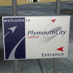
| Plymouth City X 2012 (v3.20) |

|
Images related to this file:
File Description:

Version 3.20 and "2012" addon for the previously released Plymouth City Airport scenery. This update has many new and re-created models for the "2011" version and a complete upgrade of the airport in its current state. The 2011 and 2012 airport layouts are interchangeable through the Options program included. Required: Plymouth City X version 3.00 or above.
| Filename: | eghdx2012.zip |
| License: | Freeware, limited distribution |
| Added: | 31st August 2012, 12:51:19 |
| Downloads: | 1,833 |
| Author: | South West Scenery, William Mayne |
| Size: | 12.04 MB |
| Category: Flight Simulator X - Scenery | |
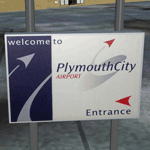
| Plymouth City X |

|
Images related to this file:
File Description:

Plymouth City Airport scenery for FSX as of November 2011. The airport was opened in 1925 and closed on 23rd December 2011. This is version 3 of the scenery - any previous versions must be uninstalled first. Scenery includes airport buildings, 3D lighting, photo ground, surrounding traffic, buildings and greenery. Also includes a special scenery level options program to turn certain features on and off and to perform minor updates.
| Filename: | eghdx2011.zip |
| License: | Freeware, limited distribution |
| Added: | 22nd December 2011, 23:32:29 |
| Downloads: | 3,404 |
| Author: | South West Scenery, William Mayne |
| Size: | 32.85 MB |
© 2001-2025 AVSIM Online
All Rights Reserved
