
Where Flight Simulation Enthusiasts Gather from Around the World!
AVSIM Library - Search Results

| Category: Flight Simulator X - Scenery | |
| Duesseldorf EDDL Patch v1.0 |

|
Images related to this file:
File Description:
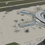
With this Patch following things were improved/changed in the Duesseldorf scenery by Thomas Ruth: - heading of 05L/23R corrected; taxiways aligned to an aerial image and airport chart; considered the latest construction at the airport (exp. taxiway M moved and added N,L; and more), according to the GND-chart; all parking positions added (93 total now), only double occupancy and some GA missing; all airport buildings aligned to aerial images (the light posts, blast fences, western offices and sky train were corrected in GMAX); assigned airlines to the parking positions; corrected apron layout; .... and more
| Filename: | Duesseldorf_EDDL_Patch_v10.zip |
| License: | Freeware |
| Added: | 24th July 2011, 19:01:39 |
| Downloads: | 10,989 |
| Author: | Max Epperlein, Thomas Ruth |
| Size: | 11.6 MB |
| Category: Flight Simulator X - Sounds | |
| KBLM Voicepack Mod |
|
File Description:
The purpose of this voicepack mod is to replace "KBLM Traffic" with "Monmouth Executive Traffic" in CTAF communications and also to replace "Choose option for KBLM Traffic" with "Choose option for Monmouth Executive Traffic" in the ATC display window. It will also change the weather service identifier in the ATC window however the automated message will still pronounce the airport's phonetic name.
NOTE: The AWOS modification requires that the AFCAD you are using for KBLM have the AWOS name entered. By default it is not. An AFCAD that does include this is my KBLM scenery (http://www.mseairports.com/index.php?page_id=592)
| Filename: | KBLM_Voicepack_Mod.zip |
| License: | Freeware |
| Added: | 20th September 2011, 14:05:46 |
| Downloads: | 115 |
| Author: | Drew Sikora |
| Size: | 2.53 KB |
| Category: Flight Simulator X - Scenery | |
| Alaska Airfields Pack 2 - v1.0 |
|
Images related to this file:
File Description:
This is my second pack of yet another three airfields in Alaska that I have modified to look more like the real thing. The scenery is made of ready made library buildings and trees, no custom made objects, but it's a vast improvement over the stock FSX airfields. The three airfields are (6AK) Rainy Pass Airfield, (8KA) Tatitna Airfield and (5NI) Nikolai Airfield.
PLEASE NOTE: These scenerys are made with FSX Acceleration and Flight 1's Ultimate Alaska X installed. I don't know how they look or work without these add-ons.
| Filename: | Alaska_Airfields_Pack_2__v10.zip |
| License: | Freeware |
| Added: | 19th February 2012, 02:09:32 |
| Downloads: | 2,399 |
| Author: | Torbjorn Kuntze |
| Size: | 1.88 MB |
| Category: Flight Simulator X - AFCAD Files | |
| Colombia Full AFCAD Package |
|
File Description:
This replaces the default AFCADS for all the main airports in Colombia with passenger service. I've fixed many things including, runway length, width, added missing markers, runway lights, PAPIs, ILSs,terminal, jetways, comm freqs, airport altitudes, etc. One exception is the Bogota airport as it has scenery with a decent AFCAD. Fixed airports: Apartado/Carepa, Armenia, Barrancabermeja, Barranquilla, Bucaramanga, Cali, Cartagena, Cucuta, Florencia, Ibague, Manizales, Medellin, Monteria, Neiva, Pasto, Pereira, Popayan, Quibdo, Riohacha, San Andres, Santa Marta, Tumaco & Valledupar.
I used the latest Jeppesen charts and satellite imagery for reference. This is the full packages, I will also release these airports individually.
| Filename: | Colombia_Full_AFCAD_Package.zip |
| License: | Freeware |
| Added: | 26th April 2012, 21:46:09 |
| Downloads: | 1,125 |
| Author: | Eric Thornton |
| Size: | 62.36 KB |
| Category: Flight Simulator X - Missions | |
| Fire in Tau Island |
|
File Description: This scene recreates a series of fires in Tau Island.
You are a rescuer!
The mission starts by taking off in Pago-Pago Airport (NSTU) and fly to Fitiuta
Airport (FAQ). Take a truck and go by coast road to Tau Airport (HI36), out of
service by fire. Rescue the settlers at the end of the road and return to the
Fitiuta Airport. Take again again your plane and take off to Pago-Pago Airport
with the rescued settlers, where they will receive hospitable attention.
Requires Tau Island Scenery: faq_-_tau_island.zip Download ID: 174863
| Filename: | Fire_in_Tau_Island.zip |
| License: | Freeware |
| Added: | 5th March 2013, 06:48:46 |
| Downloads: | 473 |
| Author: | Christian Svensson / Didisoft |
| Size: | 385.77 KB |
| Category: Flight Simulator X - AFCAD Files | |
| ENAN - Andoya - Andenes, Norway |
|
File Description:
Upgrade of default (ENAN) Andenes airport for FSX.
This is not a correct scenery for the airport, but more like an upgrade of the boring default one.
I grew up on the island Andoya in the 70`s. Trees and a lot I guess has changed since that time, but I have noticed that in FSX, everyone has moved and burned down the houses, so in this version I have put some stuff here and there on the island. There is a first version at flightsim.no, but this is a complete version so the first is not needed.
| Filename: | ENAN__Andoya__Andenes_Norway.zip |
| License: | Freeware |
| Added: | 9th March 2013, 19:12:18 |
| Downloads: | 388 |
| Author: | Oddmund Karlsen |
| Size: | 9.57 KB |
| Category: Flight Simulator X - Scenery | |
| KVUO - Pearson Field - Vancouver, Washington |
|
Images related to this file:
File Description:
Pearson Field, Vancouver Washington. This airport was originally created to accompany a large photo-scenery, which is the reason there are so many buildings that are placed accurately, but outside the area of the included photo ground. All of the buildings are straight renders from Google Earth or the Trimble Warehouse and Fort Vancouver, the Army Air Museum, the nearby mall with Fred Meyer and several other landmarks are included. The photo ground has 4 seasons and night and if the ground is a little gray, apologies, I kind of overdid it for hard winter. You can just change seasons for greener pastures.
| Filename: | KVUO__Pearson_Field__Vancouver_Washington.zip |
| License: | Freeware, limited distribution |
| Added: | 1st February 2014, 00:02:10 |
| Downloads: | 883 |
| Author: | Rick Keller |
| Size: | 85.88 MB |
| Category: Flight Simulator X - Scenery | |
| KRNO - Reno/Tahoe Intl - Nevada, USA |
|
Images related to this file:
File Description:
This airport update is made only for those that have Acceleration installed: there is one version with the Crosswind runway operating where all 3 runways will be used for takeoff/landing and one version as the default runway operation: assigned parking as per their website with extra parking including JetBlue Airways which begins on May 28 2015, taxiways and taxi signs updated to the latest charts, extra fuel trucks, support vehicle roads rebuilt and many other scenery improvements, airport views are from inside the control tower (when in tower view) please view the readme before installation.
| Filename: | KRNO__RenoTahoe_Intl__Nevada_USA.zip |
| License: | Freeware, limited distribution |
| Added: | 2nd February 2015, 14:33:51 |
| Downloads: | 19,710 |
| Author: | Craig Scott |
| Size: | 754.51 KB |
| Category: Flight Simulator X - Scenery | |
| KCVO / OR52 - Corvallis-Venell Airports |
|
Images related to this file:
File Description:
FSX Scenery - Corvallis Municipal Airport (IATA: CVO, ICAO: KCVO, FAA LID: CVO) is a city owned, public use airport located four nautical miles (5 mi, 7 km) southwest of the central business district of Corvallis, a city in Benton County, Oregon, United States. It is included in the National Plan of Integrated Airport Systems for 2011-2015, which categorized it as a general aviation facility. Venell Airport (FAA LID: OR52) is a private airport located at the southern end of Corvallis Municipal Airport in Benton County, Oregon, USA. For your flying pleasure by John B. Loney, Jr.
| Filename: | KCVO__OR52__CorvallisVenell_Airports.zip |
| License: | Freeware, limited distribution |
| Added: | 30th August 2015, 17:49:24 |
| Downloads: | 769 |
| Author: | John B. Loney, Jr. |
| Size: | 22.99 MB |
| Category: Flight Simulator X - Scenery | |
| RAF Stenigot |
|
File Description:
RAF Stenigot was a Second World War radar station situated at Stenigot, near Donington on Bain, Lincolnshire.
It was part of the Chain Home radar network, intended to provide long range early warning for raids from Luftflotte V and the northern elements of Luftflotte II along the approaches to Sheffield and Nottingham and the central midlands.
I would like to give credit and to acknowledge the following authors without whose work I could not have made this scenery; all credit for the models contained in it is theirs I merely placed it. Ted Andrews - Ian Pearson - Mike Hudson.
| Filename: | RAF_Stenigot.zip |
| License: | Freeware |
| Added: | 3rd October 2015, 18:50:05 |
| Downloads: | 309 |
| Author: | Terry Boissel |
| Size: | 130.31 KB |


© 2001-2026 AVSIM Online
All Rights Reserved
Privacy Policy |