
Where Flight Simulation Enthusiasts Gather from Around the World!
AVSIM Library - Search Results

| Category: Flight Simulator X - Scenery | |
| Victoria, Canada including US Southern Gulf Islands and San Juan Islands - Part 2 of 2 |

|
Images related to this file:
File Description:
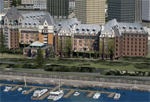
FSX-only version of Victoria, Canada area scenery including the Southern Gulf Islands and the San Juan Islands of the US. Includes automated installer and configurator by Scot Fraser.
Features:
-accurate shorelines, lakes and streams;
-landclass;
-FSX multi-LOD mesh with 10m maximum resolution;
-complete road network with moving traffic;
-railroads;
-utility corridors;
-marinas and ferry terminals;
-many static boats, including a custom model of the Canada Coast Guard ship Sir Wilfred Laurier;
-detailed models of major buildings and the Ogden Point Terminal;
-many bridges;
-nearly 300 marine lights; and corrected antennae locations.
Facilities include Don Grovestine's famous CYYJ (Victoria International Airport); 12 other Canadian land-based airports: Butler Field, Duncan (CAM3), Gaines, Hastings, Hudson Island, James Island, Thomas, Village Bay, Raven Field (CML2), Saltspring, Sidney Island, Whiskey Point; 20 US airports Blakely (38WA), Burden (61WA), Center Island (79WA), Clam Harbor (WA35), Crane Island, Decatur Shores (WN07), Decatur-Jones (WA18), Waldronaire (90WA), Orcas Island (KORS), Friday Harbour (KFHR), Lopez Island (S31), Pile Point, Roche Harbor (WA09), Shaw Island, Stuart Island Airpark (7WA5), Stuart Island West (2WA3), Wilding (6WA5), Windsock (4WA4); 12 floatplane facilities: Bedwell (CAB3), Fisherman's Bay (WA81), Friday Harbor (W33), Ganges (CAX6), Maple Bay, Mayne (CAW7), Port Washington (CAP8), Roche Harbor (W39), Rosario (W49), Shawnigan Lake (CAV8), Victoria Harbour (CYWH), Victoria International (CAP5) and Westsound, Orcas (WA83) - many with AI traffic; 9 heliports: Ganges (CAL7), Mayne (CBF5), Camel Point (CBF7), Jubilee (CBK8), Victoria General (CBW7) Madrona Bay (CBW9), Shoal Point (CBZ7), Mount Belcher (CMBH).
AI models include the DHC-2 floatplane in local liveries, a cruise ship model (by Mitsuya Hamaguchi) and two repaints, pilot boat, and small boats (by Larry Silsbee).
Ultimate Terrain X compatible (not required). Users of Vancouver+ for FSX will also get additional cruise ship traffic and additional floatplane and helicopter traffic. Full documentation. By Don Grovestine, Jon Patch and Holger Sandmann. Many other contributors: see documentation. Part 2 of 2 - you also need file vicenh7a.zip
| Filename: | Victoria_Canada_including_US_Southern_Gulf_Islands.zip |
| License: | Check within download |
| Added: | 29th January 2010, 21:21:49 |
| Downloads: | 23,168 |
| Author: | Don Grovestine, Jon Patch and Holger Sandmann |
| Size: | 59.08 MB |
| Category: Flight Simulator X - Scenery | |
| Victoria, Canada including US Southern Gulf Islands and San Juan Islands - Part 1 of 2 |
|
Images related to this file:
File Description:
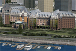
FSX-only version of Victoria, Canada area scenery including the Southern Gulf Islands and the San Juan Islands of the US. Includes automated installer and configurator by Scot Fraser.
Features:
-accurate shorelines, lakes and streams;
-landclass;
-FSX multi-LOD mesh with 10m maximum resolution;
-complete road network with moving traffic;
-railroads;
-utility corridors;
-marinas and ferry terminals;
-many static boats, including a custom model of the Canada Coast Guard ship Sir Wilfred Laurier;
-detailed models of major buildings and the Ogden Point Terminal;
-many bridges;
-nearly 300 marine lights; and corrected antennae locations.
Facilities include Don Grovestine's famous CYYJ (Victoria International Airport); 12 other Canadian land-based airports: Butler Field, Duncan (CAM3), Gaines, Hastings, Hudson Island, James Island, Thomas, Village Bay, Raven Field (CML2), Saltspring, Sidney Island, Whiskey Point; 20 US airports Blakely (38WA), Burden (61WA), Center Island (79WA), Clam Harbor (WA35), Crane Island, Decatur Shores (WN07), Decatur-Jones (WA18), Waldronaire (90WA), Orcas Island (KORS), Friday Harbour (KFHR), Lopez Island (S31), Pile Point, Roche Harbor (WA09), Shaw Island, Stuart Island Airpark (7WA5), Stuart Island West (2WA3), Wilding (6WA5), Windsock (4WA4); 12 floatplane facilities: Bedwell (CAB3), Fisherman's Bay (WA81), Friday Harbor (W33), Ganges (CAX6), Maple Bay, Mayne (CAW7), Port Washington (CAP8), Roche Harbor (W39), Rosario (W49), Shawnigan Lake (CAV8), Victoria Harbour (CYWH), Victoria International (CAP5) and Westsound, Orcas (WA83) - many with AI traffic; 9 heliports: Ganges (CAL7), Mayne (CBF5), Camel Point (CBF7), Jubilee (CBK8), Victoria General (CBW7) Madrona Bay (CBW9), Shoal Point (CBZ7), Mount Belcher (CMBH).
AI models include the DHC-2 floatplane in local liveries, a cruise ship model (by Mitsuya Hamaguchi) and two repaints, pilot boat, and small boats (by Larry Silsbee).
Ultimate Terrain X compatible (not required). Users of Vancouver+ for FSX will also get additional cruise ship traffic and additional floatplane and helicopter traffic. Full documentation. By Don Grovestine, Jon Patch and Holger Sandmann. Many other contributors: see documentation. Part 1 of 2 - you also need file vicenh7b.zip
| Filename: | Victoria_Canada_including_US_Southern_Gulf_Islands.zip |
| License: | Check within download |
| Added: | 29th January 2010, 21:23:17 |
| Downloads: | 23,164 |
| Author: | Don Grovestine, Jon Patch and Holger Sandmann |
| Size: | 56.8 MB |
| Category: Flight Simulator X - AFCAD Files | |
| Linden Airport (KLDJ), NJ v1.1 |
|
File Description:
Located 01 miles SE of Linden, New Jersey on 188 acres of land, Linden Airport is a public asphalt strip 4137' in length. Numerous changes have been made to this airport to bring it closer to its real-life counterpart including proper non-precision runway markings for R09 while only basic markings are used for R27; The 4-box VASI has been accurately located; the traffic pattern height has been adjusted; All 130 tiedown locations have been accurately placed. RAMP_GA spots are taken by static aircraft (all of which have collision disabled) so they should not be selected unless you want to start inside another aircraft! RAMP_GA_SMALL spots can be occupied by aircraft with wingspans up to 40 feet and RAMP_GA_MEDIUM spots can be occupied by aircraft with wingspans up to 60 feet. There are 4 open hangars labeled as GA_DOCK. The main hangar (NW Parking) can hold aircraft with wingspans up to 60 feet. The three smaller hangars (SW Parking) can hold aircraft with wingspans up to 35 feet. The W Helipad start location will put you in front of the smaller main tarmac hangar within the coned-off section. Fuel is only available by taxiing to a stop in front of either fuel tank to the west of the main tarmac. No AI aircraft will spawn in the SW Parking area.
Scenery constructed with use of satellite images/streetview/aerial photos - the author has not been there in person.
This scenery is meant to be used in conjunction with MegaScenery Earth New York 005. It is not required, but apron use is minimized to allow satellite scenery to show through as much as possible, and objects are placed based on the MSE textures - lack of it may make scenery look out of place.
| Filename: | Linden_Airport_KLDJ_NJ_v11.zip |
| License: | Freeware |
| Added: | 28th June 2011, 00:03:41 |
| Downloads: | 511 |
| Author: | Drew Sikora |
| Size: | 1.23 MB |
| Category: Flight Simulator X - AFCAD Files | |
| Ocean City Municipal Airport (26N), NJ |
|
File Description:
Located 02 miles SW of Ocean City, New Jersey on 60 acres of land, Ocean City Municipal Airport is host to quite a few GA aircraft, and has plenty of room for anyone looking to fly in for a few days. Around 60 tiedown spots are available on the tarmac. The main tarmac can host planes with wingspans up to 40 feet. If you managed to fly in anything larger than that head for the west end of the field to tie down. FSX may spawn some AI craft in that area but it is not attached to the main taxi network so no planes will leave from there - the majority of planes FSX spawns in that larger spot can't handle the runway length! Be sure to check your aircraft can handle takeoffs without freezing temps and a ton of headwind before you fly in. You can gas up by stopping near the fuel truck by the terminal or by the gas tank at the west end of the tarmac. Don't ask me what that yellow circle is on the tarmac - if anyone knows you can tell *me* :P It's in the airport photos so its there. Runway touchdown markings are enabled as in real life, but apparently FSX decides not to draw them because the runway is too thin.
Scenery constructed with use of satellite images/streetview, the author has not been there in person.
This scenery is meant to be used in conjunction with MegaScenery Earth New Jersey/Delaware 003. It is not required, but apron use is minimized to allow satellite scenery to show through as much as possible, and objects are placed based on the MSE textures - lack of it may make scenery look out of place.
| Filename: | Ocean_City_Municipal_Airport_26N_NJ.zip |
| License: | Freeware |
| Added: | 10th October 2010, 13:25:12 |
| Downloads: | 320 |
| Author: | Drew Sikora |
| Size: | 443.39 KB |
| Category: Flight Simulator X - Scenery | |
| KSLC - Salt Lake City Intl Airport 2020, Utah, USA |
|
Images related to this file:
File Description:
I have been asked many times could i do an update for SLC, knowing there were going to be major changes there I held off until now when someone sent me a plan for the new terminal layout and its taxiways, so here is my interpretation of what it may look like in 2020.
This is a version of Salt Lake City Intl Airport with two optional files and made only for FSX, do not use in P3D: There is one version with the Crosswind runway 14/32 operating where all 4 runways will be used for takeoff/landing and one version as the default airport runway operation, The new south terminal A and north concourse B have been designed similar to the plan i have, i also had to take a guess at which airlines will park where so may not be accurate on opening day, as a Delta hub they are only assigned to terminal A, most other airlines are assigned to the north concourse B, transient parking is retained in the same place, the north cargo ramp and buildings updated, runway 17/35 is now parallel with 16L/34R which is also part of the upgrade plan, and the approaches for it aligned with the new position, all other approaches and frequencies updated to the latest charts where needed, extra fuel trucks, Helipads/start locations now in their correct positions, De-icing pads added, support vehicle roads rebuilt and many other scenery improvements and objects added, airport views are from the roof of the control tower (when in tower view) please view the readme before installation,
| Filename: | KSLC__Salt_Lake_City_Intl_Airport_2020_Utah_USA.zip |
| License: | Freeware, limited distribution |
| Added: | 6th March 2018, 04:23:35 |
| Downloads: | 44,430 |
| Author: | Ray Smith |
| Size: | 4.91 MB |
| Category: Flight Simulator X - Scenery | |
| YWGM - White Gum Farm, Nedling Hills, Western Australia |
|
File Description:
YWGM White Gum Farm - Situated in the Needling Hills, approximately 120Km's from Perth and south east of York Brooklands, White Gum farm
was originally used for general farming and has also been active in outdoor tourist adventures and Farm stay accommodation. From August 2006 White Gum Farm Aviation with close links to SKY SPORTS has now formed, W.A's latest Microlight training facility is now open for business. White Gum Farm peaks at 380 meters above sea level. The Needling hills or (Neetling old name) comes from the Aboriginal meaning "The place of the wild dogs". White Gum Farm Aviation now boasts one of the most up to date Microlight training facilities in the West. Requires Blencowe_LibraryKit.zip
REQUIRES blencowe_librarykit_309494.zip (Available HERE)
| Filename: | YWGM__White_Gum_Farm_Nedling_Hills_Western_Austral.zip |
| License: | Freeware |
| Added: | 28th February 2013, 16:56:56 |
| Downloads: | 260 |
| Author: | Alan Blencowe |
| Size: | 6.81 MB |
| Category: Flight Simulator X - Scenery | |
| SL02 - Alcantari International - Sucre-Yamparaez - Bolivia |
|
File Description:
The Alcantari International Airport (96% completed) (Spanish: Aeropuerto Internacional Alcantari) (IATA: unknown yet, ICAO: SL02, accordingly with some information over the WEB, pending of confirmation) is a new airport under construction in Yamparaez municipality, Chuquisaca, Bolivia, around 35 Km to the south of Sucre City. Alcantari International Airport is being built to address a number of limitations of the Sucre s current airport, Juana Azurduy de Padilla Airport (ICAO: SLSU).
The airport resides at an elevation of 10.210 ft (3.112 m) above mean sea level. The new airport will have one runway designated 18/36 (pending of confirmation) with an asphalt surface measuring 11,811 by 147.63 ft (3,600 m by 45 m)and it is expected to be operational by the first quarter of 2016.
Compatible with both FSX and P3D.
| Filename: | SL02__Alcantari_International__SucreYamparaez__Bol.zip |
| License: | Freeware |
| Added: | 3rd November 2015, 00:21:08 |
| Downloads: | 665 |
| Author: | Marcos A. Rivas Torrez |
| Size: | 9.31 MB |
| Category: Flight Simulator X - Aircraft Repaints, Textures and Modifications | |
| Alpha Air "TWA Express 1995" Beechcraft 1900C |
|
File Description:
Alpha Air was an independent LAX based commuter airline who began operating as a Trans World Express(TWE) carrier in the mid 90s. With a fleet of 3 B1900Cs, in a mix of TWE and Alpha Air liveries, the B1900s did a combination of flying to resort cities like Mammoth Lakes, South Lake Tahoe, and the Grand Canyon and commuter flying between SoCal airports like BUR, SNA, and PSP with the route network stretching as far East as Phoenix. Between 1994 and 1995, most of the commuter routes(all except LAX-PSP-PHX) were dropped in favor of adding flights between TVL and SFO several times daily, GCN was also dropped around this time. These plans combine 94/95 to represent all routes flown in the mid-90s. Also included are textures for the full fleet with 3 variations of the HTAI B1900C.
| Filename: | Alpha_Air_TWA_Express_1995_Beechcraft_1900C.zip |
| License: | Freeware |
| Added: | 25th January 2017, 00:32:25 |
| Downloads: | 176 |
| Author: | Chasen Richardson |
| Size: | 1.86 MB |
| Category: Flight Simulator X - Scenery | |
| EGHA Compton Abbas |
|
File Description:
All additional Buildings were placed using default objects.
AI traffic uses default aircraft which was scheduled by hand using the TrafficDatabaseBuilder from the SDK tools provided by FSX Deluxe.
Any additional roads and modified Landclass & water features were created using FSX-KML.
This package adds the apron , Hangars, clubhouse and the fueling station has been moved to the correct spot between the hangars.
Some of the local roads have been added to allow road access to the airfield.
The main wooded areas have been added to the North and south of the airfield and cropland defined surrounding the immediate area although FSX insists on putting trees on some steeper slopes.
I have also included 3 of the villages nearby , Compton Abbas, Ashmore and Fontmell Magna .
It also provides parking spots and ATC interaction along with some AI traffic.
Hope you like it :)
| Filename: | EGHA_Compton_Abbas.zip |
| License: | Freeware, limited distribution |
| Added: | 1st October 2007, 17:08:37 |
| Downloads: | 1,887 |
| Author: | Len Hickman |
| Size: | 17.45 KB |
| Category: Flight Simulator X - Aircraft Repaints, Textures and Modifications | |
| RAAF Beaufighter A19-82 |
|
File Description:
Here is a repaint of CBFS Designs wonderful Bristol Beaufighter MkVIC.
Paint depicts RAAF Beaufighter A19-82 Crew: Pilot Phil Quance and Nav FLGOFF Cec Taylor. They were members of RAAF's 31 Squadron based at Coomalie Creek, NT, and conducted many missions against the enemy held Timor and South west Pacific area. A19-82 (RAF Ser. No. EL260), of 31 Squadron RAAF, crashed on take off at Coomalie Creek airfield in the Northern Territory on 21 November 1943. Beaufighter A19-82 had been delivered to the RAAF in December 1942. It was converted to components after this accident.
Repaint was kindly done by Matt Levii for Don Taylor son of FLGOFF Cec Taylor. Matt has 5 other repaints at avsim for this AC, if you do a search for "matt levi", you will find them plus other australian AC
| Filename: | RAAF_Beaufighter_A1982.zip |
| License: | Freeware |
| Added: | 13th November 2008, 08:05:19 |
| Downloads: | 346 |
| Author: | Matt Levi/CBFS |
| Size: | 3.08 MB |


© 2001-2026 AVSIM Online
All Rights Reserved
Privacy Policy |