
Where Flight Simulation Enthusiasts Gather from Around the World!
AVSIM Library - Search Results

| Category: Flight Simulator X - Scenery | |
| X2DA - RAF Down Ampney - Gloucestershire, England |

|
File Description:
RAF Down Ampney (ICAO X2DA) was a Royal Air Force station located 1.8 miles (2.9 km) north east of Cricklade, Wiltshire and 3 miles (4.8 km) south west of RAF Fairford, Gloucestershire.
The airfield operated during World War II from February 1944 until February 1947.
Down Ampney was part of a group of 3 airfields with RAF Broadwell and RAF Blakehill Farm dedicated to air transportation.
No. 48 Squadron RAF and No. 271 Squadron RAF flew Douglas Dakotas on major missions. On D-Day they dropped the main elements of the 3rd Parachute Brigade in Normandy as well as towing Airspeed Horsa gliders across the English Channel.
They were also active in Operation Market Garden (Arnhem) and the Rhine crossing.
Source: Wikipedia.
| Filename: | X2DA__RAF_Down_Ampney__Gloucestershire_England.zip |
| License: | Freeware |
| Added: | 16th April 2016, 11:37:35 |
| Downloads: | 149 |
| Author: | Terry Boissel |
| Size: | 1.94 MB |
| Category: Flight Simulator X - AFCAD Files | |
| KORD - Chicago Ohare INTL - Chicago, IL, USA - Fully Up To Date Scenery As of MARCH 29, 2018 - V3.0 (FSX) |
|
Images related to this file:
File Description:
Readme included. Please read the readme! VERY IMPORTANT! KORD - Fully up to date (3-29-18) with recent changes including permanent closure of runway 33 and conversion into Taxiway SS. This download does not require any other supporting downloads. This download is for FSX/P3D V1-3 ONLY!! P3D4 version available on AVSIM within the P3D - AFCAD section!
| Filename: | KORD__Chicago_Ohare_INTL__Chicago_IL_USA__Fully_Up.zip |
| License: | Freeware |
| Added: | 29th March 2018, 03:55:33 |
| Downloads: | 2,136 |
| Author: | John Manley |
| Size: | 3.87 MB |
| Category: Flight Simulator X - AFCAD Files | |
| Greenwood Lake Airport (4N1), NJ |
|
File Description:
Located 01 miles E of West Milford, New Jersey on 150 acres of land, Greenwood Lake Airport is a public asphalt strip that services small to medium GA air traffic. The second runway that used to be there has been re-paved and now serves as extra aircraft parking. You can park anywhere on the closed runway, along the edge of the main tarmac where the terminal building is, or between any two white cones (50 foot max wingspan) that mark tie-down locations in the middle of the main tarmac. A helicopter start is provided as well. For parking, Small GA spaces are for craft with wingspans of less than 50 feet; Medium GA spaces are for craft with wingspans from 50-60 feet. The glide slope for Runway 24 has been adjusted up from 3.5 degrees to 4 degrees as in real life the runway sits higher than the ground the trees grow from so this will give you proper clearance on approach. Fuel is available by stopping near the tank on the main tarmac. Scenery constructed with use of satellite images/streetview/aerial photos - the author has not been there in person. This scenery is meant to be used in conjunction with MegaScenery Earth New York 005. It is not required, but apron use is minimized to allow satellite scenery to show through as much as possible, and objects are placed based on the MSE textures - lack of it may make scenery look out of place.
| Filename: | Greenwood_Lake_Airport_4N1_NJ.zip |
| License: | Freeware |
| Added: | 22nd July 2011, 03:59:26 |
| Downloads: | 479 |
| Author: | Drew Sikora |
| Size: | 1.98 MB |
| Category: Flight Simulator X - AFCAD Files | |
| Vineland-Downstown Airport (28N), NJ |
|
File Description:
Located 04 miles NE of Vineland, New Jersey on 45 acres of land, Vineland-Downstown Airport is a turf field that mainly services crop dusting operations for the surrounding farms. It also can serve firefighting aircraft - in fact the second runway (12/30) is specifically for that purpose along with agricultural use. This airport as modeled in FSX is kind of inbetween the current layout and the past layout. Based on various images both satellite and other, it seems 28N has undergone some serious expansion since the MSE textures were created. A large paved area to the west of the airport has been built and has parking aprons for up to around 25 aircraft. If you use an add-on traffic program you might want to think about reconfiguring it to assign more flights to this airport because it can certainly handle them now. You can fuel up in your plane by stopping near the fuel tank on the north end of the west tarmac or in your helicopter by landing on the concrete patch north of the runway.
Scenery constructed with use of satellite images/streetview, the author has not been there in person.
This scenery is meant to be used in conjunction with MegaScenery Earth New Jersey/Delaware 004. It is not required, but apron use is minimized to allow satellite scenery to show through as much as possible, and objects are placed based on the MSE textures - lack of it may make scenery look out of place.
| Filename: | VinelandDownstown_Airport_28N_NJ.zip |
| License: | Freeware |
| Added: | 11th October 2010, 06:13:42 |
| Downloads: | 206 |
| Author: | Drew Sikora |
| Size: | 324.96 KB |
| Category: Flight Simulator X - Scenery | |
| KAFW Fort Worth Alliance Airport - Texas, US |
|
Images related to this file:
File Description:
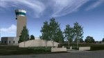
Ft. Worth Alliance Airport opened in 1989 and was billed as the world's first purely industrial airport. It is located around 14 miles North of the central business district of Ft. Worth and is also nearby the Dallas/Ft. Worth International Airport (KDFW). The airport serves general aviation, corporate jet, cargo, and military air traffic on a daily basis and it's proximity to the Texas Motor Speedway (only a few miles) brings extra dense traffic on race weekends. The airport is home to the American Airlines 777 and 767 maintenance base, FedEx Southwest Regional Sort Hub, Bell-Helicopter Training Center, DEA Air Operations Center and DynCorp International. Sadly the American Airlines maintenance base is set to close at the end of 2012 but is being kept alive in FSX!
This scenery features custom 3d buildings and objects bringing you a very accurate rendition of Ft. Worth Alliance Airport. Requires FSX Acceleration for the all scenery objects to display correctly.
Note: These files MUST be installed for the scenery to work correctly (otherwise there will be missing scenery objects at the airport):
-Filename: fsx_lts.zip - Ramp Lighting for FSX by Jim Dhaenens
-Filename: dlfcorelibraries2fsx.zip - Dan French Core Library Vol. 2
-Filename: lightstoo.zip - Jim Dhaenens Airfield Lighting
-Filename: objlib-jgse-fsx.zip - John Stinstrom JGSE Yellow Objects - this newer file replaces the older FS9 libraries with FSX versions
-Filename: objlib-ggse-fsx.zip - John Stinstrom GGSE Green Objects - this file also replaces FS9 libraries with FSX versions
| Filename: | KAFW_Fort_Worth_Alliance_Airport__Texas_US.zip |
| License: | Freeware, limited distribution |
| Added: | 12th December 2012, 16:56:36 |
| Downloads: | 2,936 |
| Author: | Brandon Thetford |
| Size: | 439.24 MB |
| Category: Flight Simulator X - Scenery | |
| NEW YORK AIRPORTS X V2 DEMO |
|
Images related to this file:
File Description:
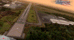
NEW YORK AIRPORTS X V2 DEMO is a package containing 6 airports located in New York metropolitan areas - KJFK Kennedy, KEWR Newark and KLGA LaGuardia + 3 business & general aviation airports - KTEB Teterboro, KCDW Essex County and KLDJ Linden.
This package is fully compatible with FSX/FSX:SE/P3Dv1/P3Dv2/P3Dv3/P3Dv4/FSW and with New York City X by Drzewiecki Design (v2.3 and higher), Manhattan X by Aerosoft, all ORBX products, all PILOT’S products and all Megascenery products.
This is a fully functional freeware scenery, perfectly aligned with the full payware version. This ensures no problems with online (VATSIM, IVAO and multiplayer) flying in case some users have the payware scenery and some don't. The demo gives you all the terminals with low resolution textures and non-animated jetways plus a 4.8m/pix resolution photoreal ground for all 6 airports.
John F. Kennedy International Airport (JFK/KJFK) - the busiest international air passenger gateway in the United States. Newark Liberty International Airport (EWR/KEWR) was the first major airport in the United States. LaGuardia Airport (LGA/KLGA) is a hub for Delta Air Lines and a focus city for American Airlines and regional affiliate American Eagle.
It's equipped with an automatic installer, which means that the scenery will be automatically added to the Flight Simulator Scenery Library.
Please uninstall all previous versions of the airports you may have installed before. Please make also sure that no duplicated AFCAD files are installed.
Enjoy your virtual flying with Drzewiecki Design!
| Filename: | NEW_YORK_AIRPORTS_X_V2_DEMO.zip |
| License: | Freeware, limited distribution |
| Added: | 21st February 2018, 23:28:33 |
| Downloads: | 6,288 |
| Author: | Drzewiecki Design |
| Size: | 39.35 MB |
| Category: Flight Simulator X - AFCAD Files | |
| P04 - Bisbee Municipal Airport, Bisbee, Arizona. |
|
File Description:
This is a redesign of P04 - Bisbee Municipal Airport, Bisbee, Arizona. Google Maps and Skyvector have been used to provide the correct (as physically possible within FSX and ADE) position, size and type of runway, aprons and buildings. The immediate surrounding scenery has been included. ADE used to compile the design.
| Filename: | P04__Bisbee_Municipal_Airport_Bisbee_Arizona.zip |
| License: | Freeware |
| Added: | 11th December 2017, 20:26:44 |
| Downloads: | 225 |
| Author: | Matthew Ward |
| Size: | 657.45 KB |
| Category: Flight Simulator X - AFCAD Files | |
| P10 - Polacca Airport, Polacca, Arizona. |
|
File Description:
This is a redesign of P10 - Polacca Airport, Polacca, Arizona. Google Maps and Skyvector have been used to provide the correct (as physically possible within FSX and ADE) position, size and type of runway, aprons and buildings. The immediate surrounding scenery has been included. ADE used to compile the design.
| Filename: | P10__Polacca_Airport_Polacca_Arizona.zip |
| License: | Freeware |
| Added: | 11th December 2017, 20:27:05 |
| Downloads: | 152 |
| Author: | Matthew Ward |
| Size: | 146.7 KB |
| Category: Flight Simulator X - AFCAD Files | |
| 60R - Navasota Municipal Airport, Navasota, Texas. |
|
File Description:
This is a redesign of 60R - Navasota Municipal Airport, Navasota, Texas. Google Maps and Skyvector has been used to provide the correct (as physically possible within FSX and ADE) position, size and type of runway, aprons and buildings. The immediate surrounding scenery has been included. ADE used to compile the design.
| Filename: | 60R__Navasota_Municipal_Airport_Navasota_Texas.zip |
| License: | Freeware |
| Added: | 6th November 2017, 21:44:56 |
| Downloads: | 170 |
| Author: | Matthew Ward |
| Size: | 340.84 KB |
| Category: Flight Simulator X - AFCAD Files | |
| MPEJ - Enrique A Jiminez Airport, Colon, Panama. |
|
File Description:
This is a redesign of MPEJ - Enrique A Jiminez Airport, Colon, Panama. Google Maps has been used to provide the correct (as physically possible within FSX and ADE) position, size and type of runway, aprons and buildings. The immediate surrounding scenery has been included. ADE used to compile the design.
| Filename: | MPEJ__Enrique_A_Jiminez_Airport_Colon_Panama.zip |
| License: | Freeware |
| Added: | 25th November 2017, 19:42:12 |
| Downloads: | 612 |
| Author: | Matthew Ward |
| Size: | 2.3 MB |


© 2001-2026 AVSIM Online
All Rights Reserved
Privacy Policy |