
Where Flight Simulation Enthusiasts Gather from Around the World!
AVSIM Library - Search Results

| Category: Flight Simulator X - Scenery | |
| Gautam Buddha Airport Bhairahawa v2 |

|
Images related to this file:
File Description:

Gautam Buddha Airport Bhairahawa (VNBW), Nepal. A small regional airport. Features photoreal terminal, building, taxiways and runways. Added extra scenery around airport for more realism.
| Filename: | Gautam_Buddha_Airport_Bhairahawa_v2.zip |
| License: | Freeware |
| Added: | 8th May 2017, 15:19:11 |
| Downloads: | 396 |
| Author: | Kapil Gyawali |
| Size: | 35.11 MB |
| Category: Flight Simulator X - Scenery Design | |
| (Version 2.0) KEFD -Ellington 2025 Refresh FSX (Circa 2006-2010)- Johnson Space Center Houston |
|
Images related to this file:
File Description:
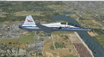
Version 2.0 covers landclass across the entire greater Houston area, with a large increase in LOD. This version significantly tightens up and improves the landclass from version 1.0, and adds a vast amount of scenery objects that brings the Bay Area-KEFD area into the modern era. This improves and adds a highly accurate runway 17 approach with accurate placement of buildings and scenery around the year 2011-modern day. In addition, includes several new files including a new airport/helipad via Houston Clear lake regional airport, T41 La Porte Municipal and surrounding shipping ports, Kemah Boardwalk, and a giant improvement to Johnson Space Center Houston. Rundway 35 and Runway 22 landclass is significantly increased, and more accurate as well. You can fly an accurate VFR approach or set up an ILS for any one of KEFD's runways with ease with this improvement.List of Version 2.0 additions and changes: - I added a ton of scenery objects and tightened up the landclass at Johnson Space Center Houston- NASA Control Center--- Added Talon Park with T38s (via static objects)--- Added Gemeni V rocket and 747 for the shuttle transporter--- And a whole bunch of vegetation, new buildings, and tour buses.- Added Kemah boardwalk and several boat docks- Removed a TON of highrise textures and replaced with medium and large city suburb landclass.- Added Clear Lake regional Hospital with helipad and surrounding scenery by Walter Reed Park- Added El Jardin or "Bayport Container port" with several scenery objects and significantly tightened up landclass.-- Looks great when setting up ILS approach for RWY 22- Tightened up Bay Area BLVD landclass, "adding" University of Houston Clear Lake"-- UHCL was semi already present, just made it more pronounced.- Made Red Bluff road landclass super recognizable!-- Red Bluff road is used to set up VFR approach and or field break for RWY 22 and RWY 17 R.----- Its common to see private jets and the USAF doing a break along Red Bluff road.- Added First Baptist Church, and water tower to Pasadena Convention center- Made Fairmont Parkway pronounced with landclass- Added Houston Port Authority at Morgan's Point--- Another Landmark for the RWY 22 ILS approach, NASA religiously uses this to line up the 10 mile ILS.- Tightened up landclass at Village Grove East and along Fairmont Parkway- Added a TON of scenery objects and landclass corrections for approach of RWY 17 L and 17 R.---- Added Home Depot, Lowes, Walmart Super center, Guitar center etc.---- added South Main Baptist Church--- Bondy Jr High, Turner Elementary, and Pasadena Memorial High School--- Added Saint Luke's Hospital--- Added Hampton Inn Suites and HCA rehab hospital--- Added a ton to the container facility behind best buy and storage facility--- Added smaller churches on RWY 17 approach--- Added a ton of scenery at the base of RWY 17 R, i.e., concrete plant, containers, trucks-- Added gas stations on the corner of beltway 8 and genoa red bluff-- Significantly changed and tightened up landclass at the base of RWY 22 and RWY 17 L and 17 R-- Made several roads and Beltway pronounced------ This decision looks AWESOME at night, really adds demarcation to the roads.**All of this makes the RWY 17 approach super recognizable** RWY 22 approach landclass is much more accurate.- Significantly changed and tightened up landclass near southbelt ellington and interstate 45.- Added Grace Church-- I wanted to do San Jacinto College south, but seemed over kill at that point.- SIGNIFICANTLY tightened up landclass for RWY 35 approach and near baybrook mall.-- Along I45- Added TDECU stadium at the University of Houston Main Campus---- So you can practice flybys for Cougar games!- Added the Battleship at San Jacinto Monument- I also "borrowed" T41 La Porte Municipal's tower camera to make a SWEET view of KEFD.- I included landclass for Sealy Texas this time, as well as my significant enhancements of Austin, Texas greater area as well (optional, but recommended!)---------------------------------------------------------------------------Version 1.0 originally added:- Added the Johnson Space Center Houston, which is now greatly enhanced and blended.- San Jacinto Community College-Central- Pasadena Convention Center- Pasadena Water Treatment Facility- NASA Bouncy Lab- Pasadena Shopping center, now greatly enhanced and blended.- Baybrook Mall and other shopping spots.- Significant Landclass improvements across the entire greater Houston Area File also includes landclass and scenery improvements for the greater Austin, Texas Area (optional), KIAH, KDWH, and Sealy, Texas. Each of these projects combined covers roughly 15,000 square miles of landclass improvement. Allowing you to fly entirely from Houston to Austin, or Houston to San Antonio in accurate landclass. -Enjoy!DJN
| Filename: | Version_20_KEFD_Ellington_2025_Refresh_FSX_Circa_2.zip |
| License: | Freeware |
| Added: | 12th October 2025, 16:15:47 |
| Downloads: | 70 |
| Author: | Dan Nelson |
| Size: | 277.28 MB |
| Category: Flight Simulator X - Scenery | |
| Marchwood Sea Mounting Centre & Power Station |
|
File Description:
Marchwood Sea Mounting Centre & Power Station Scenery.
Had a few hours over the Christmas period to have a go at FSX secenery design. Know it's not perfect but using a few free programs, knocked up a Marchwood scene to try and improve the look of VFR Photographic Scenery in the area.
The programs I used as follows:-
Google Earth Pro (to take overhead screen shots of area)
ModelconverterX (to import Sketchup .skp file and convert to BGL
Sketchup Make (to model buildings and export .skp to .dae files)
Microsoft Paint (save copy of screen shot)
GIMP2 (to enhance image & cut / blend image to import to Sketchup)
My thanks to the people who provide these tools especially Arno and the people behind MCX.
The ships I converted from ones provided on the free Sketchup 3D Warehouse, my thanks to them.
Install: Copy the Final Marchwood & MW Power Station Folders to your FSX Addon scenery folder.
Do that for the HMS Trio & Husband Shore Folders also if you think it may improve the scenery. It did using my set up.
Make sure you have the fx_SmokeStack2.fx effect in your Effects folder. If not copy the file into the folder.
Install all as normal using the FSX Add Scenery facility.
Provided as freeware. Not to be distributed by anyone for gain.
Hope you like the scenery and hope it dosent affect frame rates too much.
ijm1959... ([email protected])
| Filename: | Marchwood_Sea_Mounting_Centre__Power_Station.zip |
| License: | Freeware |
| Added: | 7th January 2018, 16:59:11 |
| Downloads: | 166 |
| Author: | Ian McAdam |
| Size: | 9.9 MB |
| Category: Flight Simulator X - Scenery | |
| Middle East Carrier Operations (MECOPS) |
|
Images related to this file:
File Description: This scenery has been developed for FSX Flight Simulator SP1 or SP2. It
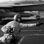
has also been tested with Microsoft Acceleration , but compatibility is not
guaranteed by the author.
The scenery includes: Two carrier groups CVN68 and CVN69, ( carrier models from
Javier Fernandez ), two AI KC-135 tanker aircraft, AI F-18A aircraft approaching
the carrier, Navy destroyer and a Navy Cruiser as escort ships for the carrier,
a number of oil platforms and the ARS4 radar gauge which displays air targets
and boat targets.
The ARS4 radar gauge provides also a auto landing function for the carrier and a
auto tracking function for aircraft in order to support a A2A re-fueling. The
scenery package includes as well the program Arrcab, developed by Richard Hogan,
and the RCBCO gauge developed by Rob Barendregt. Arrcab or RCBCO are required to
support a catapult start from a carrier and the cable arrestor function for a
carrier landing.
This is not a load and fly package. Please take your time to read the included
documentation for the ARS4 gauge and the MECOPS scenery carefully. Do not skip
chapters because you may think, they are not important for you.
Do not start the installation of the scenery before you have finished the
reading of the documents.
For copyrights and credits please look at the documentation for this scenery.
| Filename: | Middle_East_Carrier_Operations_MECOPS.zip |
| License: | Freeware, limited distribution |
| Added: | 4th March 2013, 18:03:32 |
| Downloads: | 1,892 |
| Author: | Dietmar Loleit |
| Size: | 62.04 MB |
| Category: Flight Simulator X - Scenery | |
| Murray river + SE victoria airports ****UPDATED****. YRIO Robinvale YBRN Balranald YDLQ Deniliquin YLEG Leongatha YYRM Yarram |
|
Images related to this file:
File Description:
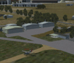
This is an updated version (original July 2018) with some ground texture problems fixed plus a lot of added and improved objects. There are 5 airports. 3 airports near the Murray river in Victoria and NSW - YRIO Robinvale, YBRN Balranald, YDLQ Deniliquin. 2 airports in SE Victoria - YLEG Leongatha, YYRM Yarram. A few airports but this is no quicky slap dash effort but hundred+ hours. Surrounding scenery modified to match real life. Towns have been added or shifted. Forests cut down or added. Race courses, sewage treatment ponds and other stuff added. Local obstacles (towers etc) added. Included are 2 AI traffic files that covers the airports. These files are for Flight Simulator X. Made using Airport Design Editor using some objects borrowed from Robert Budd's excellent Baccus Marsh. RECOMMENDED The scenery is designed to interface with ORBX FTX_AU scenery for Australia (payware). It will work without ORBX but will not interface as well with standard scenery.
| Filename: | Murray_river__SE_victoria_airports_UPDATED_YRIO_Ro.zip |
| License: | Freeware |
| Added: | 22nd February 2019, 18:09:09 |
| Downloads: | 272 |
| Author: | Colin Jeffery |
| Size: | 3.44 MB |
| Category: Flight Simulator X - AFCAD Files | |
| Camden County Airport (19N), NJ |
|
File Description:
Located 01 miles SW of Berlin, New Jersey on 75 acres of land, Camden County Airport is a small general aviation airport privately owned by Albion Airport, Inc. The airport can handle small commuter planes (like the Cessna 208B) as well as small GA craft. Tiedowns are available on both the grass turf at the west end of the airport and the tarmac on the east end. Fuel is only available on the tarmac - park next to the fuel trucks. Trees are summer time ONLY.
Scenery constructed with use of Google Maps images/streetview, the author has not been there in person.
This scenery is meant to be used in conjunction with MegaScenery Earth New Jersey/Delaware 004. It is not required, but apron use is minimized to allow satellite scenery to show through as much as possible, and objects are placed based on the MSE textures - lack of it may make scenery look out of place.
| Filename: | Camden_County_Airport_19N_NJ.zip |
| License: | Freeware |
| Added: | 8th October 2010, 14:04:03 |
| Downloads: | 243 |
| Author: | Drew Sikora |
| Size: | 944.87 KB |
| Category: Flight Simulator X - AFCAD Files | |
| Air-List-Ads Airport (JY07), NJ |
|
File Description:
This is a small turf strip 1500x70 feet located near the border of NJ and PA in the northwestern part of the state. It's not officially listed so I don't have any more data than that. No services of any kind are available. Trees are summer ONLY. If you fly VFR around the area, this will at least prevent you from seeing a random-looking grass strip over some trees and half a neighborhood. Runway headings are 11/29
Scenery constructed with use of satellite images/streetview, the author has not been there in person.
This scenery is meant to be used in conjunction with MegaScenery Earth New York 007. It is not required, but apron use is minimized to allow satellite scenery to show through as much as possible, and objects are placed based on the MSE textures - lack of it may make scenery look out of place.
| Filename: | AirListAds_Airport_JY07_NJ.zip |
| License: | Freeware |
| Added: | 16th October 2010, 08:57:57 |
| Downloads: | 182 |
| Author: | Drew Sikora |
| Size: | 283.7 KB |
| Category: Flight Simulator X - AFCAD Files | |
| Old Bridge Airport (3N6), NJ |
|
File Description:
Located 05 miles S of Old Bridge, New Jersey on 120 acres of land, Old Bridge Airport is a public airstrip. Fuel is available by stopping next to the tank north of the parking area. This airport has hangars for transient aircraft - two hangars next to the parking area are open for parking. You can also start in them by selecting one of the DOCK parking options. Immediately adjacent to the airport is Raceway Park, which features a drag strip, road course, dirt bike course, and karting/motoX areas. Trees are summertime ONLY.
Scenery constructed with use of satellite images/streetview, the author has not been there in person.
This scenery is meant to be used in conjunction with MegaScenery Earth New Jersey/Delaware 001. It is not required, but apron use is minimized to allow satellite scenery to show through as much as possible, and objects are placed based on the MSE textures - lack of it may make scenery look out of place.
| Filename: | Old_Bridge_Airport_3N6_NJ.zip |
| License: | Freeware |
| Added: | 22nd November 2010, 18:40:52 |
| Downloads: | 211 |
| Author: | Drew Sikora |
| Size: | 1.61 MB |
| Category: Flight Simulator X - Scenery | |
| Deer Valley FC Resort & Roosevelt Lake |
|
File Description:
Deer Valley Resort at Roosevelt Lake Scenery. -
This is a fictious Resort at Roosevelt Lake by Grapevine AZ USA.
Its basically a fly-in resort for the Deer Valley Flying Club members to relax, do some fishing, go to the Amusement Park and have a general great time. But the resort is now open to the public. If you dont want to spend the big bucks, there is a small campground located nearby.
I suggest a float plane or helocopter for the trip out and back. If you're a competent bush pilot, you might be able to land on the grass runway, but its a very difficult strip. Fly a STOL plane or you wil not make it.
Acknowledments:
Microsoft: FS X Sdk Scenery function of the Mission builder.
Abacus: Scenery shortcut tool.
Lee Swordy: AFCAD Ver 2.21.
NOTE: This scenery is frame rate friendly, but I would highly suggest turning off ground shadows.
| Filename: | Deer_Valley_FC_Resort__Roosevelt_Lake.zip |
| License: | Freeware |
| Added: | 18th January 2007, 05:20:29 |
| Downloads: | 1,219 |
| Author: | Bob Caparoula |
| Size: | 4.16 MB |
| Category: Flight Simulator X - Scenery | |
| SCIP - Isla de Pascua & Mataveri Intl - Easter Island |
|
Images related to this file:
File Description:
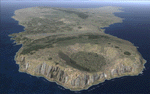
This project rebuilds Easter Island / Isla de Pascua. Mataveri Intl (SCIP) is completely overhauled, and all airport objects are aligned from satellite imagery. Landclass polygons and coastlines were meticulously hand-drawn directly from satellite imagery to provide the most detailed and accurate scenery available for this region. AI road and boat traffic is activated for the region. Accurate coastlines and road data, as well as corrected land and waterclass are provided based on the latest available satellite imagery. GA flights use default aircraft and include an option to add Chilean Air Force planes around the island. Numerous Moai (Easter Island heads) have been placed around the island according to satellite imagery. Scenery was created using Airport Design Editor X v1.61.5298, SBuilderX 3.13, and the FSX Object Placement Tool. Scenery objects were added and modified from stock FSX scenery to resemble as closely as possible the actual airports. The FSX apron lights included are from the terrific set created by Jim Dhaenens.
| Filename: | SCIP__Isla_de_Pascua__Mataveri_Intl___Easter_Islan.zip |
| License: | Freeware |
| Added: | 12th July 2014, 08:17:55 |
| Downloads: | 5,723 |
| Author: | Carlyle Sharpe |
| Size: | 5.33 MB |


© 2001-2026 AVSIM Online
All Rights Reserved
Privacy Policy |