
Where Flight Simulation Enthusiasts Gather from Around the World!
AVSIM Library - Search Results

| Category: Flight Simulator X - AFCAD Files | |
| Davis University Airport (0O5) |

|
File Description:
This scenery package accurately updates taxiways, runways, and various other aspects of University Airport in Davis, California (0O5). For FSX ONLY! Real world dimensions were used through Google Earth. In addition, it includes the placement of various objects from the default FSX scenery library. Compiled using Airport Design Editor. View Readme file for installation instructions and notes.
| Filename: | Davis_University_Airport_0O5.zip |
| License: | Freeware |
| Added: | 17th May 2008, 08:48:01 |
| Downloads: | 451 |
| Author: | Phillip Coyle |
| Size: | 92.38 KB |
| Category: Flight Simulator X - AFCAD Files | |
| San Luis County Regional Airport, San Luis Obispo, California (KSBP) |
|
File Description:
This is the start of my scenery packages for Southern California: San Luis County Regional Airport in San Luis Obispo, California. Taxiways, runways, and other aspects were updated using real satellite images from Google Earth for accuracy. Default objects from the FSX scenery libraries were used. View Readme file for installation and notes. Compiled using Airport Design Editor.
| Filename: | San_Luis_County_Regional_Airport_San_Luis_Obispo_C.zip |
| License: | Freeware |
| Added: | 21st August 2008, 01:02:09 |
| Downloads: | 772 |
| Author: | Phillip Coyle |
| Size: | 281.63 KB |
| Category: Flight Simulator X - Scenery | |
| Cerval Airfield, Portugal - FSX SP2 |
|
File Description:
Scenery of the Cerval Airfield, located near Valença do Minho, in the northern border between Portugal and Spain. For FSX SP2 and not compatible with my other previous work. It includes an area of 20x20 km of terrain completely redrawn from scratch.
Because the Airfield has not officially attributed ICAO code, in the scenery is accessible as "LPCE".
| Filename: | Cerval_Airfield_Portugal__FSX_SP2.zip |
| License: | Freeware, limited distribution |
| Added: | 25th September 2008, 00:29:11 |
| Downloads: | 1,830 |
| Author: | José Maia |
| Size: | 6.01 MB |
| Category: Flight Simulator X - Scenery | |
| Toronto City Centre 2 |
|
File Description:
This is a substitute version of Toronto City Centre Scenery which includes scenery for Toronto CYTZ airport for users of Ultimate Terrain X Canada. Includes airport runway-taxiway-parking changes per Google Earth imagery, and replacement of the "floating" airport generic buildings. This version excludes downtown Toronto building relocations which are already included in UTX Canada.
| Filename: | Toronto_City_Centre_2.zip |
| License: | Freeware |
| Added: | 11th November 2008, 11:11:10 |
| Downloads: | 3,360 |
| Author: | Art Poole |
| Size: | 150.61 KB |
| Category: Flight Simulator X - Scenery | |
| Truckee-Tahoe Airport (KTRK) |
|
File Description:
This is a scenery update Truckee-Tahoe airport in Northern California. Taxiways, runways, buildings, and other aspects were updated using satellite images from Google Earth. The glider field at the north end of the airport was also added. Default scenery objects from the FSX libraries were used. Compiled using Airport Design Editor. View Readme file for installation and notes.
| Filename: | TruckeeTahoe_Airport_KTRK.zip |
| License: | Freeware |
| Added: | 22nd November 2008, 02:21:50 |
| Downloads: | 935 |
| Author: | Phillip Coyle |
| Size: | 223.44 KB |
| Category: Flight Simulator X - Scenery | |
| Garstang Wind Generator,England.For FSX |
|
File Description:
A new wind generator just gone live near the town of Garstang and is large enough to serve as a good landmark for pilots around the area.
Designed for my Northern-Microlights and VFR scenery from Horizon and Just-Flight but will work with the default scenery.
Should work with FS9 but I havent tried. it.
| Filename: | Garstang_Wind_GeneratorEnglandFor_FSX.zip |
| License: | Freeware |
| Added: | 17th October 2010, 22:22:09 |
| Downloads: | 377 |
| Author: | By Neil Birch and Stewart Haworth. |
| Size: | 1015.22 KB |
| Category: Flight Simulator X - Scenery | |
| Diest-EBDT |
|
Images related to this file:
File Description:
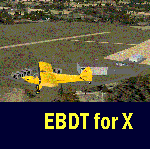
EBDT Diest [Schaffen-Diest] Scenery for FSX.
FSX doesn't have EBDT airfield in Belguim, yet it's fairly big.
[see jpeg's in the zip-file]
It's a Military base as well.
1 grass strip 800x40m. 24 - 06 [24 Right-hand circuit 06 Left-hand ]
Open to small aircraft and gliders.
The scenery is adjusted for UTX Europe
| Filename: | DiestEBDT.zip |
| License: | Freeware, limited distribution |
| Added: | 18th September 2011, 23:56:37 |
| Downloads: | 406 |
| Author: | Joost Visser |
| Size: | 1.08 MB |
| Category: Flight Simulator X - Scenery | |
| LTBA 2009 - runway and taxiway signs FIX |
|
File Description:
This is a fix for the LTBA2009 scenery made by Serdar Nuzhet for FSX (ltba2009.zip). In the LTBA2009 scenery , the taxiway and runway signs are named according to the old charts of LTBA. With this fix, airport idents and taxiway and runway signs are fixed according to the new charts. Created with Airport Design Editor X. FSX only.
| Filename: | LTBA_2009__runway_and_taxiway_signs_FIX.zip |
| License: | Freeware |
| Added: | 13th November 2011, 18:30:51 |
| Downloads: | 10,993 |
| Author: | Murat Okay |
| Size: | 19.07 KB |
| Category: Flight Simulator X - Scenery | |
| Carora Airport (SVCO) - Venezuela |
|
File Description:
Regional airport located in the city of Carora, the second city of the Lara state after Barquisimeto, in western Venezuela. With photo-terrain scenery from satellite imagery in Google Earth.
Not compatible with versions prior to FSX.
This scenery includes terminal building and hangars with realistic
textures from images obtained from Internet. Also includes a friendly Auto-Install.
| Filename: | Carora_Airport_SVCO__Venezuela.zip |
| License: | Freeware |
| Added: | 12th March 2012, 16:41:17 |
| Downloads: | 1,400 |
| Author: | David Maldonado |
| Size: | 80.7 MB |
| Category: Flight Simulator X - Scenery | |
| Lebanon TerrainX V1.5 |
|
Images related to this file:
File Description:

Lebanon Terrain X V1.5 for FSX by Lebor Simulations, improves the following landscape aspects of Lebanon: Elevation, coastline, waterclass, region class / Population, Snow coverage in winter, vector class for towns around Beirut etc. It also features the major roads of Lebanon with moving traffic.
This scenery package is a MUST have for our scenery OLBAXV1.0
| Filename: | Lebanon_TerrainX_V15.zip |
| License: | Freeware |
| Added: | 3rd February 2013, 05:04:52 |
| Downloads: | 12,050 |
| Author: | Lebor Simulations (Jad Abizeid, Michel Karam) |
| Size: | 26.33 MB |


© 2001-2026 AVSIM Online
All Rights Reserved
Privacy Policy |