
Where Flight Simulation Enthusiasts Gather from Around the World!
AVSIM Library - Search Results

| Category: Flight Simulator X - Scenery | |
| Crosswind Runways for California Central Coast Scenery for FSX with CCFSXMSG.ZIP or CCFSXMS.ZIP Installed |

|
Images related to this file:
File Description:
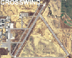
This scenery contains several revised files for my previously uploaded California Central Coast sceneries CCFSXMSG.ZIP and CCFSXMS.ZIP. These are the versions of my CCC scenery for FSX with MegaScenery Earth. The "G" version also requires Genesis Terrain Mesh but is the most complete version. Included here are revised AFCAD files for the major airports in those sceneries which will add interesting crosswind capability to C80, PRB, SBP, SMX and SBA airports. Additionaly, revised AFCAD and associated files for IZA, LPC, L52 and VBG are included. In some cases ground traffic has been added, a few glitches repaired and minor improvements effected. The crosswind AFCAD's for the 5 airports with tangential or crossing runways were revised using the technique developed by Jim Vile and executed by Airport Design Editor (ADEX). This procedure will unavoidably bolix up the ATIS runway advisories at the 3 tower controlled airports with ATIS (SBA, SBP and SMX) but will make all of the runways useable for AI traffic depending on wind conditions. This is not a problem at C80 and PRB since they are uncontrolled fields and have no ATIS available. Therefore, I've included revised AFCADs for SBA, SBP and SMX that do not have crosswind provisions that can be substituted if desired.
| Filename: | Crosswind_Runways_for_California_Central_Coast_Sce.zip |
| License: | Freeware |
| Added: | 7th January 2010, 22:05:25 |
| Downloads: | 514 |
| Author: | Al Wheeler |
| Size: | 194.42 KB |
| Category: Flight Simulator X - Scenery | |
| EGBT - Turweston aerodrome |
|
File Description:
EGBT - Turweston airport for FSX (and above?) Version 1.0 18/01/2009
FSX scenery of Turweston aerodrome (EGBT). Mike, one of the instructors is pictured by the cafe/flight school. Various scenery density is used throughout. For full detail, use this scenery at VERY DENSE level.
| Filename: | EGBT__Turweston_aerodrome.zip |
| License: | Freeware |
| Added: | 18th January 2009, 12:29:06 |
| Downloads: | 909 |
| Author: | Tim Dale |
| Size: | 998.63 KB |
| Category: Flight Simulator X - AFCAD Files | |
| VNBW Gautam buddha international airport |
|
Images related to this file:
File Description:
This is AFCAD file for VNBW - Gautam Buddha International Airports made by Resh Bikram Bhattarai in ADE. Scenery includes new runway 10/28, taxiway designation, International Parking, Domestic Parking.
This scenery has been tested with FSX Steam Edition, Prepar3D V4 & v5.
Scenery Testers:
Samrat Kathayat
Afaq
| Filename: | VNBW_Gautam_buddha_international_airport.zip |
| License: | Freeware |
| Added: | 22nd April 2022, 05:06:59 |
| Downloads: | 242 |
| Author: | Resh Bikram Bhattarai |
| Size: | 6.83 KB |
| Category: Flight Simulator X - Scenery | |
| Ventotene Island - Italy - European Summit 2016 |
|
File Description:
European Summit 2016 on the island of Ventotene This island is an important VFR reference points on the Tyrrhenian coast.
In the package you'll find a folder Ventotene.zip That will be Placed in addon scenery folder of FSX scenery to the scenery add scenary will be installed.
| Filename: | Ventotene_Island__Italy__European_Summit_2016.zip |
| License: | Freeware |
| Added: | 23rd August 2016, 21:47:33 |
| Downloads: | 416 |
| Author: | Pasquale Marrulli |
| Size: | 875.04 KB |
| Category: Flight Simulator X - AFCAD Files | |
| KRDM - Redmond Municipal Airport - Oregon, USA |
|
File Description:
I created this KRDM (aka Roberts field) scenery because the default FSX scenery was incorrect and also needed to be updated. This is my first try at creating airport scenery so don't expect too much. Updated taxiways and parking/gates with a terminal thing I put together.
| Filename: | KRDM__Redmond_Municipal_Airport__Oregon_USA.zip |
| License: | Freeware |
| Added: | 29th June 2015, 00:04:34 |
| Downloads: | 379 |
| Author: | Kyle Martin |
| Size: | 10.79 KB |
| Category: Flight Simulator X - Scenery | |
| Billings Logan Intl Terminal - Billings, MT |
|
Images related to this file:
File Description:
FS2004/FSX Scenery - This scenery is of the terminal at Billings Logan International Airport in Billings, MT. This is your only download. I have included all the files necessary for the scenery to work. The rest of the airport is default. Created by John B Loney, Jr
| Filename: | Billings_Logan_Intl_Terminal__Billings_MT.zip |
| License: | Freeware, limited distribution |
| Added: | 4th September 2013, 20:18:31 |
| Downloads: | 1,113 |
| Author: | John B. Loney Jr. |
| Size: | 5.94 MB |
| Category: Flight Simulator X - Scenery | |
| KFAR - Hector Intl. Airport - Fargo, North Dakota |
|
File Description:
This is an updated photo-realistic scenery for Hector International Airport (KFAR) located in Fargo, ND. This scenery includes several enhancements to airport and is a realistic representation of the actual airport. This scenery uses all stock library objects and has been tested in FSX and Prepar3d.
| Filename: | KFAR__Hector_Intl_Airport__Fargo_North_Dakota.zip |
| License: | Freeware |
| Added: | 15th April 2013, 05:49:47 |
| Downloads: | 2,508 |
| Author: | Matt Boddicker |
| Size: | 25.22 MB |
| Category: Flight Simulator X - AFCAD Files | |
| Ekdahl Airport (NJ59), NJ |
|
File Description:
Located 04 miles S of Freehold, New Jersey, Ekdahl Airport is a private turf strip 1300' in length bordered closely by trees. This makes for an interesting landing as the 90' width of the runway is all the room you have to play with. However because it can be difficult to gauge your distance to trees and also because even the slightest brush with a tree can cause a crash, all trees immediately adjacent to the runway have crash disabled - mainly so you can turn your plane around if you land on Runway 02. The hard surface runway was removed so make sure your terrain mesh complexity is set as high as possible to get that bumpy ground realism. A windsock is listed as being available on this field but I could not locate it in any imagery and so placed it by default near the hangar building. You can start on the runways or parked in front of the hangar. Make sure your plane is capable of these take off and landing distances! Tree height around the field was not listed so I again used my best judgement from studying aerial photos. There is no fuel or parking for transient aircraft available. The field is not lit - daytime VFR operations only are recommended.
Scenery constructed with use of satellite images/streetview/aerial photos - the author has not been there in person.
This scenery is meant to be used in conjunction with MegaScenery Earth New Jersey/Delaware 002. It is not required, but apron use is minimized to allow satellite scenery to show through as much as possible, and objects are placed based on the MSE textures - lack of it may make scenery look out of place.
| Filename: | Ekdahl_Airport_NJ59_NJ.zip |
| License: | Freeware |
| Added: | 13th August 2011, 16:53:55 |
| Downloads: | 172 |
| Author: | Drew Sikora |
| Size: | 550.03 KB |
| Category: Flight Simulator X - AFCAD Files | |
| Peters Airport (4NJ8), NJ v1.1 |
|
File Description:
Located 05 miles W of Somerville, New Jersey on 70 acres of land, Peters Airport is a private turf strip that will test your short field skills to the max. The published runway dimensions for this strip are 1700x200 feet, and for the most case this is fairly accurate - however at the ends of both runways you have tree obstacles to overcome so this can shorten the amount of usable runway significantly, although the tree obstacles are no higher than 12-14m. There is no hardened runway surface so you will be landing/taking off on terrain. Depending on how high your mesh resolution is, this can be a significant factor, as Runway 31 is mainly uphill enough that you will need to power up with parking brakes on if you want to make it in the air. Runway 13 is the best since you are going downhill and the trees at the end are fewer and smaller. Pay close attention to the pattern! Runway 13 is Left and Runway 31 is Right - this airport is within 2 miles of Solberg-Hunterdon (N51) and you don't want to get in the way of that field's traffic! The runway is not lit, so daytime VFR operations only. There are no services at this strip for transient aircraft.
Scenery constructed with use of satellite images/streetview/aerial photos - the author has not been there in person.
This scenery is meant to be used in conjunction with MegaScenery Earth New Jersey/Delaware 001. It is not required, but apron use is minimized to allow satellite scenery to show through as much as possible, and objects are placed based on the MSE textures - lack of it may make scenery look out of place.
| Filename: | Peters_Airport_4NJ8_NJ_v11.zip |
| License: | Freeware |
| Added: | 20th September 2011, 14:08:43 |
| Downloads: | 405 |
| Author: | Drew Sikora |
| Size: | 461.03 KB |
| Category: Flight Simulator X - Scenery | |
| Spoleto City |
|
File Description:
The filmmakers FSX they have not taken into account the city's Italian,
therefore, I decided to make some Italian cities such as the city of Spoleto (PG) N 42.44.31 E12.44.84.
In the package you will find the file spoletocity.bgl that will be placed at the
addon scenery folder and subfolder scenery automatically when FSX scenery you will find it
in the scenery.
In scenery you can fly over the city, the castle and the bridge roman name delle Torri.
Good flight at all. We accept criticism and advice [email protected]
| Filename: | Spoleto_City.zip |
| License: | Freeware |
| Added: | 28th June 2015, 23:43:28 |
| Downloads: | 545 |
| Author: | Pasquale Marrulli |
| Size: | 1.78 KB |
© 2001-2026 AVSIM Online
All Rights Reserved
Privacy Policy |