
Where Flight Simulation Enthusiasts Gather from Around the World!
AVSIM Library - Search Results

| Category: Flight Simulator X - Scenery | |
| Unalakleet Alaska V3.0 |

|
Images related to this file:
File Description:
Made famous on the Discovery Channel in the program Flying Wild Alaska , this is Unalakleet airport.Completely custom built with animated smoke and a reworked AFCAD.Works best with FSX SP2 or Acceleration installed.This airport works with ultimate terrain Alaska and the default FSX scenery.If you have Ultimate Terrain Alaska installed put this airport higher up in your priority list.More parking for traffic and beacon was upgraded.Thanks to jim Dhaenens for the beacon.No more crash if you got crash detection on,fix and working,sorry for that.
| Filename: | Unalakleet_Alaska_V30.zip |
| License: | Freeware |
| Added: | 19th May 2011, 01:13:42 |
| Downloads: | 4,670 |
| Author: | Frits Beyer and Jacques Botha |
| Size: | 2.37 MB |
| Category: Flight Simulator X - AFCAD Files | |
| Airport of Madrid/Barajas (LEMD) AFCAD only for FSX |
|
File Description:
This is a modified version of the default LEMD airport.
The most important improvements are:
-Many gates renumbered based on AENA data.
-Added several additional real ramp stands, also based on AENA data.
-Airline codes assigned to the stands (i.e. you will see Iberia planes going only to the T4 and T4S, ...)
-PAPI 4 light system changed from single side to both runway sides.
Additionally I've included another file with a couple of gates for the default FSX Gibraltar Airport, which has no parking stands.
| Filename: | Airport_of_MadridBarajas_LEMD_AFCAD_only_for_FSX.zip |
| License: | Freeware |
| Added: | 6th April 2007, 07:14:41 |
| Downloads: | 5,619 |
| Author: | Miguel A. Perez Soria |
| Size: | 33.63 KB |
| Category: Flight Simulator X - Scenery | |
| KSDF Louisville Photo Scenery |
|
File Description:
This scenery is an FSX photo version of KSDF Louisville Intl-Standiford Field. The scenery includes night textures, revised AFCAD, additional traffic and thorough autogen. The UPS main Air Hub is located on the south half of the airport. Just south of the airport is the Ford Louisville assembly plant where the Explorers are built. The UPS facility, Ford plant, parking garage and FBO on the east side are modeled using default FSX textures. The FSX terminals have been moved to match the photo.
| Filename: | KSDF_Louisville_Photo_Scenery.zip |
| License: | Freeware |
| Added: | 7th February 2008, 01:37:30 |
| Downloads: | 4,969 |
| Author: | Kevin Burns |
| Size: | 36.95 MB |
| Category: Flight Simulator X - Scenery | |
| KAMA "Photoreal" - Rick Husband International - Amarillo, Texas V2.0 |
|
Images related to this file:
File Description:
Rick Husband International airport is located in Amarillo, Texas, in the pan handle and handles traffic from Southwest, Continental, United and American Eagle as well as scores of GA aircraft and is home to one of Bell Helicopters plants.
This airport was created with ADE 1.65, SBBUILDER X and Instant Scenery 3 from Flight1. It is photo real with all buildings, taxiways, runways, taxi signs and road traffic aligned to real world GPS positions.
Additional night lighting available to owners of FTX Global.
| Filename: | KAMA_Photoreal__Rick_Husband_International__Amaril.zip |
| License: | Freeware |
| Added: | 29th March 2015, 22:34:57 |
| Downloads: | 3,442 |
| Author: | Brian Navy |
| Size: | 36.72 MB |
| Category: Flight Simulator X - Scenery | |
| Samos - Greece |
|
Images related to this file:
File Description:
Island of Samos Dn
This is a highly detailed photorealistic scenery of the beautiful island of
Samos WITH NIGHT TEXTURES.
The scenery contains many objects like cars, boats and buldings in the City
of Samos and around the island.
Default FSX airport of the island (LGSM) was corrected and repositioned to
the exact location and some buildings and trees were added in the airport
vicinity.
The scenery also includes autogen buildings, vegetation and road trafic near
the cities to enhance and animate the landscape.
| Filename: | Samos__Greece.zip |
| License: | Freeware |
| Added: | 24th November 2016, 17:42:21 |
| Downloads: | 1,375 |
| Author: | Angelo Tassoglou |
| Size: | 17.26 MB |
| Category: Flight Simulator X - Scenery | |
| LMML-JVX |
|
Images related to this file:
File Description:
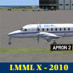
LMML Luqa Malta Airport reworked.
Landing on a flight to Luqa I found out the Runway numbers and directions [degr.] of the scenery was wrong.
Not only that, Luqa is a fairly big airport, but this scenery is a bit barren as well.
Therefore: Luqa with corrected runways 31-13 plus slightly corrected heading 313 degree. plus a bit.
Runway 23-05 corrected by name not by direction.
Added the usual fun stuff such as boats on the Mediterranean Sea, seagulls, crows, sinage, buildings etc.
| Filename: | LMMLJVX.zip |
| License: | Freeware, limited distribution |
| Added: | 26th May 2010, 19:02:30 |
| Downloads: | 6,794 |
| Author: | Joost Visser |
| Size: | 327.84 KB |
| Category: Flight Simulator X - Scenery | |
| East Coast Victoria v2 for ORBX v2 YLKE Lakes Entrance YGRL Great Lakes Airport YORB Orbost YMCO Mallacoota |
|
Images related to this file:
File Description:
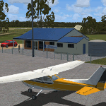
'East Coast Victoria v2' is made to match ORBX Australia v2 scenery. For ORBX v1 or no ORBX use 'East Coast Victoria'. There are 4 airports. YLKE Lakes Entrance YGRL Great Lakes Airport YORB Orbost YMCO Mallacoota. ORBX has done 2 of these (YORB, YMCO) as they have done every airport included with FSX in Australia to a reasonable standard. If I had not already done them for ORBX V1 I would not have bothered. However these are better than ORBX because the surroundings have been modified to match real life. Towns have been added or shifted. Forests cut down or added. There are also custom accurate versions of the terminal buildings. Included is an AI traffic files that covers the airports (little or no traffic from ORBX). In short a lot more time spent by me as I did not have to do every airport in Australia! These files are for Flight Simulator X. Made using Airport Design Editor using some objects borrowed from Robert Budd's excellent Baccus Marsh. REQUIRED The scenery is designed to interface with ORBX FTX_AU V2 scenery for Australia (payware).
| Filename: | East_Coast_Victoria_v2____for_ORBX_v2____YLKE_Lake.zip |
| License: | Freeware |
| Added: | 16th September 2019, 16:27:48 |
| Downloads: | 393 |
| Author: | Colin Jeffery |
| Size: | 6.32 MB |
| Category: Flight Simulator X - Scenery | |
| LFMA - Aix les Milles |
|
File Description:
Welcome to Aix Les Milles Airport.
Situated in the south coast of France, only few miles North East of Marignane (Marseille Provence - LFML). This is a great option for all G.A aircrafts to visit as well as Helicopters/Medical with their own base and it's even large enough to welcome the famous Alphajets from the "Patrouille de France".:)
The airport is used by those who wants to spend a great week end in the very well known city called Aix En provence and discover the beauty of Provence.
I have enhanced the entire airport with all buildings, proper taxi marking of aprons, taxisigns, Glider area/parking lot, Heli area including the medical one, replaced the tower at its own place, a military parking for the Alpha jets (Novembre West apron) and added...the LFMA VFR chart!!!
Enjoy!
| Filename: | LFMA__Aix_les_Milles.zip |
| License: | Freeware |
| Added: | 1st May 2009, 00:14:01 |
| Downloads: | 1,975 |
| Author: | Daniel Louvet |
| Size: | 1.29 MB |
| Category: Flight Simulator X - Utilities | |
| Taxi Navigation (+Destination Weather Reporter) for FSX/FS9 V1.0 |
|
Images related to this file:
File Description:

Do you prepare airport charts of every airport you visit, or just follow the progressive taxi to do taxiing?
This utility will make taxiing easy and realistic by providing simple taxi navigation information in text.
While taxiing, press "Ctrl + Shift + X", then taxi navigation information will be displayed.
It includes current taxiway name, intersecting taxiways' name and distance
(e.g. "On R7 : R2 (250m), R1 (643m), A (748m), A7 (748m)").
And one more thing, it also provides destination weather report.
It can be very helpful to set up exact T/D(Top of Descent), by assuming expected runway with wind information.
Enter destination airport before flight, and press "Ctrl + Shift + W" while flying,
then destination weather information will be displayed.
It looks like METAR and includes wind direction and speed, visibility, temperature, dew point and pressure
(e.g. "RKPK 29403KT 47SM 32/23 1010mb").
| Filename: | Taxi_Navigation_Destination_Weather_Reporter_for_F.zip |
| License: | Freeware |
| Added: | 3rd August 2012, 06:47:24 |
| Downloads: | 2,941 |
| Author: | Dongjin Shin |
| Size: | 4.88 MB |
| Category: Flight Simulator X - Scenery | |
| KCAE - Columbia South Carolina Metropolitan Airport - South Carolina, USA |
|
Images related to this file:
File Description:
Columbia South Carolina Metropolitan Airport for FSX. Several improvements have been made to the default airport, including replacing the default terminal with new buildings modelled in FSDS, correctly numbering and coding gates using Airport Design Editor 1.67.5684, creating a new vehicle network, adding ample GA parking, changing the tower view to the roof of the control tower, adding a new static UPS truck modelled in FSDS in three different color schemes, placing static aircraft created using Static Aircraft Model Maker, and including the option of having all runways open to AI traffic.
Also included are Jim Dhaenen's excellent ramp lights and a set of GA flight plans made using AI flight Planner using all FSX default aircraft to liven up the GA area. Please read the README FIRST.txt and installation.txt files to insure proper installation of all files.
| Filename: | KCAE__Columbia_South_Carolina_Metropolitan_Airport.zip |
| License: | Freeware |
| Added: | 20th December 2015, 16:35:16 |
| Downloads: | 1,362 |
| Author: | Patrick Finch |
| Size: | 3.72 MB |


© 2001-2026 AVSIM Online
All Rights Reserved
Privacy Policy |