
Where Flight Simulation Enthusiasts Gather from Around the World!
AVSIM Library - Search Results

| Category: Flight Simulator X - AFCAD Files | |
| WIPA- Sultan Thaha (Taha), Jambi, Indonesia. |

|
File Description:
This is a redesign of WIPA- Sultan Thaha (Taha), Jambi, Indonesia. Google Maps and Jeppesen have been used to provide the correct (as physically possible within FSX and ADE) position, size and type of runway, aprons and buildings. The immediate surrounding scenery has been included. ADE used to compile the design.
| Filename: | WIPA_Sultan_Thaha_Taha_Jambi_Indonesia.zip |
| License: | Freeware |
| Added: | 31st January 2018, 05:21:43 |
| Downloads: | 1,962 |
| Author: | Matthew Ward |
| Size: | 1.61 MB |
| Category: Flight Simulator X - Scenery | |
| KROA, Roanoke-Blacksburg Regional Airport |
|
Images related to this file:
File Description:
Completely new setup done with ADE. Roanoke Airport is a regional airfield in the heart of the state of Virginia in the Roanoke valley. Complete with taxiway shoulders, taxisigns, terminal apron, GA parking, heliport, and cargoramp. Rwy06 has an offset ILS.
See my short Youtube impression: https://www.youtube.com/watch?v=8hTgJdVWW0g
| Filename: | KROA_RoanokeBlacksburg_Regional_Airport.zip |
| License: | Freeware |
| Added: | 8th November 2017, 15:03:00 |
| Downloads: | 635 |
| Author: | Tim van Ringen |
| Size: | 717.35 KB |
| Category: Flight Simulator X - Scenery | |
| LGMG - Megara Airport, Greece |
|
File Description:
Megara Airport LGMG is located close to Athens, is a military base and also hosts a large amount of general aviation aircraft. This scenery provides an updated afcad including the second runway, a photoreal image of the area surrounding the airport and re-positions megara NDB to it's true location.
| Filename: | LGMG__Megara_Airport_Greece.zip |
| License: | Freeware |
| Added: | 5th October 2013, 18:31:21 |
| Downloads: | 2,431 |
| Author: | Nick Papa |
| Size: | 11.43 MB |
| Category: Flight Simulator X - Missions | |
| Direct Fly 3: Orbit ( UA ) 1164 - B738 |
|
Images related to this file:
File Description:
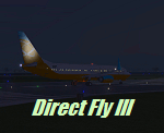
Fly the third mission of the serie Direct Fly and bring your passengers safely from San Francisco to San Diego Lindberg Field. The mission is created this time for the default Boing 737-800. A guiding copilot will be on your side, giving you all important informations and hints during the flight, so that you are able to bring the twin-jet straight in to the air and in the end safely back to the ground. The flight is based on the original commuter-flight of United Airlines 1164. As a additional feature, the mission includes a simulation of a ground alert system if you land at San Diego and a altitude alert system if you reach the different altitudes by climbing or descending. With the third mission is the first day of the four days service schedule complete. You only need the Microsoft Flightsimulator X with Service Pack 2 for this mission. No addon or download is required.
| Filename: | Direct_Fly_3_Orbit__UA__1164__B738.zip |
| License: | Freeware |
| Added: | 9th May 2010, 01:36:46 |
| Downloads: | 4,710 |
| Author: | Carsten Wanzelius |
| Size: | 21.83 MB |
| Category: Flight Simulator X - Scenery | |
| Avon Park Executive Airport Florida |
|
Images related to this file:
File Description:
Avon Park Executive Airport, Airport Code KAVO, is located in the
center of the Florida peninsula. It is within 80 miles of several major
Florida cities and International Airports including Tampa International
and Orlando International. Miami International is located about 150
miles SSE. Although used primarily by local businesses, it has repair
facilities for planes flown in for that purpose. In addition, it is
used as a temporary base for people attending the 12 Hours of Sebring
Gran Prix auto race as well as air shows held both at Sebring Regional
and Lakeland Linder airports.
The Terminal/Office building was created by me in Google Sketchup and
contains nothing from any other source. The windows are actual photos
taken of the building at the Avon Park Airport. I obtained permission
to use those photos from the Avon Park Executive Airport director. You
may use all or any part of this upload for any purpose that is legal.
| Filename: | Avon_Park_Executive_Airport_Florida.zip |
| License: | Freeware |
| Added: | 21st January 2013, 00:39:01 |
| Downloads: | 806 |
| Author: | Frank Watson |
| Size: | 2.08 MB |
| Category: Flight Simulator X - Aircraft Repaints, Textures and Modifications | |
| Braathens SAFE Douglas C-54A |
|
Images related to this file:
File Description:
In 1946 and 1947 the newly established Norwegian airline Braathens South American & Far East Airtransport A.S. purchased for its medium- and long haul operations on charter basis four ex-USAAF Douglas C-54A Skymasters. Three of them had been converted to DC-4 standard by Texas Maintenance Company (Temco) at Fort Worth, Texas, and featured on the starboard side an enlarged emergency exit. The fourth C-54A was purchased from KLM. Around 1950 the Norwegian authorities concluded that Braathens' operations got increasingly a structural character, read: scheduled, operations and as such became a threat for Scandinavian Airlines System (SAS) which was a conglomerate of "state" airlines of Denmark, Norway and Sweden. SAS received all concessions for the international scheduled routes, which meant the end of the use of the Temco converted C-54A's. These are textures only. You will need Jens B. Kristensen's FSX Douglas DC-4 & C-54 (DC4_V30X.ZIP). Repaint by Maarten Brouwer.
| Filename: | Braathens_SAFE_Douglas_C54A.zip |
| License: | Freeware, limited distribution |
| Added: | 13th August 2014, 21:00:22 |
| Downloads: | 131 |
| Author: | Maarten Brouwer |
| Size: | 1.04 MB |
| Category: Flight Simulator X - Scenery | |
| FSX Grand Canyon North Rim Simulation |
|
Images related to this file:
File Description:
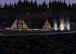
Welcome to the North Rim of the Grand Canyon!
This scenery is a mostly fictitious representation of what the North Rim might look like of it had been developed like the South rim. A new airport (KKPA, Kaibab Plateau Airport) is the centerpiece. It sits at 8,730 ft MSL so density altitude is a real issue. Runway 17/35 is 6,500ft long so biz jets can get in and out safely. A new resort sits atop the ridge to the east [Eagle's Nest]. There is a helipad for access. An NDB makes finding it easier [AZ95 220.9 kHz]. Or you can just follow the traffic on the access road that branches off from highway 67 just south of the airport. To the north I have added a gravel strip to Jacob Lake where 67 joins 89A. Runway 14/32 is 3000 ft long and sits at 7900 ft MSL. An NDB [AZ93 393 kHz] is included. At the south end of Highway 67 sits the North Rim Visitor Center. There is a helipad on the roof for those who like rotary wing challenges. The NDB is AZ94 at 423.4 kHz. The entire length of Highway 67 is represented with traffic going both ways. You will see
air traffic from KGCN at the South Rim and traffic between KKPA and Jacob Lake.
| Filename: | FSX_Grand_Canyon_North_Rim_Simulation.zip |
| License: | Freeware, limited distribution |
| Added: | 19th May 2021, 19:28:12 |
| Downloads: | 101 |
| Author: | Brett Delana |
| Size: | 16.26 MB |
| Category: Flight Simulator X - Aircraft Repaints, Textures and Modifications | |
| VRS F-18E Canadian Superbug Series RCAF #703 NORAD 50th Repaint Textures |
|
Images related to this file:
File Description:
I used Boeing's RCAF/ARC concept picture online as a guide and I "converted/painted over" one of the VRS jets included in the SuperBug package into a series of "NEW" Canadian Super Hornets...Sierra Hotel! In VERSION ONE of this jet I used the stock VRS color scheme for my "grey base paint", but on VERSION TWO I tried re-creating the "Classic CF-18" colors. I've included both textures in this package and you can decide which you like best!
| Filename: | VRS_F18E_Canadian_Superbug_Series_RCAF_703_NORAD_5.zip |
| License: | Freeware |
| Added: | 24th January 2021, 20:35:21 |
| Downloads: | 57 |
| Author: | Daniel W Gregory |
| Size: | 10.94 MB |
| Category: Flight Simulator X - AFCAD Files | |
| KPSO - Stevens Field, Pagosa Springs, Colorado, USA - V2.0 |
|
Images related to this file:
File Description:
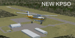
Updated scenery of Stevens Field, Pagosa Springs Airport nested in the high-altitude Rocky Mountains of Colorado. This scenery includes the airport and land class for surrounding areas to include the many small lakes, the city of Pagosa, and nearby inhabited areas. Airport features runway distance markers, new taxiways, taxiway signs, realistic parking, scenery objects, hangars, and FBO. How is your high-altitude flying? Enjoy! Version 2 includes updated taxiway structure circa 2013, signage, major roads added, and land class tweaks.
| Filename: | KPSO__Stevens_Field_Pagosa_Springs_Colorado_USA__V.zip |
| License: | Freeware |
| Added: | 30th May 2013, 06:10:06 |
| Downloads: | 536 |
| Author: | AJ Cook |
| Size: | 17.21 KB |
| Category: Flight Simulator X - AFCAD Files | |
| YSBK - Bankstown Airport - Bankstown, Australia |
|
Images related to this file:
File Description:
Bankstown Airport is a general aviation airport and business park located in the City of Bankstown, 22 km (14 mi) from the central business district of Sydney, Australia. The airport is situated on 313 ha (770 acres) of land and has three parallel runways, several apron areas, a small passenger terminal and a business park, home to over 170 businesses.
Using ADEx 1.55, aeronautical maps and Google Earth the default AFCAD has been completely reworked to reflect today´s situation.
| Filename: | YSBK__Bankstown_Airport__Bankstown_Australia.zip |
| License: | Freeware |
| Added: | 4th January 2014, 18:12:35 |
| Downloads: | 703 |
| Author: | Menno C. Robert |
| Size: | 624.49 KB |


© 2001-2026 AVSIM Online
All Rights Reserved
Privacy Policy |