
Where Flight Simulation Enthusiasts Gather from Around the World!
AVSIM Library - Search Results

| Category: Flight Simulator X - Scenery | |
| California North Central Coast |

|
Images related to this file:
File Description:
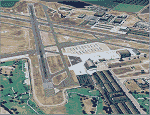
This is an expansion of my previously released CCFSXMSG scenery that covered 27 airports/airstrips within the confines of MegaScenery Earth California 012, 013, 014, 015, 028 and 029. CCNFSXMSG adds 20 more airstrips/airports North of those regions within the confines of MegaScenery Earth California 010, 011, 026 and 027. This addition covers roughly from N37 16' (Gustine) down to N36 10' (King City) and from the coast East to W120 42'/120 28'. CCFSXMSG.ZIP must have been installed for this scenery addition to work since many textures, etc. are shared.
| Filename: | California_North_Central_Coast.zip |
| License: | Freeware |
| Added: | 17th September 2010, 23:38:03 |
| Downloads: | 1,104 |
| Author: | Al Wheeler |
| Size: | 1.31 MB |
| Category: Flight Simulator X - Scenery | |
| Zegrze Pomorskie 1953-2013 * Update * |
|
Images related to this file:
File Description:
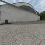
Zegrze Pomorskie Airport (old code EPKO) is a beautifully placed aerodrome in the north of Poland, ca. 20 km. from Koszalin city (107,000 habitants). For almost 50 years it was the base of a Polish 26th Fighter Regiment transformed later to Polish 9th Fighter Regiment.
SCENERY FEATURES:
-Compatible with FSX SP2/ACC only, blended to default FSX!
-Detailed reconstruction of the airport.
-Seasonal ground textures (0.30m per pixel).
-Very Hight accuracy of all objects (blends, naormal maps, specular maps).
-Precisely created aprons, taxiways and runway with seasonal textures, made in GMax.
-Landclass incuded.
| Filename: | Zegrze_Pomorskie_19532013__Update_.zip |
| License: | Freeware, limited distribution |
| Added: | 29th August 2013, 16:58:13 |
| Downloads: | 4,433 |
| Author: | Pawel Aziukiewicz |
| Size: | 314.95 MB |
| Category: Flight Simulator X - Aircraft Repaints, Textures and Modifications | |
| Epic LT Wood Veneer Panel Upgrade |
|
File Description:
This is a nice Wood Veneer VC panel upgrade for the payware Epic LT / Dynasty by Lionheart Creations. This will place a Cherry wood stained classy wood panel on your VC of your Epic texture pack of choice. This Upgrade kit features both FSX and FS2004 textures (DDS and DXT). Simply drop the appropriate format into the texture pack of your choice. Note, works best with Cherrywood versions of trim, such as N011L and D-LION Registries. This does not have a 2D panel texture. By William Ortis, Lionheart Creations Ltd.
| Filename: | Epic_LT_Wood_Veneer_Panel_Upgrade.zip |
| License: | Freeware, limited distribution |
| Added: | 24th August 2008, 00:13:47 |
| Downloads: | 277 |
| Author: | William Ortis |
| Size: | 5.58 MB |
| Category: Flight Simulator X - Aircraft Repaints, Textures and Modifications | |
| Philippines Boeing 747-400 |
|
File Description:
Repaint of the default FSX 747 featuring the Air Phillippines livery, note that the jpg shows the anme missing the second 'p', the skin has been corrected.
| Filename: | Philippines_Boeing_747400.zip |
| License: | Freeware, limited distribution |
| Added: | 7th September 2008, 13:27:49 |
| Downloads: | 1,428 |
| Author: | Jon Murchison |
| Size: | 770.02 KB |
| Category: Flight Simulator X - Scenery | |
| YFRV Oombugurri Community, Western Australia (Town closed 2011) |
|
File Description:
YFRV Oombugurri Community, Western Australia, formerly Forrest River Mission. Features extensive flattening of Forrest River which runs uphill. Take a flight there before installing the scenery.
Oombulgurri, was an Aboriginal community in the eastern Kimberley, 45 kilometres southeast of Wyndham.
The Anglican Forrest River Mission for Aborigines was founded in 1896���¢������97 by Harold Hale (Later Bishop of Prth) but was abandoned after a few months. A permanent mission, known as the Forrest River Mission, was established on the site in 1913 by the bishop of the north west, the Rt. Rev. Gerard Trower. In December 1913, Anglican priest Ernest Gribble took charge, three years after he was forced to resign as superintendent at Yarrabah. Gribble remained as superintendent until the early 1930s.
In 1926 the mission was plagued by an influenza epidemic and impacted by the Forrest River massacre where police killed a number of Aboriginal people. This event remains controversial.
The mission was closed in 1969, after the 1967 Aboriginal referendum.
In 1973, fifty Aboriginal people decided to resettle their abandoned tribal land and rename it Oombulgurri. Within a year, the population had grown to 200. Infrastructure and welfare programs were set up in the 1970s and 1980s to provide the residents with basic amenities and to allow the town to become self-sufficient.
In 2007 a Coronial Inquiry began into Aboriginal deaths in the Kimberley, including five in Oombulgurri. It revealed high levels of alcohol abuse, suicide and child neglect in Oombulgurri. Some time after the inquest, alcohol was banned there and the population began to move away to areas where alcohol was available.
It had a population of 107 as of the 2006 census. In 2011, the government of Western Australia encouraged residents of Oombulgurri to move elsewhere as it considered the community "unviable". The last residents from Oombulgurri were relocated to Wyndham just before Christmas 2011. REQUIRES Blencowe_LibraryKit.zip
REQUIRES blencowe_librarykit_309494.zip (Available HERE)
| Filename: | YFRV_Oombugurri_Community_Western_Australia_Town_c.zip |
| License: | Freeware |
| Added: | 28th February 2013, 02:37:06 |
| Downloads: | 229 |
| Author: | Alan Blencowe |
| Size: | 2.97 MB |
| Category: Flight Simulator X - AFCAD Files | |
| Wide Sky Airpark Airport (JY31), NJ |
|
File Description:
Located 03 miles NW of Bridgeton, New Jersey on 23 acres of land, Wide Sky Airpark Airport is a private turf field 2550' in length. There is no fuel available, but there is tiedown space by the main hangar in the middle of the field to the west. You can start in the parking spot there if you have a plane with 40' or less wingspan (collision with static aircraft is disabled so you can put a bigger plane there if you wish with no trouble). The windsock is not lit at night and is located atop the south end of then main hangar's roof. The field is hedged in to the east with bushes but they do not cause aircraft collisions. The runway is lit for night VFR operations. There is no hard surfaced runway so set your terrain mesh settings as high as possible to enjoy rolling around on bare bumpy terrain.
Scenery constructed with use of satellite images/streetview/aerial photos - the author has not been there in person.
This scenery is meant to be used in conjunction with MegaScenery Earth New Jersey/Delaware 004. It is not required, but apron use is minimized to allow satellite scenery to show through as much as possible, and objects are placed based on the MSE textures - lack of it may make scenery look out of place.
| Filename: | Wide_Sky_Airpark_Airport_JY31_NJ.zip |
| License: | Freeware |
| Added: | 10th May 2011, 13:40:36 |
| Downloads: | 157 |
| Author: | Drew Sikora |
| Size: | 1.27 MB |
| Category: Flight Simulator X - Scenery | |
| EDST - Hahnweide Kirchheim - Germany *v1.2* |
|
Images related to this file:
File Description:
The airfield EDST-Hahnweide is located approximately 17 nautical miles southeast of EDDS- Stuttgart. Former it was just a gliderfield but now ist is available also for small motor-aircrafts.
Each two years there are happens the greatest meeting of oldtimer-aircrafts in Europe.
This scenery is designed very much in detail. All important objects have been created by me and Joachim Herwig using actual original photos of the airfield and its surrounding. A retouched photo background, covering all four seasons, completes the scenery.
EDST Hahnweide does not exist in the standard scenery of the FSX. So this scenery is an addon-scenery, which hopefully will fill one of the plenty “white spots†in the World of FSX.
Because this field is some like a “bumpi†medow, the airfield ground is exactly designed like this. Therefore you will not find a plane runway.
Libraries: Many smaller Objects, like people, cars or static airplanes in this scenery were taken from three popular freeware libraries for whose use I got the friendly permission of the authors. If these libraries are not installed , many objects are not visible !
The following libraries are used:
1. FS-Piloten_Objektlibrary -
http://www.fs-piloten.de/thread.php?threadid=1063
2. FSX_FlightPortLib -
http://www.flightport.de/libraries/flightport-library/
3. 3d People Library -
http://library.avsim.net/download.php?DLID=192454
| Filename: | EDST__Hahnweide_Kirchheim___Germany_v12.zip |
| License: | Freeware, limited distribution |
| Added: | 25th October 2016, 21:01:37 |
| Downloads: | 1,482 |
| Author: | Wolfgang Allers, Joachim Herwig |
| Size: | 369.26 MB |
| Category: Flight Simulator X - AFCAD Files | |
| D25 - Manitowish Waters, Wisconsin. |
|
File Description:
This is a redesign of D25 - Manitowish Waters, Wisconsin. Google Maps and Skyvector have been used to provide the correct (as physically possible within FSX and ADE) position, size and type of runway, aprons and buildings. The immediate surrounding scenery has been included. ADE used to compile the design.
| Filename: | D25__Manitowish_Waters_Wisconsin.zip |
| License: | Freeware |
| Added: | 29th November 2017, 14:42:25 |
| Downloads: | 161 |
| Author: | Matthew Ward |
| Size: | 1.4 MB |
| Category: Flight Simulator X - AFCAD Files | |
| MPBO - Bocas Del Toro Airport, Panama. |
|
File Description:
This is a redesign of MPBO - Bocas Del Toro Airport, Panama. Google Maps has been used to provide the correct (as physically possible within FSX and ADE) position, size and type of runway, aprons and buildings. The immediate surrounding scenery has been included. ADE used to compile the design.
| Filename: | MPBO__Bocas_Del_Toro_Airport_Panama.zip |
| License: | Freeware |
| Added: | 25th November 2017, 19:41:59 |
| Downloads: | 436 |
| Author: | Matthew Ward |
| Size: | 1.58 MB |
| Category: Flight Simulator X - AFCAD Files | |
| 19TE - Cut and Shoot Airport, Conroe, Texas. |
|
File Description:
This is a redesign of 19TE - Cut and Shoot Airport, Conroe, Texas. Google Maps and Skyvector has been used to provide the correct (as physically possible within FSX and ADE) position, size and type of runway. The immediate surrounding scenery has been included. ADE used to compile the design.
| Filename: | 19TE__Cut_and_Shoot_Airport_Conroe_Texas.zip |
| License: | Freeware |
| Added: | 21st March 2018, 03:07:52 |
| Downloads: | 160 |
| Author: | Matthew Ward |
| Size: | 592.44 KB |


© 2001-2026 AVSIM Online
All Rights Reserved
Privacy Policy |