
Where Flight Simulation Enthusiasts Gather from Around the World!
AVSIM Library - Search Results

| Category: Flight Simulator X - Scenery | |
| NAS Sunnyvale CA (KNUQ) |

|
Images related to this file:
File Description:

In 1931, the city of Sunnyvale acquired a 1,000 acre (4 km���²) parcel of farmland bordering San Francisco Bay, then "sold" the parcel for $1 to the US government as a home base for the Navy airship USS Macon.
The location proved to be ideal for an airport, since the area is often clear while other parts of the San Francisco Bay are covered in fog. This is due to the Coast Range to the west which blocks the cold oceanic air which is the cause of San Francisco fog.
The base, originally named Airbase Sunnyvale CAL (it was thought that calling it Mountain View would cause officials to fear airships colliding with mountainsides), was accepted by the U.S. Navy on February 12, 1931 and dedicated NAS Sunnyvale on April 12, 1933. After the death of Rear Admiral William A. Moffett, in the loss of the USS Akron on April 4, 1933, the Air Field (but not the Naval Air Station) was renamed Moffett Field on September 1, 1933.
| Filename: | NAS_Sunnyvale__CA_KNUQ.zip |
| License: | Freeware |
| Added: | 6th October 2010, 00:16:16 |
| Downloads: | 769 |
| Author: | John Stinstrom & Jim Dhaenens |
| Size: | 7 MB |
| Category: Flight Simulator X - Scenery | |
| RAF Wickenby (1940s) |
|
File Description:
RAF Wickenby was a purpose built Royal Air Force station constructed late 1942 and early 1943 it had two T2 type
hangars and one B1 type. The B1 and one of the T2 hangars can still be seen on the airfield site. The T2 near the
threshold of runway 21 was recently acquired by the airfield owners and after many years of industrial use is now,
once more, an aircraft hangar.
The airfield covered about 600 acres (2.4 km2), and had the usual three runway configuration with perimeter track,
hard standings, a brick watchtower and numerous brick and metal buildings for the aircrews and ground staff. A number
of the buildings were to the east (Communal Site, Living Quarters, WAAF Quarters) and stretched to and beyond the
Lissington road - a road travelled many an evening by the airmen and women who visited their favourite watering hole,
the White Hart at Lissington. The Sick Quarters were to the south of the airfield together with a Communal Site and
Living Quarters.
The north part of the former airfield is now known as Wickenby Aerodrome, which is a grass and concrete airfield. A
road from Holton cum Beckering to Snelland runs right over the former airfield. Companies based at the airfield are
Thruster Aircraft who make microlight planes; Fly365 Ltd who fly pleasure flights; and Rase Distribution - a haulage
firm. Planes using the airfield have to make contact first with the control tower at RAF Waddington.
The Watch Office is the home of the RAF Wickenby Memorial Collection and the Wickenby Archive, a museum and collection
of memorabilia and archive dedicated to the memory of the Squadrons who served here.
| Filename: | RAF_Wickenby_1940s.zip |
| License: | Freeware |
| Added: | 10th March 2017, 14:46:25 |
| Downloads: | 136 |
| Author: | Terry Boissel |
| Size: | 15.14 KB |
| Category: Flight Simulator X - AFCAD Files | |
| Paramount Air Airport JY04 , NJ |
|
File Description:
Located 01 miles N of Green Creek, New Jersey on 20 acres of land, Paramount Air Airport is a private turf strip 2000' in length, although about 300' of it at the end of Runway 32 isn't in the best shape. The runway is 100' wide but closely hedged in by trees along both sides for the length of the runway. A hangar is past the end of Runway 14 but no services are offered for transient aircraft. Still, you can choose to start parked at the hangar if you wish. There is no hard surfaced runway so having your terrain mesh set as high as possible is recommended. No windsock is present, so know your weather (KWWD is very close by) and the airport is unlit so daytime VFR operations only are recommended.
Scenery constructed with use of satellite images/streetview/aerial photos - the author has not been there in person.
This scenery is meant to be used in conjunction with MegaScenery Earth New Jersey/Delaware 005. It is not required, but apron use is minimized to allow satellite scenery to show through as much as possible, and objects are placed based on the MSE textures - lack of it may make scenery look out of place.
| Filename: | Paramount_Air_Airport__JY04__NJ.zip |
| License: | Freeware |
| Added: | 20th April 2011, 16:42:48 |
| Downloads: | 179 |
| Author: | Drew Sikora |
| Size: | 418.37 KB |
| Category: Flight Simulator X - Missions | |
| IrelandVFRTour9.zip |
|
File Description:
Helicopter VFR Tour of Ireland number 9 of 10 based on the work of Daniel Florentin. You will need Daniel's scenery packs (see tour 1 for details) and Orbx EU Ireland installed.
| Filename: | IrelandVFRTour9zip.zip |
| License: | Freeware |
| Added: | 31st March 2019, 00:21:35 |
| Downloads: | 93 |
| Author: | HeloMissionMan |
| Size: | 10.23 MB |
| Category: Flight Simulator X - Aircraft Repaints, Textures and Modifications | |
| Bay Tower's Van's RV7 (N819GW) |
|
Images related to this file:
File Description:
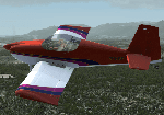
One of a trio of RVs (N81TT and N554DL) that fly formation out of Riverside municipal, California. N819GW is actually an RV6 and although I can't credit the painter, it's DEFINITELY SoCal!
| Filename: | Bay_Towers_Vans_RV7_N819GW.zip |
| License: | Freeware |
| Added: | 13th March 2012, 21:51:28 |
| Downloads: | 100 |
| Author: | Ron Attwood |
| Size: | 6.21 MB |
| Category: Flight Simulator X - Missions | |
| CzechCastleTourThree.zip |
|
File Description:
Helicopter mission. AÂ helicopter at LKSU airport provides services. Take a group of tourists out for an aerial tour of castles and estates in the Czech Repulic.This is tour three of nine.
| Filename: | CzechCastleTourThreezip.zip |
| License: | Freeware |
| Added: | 9th October 2023, 17:42:14 |
| Downloads: | 25 |
| Author: | helomissionman |
| Size: | 5.36 MB |
| Category: Flight Simulator X - Miscellaneous Files | |
| New Zealand airports list |
|
File Description:
A survey of ORBX New Zealand airports (NZ1 and NZ2); tells you if the airports have deluxe grass-veg, people, type of runway surface, and amount of buildings. Other comments are included.
| Filename: | New_Zealand_airports_list.zip |
| License: | Freeware |
| Added: | 1st August 2013, 19:29:00 |
| Downloads: | 213 |
| Author: | Ronald Pokatiloff |
| Size: | 147.39 KB |
| Category: Flight Simulator X - Scenery | |
| Puerto Rico X - Alive |
|
File Description:
Puerto Rico X is an upgrade to the default FSX scenery of Puerto Rico. It consists of major roads with moving traffic, power lines, Land Class and an updated AFCAD2 of TJSJ.
| Filename: | Puerto_Rico_X__Alive.zip |
| License: | Freeware, limited distribution |
| Added: | 8th December 2006, 05:01:45 |
| Downloads: | 3,838 |
| Author: | Juan Pizarro |
| Size: | 1.52 MB |
| Category: Flight Simulator X - AI Flight Plans | |
| Air Mediterranean Summer 2025 flight Plans |
|
Images related to this file:
File Description:

Flightplans for Air Mediterranean, operating a fleet of 1 Boeing 737-400 during the summer of 2025 on behalf of GoToFly Italy. Schedule taken from June 15-21, 2025 as per Flightradar24.
| Filename: | Air_Mediterranean_Summer_2025_flight_Plans.zip |
| License: | Freeware |
| Added: | 22nd June 2025, 13:52:34 |
| Downloads: | 93 |
| Author: | Ryan O'Reilly |
| Size: | 9.39 KB |
| Category: Flight Simulator X - Scenery | |
| SKBO 2011 |
|
File Description:
El Dorado International Airport (IATA: BOG, ICAO: SKBO) is an international airport located in Bogota, Colombia. It is the largest Latin America airport in terms of cargo movements with 593,946 tons (2010) and the third in terms of passenger traffic, only behind Sao Paulo-Guarulhos International Airport and Mexico City's Benito Juarez International Airport, transporting 18,934,203 passengers in 2010; as well as the largest airport in Colombia and the main international and domestic air gateway in the country, serving as an important hub for Avianca, Copa Airlines Colombia, Aires, Satena, EasyFly and other cargo companies.
This file has the right coordinates, with the apron and characteristics of the airport. The runways were reoriented to the correct direction, runway were resized the gates placed on correct location and number, CATAM was placed (Colombian Air force and Colombian National Army) and Colombia National Police and Colombian National Armada were assigned a correct apron. All the jet ways including the ones of the executive terminal are working. There is a copy of all the airport charts required to navigate in and out of this airport which are courtesy of: Areonatica Civil de Colombia
| Filename: | SKBO_2011.zip |
| License: | Freeware |
| Added: | 29th June 2011, 21:16:37 |
| Downloads: | 2,943 |
| Author: | Anwar Gonzalez |
| Size: | 14.34 MB |


© 2001-2026 AVSIM Online
All Rights Reserved
Privacy Policy |