
Where Flight Simulation Enthusiasts Gather from Around the World!
AVSIM Library - Search Results

| Category: Flight Simulator X - Scenery | |
| EPGO Goraszka 2010 - The Airshow Challenge |

|
Images related to this file:
File Description:
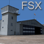
EPGO Goraszka 2010 - The Airshow Challenge is a freeware, extremely detailed scenery of a general aviation airport located 12nm (20km) south-east of Warsaw downtown and Warsaw Frederic Chopin International Airport, Poland. EPGO Goraszka airfield was built in 1994 and currently belongs to General Aviation company, which offers aero-taxi flights, air transport and special flights (air photo, patrol) and airport services. The airport has a 800m-long runway and a lightened helipad, which can be used by helicopters up to 5700kg weight. General Aviation's fleet includes Antonov AN-2, PZL-104 Wilga 80, Bell 407 and 427. Since 1996 the International Air Picnic Goraszka is organized every year by "Polish Eagles" Foundation created on initiative of Zbigniew Niemczycki.
The scenery is equipped with an automatic installer. Currently we support a safe, manual way of adding new sceneries to Scenery Library in Flight Simulator. This is just one thing users need to do for themselves. Detailed instructions will be given during the installation process.
Scenery features:
-Compatible with FSX only
-Highest level of accuracy in geographic positioning, modelling and texturing
-Incredibly high quality photoreal textures of all airport buildings. Textures are based on over 300 real world -photographs made for this project.
-Hundrieds of 3D objects like tents, exhibitions, airport buildings and surrounding buildings
-Life in the airport: people and cars will enchance your feelings
-AI traffic, animations and effects, designed specifically for FSX
-Some buildings include interior (control tower)
-High quality aerial photos of the airport surrondings (5 seasons + night) with autogen and water mask
-Ultra high quality aerial photos of the airport (with seasons)
-Plain airport scenery with no airshow objects available too (details in the manual)
-Product includes manual and airport charts in PDF format
EPGO Goraszka 2010 - The Airshow Challenge scenery is compatible with almost every payware add-on, including Ultimate Terrain Eastern Europe and Warsaw Photo Scenery by Simdesign. Scenery by Drzewiecki Design - www.drzewiecki-design.net .
| Filename: | EPGO_Goraszka_2010__The_Airshow_Challenge.zip |
| License: | Freeware |
| Added: | 16th July 2010, 12:31:42 |
| Downloads: | 4,712 |
| Author: | Drzewiecki Design - Stanislaw Drzewiecki, Jakub Paczek |
| Size: | 237.18 MB |
| Category: Flight Simulator X - Aircraft Repaints, Textures and Modifications | |
| Spitfire PR.XIX PS888 'The Last Sortie.' |
|
File Description:
On 1 April 1954 this aircraft of 81 Sqdn conducted the last ever operational sortie by an RAF Spitfire, flying a PR mission from its base at Seletar to an area of jungle in Johore thought to contain Communist guerrilla hideouts. After the flight the aircraft's ground crew painted the inscription ‘The Last!' on the left engine cowling. PS915 of the BBMF currently wears the colour scheme and markings of PS888. Textures by Grant MacLean/Sean Moloney/RealAir.
| Filename: | Spitfire_PRXIX_PS888_The_Last_Sortie.zip |
| License: | Freeware |
| Added: | 16th May 2008, 23:32:59 |
| Downloads: | 581 |
| Author: | Grant MacLean |
| Size: | 7.06 MB |
| Category: Flight Simulator X - Scenery | |
| LWSK Skopje "Alexander the Great" Airport |
|
File Description:
Skopje "Alexander the Great" Airport (IATA: SKP, ICAO: LWSK)[2] (is the larger and busier of the two international airports in the Republic of Macedonia. It is located 17 km (11 mi) southeast of the national capital Skopje
in the Municipality of Petrovec.
This is a humble tribute to Macedonian people for all the culture that they inhered to us.
This file has the right coordenates, with the apron and characteristics of the airport and buildings and jetways.
| Filename: | LWSK_Skopje_Alexander_the_Great_Airport.zip |
| License: | Freeware |
| Added: | 27th October 2012, 00:40:17 |
| Downloads: | 1,343 |
| Author: | Anwar Gonzalez |
| Size: | 11.22 MB |
| Category: Flight Simulator X - Flight Plans | |
| Scenic Flight Through The Grand Canyon |
|
Images related to this file:
File Description:
FSX Flight Plan for a flight through the Grand Canyon. If you want some spectacular views and fun flying try out this flight plan. There are over 800 way points used that take you through most of the canyon. Two flights included. One going eastbound and the other going westbound. You will be flying in the default Cessna 172 with the autopilot connected. Just sit back and watch the scenery go by. Don't get too relaxed because there are a couple of turns that you will have to take control of the aircraft. Included in this package are two spectacular gauges by Karol Chlebowski for TFR flying and Pave Tack which enhance the sight seeing experience. Another option to download Version 2.1 of my mini panel which has all this functionality included and more.
| Filename: | Scenic_Flight_Through_The_Grand_Canyon.zip |
| License: | Freeware, limited distribution |
| Added: | 12th July 2011, 02:34:24 |
| Downloads: | 678 |
| Author: | Bill McClellan |
| Size: | 2.66 MB |
| Category: Flight Simulator X - Scenery | |
| MYAM - Marsh Harbour, Andros, The Bahamas |
|
Images related to this file:
File Description:

Marsh Harbour is the third busiest airport in the Bahamas, and now has a new runway, a new terminal, and the addition of a control tower and fire station. Completion of scenery for Marsh Harbour has been delayed since beginning work on the Bahamas' airports due to construction and a long delay in opening the new facilities, which occurred on May 27, 2014. There are currently no plans for opening the control tower, and it is not operational in this scenery. The scenery includes custom scenery objects, placement of library objects and landclass changes. Scenery is based on Google Earth and photos taken locally, and it is optimized for use with UTX-TAC. Some scenery details have changed from what is shown in screenshots included with the installation package.
| Filename: | MYAM__Marsh_Harbour_Andros_The_Bahamas.zip |
| License: | Freeware |
| Added: | 28th June 2014, 05:54:38 |
| Downloads: | 890 |
| Author: | Art Poole |
| Size: | 2.5 MB |
| Category: Flight Simulator X - Scenery | |
| Great Harbour Cay (MYBG) - The Bahamas |
|
Images related to this file:
File Description:

This airport is located in the Berry Islands north of Nassau, once a golf resort for the rich and famous. The scenery includes custom scenery objects, placement of library objects and landclass changes. Scenery is based on Google Earth, Bing Maps and photos taken locally, and it is optimized for use with UTX-TAC.
| Filename: | Great_Harbour_Cay_MYBG__The_Bahamas.zip |
| License: | Freeware |
| Added: | 26th October 2013, 23:52:07 |
| Downloads: | 625 |
| Author: | Art Poole |
| Size: | 1.17 MB |
| Category: Flight Simulator X - Scenery | |
| Arthur's Town Airport (MYCA) - The Bahamas |
|
Images related to this file:
File Description:
One of three airports on Cat Island, named after the pirate Arthur Catt and home to Bahamian rake and scrape music. Academy Award winning actor Sidney Poitier grew up just outside Arthur's Town. The scenery includes custom scenery objects, placement of library objects and landclass changes. Scenery is based on photos taken locally, and it is optimized for use with UTX-TAC.
| Filename: | Arthurs_Town_Airport_MYCA__The_Bahamas.zip |
| License: | Freeware |
| Added: | 22nd July 2013, 03:22:42 |
| Downloads: | 1,188 |
| Author: | Art Poole |
| Size: | 735.76 KB |
| Category: Flight Simulator X - Scenery | |
| Treasure Cay Airport (MYAT) - The Bahamas |
|
Images related to this file:
File Description:

Treasure Cay is the most northern international airport in the Bahamas on North Abaco island directly east of West Palm Beach, Florida. The scenery includes custom scenery objects, placement of library objects and landclass changes. Scenery is based on Bing Maps, Google Earth and photos taken locally, and it is optimized for use with UTX-TAC.
| Filename: | Treasure_Cay_Airport_MYAT__The_Bahamas.zip |
| License: | Freeware |
| Added: | 18th July 2013, 23:58:30 |
| Downloads: | 1,336 |
| Author: | Art Poole |
| Size: | 1.98 MB |
| Category: Flight Simulator X - Scenery | |
| MYEH - North Eleuthera Airport - The Bahamas |
|
Images related to this file:
File Description:
Northernmost of three airports on Eleuthera Island in the Bahamas just east of Nassau. The scenery includes custom scenery objects; placement of library objects and landclass changes. Scenery is based on Bing Maps, Google Earth and photos taken locally, and it is optimized for use with UTX-TAC.
| Filename: | MYEH__North_Eleuthera_Airport__The_Bahamas.zip |
| License: | Freeware |
| Added: | 16th May 2013, 07:38:48 |
| Downloads: | 1,441 |
| Author: | Art Poole |
| Size: | 1.95 MB |
| Category: Flight Simulator X - Scenery | |
| MYLS - Stella Maris Airport - The Bahamas |
|
Images related to this file:
File Description:
Stella Maris is the northernmost of two airports on Long Island served by Bahamas Air, Southern Air, Pineapple Air and others. The scenery includes custom scenery objects; placement of library objects and landclass changes. Scenery is based on Bing Maps and photos taken locally, and it is optimized for use with UTX-TAC.
| Filename: | MYLS__Stella_Maris_Airport__The_Bahamas.zip |
| License: | Freeware |
| Added: | 8th May 2013, 21:16:44 |
| Downloads: | 1,058 |
| Author: | Art Poole |
| Size: | 1.38 MB |
© 2001-2026 AVSIM Online
All Rights Reserved
Privacy Policy |