
Where Flight Simulation Enthusiasts Gather from Around the World!
AVSIM Library - Search Results

| Category: Flight Simulator X - Scenery | |
| LEMG-X-JVX |

|
Images related to this file:
File Description:

LEMG, Malaga, Spain.
Hello Flightsim friends.
This is an reworked ADE [Scruffy Duck] scenery of LEMG, Malaga Airport, Spain, for FSX
It was annoying to find that almost everything was wrong at LEMG in FSX.
Runway numbers, Exits, Entrances to the Apron etc.
I've tried to get all the runways, turn offs and runway signs in their correct positions.
The Runways are now: 13 and 31 instead of 14 and 32
-crows next to entrance D13 at the NW end of the runway 13 and south of the airport almost halfways.-Seagulls next to the shore line.-Fishingships, a Cruiseliner and a freighter at sea.-Oil tanks near Apron entrance D2 [extremely dense setting]- Some military objects on the MIL part of the airport plus extra buildings.-Somewhere in the mountains there should be Eagles I know they are there but heck, I didn't yet see them my self :-) The MAR approach should lead you past them though]
AVSIM upload only
| Filename: | LEMGXJVX.zip |
| License: | Freeware, limited distribution |
| Added: | 1st April 2010, 02:21:00 |
| Downloads: | 1,728 |
| Author: | Joost Visser |
| Size: | 435.24 KB |
| Category: Flight Simulator X - Missions | |
| The Most Dangerous Airports: Lukla V2 |
|
Images related to this file:
File Description:
Approach to Lukla V2 (Totally New Mission)
You are a very experienced pilot flying the Twin Otter for Yeti Airlines on an imaginary flight to and from Lukla. Take-off from Biratnagar airport VNVT climb to at least 13500 ft to WP1 Turn to Lukla. From WP1 carefully descent to 10000 ft (there should be cloud to make it more difficult, if you have some sort of weather add-on running) to WP2 Approach to VNLK, after passing through the gate turn sharp right and land at Lukla airport, remember that the runway has an incline of several degrees. Turn around and take-off again, stay on the runway and rotate just before the end of the runway. Follow the valley back to the south until you are able to track the VOR 112.30 at roughly 276�°, till you reach Kathmandu Intl Airport and land. Yes, it sounds easy, butâ�¦ find out for yourself.
| Filename: | The_Most_Dangerous_Airports_Lukla_V2.zip |
| License: | Freeware |
| Added: | 9th June 2010, 02:40:12 |
| Downloads: | 1,680 |
| Author: | Robbie Albers |
| Size: | 2.17 MB |
| Category: Flight Simulator X - Scenery | |
| CYSG - St. Georges Aerodrome - Quebec, Canada - v1.2 |
|
Images related to this file:
File Description:
Saint-Georges Aerodrome, (ICAO: CYSG), is a general aviation aerodrome located 1.5 nautical miles (2.8 km; 1.7 mi) west-southwest of Saint-Georges, Quebec, Canada near the border with Maine. The airport has a long, paved runway, suitable for use by jets. This scenery FSX and P3D Airport St-Georges was inspired by the great FS2004 scenery of the late pilot Virtual Hugues Caron img12. It was made very humbly in his memory. This scenery been validated and tested with FSX SP1, SP2, Acceleration and P3D v2. This is a complete reproduction, more accurate and realistic in Saint-Georges Beauce airport with all the buildings around it. For technical information or assistance contact one of the following email addresses support: [email protected] or [email protected]. Web site : http://imaginairvirtuel.qc.ca
In addition to compatibility P3D added, version 1.2 will replace and improve version 1.1. It is suggested to uninstall version 1.1 and replace it.
| Filename: | CYSG__St_Georges_Aerodrome__Quebec_Canada__v12.zip |
| License: | Freeware, limited distribution |
| Added: | 8th March 2015, 22:27:34 |
| Downloads: | 1,417 |
| Author: | Georges Bourgouin |
| Size: | 7.67 MB |
| Category: Flight Simulator X - Scenery | |
| MMTJ - Gen Abelardo L Rodriguez Intl - Tijuana, Mexico ----- KSDM - Brown Mun - San Diego, California - USA |
|
Images related to this file:
File Description:
This scenery adds the new Cross Border Xpress (CBX) terminal to MMTJ, which opened on December 9, 2015, making it the first airport in the world to have connecting terminals in two different countries. All of MMTJ is also updated to reflect the most current airport layout. The neighboring KSDM is also completely updated and included in this scenery package. This scenery is optimized to fit seamlessly with FTX Global/Vector and also includes an optional CVX file which adds roads for default FSX users. All elements of both airports were traced directly from current satellite imagery and updated to reflect current satellite positioning. Scenery was created using Airport Design Editor X v1.61.5298, SBuilderX 3.13, and the FSX Object Placement Tool. Scenery objects were added and modified from stock FSX scenery to resemble as closely as possible the actual airports. The FSX apron lights included are from the set created by Jim Dhaenens.
| Filename: | MMTJ__Gen_Abelardo_L_Rodriguez_Intl__Tijuana_Mexic.zip |
| License: | Freeware |
| Added: | 3rd January 2016, 12:58:36 |
| Downloads: | 2,672 |
| Author: | Carlyle Sharpe |
| Size: | 3.58 MB |
| Category: Flight Simulator X - Scenery | |
| KIND - Indianapolis Intl, Indiana, USA |
|
Images related to this file:
File Description:
This is an up-to-date version of Indianapolis Intl airport with two optional files and made only for FSX users, do not use in P3D: There is one version with the Crosswind runway 14/32 activated where all 3 runways will be used for takeoff/landing and one version as the default airport runway operation,
This update removes the "jfk jetways" mainly for those who have had issues installing the textures to get these jetways to display, these jetways have now been replaced by jetway extensions that use there own textures, the terminal and its piers completely rebuilt, assigned parking as per their website with extra parking, the Fedex ramp updated and buildings replaced, all taxiways and taxi signs updated to the latest charts, support vehicle roads rebuilt, extra fuel trucks, Helipad added to the GA apron and many other scenery improvements and objects added, airport views are from inside the control tower (when in tower view) please view the readme before installation.
| Filename: | KIND__Indianapolis_Intl_Indiana_USA.zip |
| License: | Freeware, limited distribution |
| Added: | 11th March 2020, 18:46:54 |
| Downloads: | 30,506 |
| Author: | Ray Smith |
| Size: | 4.2 MB |
| Category: Flight Simulator X - Scenery | |
| LFST - Strasbourg-Entzheim, France |
|
Images related to this file:
File Description:
A very detailed rendition of Strasbourg-Entzheim airport (France).
This scenery has been made for FSX SP2 or Acceleration and DirectX9.
However, it has been tested successfully with DX10 free shaders from Steve Parsons (not tested with DX10 Scenery Fixer SteveFSX)and with Prepar3D v.2.1.
Almost all the buildings have been built accurately, based on numerous pictures.
Runway, taxiways and aprons are covered with textured polygons so as to keep the look of the pavement regardless of extra add-ons installed. These textured polygons enable a smooth transition with the photorealistic ground (blend effect).
Aprons markings are up to date. This scenery is ready to accommodate your AI traffic : the stands are assigned to the main airlines serving the airport and their settings match with the real ones (nose-in, nose-out, drive through).
I have spent more than 2 years to make this photorealistic scenery.
I hope you enjoy discovering Strasbourg airport, have nice flights!
| Filename: | LFST__StrasbourgEntzheim_France.zip |
| License: | Freeware, limited distribution |
| Added: | 9th March 2014, 22:52:25 |
| Downloads: | 16,958 |
| Author: | Jacques-Paul Bollard |
| Size: | 66.87 MB |
| Category: Flight Simulator X - Scenery | |
| Victoria, Canada including US Southern Gulf Islands and San Juan Islands - Part 2 of 2 |
|
Images related to this file:
File Description:
FSX-only version of Victoria, Canada area scenery including the Southern Gulf Islands and the San Juan Islands of the US. Includes automated installer and configurator by Scot Fraser.
Features:
-accurate shorelines, lakes and streams;
-landclass;
-FSX multi-LOD mesh with 10m maximum resolution;
-complete road network with moving traffic;
-railroads;
-utility corridors;
-marinas and ferry terminals;
-many static boats, including a custom model of the Canada Coast Guard ship Sir Wilfred Laurier;
-detailed models of major buildings and the Ogden Point Terminal;
-many bridges;
-nearly 300 marine lights; and corrected antennae locations.
Facilities include Don Grovestine's famous CYYJ (Victoria International Airport); 12 other Canadian land-based airports: Butler Field, Duncan (CAM3), Gaines, Hastings, Hudson Island, James Island, Thomas, Village Bay, Raven Field (CML2), Saltspring, Sidney Island, Whiskey Point; 20 US airports Blakely (38WA), Burden (61WA), Center Island (79WA), Clam Harbor (WA35), Crane Island, Decatur Shores (WN07), Decatur-Jones (WA18), Waldronaire (90WA), Orcas Island (KORS), Friday Harbour (KFHR), Lopez Island (S31), Pile Point, Roche Harbor (WA09), Shaw Island, Stuart Island Airpark (7WA5), Stuart Island West (2WA3), Wilding (6WA5), Windsock (4WA4); 12 floatplane facilities: Bedwell (CAB3), Fisherman's Bay (WA81), Friday Harbor (W33), Ganges (CAX6), Maple Bay, Mayne (CAW7), Port Washington (CAP8), Roche Harbor (W39), Rosario (W49), Shawnigan Lake (CAV8), Victoria Harbour (CYWH), Victoria International (CAP5) and Westsound, Orcas (WA83) - many with AI traffic; 9 heliports: Ganges (CAL7), Mayne (CBF5), Camel Point (CBF7), Jubilee (CBK8), Victoria General (CBW7) Madrona Bay (CBW9), Shoal Point (CBZ7), Mount Belcher (CMBH).
AI models include the DHC-2 floatplane in local liveries, a cruise ship model (by Mitsuya Hamaguchi) and two repaints, pilot boat, and small boats (by Larry Silsbee).
Ultimate Terrain X compatible (not required). Users of Vancouver+ for FSX will also get additional cruise ship traffic and additional floatplane and helicopter traffic. Full documentation. By Don Grovestine, Jon Patch and Holger Sandmann. Many other contributors: see documentation. Part 2 of 2 - you also need file vicenh7a.zip
| Filename: | Victoria_Canada_including_US_Southern_Gulf_Islands.zip |
| License: | Check within download |
| Added: | 29th January 2010, 21:21:49 |
| Downloads: | 23,166 |
| Author: | Don Grovestine, Jon Patch and Holger Sandmann |
| Size: | 59.08 MB |
| Category: Flight Simulator X - Scenery | |
| Victoria, Canada including US Southern Gulf Islands and San Juan Islands - Part 1 of 2 |
|
Images related to this file:
File Description:
FSX-only version of Victoria, Canada area scenery including the Southern Gulf Islands and the San Juan Islands of the US. Includes automated installer and configurator by Scot Fraser.
Features:
-accurate shorelines, lakes and streams;
-landclass;
-FSX multi-LOD mesh with 10m maximum resolution;
-complete road network with moving traffic;
-railroads;
-utility corridors;
-marinas and ferry terminals;
-many static boats, including a custom model of the Canada Coast Guard ship Sir Wilfred Laurier;
-detailed models of major buildings and the Ogden Point Terminal;
-many bridges;
-nearly 300 marine lights; and corrected antennae locations.
Facilities include Don Grovestine's famous CYYJ (Victoria International Airport); 12 other Canadian land-based airports: Butler Field, Duncan (CAM3), Gaines, Hastings, Hudson Island, James Island, Thomas, Village Bay, Raven Field (CML2), Saltspring, Sidney Island, Whiskey Point; 20 US airports Blakely (38WA), Burden (61WA), Center Island (79WA), Clam Harbor (WA35), Crane Island, Decatur Shores (WN07), Decatur-Jones (WA18), Waldronaire (90WA), Orcas Island (KORS), Friday Harbour (KFHR), Lopez Island (S31), Pile Point, Roche Harbor (WA09), Shaw Island, Stuart Island Airpark (7WA5), Stuart Island West (2WA3), Wilding (6WA5), Windsock (4WA4); 12 floatplane facilities: Bedwell (CAB3), Fisherman's Bay (WA81), Friday Harbor (W33), Ganges (CAX6), Maple Bay, Mayne (CAW7), Port Washington (CAP8), Roche Harbor (W39), Rosario (W49), Shawnigan Lake (CAV8), Victoria Harbour (CYWH), Victoria International (CAP5) and Westsound, Orcas (WA83) - many with AI traffic; 9 heliports: Ganges (CAL7), Mayne (CBF5), Camel Point (CBF7), Jubilee (CBK8), Victoria General (CBW7) Madrona Bay (CBW9), Shoal Point (CBZ7), Mount Belcher (CMBH).
AI models include the DHC-2 floatplane in local liveries, a cruise ship model (by Mitsuya Hamaguchi) and two repaints, pilot boat, and small boats (by Larry Silsbee).
Ultimate Terrain X compatible (not required). Users of Vancouver+ for FSX will also get additional cruise ship traffic and additional floatplane and helicopter traffic. Full documentation. By Don Grovestine, Jon Patch and Holger Sandmann. Many other contributors: see documentation. Part 1 of 2 - you also need file vicenh7b.zip
| Filename: | Victoria_Canada_including_US_Southern_Gulf_Islands.zip |
| License: | Check within download |
| Added: | 29th January 2010, 21:23:17 |
| Downloads: | 23,162 |
| Author: | Don Grovestine, Jon Patch and Holger Sandmann |
| Size: | 56.8 MB |
| Category: Flight Simulator X - AFCAD Files | |
| UKDE v 0.0.0.1 |
|
File Description:
UKDE v. 0.0.0.1
Zaporozhia International Air-port of the name "Mokraya"
It touched up Afcad nearer to real, what default.
- the system of fires is Changed on the real.
- stands are more Correct placed. *
- Corrected standard grounds.
- Correct motion Aircraft. *
- Added for a surface technique.
- Edited frequency card. Atis is added.
- ILS is Edited.
*- In real of stand for IL-76 are on the south-west of air-port, but I did them on a northeast.
There also stands for Silt-76, but for those which will utilize. In future versions necessarily will correct it.
| Filename: | UKDE_v_0001.zip |
| License: | Freeware |
| Added: | 29th February 2008, 00:00:24 |
| Downloads: | 333 |
| Author: | Vanihin Andrey |
| Size: | 185.89 KB |
| Category: Flight Simulator X - Aircraft Repaints, Textures and Modifications | |
| Bede BD5 G/J - four liveries |
|
Images related to this file:
File Description:
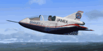
Four repaints for the recently released FSX payware addon from IRIS Flight Simulation Software - Bede BD5 G/J. First of all there is one "freestyle" paint for the prop version (works on the jet too - see the readme). Then there are the three "SMART-1" liveries operated by Aerial Productions International, Inc. SMART 1 - this acronym means: Small Manned Aerial Radar Target, model 1. Very simply put, the guys who fly these pretend to be cruise missiles and fly mission profiles against air defence systems to give the operators "live" targets to track and intercept.
| Filename: | Bede_BD5_GJ__four_liveries.zip |
| License: | Freeware |
| Added: | 9th December 2010, 01:37:14 |
| Downloads: | 357 |
| Author: | Chris Brisland |
| Size: | 7.07 MB |


© 2001-2026 AVSIM Online
All Rights Reserved
Privacy Policy |