
Where Flight Simulation Enthusiasts Gather from Around the World!
AVSIM Library - Search Results

| Category: Flight Simulator X - Missions | |
| The Guggenheim Robbery |

|
Images related to this file:
File Description:
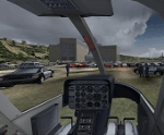
(Spanish and English version in the same download).Acceleration required.Music, lights, rewards...The Guggenheim Museum in Bilbao has been robbed! Thieves are on the run. Police know that they are fleeing to Bayonne (France) aboard an aircraft.But French Police have no jurisdiction over them, so it is up to you to catch them if you can.Our mission is to reach Bayonne Airport before them, and then take them unawares as soon as they land.Be careful ! The range between the speed that you need to catch them and the Lear's overspeed is very narrow.And is dificult to maintein this range with lots of turbulences.
Se ha producido un robo en el museo Guggenheim de Bilbao, y los ladrones han escapado. La policÃ�Â�Ã�ÂÂa ha conseguido averiguar que han escapado en un avi���³n que se dirige a Bayona ( Francia).La policÃ�Â�Ã�ÂÂa francesa no tiene jurisdicci���³n sobre el caso, por lo que eres tu quien debe detenerlos.Nuestro objetivo es llegar al aeropuerto de Bayona antes que ellos, para sorprenderles y poder atraparles cuando aterricen.Ten cuidado ! El margen entre la velocidad que necesitas para poder atrapar a los ladrones, y la VNE del Lear es muy estrecho.Ademas, es dificil mantenerlo con muchas turbulencias.
| Filename: | The_Guggenheim_Robbery.zip |
| License: | Freeware, limited distribution |
| Added: | 10th May 2010, 17:55:00 |
| Downloads: | 1,476 |
| Author: | Jose Enrique Arino |
| Size: | 10.1 MB |
| Category: Flight Simulator X - Panels | |
| General Dynamics F-111 "Aardvark" PIG HUD Project (Upgrade, Revison 7) |
|
Images related to this file:
File Description:
FSX F-111 PIG HUD PROJECT - Navigation/Situation awareness cockpit.
REVISION 7.UPGRADE. MUST already have fxpiggb5.zip installed.
Unique STAND OFF capability has been added to both Pave Tack and Radar.
This is a stunning feature not previously implemented in FSX. Radar contours
now sea level to 17,000'and radar can view any airport worldwide from its
current position. Flt Pln leg toggle SW can set radar view. Pave Tack now
provides sharp detail close up views in steps to 20NM and has full 1 degree
increments with freedom of panning. Approx 5 pages added to current 56 page
Flight Manual, other minor improvements covered in the comprehensive notes.
Adds to what is already an extreme capability panel and package packed
with custom instruments and concepts not available in other aircraft.
All instruments and text are sized to be clearly and easily readable.
Includes enhanced HUD, multiple radars, GPS units, MFDs, and effects, TFR,
autopilot/autothrottle, is Carrier and Air to Air capable, ICAO entry and
day/night/IFR/VFR navigation with constant current position awareness.
HUD available in all views including the 10 Camera views. This package sets
the benchmark for the amount, type of data provided and its presentation.
Possibly the best pilot friendly military aircraft available.
This is the complete panel with simple installation procedure.
By Karol Chlebowski.
| Filename: | General_Dynamics_F111_Aardvark_PIG_HUD_Project_Upg.zip |
| License: | Check within download |
| Added: | 8th February 2011, 23:13:23 |
| Downloads: | 566 |
| Author: | Karol Chlebowski |
| Size: | 16.06 MB |
| Category: Flight Simulator X - Scenery | |
| EDTQ Pattonville |
|
Images related to this file:
File Description:
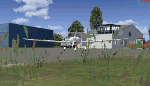
Airfield Pattonville (ICAO-Code: EDTQ)
See http://pattonville.pa.funpic.de/ for more information.
The Airfield Pattonville is a small airfield north of Stuttgart in southern germany. It is used by several aviator-clubs and hosts the base for a rescue helicopter. The runway suits for planes up till 3.5 tons.
This airfield was built bevor 2nd world war between Kornwestheim and Remseck-Aldingen. After WW2 it was used by the US-army and named "Ludwigsburg Army Airfield" and hosted missile-Launchpads during the Korea-war.
Since 16th of Juli 2003 The Airfield Pattonville is name as �������¢����������������Sonderlandeplatz Pattonville�������¢���������������� and has ICAO-Code EDTQ.
Due to the rising amount of airtraffic at Airport EDDS Stuttgart, the rescue-helicopter 'Christoph 51' moved to Pattonville at 1st of October 2009.
| Filename: | EDTQ_Pattonville.zip |
| License: | Freeware |
| Added: | 18th May 2012, 23:00:49 |
| Downloads: | 2,340 |
| Author: | Joe Herwig |
| Size: | 12.96 MB |
| Category: Flight Simulator X - Miscellaneous Files | |
| Fireworks for Deepawali |
|
Images related to this file:
File Description:
Deepawali, also known as Diwali is one of the Major Festival celebrated in India from Jammu Kashmir to Kanyakumari. Deepawali or Diwali is certainly the biggest and the brightest of all festivals. It's the festival of lights (deep = light and avali = a row i.e., a row of lights) that's marked by four days of celebration, which literally illumines the country with its brilliance, and dazzles all with its joy. From darkness unto light the light that empowers us to commit ourselves to good deeds, that which brings us closer to divinity. During Diwali, lights illuminate every corner of India and the scent of incense sticks hangs in the air, mingled with the sounds of fire-crackers, Fireworks, joy, togetherness. On third day of the festival from evening to midnight the entire sky of India is full of colorful fireworks. Its the most awesome night of the year to witness. Every single family in India celebrates Diwali with lights, fire-crackers and fire works.
Lets celebrate Diwali in the virtual world of Flight Simulator. Fly in or out of any airport in India and enjoy your departure or approach phase with great show of fireworks all over the country. Fireworks for both FS2004 & FSX SP2 / Acceleration pack. Tested in FS2004 and FSX Acceleration pack only because its what I have. Enjoy!
| Filename: | Fireworks_for_Deepawali.zip |
| License: | Freeware |
| Added: | 15th October 2014, 00:10:49 |
| Downloads: | 222 |
| Author: | Ashish SIngh |
| Size: | 174.33 KB |
| Category: Flight Simulator X - Scenery | |
| Moscow City X DEMO |
|
Images related to this file:
File Description:
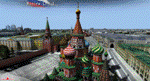
Moscow City X DEMO is a very detailed model of Moscow metropolitan area in Russia, together with lite sceneries of 7 airports (UUWW Vnukovo, UUDD Domodedovo, UUBW Zhukovski, UUMO Ostafyevo, UUBM Myachkovo and UUMB Kubinka), many heliports and thousands of buildings. This product is fully compatible with FSX/FSX:SE/P3Dv1/P3Dv2/P3Dv3/P3Dv4 and FSW by Dovetail.
It's a fully functional DEMO version of the commercial payware product, copmatible with both UUEE Moscow Sheremetyevo X by Drzewiecki Design and UUDD Moscow Domodedovo FSX/P3D by MDesign. It features same airport layout as in the full version but with limited 3D objects and low resolution textures. Using this free demo ensures no problems with online (VATSIM, IVAO, multiplayer etc.) flying in case some users use the payware scenery and some don't.
Moscow is the capital city and the most populous federal subject of Russia. It's the second most populous city in Europe after Istanbul and the 8th largest city proper in the world, as well as the largest amongst high income economies.
It's equipped with an automatic installer, which means that the scenery will be automatically added to the Flight Simulator Scenery Library.
Please uninstall all previous versions of the airports included in this package that you may have installed before. Please make also sure that no duplicated AFCAD files are installed!
Enjoy your virtual flying with Drzewiecki Design!
| Filename: | Moscow_City_X_DEMO.zip |
| License: | Freeware, limited distribution |
| Added: | 23rd August 2017, 01:37:04 |
| Downloads: | 4,131 |
| Author: | Drzewiecki Design |
| Size: | 18.56 MB |
| Category: Flight Simulator X - Utilities | |
| AI Aircraft SID and STAR Controller - Version 1.4B <b>for FSX, FSX Steam and P3D</b> |
|
Images related to this file:
File Description:
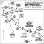
The AIController utility automatically vectors FSX, FSX-Steam or Prepar3D Artificial Intelligence (AI) aircraft through predefined Standard Instrument Departures (SIDs), jet routes, Standard Instrument Arrivals (STARs) (or alternatively generic traffic patterns), and/or final approaches. AIController automatically selects the most appropriate SID, jet route or STAR for each AI aircraft. AIController also lands arriving AI using published, custom or automatic final approach procedures, then provides taxi service to parking. The user can customize the procedures to fine tune AI arrival and departure patterns at each airport, such as specifying landing runways on-the-fly.
AIController optionally enforces spacing minimums between arriving AI aircraft by commanding speed changes and/or commanding the AI to hold at waypoints, thus reducing go-arounds. AIController can also enforce spacing minimums between the AI aircraft and the user's aircraft.
A stand-alone, windows based AI traffic monitoring program (AIMonitor.exe) is also included to provide the user with a graphical front-end. A converter (SIDSTARConverter) is included to automatically convert SID and STAR files from standard, aircraft format to the format used by AIController.
AIController requires an installed FSX or P3D SimConnect and can be run on a networked computer. The latest, registered version of FSUIPC ver. 4.9x (or later version) is also required.
| Filename: | AI_Aircraft_SID_and_STAR_Controller__Version_14B_b.zip |
| License: | Freeware |
| Added: | 18th July 2015, 00:11:26 |
| Downloads: | 14,192 |
| Author: | Roland Foster |
| Size: | 16.23 MB |
| Category: Flight Simulator X - Aircraft Repaints, Textures and Modifications | |
| Project Airbus A321 FD-FMC version 1.20 <b>FSX and P3D</b> |
|
Images related to this file:
File Description:
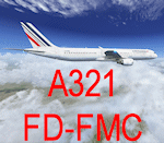
A321 FD-FMC is a freeware FMC project, only for FSX and P3D, based on Project Airbus A321 aircraft with enhanced VC, which provide real vertical navigation feature and all Airbus autopilot advanced modes (all knobs like real Airbus : Push-pull). FD-FMC has a unrealistic interface, to be easy to use, but it offers true vertical navigation in N1 mode with adaptive pitch control. Aircraft pack include an airport database (more than 200 airports) and new airports procedure files are created each month and can be downloaded. This database include real SID, STAR and approach procedures. FD-FMC manages altitude and speed constraint, holding pattern, DME-ARC, ILS/LOC/RNAV approaches, autolanding, LOC back course mode, multiple gradient approaches. You can set easily all performance in FMC pages, for Take off, climb, descent and approach. VC fully functional, with all system (Bleeds system, fuel system, Fly by wire). All switches working. ND with Radar terrain (TAWS) and basic TCAS (traffic). All real airbus autopilot mode works and reported on the PFD's FMA : THR CLB, CB, SRS, DES THR IDLE, etc ......Flight can be saved (update automatically FSX flight plan file) and all FMC data are saved.
Flight begin in cold and Dark; Real Start engine procedure.....Please, read the install manual and user manual English and French). A very advanced Airbus panel. FD-FMC is copyright Francois Dore.
| Filename: | Project_Airbus_A321_FDFMC_version_120_bFSX_and_P3D.zip |
| License: | Freeware |
| Added: | 4th April 2016, 21:46:09 |
| Downloads: | 2,582 |
| Author: | Francois Dore - Project Airbus |
| Size: | 327.24 MB |
| Category: Flight Simulator X - Scenery | |
| Eagle Field - Port Matilda, PA |
|
Images related to this file:
File Description:
Eagle field- 09PA Port Matilda PA.
Private Glider field Owned by Karl Striedieck. Karl is a world record setting glider pilot and a member of the U.S. Soaring Hall of Fame. He was an early pioneer of ridge soaring in the Ridge-and-valley Appalachians in the 1960s, ultimately setting nine world records flying gliders there. He was selected for the U.S. national soaring team 12 times, and won a silver medal in the world championships in 1978 and 1983.
Mr. Striedieck was a U.S. Air Force pilot from 1959 to 1962, flying the F-86 Sabre and F-102 Delta Dagger, then continued his military service until 1981 in the Pennsylvania Air National Guard, where he transitioned to the A-7 Corsair II. A year before graduating from Pennsylvania State University in 1965, he started flying gliders when he and Bill Clark co-founded the Nittany Soaring Club, flying out of the former State College Air Depot. He has over 15,000 flying hours, with nearly half of that total in gliders.
Mr. Striedieck moved his home to the Eagle Field private airport on top of Bald Eagle Mountain, near State College, Pennsylvania in 1966, and now lives there with his second wife, Iris.
Basically a manicured farm field, this private glider field offers access to the famous ridge lift of central Pennsylvania.Nearby Ridge Soaring is another one of my airfields available.
| Filename: | Eagle_Field__Port_Matilda_PA.zip |
| License: | Freeware |
| Added: | 11th June 2014, 16:30:28 |
| Downloads: | 324 |
| Author: | Jon Davidson |
| Size: | 16.52 MB |
| Category: Flight Simulator X - Scenery | |
| Whale Island (Hi Resolution Photo and mesh), New Zealand |
|
Images related to this file:
File Description:
Whale Island (Maori Name: Moutohora) is a small island located off the Bay of Plenty coast of New Zealand's North Island. It is located about 12 kilometers north of the town of Whakatane. A whaling station existed on the island during the 19th century. The 1.43 km island is a remnant of a complex volcano which has eroded, leaving two peaks. This is still an area of volcanic activity and there are hot springs on the island in Sulphur Valley, McEwans Bay, and Sulphur Bay.
This Hi Resolution scenery was created from a 0.25m pixel resolution Ortho-rectified Aerial mosaic owned by Environment Bay of Plenty (The Bay of Plenty Regional Council) and flown in 2007. The imagery has been slightly de-sampled for use in Flight Simulator X and utilizes the a custom hi resolution 5m Mesh derived from photogrammetry data off the photos. The textures are intended for summer daylight flying only, although due to the evergreen nature of New Zealand's native bush, the Islands appearance remains relatively constant throughout the year.
The island contains a small helicopter pad which is used for checking the various radio antennas on the Island. There is also a small Department of Conservation hut near the south western tip of the Island. These objects have been added from the FSX library of objects. Make sure to turn up your graphics sliders to make the most of this data! To find the Island fly north from Whakatane airport.
| Filename: | Whale_Island_Hi_Resolution_Photo_and_mesh_New_Zeal.zip |
| License: | Freeware, limited distribution |
| Added: | 20th January 2010, 10:12:14 |
| Downloads: | 4,650 |
| Author: | Tim Barnes |
| Size: | 9.94 MB |
| Category: Flight Simulator X - Scenery | |
| Amundsen-Scott Station |
|
File Description:
The Amundsen-Scott South Pole Station is the American scientific research station on the high plateau of Antarctica. This station is located at the southernmost place on the Earth, the Geographic South Pole, at an elevation of 2,835 meters (9301 feet) above sea level.
Since the Amundsen-Scott Station is located at the South Pole, it is at the only place on the land surface of the Earth where the sun is continuously up for six months and then continuously down for six months. (The only other such place is at the North Pole, on the sea ice in the middle of the Arctic Ocean.) Thus, during each year, this station experiences one extremely long "day" and one extremely long "night". During the six-month "day", the angle of elevation of the Sun above the horizon varies continuously. The sun rises on the September equinox, reaches its maximum angle above the horizon on the summer solstice in the Southern Hemisphere, around 20 December, and sets on the March equinox.
During the six-month "night", it gets extremely cold at the South Pole, with air temperatures sometimes dropping below -73�°C (-100�°F). This is also the time of the year when blizzards, sometimes with gale-force winds, strike the Amundsen-Scott Station. The continuous period of darkness and dry atmosphere make the station an excellent place from which to make astronomical observations.
This file has the apron and characteristics of the airport the coordenates are placed as far south as FS allow it.
| Filename: | AmundsenScott_Station.zip |
| License: | Freeware |
| Added: | 17th October 2011, 22:01:33 |
| Downloads: | 1,299 |
| Author: | Anwar Gonzalez |
| Size: | 5.92 KB |


© 2001-2026 AVSIM Online
All Rights Reserved
Privacy Policy |