
Where Flight Simulation Enthusiasts Gather from Around the World!
AVSIM Library - Search Results

| Category: Flight Simulator X - AFCAD Files | |
| Hammonton Municipal Airport (N81) NJ |

|
File Description:
Located 03 miles NE of Hammonton, New Jersey on 107 acres of land, Hammonton Municipal Airport is a public asphalt strip 3601' in length. It has recently been renovated with all-new taxiways and aprons and this update is depicted in this version with the big change being the extension of the main apron to join the previously-separated north and south tarmacs. The airport's magnetic variation, traffic pattern height, and PAPI glide slope and location have also all been accurately adjusted. All tie down parking locations are located on either the North or South tarmacs. Parking spots marked as RAMP_GA are occupied by static aircraft/objects and should not be chosen to start in (although all static objects have collision disabled). North parking spots can accommodate wingspans up to 50' while South parking spots should only be used by aircraft with wingspans of 40' or less. The one DOCK_GA location in the hangar start that can accommodate aircraft with wingspans up to 45'. The helicopter start location will place you on the North tarmac in front of the main hangar. Fuel is available by stopping on the concrete area on the North tarmac or by the fuel truck on the South tarmac in front of the hangars. Please see the ReadMe for known issues regarding AI aircraft parking.
Scenery constructed with use of satellite images/streetview/aerial photos - the author has not been there in person.
This scenery is meant to be used in conjunction with MegaScenery Earth New Jersey/Delaware 003. It is not required, but apron use is minimized to allow satellite scenery to show through as much as possible, and objects are placed based on the MSE textures - lack of it may make scenery look out of place.
| Filename: | Hammonton_Municipal_Airport_N81_NJ.zip |
| License: | Freeware |
| Added: | 5th June 2011, 06:22:53 |
| Downloads: | 202 |
| Author: | Drew Sikora |
| Size: | 897.82 KB |
| Category: Flight Simulator X - AFCAD Files | |
| Toulouse-Blagnac Airport Scenery (LFBO) |
|
Images related to this file:
File Description:
This is an FSX addon scenery of the Toulouse-Blagnac Airport (LFBO). It has been made using the excellent freeware tool ADE. It includes the new terminal gates, the A380 production line (using Lagardere) at the north of the airport, the new delivery center called Aire Ziegler where the brand new A380s are delivered. I modified taxiways and parking to make them look like in the reality. There are two landing pads for helicopters like in reality. I have changed the parking assignment to make sure that the usual traffic will park on the parkings E, F D AB, V and U, as it is on the reality. Finally, the close surroundings of the airport were modified to display the Airbus facilities as far as possible with generic buildings.
| Filename: | ToulouseBlagnac_Airport_Scenery_LFBO.zip |
| License: | Freeware |
| Added: | 13th June 2011, 03:32:00 |
| Downloads: | 1,392 |
| Author: | Jose Mauriz |
| Size: | 220.42 KB |
| Category: Flight Simulator X - AFCAD Files | |
| Linden Airport (KLDJ), NJ v1.1 |
|
File Description:
Located 01 miles SE of Linden, New Jersey on 188 acres of land, Linden Airport is a public asphalt strip 4137' in length. Numerous changes have been made to this airport to bring it closer to its real-life counterpart including proper non-precision runway markings for R09 while only basic markings are used for R27; The 4-box VASI has been accurately located; the traffic pattern height has been adjusted; All 130 tiedown locations have been accurately placed. RAMP_GA spots are taken by static aircraft (all of which have collision disabled) so they should not be selected unless you want to start inside another aircraft! RAMP_GA_SMALL spots can be occupied by aircraft with wingspans up to 40 feet and RAMP_GA_MEDIUM spots can be occupied by aircraft with wingspans up to 60 feet. There are 4 open hangars labeled as GA_DOCK. The main hangar (NW Parking) can hold aircraft with wingspans up to 60 feet. The three smaller hangars (SW Parking) can hold aircraft with wingspans up to 35 feet. The W Helipad start location will put you in front of the smaller main tarmac hangar within the coned-off section. Fuel is only available by taxiing to a stop in front of either fuel tank to the west of the main tarmac. No AI aircraft will spawn in the SW Parking area.
Scenery constructed with use of satellite images/streetview/aerial photos - the author has not been there in person.
This scenery is meant to be used in conjunction with MegaScenery Earth New York 005. It is not required, but apron use is minimized to allow satellite scenery to show through as much as possible, and objects are placed based on the MSE textures - lack of it may make scenery look out of place.
| Filename: | Linden_Airport_KLDJ_NJ_v11.zip |
| License: | Freeware |
| Added: | 28th June 2011, 00:03:41 |
| Downloads: | 511 |
| Author: | Drew Sikora |
| Size: | 1.23 MB |
| Category: Flight Simulator X - Scenery | |
| Ficksburg Sentraoes Airport South Africa |
|
Images related to this file:
File Description:
Ficksburg made from completely custom designed objects and effects.Has a custom AFCAD and a phot real base that changes with the seasons.Ficksburg has become one of the Free State major tourist points for foreign visitors to South Africa.Fickburg lies at the foot of the Mpharane Mountain on the banks of the Caledon River.FSX Acceleration will give the best results.(Also SP2 compatable).Acceleration users will have more eye candy !
| Filename: | Ficksburg_Sentraoes_Airport_South_Africa.zip |
| License: | Freeware |
| Added: | 5th July 2011, 03:56:42 |
| Downloads: | 436 |
| Author: | Frits Beyer and Jacques Botha |
| Size: | 8.75 MB |
| Category: Flight Simulator X - Scenery | |
| Ficksburg Sentraoes Airport South Africa |
|
Images related to this file:
File Description:
Ficksburg made from completely custom designed objects.Has a custom AFCAD and a photo real base that changes with the seasons.Ficksburg has become one of the Free State major tourist points for foreign visitors to South Africa. Fickburg lies at the foot of the Mpharane Mountain on the banks of the Caledon River.FSX Acceleration will give the best results.(Also SP2 compatable).Acceleration users will have more eye candy !
| Filename: | Ficksburg_Sentraoes_Airport_South_Africa.zip |
| License: | Freeware |
| Added: | 5th July 2011, 04:50:04 |
| Downloads: | 807 |
| Author: | Frits Beyer and Jacques Botha |
| Size: | 8.75 MB |
| Category: Flight Simulator X - Scenery | |
| Frankfurt Main Airport v4 (EDDF) |
|
Images related to this file:
File Description:
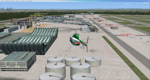
This is a major update to the previous airport package (Frankfurt Airport v3.2) using ADE 1.47 and represents the layout of the airport from June 2010.
This revision update includes all the re-designated taxiways and signage as per the real world airport at this time as well as introducing new taxiways and textures for Romeo, R3, L4, L5 and M8. Other major features include construction work on taxiway Sierra and the construction area including cranes at the site of the new A-plus terminal.
Also featured is additional apron lighting at various other northern parking and cargo aprons and Cargo Sud, re-modeled de-icing aprons with night lighting and addition of DP2 apron, updated gate designations for gates A11 to A25 and updated airline parking codes for V gates. A number of miscellaneous updates and fixes are also included. See readme file for more details.
| Filename: | Frankfurt_Main_Airport_v4_EDDF.zip |
| License: | Freeware |
| Added: | 17th July 2011, 20:28:35 |
| Downloads: | 2,454 |
| Author: | Mark Aldridge |
| Size: | 1.04 MB |
| Category: Flight Simulator X - AFCAD Files | |
| Greenwood Lake Airport (4N1), NJ |
|
File Description:
Located 01 miles E of West Milford, New Jersey on 150 acres of land, Greenwood Lake Airport is a public asphalt strip that services small to medium GA air traffic. The second runway that used to be there has been re-paved and now serves as extra aircraft parking. You can park anywhere on the closed runway, along the edge of the main tarmac where the terminal building is, or between any two white cones (50 foot max wingspan) that mark tie-down locations in the middle of the main tarmac. A helicopter start is provided as well. For parking, Small GA spaces are for craft with wingspans of less than 50 feet; Medium GA spaces are for craft with wingspans from 50-60 feet. The glide slope for Runway 24 has been adjusted up from 3.5 degrees to 4 degrees as in real life the runway sits higher than the ground the trees grow from so this will give you proper clearance on approach. Fuel is available by stopping near the tank on the main tarmac. Scenery constructed with use of satellite images/streetview/aerial photos - the author has not been there in person. This scenery is meant to be used in conjunction with MegaScenery Earth New York 005. It is not required, but apron use is minimized to allow satellite scenery to show through as much as possible, and objects are placed based on the MSE textures - lack of it may make scenery look out of place.
| Filename: | Greenwood_Lake_Airport_4N1_NJ.zip |
| License: | Freeware |
| Added: | 22nd July 2011, 03:59:26 |
| Downloads: | 479 |
| Author: | Drew Sikora |
| Size: | 1.98 MB |
| Category: Flight Simulator X - AFCAD Files | |
| Salem Airfield Airport (NJ74), NJ |
|
File Description:
Located 01 miles E of Salem, New Jersey on 14 acres of land, Salem Airfield is a private turf strip 2200' in length. The hard surface runway has been removed so have your mesh settings as high as possible to get the most out of landing/taking off on actual terrain. The surrounding area has been highly detailed with as much forestation as possible included to block out the horizon as much as possible considering the many open spaces surrounding the airport. Tie downs are located next to the middle of the runway, look for the marker cones or start in any RAMP_GA_SMALL parking locations. A hangar is available as well, and attendant is on call on NAV2 to open the door. You can start inside the hangar in the DOCK_GA parking spot or outside the hangar in the RAMP_GA parking spot. All parking is for aircraft with wingspans no greater than 40 feet. There is no fuel available. The field is lit for night use, but the windsock is not so check your weather before flying in!
Scenery constructed with use of satellite images/streetview/aerial photos - the author has not been there in person.
This scenery is meant to be used in conjunction with MegaScenery Earth New Jersey/Delaware 004. It is not required, but apron use is minimized to allow satellite scenery to show through as much as possible, and objects are placed based on the MSE textures - lack of it may make scenery look out of place.
| Filename: | Salem_Airfield_Airport_NJ74_NJ.zip |
| License: | Freeware |
| Added: | 10th August 2011, 02:05:51 |
| Downloads: | 176 |
| Author: | Drew Sikora |
| Size: | 910.96 KB |
| Category: Flight Simulator X - Scenery | |
| Empangeni Airport (FAEM) South Africa |
|
Images related to this file:
File Description:
This is Empangeni airfield in Kwazulu Natal South Africa.Made from custom objects and textures.It has a Photo real background that changes with the seasons.Great for short hops to Durban.FSX Acceleration will give the best results.(Also SP2 compatible).Acceleration users will have more eye candy !
| Filename: | Empangeni_Airport_FAEM_South_Africa.zip |
| License: | Freeware |
| Added: | 4th September 2011, 20:35:02 |
| Downloads: | 593 |
| Author: | Jacques Botha and Frits Beyer |
| Size: | 1.97 MB |
| Category: Flight Simulator X - AFCAD Files | |
| Peters Airport (4NJ8), NJ v1.1 |
|
File Description:
Located 05 miles W of Somerville, New Jersey on 70 acres of land, Peters Airport is a private turf strip that will test your short field skills to the max. The published runway dimensions for this strip are 1700x200 feet, and for the most case this is fairly accurate - however at the ends of both runways you have tree obstacles to overcome so this can shorten the amount of usable runway significantly, although the tree obstacles are no higher than 12-14m. There is no hardened runway surface so you will be landing/taking off on terrain. Depending on how high your mesh resolution is, this can be a significant factor, as Runway 31 is mainly uphill enough that you will need to power up with parking brakes on if you want to make it in the air. Runway 13 is the best since you are going downhill and the trees at the end are fewer and smaller. Pay close attention to the pattern! Runway 13 is Left and Runway 31 is Right - this airport is within 2 miles of Solberg-Hunterdon (N51) and you don't want to get in the way of that field's traffic! The runway is not lit, so daytime VFR operations only. There are no services at this strip for transient aircraft.
Scenery constructed with use of satellite images/streetview/aerial photos - the author has not been there in person.
This scenery is meant to be used in conjunction with MegaScenery Earth New Jersey/Delaware 001. It is not required, but apron use is minimized to allow satellite scenery to show through as much as possible, and objects are placed based on the MSE textures - lack of it may make scenery look out of place.
| Filename: | Peters_Airport_4NJ8_NJ_v11.zip |
| License: | Freeware |
| Added: | 20th September 2011, 14:08:43 |
| Downloads: | 405 |
| Author: | Drew Sikora |
| Size: | 461.03 KB |


© 2001-2026 AVSIM Online
All Rights Reserved
Privacy Policy |