
Where Flight Simulation Enthusiasts Gather from Around the World!
AVSIM Library - Search Results

| Category: Flight Simulator X - Aircraft Repaints, Textures and Modifications | |
| The Netherlands Government Douglas C-47 (PH-PBA) as operated from 1946 - 1947 and 1947 until 1960 |

|
Images related to this file:
File Description:
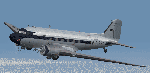
This download contains two liveries for the C-47 as owned and flown The Netherlands Government and is applicable for the Douglas C-47 V3 version by Manfred Jahn, Jan Visser and their team. This aircraft was once active in the II World War and thereafter stored in Germany. In 1946 it came in ownership with the Netherlands Government and was regularly flown by his RH Prince Bernard of The Netherlands and has flown for the Royal household for some years. In the first year it flew under its military registration and later it became registered as the well known PH-PBA. Requires "DOUGLAS_C-47_V3_12_BETA.ZIP" to be installed on your system in advance.The textures are based on the original textures from Jan Visser and have been modified by Emile Lancee.
| Filename: | The_Netherlands_Government_Douglas_C47_PHPBA_as_op.zip |
| License: | Freeware |
| Added: | 8th November 2016, 23:18:13 |
| Downloads: | 223 |
| Author: | Emile Lancee |
| Size: | 33.55 MB |
| Category: Flight Simulator X - Scenery | |
| FALE - King Shaka Airport, Durban, South Africa V2 |
|
File Description:
King Shaka International Airport, named after Shaka, leader of the Zulu nation in the early 19th century, also known as La Mercy Airport (after the area in which it is situated) and abbreviated as KSIA, will be the primary airport serving Durban, South Africa. Located at La Mercy, approximately 35 kilometers (22 mi) north of the city centre, it is expected to open on May 1, 2010 (just over a month before the start of the 2010 FIFA World Cup); replacing the existing Durban International Airport. All flights handled by Durban International Airport will terminate on April 30, 2010 and will move to King Shaka International Airport overnight, with KSIA handling its first flight on May 1, 2010.
This updated version caters for AI flight plans and Aircraft.
| Filename: | FALE__King_Shaka_Airport_Durban_South_Africa_V2.zip |
| License: | Freeware |
| Added: | 8th April 2010, 00:07:56 |
| Downloads: | 2,147 |
| Author: | Pierre Cornelissen & Mundus Yssel |
| Size: | 22.17 KB |
| Category: Flight Simulator X - Scenery | |
| FALE King Shaka Airport |
|
File Description:
King Shaka International Airport, named after Shaka, leader of the Zulu nation in the early 19th century, also known as La Mercy Airport (after the area in which it is situated) and abbreviated as KSIA, will be the primary airport serving Durban, South Africa. Located at La Mercy, approximately 35 kilometers (22 mi) north of the city centre, it is expected to open on May 1, 2010 (just over a month before the start of the 2010 FIFA World Cup); replacing the existing Durban International Airport. All flights handled by Durban International Airport will terminate on April 30, 2010 and will move to King Shaka International Airport overnight, with KSIA handling its first flight on May 1, 2010. This updated version caters for AI flight plans and Aircraft. I just added jetways
| Filename: | FALE_King_Shaka_Airport.zip |
| License: | Freeware |
| Added: | 2nd May 2010, 05:36:47 |
| Downloads: | 5,652 |
| Author: | Pierre Cornelissen & Mundus Yssel: Peter Vermeulen added jet ways |
| Size: | 28.58 KB |
| Category: Flight Simulator X - Scenery | |
| West Coast Victoria, Australia - 3 airports - YWBL Warrnambool YPOD Portland YPFA Port Fairy |
|
Images related to this file:
File Description:
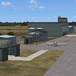
West Coast Victoria includes 3 airports YWBL Warrnambool YPOD Portland YPFA Port Fairy. This scenery is the latest version of these airports which are (were) available as separate files. It is a major update/improvement with more detail plus improvements to Warrnambool recently added in the real world. Surrounding scenery modified to match real life. Local obstacles (towers etc) added. Included are AI traffic files for all 3 airports + YHML Hamilton nearby. Recommend installing the excellent YHML Hamilton (by Anthony Lynch). These files are for Flight Simulator X. Made using Airport Design Editor using some objects borrowed from Robert Budd's excellent Baccus Marsh. RECOMMENDED The scenery is designed to interface with ORBX FTX_AU scenery for Australia (payware). It will work without ORBX but will not interface as well with standard scenery.
| Filename: | West_Coast_Victoria_Australia__3_airports___YWBL_W.zip |
| License: | Freeware |
| Added: | 10th December 2018, 03:03:09 |
| Downloads: | 456 |
| Author: | Colin Jeffery |
| Size: | 1.68 MB |
| Category: Flight Simulator X - Flight Plans | |
| Scenic Flight Through The Grand Canyon |
|
Images related to this file:
File Description:
FSX Flight Plan for a flight through the Grand Canyon. If you want some spectacular views and fun flying try out this flight plan. There are over 800 way points used that take you through most of the canyon. Two flights included. One going eastbound and the other going westbound. You will be flying in the default Cessna 172 with the autopilot connected. Just sit back and watch the scenery go by. Don't get too relaxed because there are a couple of turns that you will have to take control of the aircraft. Included in this package are two spectacular gauges by Karol Chlebowski for TFR flying and Pave Tack which enhance the sight seeing experience. Another option to download Version 2.1 of my mini panel which has all this functionality included and more.
| Filename: | Scenic_Flight_Through_The_Grand_Canyon.zip |
| License: | Freeware, limited distribution |
| Added: | 12th July 2011, 02:34:24 |
| Downloads: | 678 |
| Author: | Bill McClellan |
| Size: | 2.66 MB |
| Category: Flight Simulator X - AFCAD Files | |
| CYDF - Deer Lake Regional Airport / Deer Lake, Newfoundland and Labrador, Canada |
|
Images related to this file:
File Description:
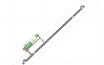
This airport update was made with the latest version of ADE (Airport Design Editor) and made for FSX as a replacement for the stock (default) airport. I've made several changes to the airport which are listed below. All these enchancements are as close to the real airport as I can get with stock library objects. I've used satellite images, terminal photos and maps throughout the whole process so building locations are as accurate as possible. Happy landings in the beautiful Canada!
Features:
*Expanded parking apron
*Main terminal building with commercial aircraft parking
*Seperate parking aprons for GA traffic
*Hangars and other airport buildings
*Airport vehicles and objects throughout the airport
*Parking lot with static vehicles
*Airport fire station with fire truck
*De-icing vehicle/runway plow
*Helipads
*Fuel tanks
| Filename: | CYDF__Deer_Lake_Regional_Airport__Deer_Lake_Newfou.zip |
| License: | Freeware |
| Added: | 1st August 2012, 13:11:03 |
| Downloads: | 379 |
| Author: | Jaison Diaz / Endeavour ai |
| Size: | 81.2 KB |
| Category: Flight Simulator X - Flight Plans | |
| Current Low Altitude Military Training Route in the Northhwestern United States |
|
Images related to this file:
File Description:
FSX Flight Plans for current low altitude military training route in the Northwestern U.S. This package includes 75 individual flight plans for IFR, VFR and Slow Speed Routes. These are great routes for B-52, F-111, B-1B, B-2 A6, A4, Vulcan and any fighter or bomber enthusiasts. Of course you can fly the route with any aircraft of your choice. Also included in this package are two spectacular gauges by Karol Chlebowski for TFR flying and Pave Tack which includes many advanced features for bombing, navigation and reconnaissance. These two gauges will greatly enhance
your ability to fly these challenging routes and are a great companion of the flight plans. Another option is to download Version 2.1 of my mini panel which has all this functionality and more.
| Filename: | Current_Low_Altitude_Military_Training_Route_in_th.zip |
| License: | Freeware |
| Added: | 16th September 2011, 14:15:22 |
| Downloads: | 426 |
| Author: | Bill McClellan |
| Size: | 5.37 MB |
| Category: Flight Simulator X - Flight Plans | |
| Current Low Altitude Military Training Route in Alaska |
|
Images related to this file:
File Description:
FSX Flight Plans for current low altitude military training route in Alaska. This package includes 53 individual flight plans for IFR, VFR and Slow Speed Routes. These are great routes for B-52, F-111, B-1B, B-2 A6, A4, Vulcan and any fighter or bomber enthusiasts. Of course you can fly the route with any aircraft of your choice. Also included in this package are two spectacular gauges by Karol Chlebowski for TFR flying and Pave Tack which includes many advanced features for bombing, navigation and reconnaissance. These two gauges will greatly enhance your ability to fly these challenging routes and are a great companion of the flight plans. Another option is to download Version 2.1 of my mini panel which has all this functionality and more.
| Filename: | Current_Low_Altitude_Military_Training_Route_in_Al.zip |
| License: | Freeware |
| Added: | 16th September 2011, 14:15:58 |
| Downloads: | 566 |
| Author: | Bill McClellan |
| Size: | 1.71 MB |
| Category: Flight Simulator X - Flight Plans | |
| Current Low Altitude Military Training Route in the Southwesternl United States |
|
Images related to this file:
File Description:
FSX Flight Plans for current low altitude military training route in the Southwestern U.S. This package includes 142 individual flight plans for IFR, VFR and Slow Speed Routes. These are great routes for B-52, F-111, B-1B, B-2 A6, A4, Vulcan and any fighter or bomber enthusiasts. Of course you can fly the route with any aircraft of your choice. Also included in this package are two spectacular gauges by Karol Chlebowski for TFR flying and Pave Tack which includes many advanced features for bombing, navigation and reconnaissance. These two gauges will greatly enhance your ability to fly these challenging routes and are a great companion of the flight plans. Another option
is to download Version 2.1 of my mini panel which has all this functionality and more.
| Filename: | Current_Low_Altitude_Military_Training_Route_in_th.zip |
| License: | Freeware |
| Added: | 16th September 2011, 14:14:58 |
| Downloads: | 382 |
| Author: | Bill McClellan |
| Size: | 7.03 MB |
| Category: Flight Simulator X - Flight Plans | |
| Current Low Altitude Military Training Route in the Northeastern United States |
|
Images related to this file:
File Description:
FSX Flight Plans for current low altitude military training route in the Northeastern U.S. This package includes 196 individual flight plans for IFR, VFR and Slow Speed Routes. These are great routes for B-52, F-111, B-1B, B-2 A6, A4, Vulcan and any fighter or bomber enthusiasts. Of course you can fly the route with any aircraft of your choice. Also included in this package are two spectacular gauges by Karol Chlebowski for TFR flying and Pave Tack which includes many advanced features for bombing, navigation and reconnaissance. These two gauges will greatly enhance your ability to fly these challenging routes and are a great companion of the flight plans. Another option is to download Version 2.1 of my mini panel which has all this functionality and more.
| Filename: | Current_Low_Altitude_Military_Training_Route_in_th.zip |
| License: | Freeware |
| Added: | 15th September 2011, 14:02:30 |
| Downloads: | 418 |
| Author: | Bill McClellan |
| Size: | 7.18 MB |


© 2001-2026 AVSIM Online
All Rights Reserved
Privacy Policy |