
Where Flight Simulation Enthusiasts Gather from Around the World!
AVSIM Library - Search Results

| Category: Flight Simulator X - Aircraft Repaints, Textures and Modifications | |
| Qantas Boeing 737-800WL (VH-VXA) |

|
Images related to this file:
File Description:

Qantas Boeing 737-838 VH-VXA in the standard livery was the first B738 to join Qantas' fleet.
| Filename: | Qantas_Boeing_737800WL_VHVXA.zip |
| License: | Freeware, limited distribution |
| Added: | 11th November 2014, 17:52:35 |
| Downloads: | 192 |
| Author: | Mathew Tank |
| Size: | 71.33 MB |
| Category: Flight Simulator X - Scenery | |
| Tobago TTCPx Patch Ver. 1.2 ( Rev. 7 ) |
|
Images related to this file:
File Description:
Unofficial LatinVFR Tobago TTCP for FSX Expansion Pack. This freeware patch contents: a new photoreal scenery with seasons to local airport area ( day and night for winter/fall and summer/spring seasons ); a new land and water classification in the entire island of Tobago; a correction of the entire island terrain including a better flatten around the airport area; more buildings, objects, vegetation and life around on the island of Tobago ( FSX default fictitious objects ); more road traffic over the photoreal area; and other minor fixes. System Requirements: LatinVFR Tobago TTCP v1.1 for FSX and Microsoft Flight Simulator X SP2 or Acceleration.
| Filename: | Tobago__TTCPx_Patch_Ver_12__Rev_7_.zip |
| License: | Freeware |
| Added: | 19th August 2010, 22:54:02 |
| Downloads: | 843 |
| Author: | Gladson Moreira |
| Size: | 30.76 MB |
| Category: Flight Simulator X - Scenery | |
| Shahjalal International Airport (Zia) v1.1 |
|
Images related to this file:
File Description:
Updates and Fixed Issues:
**The "VGZR_ADEX_FSX.bgl" is re-edited;
**Some other minor bugs where fixed.
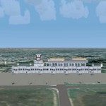
The biggest Shahjalal International Airport (Zia). Meticulously detailed and realistically depicted Flight Simulator X scenery for Shahjalal International Airport (Zia). Created with 3ds max from scratch, the scenery includes accurate buildings, hangars, parking bays, night texturing and illumination effects. The scenery contains variety of static aircraft and animations and photo real terrain texture. This a complete scenery for FSX. The ZIA_Shahjalal International Airport is the busiest airport in Bangladesh and provides access to 4,6 Mio. million passengers a year.
| Filename: | Shahjalal_International_Airport_Zia_v11.zip |
| License: | Freeware |
| Added: | 8th January 2012, 07:38:28 |
| Downloads: | 4,620 |
| Author: | Huseyin Buharali |
| Size: | 14.01 MB |
| Category: Flight Simulator X - Scenery | |
| Whale Island Scenery: "Islands of the Bay of Plenty" |
|
File Description:
This scenery was created from a digital Orthorectified aerial mosaic owned by Environment Bay of Plenty (The Bay of Plenty Regional Council). The imagery has been de-sampled for use in Flight Simulator X and utilizes the default terrain mesh. The textures are intended for summer daylight flying only, although due to the sparse nature of White Islands' Evegetation, the Islands appearance remains relatively consistent throughout the year.
It includes autogen trees, a landable helicopter pad on the top of the Island, Radio masts, and the Department of Conservation (DOC) hut in the south western bay of the island.
| Filename: | Whale_Island_Scenery__Islands_of_the_Bay_of_Plenty.zip |
| License: | Freeware, limited distribution |
| Added: | 9th May 2007, 08:42:59 |
| Downloads: | 1,496 |
| Author: | Tim Barnes |
| Size: | 7.05 MB |
| Category: Flight Simulator X - Utilities | |
| Key2Mouse Universal 1.03 |
|
File Description:
Can be used to convert user-defined keypresses into mouse's actions. Users of programmable joysticks, joypads, special keypads or hardware instrument panels, may find it useful to control software (for example simulated instruments and gauges) accepting mouse clicks only. This utility has been specifically developed for Microsoft Flight Simulator X, but may work in other simulators or games as well. Used in demo mode, handles a maximum of 3 macros for 10 minutes per session (restart the program to get additional time). New version having improved compatibility with Windows Vista, easier software registration and minor bug fixes.
| Filename: | Key2Mouse_Universal_103.zip |
| License: | Shareware, time limited |
| Added: | 28th February 2007, 16:55:52 |
| Downloads: | 290 |
| Author: | Luciano Napolitano |
| Size: | 1.83 MB |
| Category: Flight Simulator X - AFCAD Files | |
| KEUG - Mahlon Sweet Field Airport | Eugene, Oregon (Ver. 2) |
|
File Description:
This is an improved version of the stock KEUG (Mahlon Sweet Field Airport) located in Eugene, Oregon, USA. Two major changes have been made: (1) runway 3-21 has been removed and (2) runway 34R-16L has been added. Both of these changes were made to the airport several years ago but have not been reflected in Flight Simulator.
Version 2 includes corrections of the 34L-16R end runway descriptors, repair of some taxiways and signs, re-alignment of a portion of the terminal building and the addition of several static objects including fuel trucks.
| Filename: | KEUG__Mahlon_Sweet_Field_Airport__Eugene_Oregon_Ve.zip |
| License: | Freeware |
| Added: | 26th March 2009, 21:17:06 |
| Downloads: | 855 |
| Author: | Dan Reynolds |
| Size: | 13.59 KB |
| Category: Flight Simulator X - Scenery | |
| Alaska Navaid Update 2011 |
|
Images related to this file:
File Description:
The default Flight Simulator database of VOR/NDB's is fast becoming out of date, Making
VOR navigation using current IFR en-route charts impractical to impossible. When flying along
charted airways, this discrepancy can cause you to become far off course. This update solves
that problem by re calibrating all navigation aids in Alaska based on information submitted to
the FAA January 13, 2011. This allows you to accurately navigate using any navaid in Alaska
while using current IFR en-route charts. This update includes magnetic variation data, and
navaid position. All data was compiled from the ground up. http://akfsnavaid.zzl.org
| Filename: | Alaska_Navaid_Update_2011.zip |
| License: | Check within download |
| Added: | 29th March 2011, 00:56:19 |
| Downloads: | 1,108 |
| Author: | Wilson Malone |
| Size: | 499.91 KB |
| Category: Flight Simulator X - Scenery Design | |
| Animated Flags Library |
|
File Description:
This scenery lib has been developed on Win 7 for FSX Flight Simulator SP1 or SP2. The package provides a little collection of animated flags for scenery designers and FS users who do understand on how to use a addon object library in FSX. The animated flag models have been developed with GMAX. Along with the textures the package includes the model bgl files and the texture files only. It is up to a tool like ADE, SBuilder etc. for example, to add the corresponding placement data. For more information look at the ReadMe file inside the zip. By: Dietmar Loleit
| Filename: | Animated_Flags_Library.zip |
| License: | Freeware |
| Added: | 30th October 2014, 19:28:40 |
| Downloads: | 610 |
| Author: | Dietmar Loleit |
| Size: | 2.24 MB |
| Category: Flight Simulator X - Aircraft Repaints, Textures and Modifications | |
| Air France Old Livery Collection (Airbus A332 | A342 | A342 Asie | A343) |
|
Images related to this file:
File Description:

This is a repaint collection/pack of Air France aircraft for Thomas Ruth's Airbus A332/A342/A343 series in the Old Livery. Original models created by Thomas Ruth. Repaints by John Hancock. This is a TEXTURES ONLY download, as you are required to install Thomas Ruth's original Airbus Packages before installation. This addon is only compatible with Flight Simulator X Service Pack 1 (SP1) and Service Pack 2 (SP2). Includes added Alpha Channels, fuselage dirt effects, Photoreal windows, and accurate livery details.
(This also contains the A340-200 Asie Version 2.0 and A340-300 Version 3.0 packages).
| Filename: | Air_France_Old_Livery_Collection_Airbus_A332__A342.zip |
| License: | Freeware |
| Added: | 2nd August 2011, 09:35:54 |
| Downloads: | 1,438 |
| Author: | Thomas Ruth / John Hancock |
| Size: | 14.25 MB |
| Category: Flight Simulator X - Scenery | |
| EKSP Skrydstrup version 1.2 update |
|
Images related to this file:
File Description:
EKSP Skrydstrup version 1.2 update, for Microsoft Flight Simulator X/Lockheed Martin Prepar3D (all versions)
Maintenance update, including compatibility fixes for LM Prepar3D version 4.
Changelog:
---------
Updated tower frequency to reflect real life changes: 118.275 MHz
Added ATIS as currently in use: 113.900 MHz
Straightened taxiway N.
Added aircraft parking spot for very large aircraft (i.e. An-225.).
Updated service vehicle parking.
Corrected wayward perimeter fence in the NW corner.
Excluded stock airport background polygon.
Moved F-16 gate guard textures to the main "Texture" folder.
Optimized light effects for minimal FPS impact.
Ramp lighting is now dynamic in P3D version 4.
| Filename: | EKSP_Skrydstrup_version_12_update.zip |
| License: | Freeware |
| Added: | 8th June 2017, 03:24:57 |
| Downloads: | 757 |
| Author: | Jens Peter Pedersen |
| Size: | 2.26 MB |


© 2001-2026 AVSIM Online
All Rights Reserved
Privacy Policy |