
Where Flight Simulation Enthusiasts Gather from Around the World!
AVSIM Library - Search Results

| Category: Flight Simulator X - Aircraft Repaints, Textures and Modifications | |
| Modification of the power table for the Continental IO-520-F Cessna CU206G Stationair 6 II de CARENADO. |

|
Images related to this file:
File Description:

New update of flight dynamics settings.
Corrected the indicated speed error (KIAS) vs the true speed (KTAS) according to the data suggested in the pilot's operating manual (POH).
In some cases the position of the center of gravity unladen weight is corrected for a better weight and balance of the airplane.
Actual direct references from Pilot Operations Manual (POH) for specific details, Power,
Nose or pitch position and weight and balance settings, airplane geometry, piston or turbine engine data,
propeller and everything that refers to references, also the real references of the manufacturers of sea engines whatever the specific case.
This model in particular, I am sure that the gauges have a difference error between what the indicator of
manifold pressure and actual airplane reading, similar case to the PA34 Seneca II, the RPM tachometer needle marked 2500 and the
Maus cursor on the tachometer said there were 2200 rpm.
In this modification of the Cessna CU206G Stationair 6 II there is still an error that could not be adjusted to what it says in manual
pilot operation (POH) because it is a gauge error and not an adjustment error in the .air file.
When the error is corrected it will be published together with a new and improved VC.
| Filename: | Modification_of_the_power_table_for_the_Continenta.zip |
| License: | Freeware |
| Added: | 15th April 2020, 18:48:28 |
| Downloads: | 147 |
| Author: | Rafael Ledezma |
| Size: | 642.83 KB |
| Category: Flight Simulator X - AFCAD Files | |
| Toulouse-Blagnac Airport Scenery (LFBO) |
|
Images related to this file:
File Description:
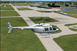
This is an FSX addon scenery of the Toulouse-Blagnac Airport (LFBO). It has been made using the excellent freeware tool ADE. It includes the new terminal gates, the A380 production line (using Lagardere) at the north of the airport, the new delivery center called Aire Ziegler where the brand new A380s are delivered. I modified taxiways and parking to make them look like in the reality. There are two landing pads for helicopters like in reality. I have changed the parking assignment to make sure that the usual traffic will park on the parkings E, F D AB, V and U, as it is on the reality. Finally, the close surroundings of the airport were modified to display the Airbus facilities as far as possible with generic buildings.
| Filename: | ToulouseBlagnac_Airport_Scenery_LFBO.zip |
| License: | Freeware |
| Added: | 13th June 2011, 03:32:00 |
| Downloads: | 1,392 |
| Author: | Jose Mauriz |
| Size: | 220.42 KB |
| Category: Flight Simulator X - Flight Plans | |
| OB-17 Statesboro Georgia Low Altitude |
|
Images related to this file:
File Description:
FSX Flight Plan for OB-17 Statesboro GA IFR high speed low altitude military training route. This is the second in a series of flight plans I will be uploading in the near future. These are great routes for B-52, F-111, B-1B, B-2 A6, A4, Vulcan and any fighter or bomber enthusiasts. Of course you can fly the route with any aircraft of your choice. Included in this package are two spectacular gauges by Karol Chlebowski for TFR flying and Pave Tack which includes many advanced features for bombing, navigation and reconnaissance. These two gauges will greatly enhance your ability to fly these challenging routes and are a great companion of the flight plans. Another option to download Version 2.1 of my mini panel which has all this functionality and more.
| Filename: | OB17_Statesboro_Georgia_Low_Altitude.zip |
| License: | Freeware, limited distribution |
| Added: | 9th July 2011, 01:01:27 |
| Downloads: | 215 |
| Author: | Bill McClellan |
| Size: | 889.26 KB |
| Category: Flight Simulator X - Flight Plans | |
| Flight Plans for Current Low Altitude Military Training Route in the Southeastern US. |
|
Images related to this file:
File Description:
FSX Flight Plans for current low altitude military training route in the Southeastern US. This package includes 196 individual flight plans for IFR, VFR and Slow Speed Routes. These are great routes for B-52, F-111, B-1B, B-2 A6, A4, Vulcan and any fighter or bomber enthusiasts. Of course you can fly the route with any aircraft of your choice. Also included in this package are two spectacular gauges by Karol Chlebowski for TFR flying and Pave Tack which includes many advanced features for bombing, navigation and reconnaissance. These two gauges will greatly enhance your ability to fly these challenging routes and are a great companion of the flight plans. Another option to download Version 2.1 of my mini panel which has all this functionality and more.
| Filename: | Flight_Plans_for_Current_Low_Altitude_Military_Tra.zip |
| License: | Freeware, limited distribution |
| Added: | 14th September 2011, 09:20:30 |
| Downloads: | 368 |
| Author: | Bill McClellan |
| Size: | 7.93 MB |
| Category: Flight Simulator X - Flight Plans | |
| Current Low Altitude Military Training Route in the Northeastern United States |
|
Images related to this file:
File Description:
FSX Flight Plans for current low altitude military training route in the Northeastern U.S. This package includes 196 individual flight plans for IFR, VFR and Slow Speed Routes. These are great routes for B-52, F-111, B-1B, B-2 A6, A4, Vulcan and any fighter or bomber enthusiasts. Of course you can fly the route with any aircraft of your choice. Also included in this package are two spectacular gauges by Karol Chlebowski for TFR flying and Pave Tack which includes many advanced features for bombing, navigation and reconnaissance. These two gauges will greatly enhance your ability to fly these challenging routes and are a great companion of the flight plans. Another option is to download Version 2.1 of my mini panel which has all this functionality and more.
| Filename: | Current_Low_Altitude_Military_Training_Route_in_th.zip |
| License: | Freeware |
| Added: | 15th September 2011, 14:02:30 |
| Downloads: | 419 |
| Author: | Bill McClellan |
| Size: | 7.18 MB |
| Category: Flight Simulator X - Flight Plans | |
| Current Low Altitude Military Training Route in the South Central United States |
|
Images related to this file:
File Description:
FSX Flight Plans for current low altitude military training route in the South Central U.S. This package includes 179 individual flight plans for IFR, VFR and Slow Speed Routes. These are great routes for B-52, F-111, B-1B, B-2 A6, A4, Vulcan and any fighter or bomber enthusiasts. Of course you can fly the route with any aircraft of your choice. Also included in this package are two spectacular gauges by Karol Chlebowski for TFR flying and Pave Tack which includes many advanced features for bombing, navigation and reconnaissance. These two gauges will greatly enhance your ability to fly these challenging routes and are a great companion of the flight plans. Another option is to download Version 2.1 of my mini panel which has all this functionality and more.
| Filename: | Current_Low_Altitude_Military_Training_Route_in_th.zip |
| License: | Freeware |
| Added: | 16th September 2011, 14:13:54 |
| Downloads: | 342 |
| Author: | Bill McClellan |
| Size: | 4.74 MB |
| Category: Flight Simulator X - Flight Plans | |
| Current Low Altitude Military Training Route in the North Central United States |
|
Images related to this file:
File Description:
FSX Flight Plans for current low altitude military training route in the North Central U.S. This package includes 77 individual flight plans for IFR, VFR and Slow Speed Routes. These are great routes for B-52, F-111, B-1B, B-2 A6, A4, Vulcan and any fighter or bomber enthusiasts. Of course you can fly the route with any aircraft of your choice. Also included in this package are two spectacular gauges by Karol Chlebowski for TFR flying and Pave Tack which includes many advanced features for bombing, navigation and reconnaissance. These two gauges will greatly enhance your ability to fly these challenging routes and are a great companion of the flight plans. Another option is to download Version 2.1 of my mini panel which has all this functionality and more.
| Filename: | Current_Low_Altitude_Military_Training_Route_in_th.zip |
| License: | Freeware |
| Added: | 16th September 2011, 14:14:26 |
| Downloads: | 388 |
| Author: | Bill McClellan |
| Size: | 5.13 MB |
| Category: Flight Simulator X - Flight Plans | |
| Current Low Altitude Military Training Route in the Southwesternl United States |
|
Images related to this file:
File Description:
FSX Flight Plans for current low altitude military training route in the Southwestern U.S. This package includes 142 individual flight plans for IFR, VFR and Slow Speed Routes. These are great routes for B-52, F-111, B-1B, B-2 A6, A4, Vulcan and any fighter or bomber enthusiasts. Of course you can fly the route with any aircraft of your choice. Also included in this package are two spectacular gauges by Karol Chlebowski for TFR flying and Pave Tack which includes many advanced features for bombing, navigation and reconnaissance. These two gauges will greatly enhance your ability to fly these challenging routes and are a great companion of the flight plans. Another option
is to download Version 2.1 of my mini panel which has all this functionality and more.
| Filename: | Current_Low_Altitude_Military_Training_Route_in_th.zip |
| License: | Freeware |
| Added: | 16th September 2011, 14:14:58 |
| Downloads: | 383 |
| Author: | Bill McClellan |
| Size: | 7.03 MB |
| Category: Flight Simulator X - Flight Plans | |
| Current Low Altitude Military Training Route in the Northhwestern United States |
|
Images related to this file:
File Description:
FSX Flight Plans for current low altitude military training route in the Northwestern U.S. This package includes 75 individual flight plans for IFR, VFR and Slow Speed Routes. These are great routes for B-52, F-111, B-1B, B-2 A6, A4, Vulcan and any fighter or bomber enthusiasts. Of course you can fly the route with any aircraft of your choice. Also included in this package are two spectacular gauges by Karol Chlebowski for TFR flying and Pave Tack which includes many advanced features for bombing, navigation and reconnaissance. These two gauges will greatly enhance
your ability to fly these challenging routes and are a great companion of the flight plans. Another option is to download Version 2.1 of my mini panel which has all this functionality and more.
| Filename: | Current_Low_Altitude_Military_Training_Route_in_th.zip |
| License: | Freeware |
| Added: | 16th September 2011, 14:15:22 |
| Downloads: | 426 |
| Author: | Bill McClellan |
| Size: | 5.37 MB |
| Category: Flight Simulator X - Flight Plans | |
| Current Low Altitude Military Training Route in Alaska |
|
Images related to this file:
File Description:
FSX Flight Plans for current low altitude military training route in Alaska. This package includes 53 individual flight plans for IFR, VFR and Slow Speed Routes. These are great routes for B-52, F-111, B-1B, B-2 A6, A4, Vulcan and any fighter or bomber enthusiasts. Of course you can fly the route with any aircraft of your choice. Also included in this package are two spectacular gauges by Karol Chlebowski for TFR flying and Pave Tack which includes many advanced features for bombing, navigation and reconnaissance. These two gauges will greatly enhance your ability to fly these challenging routes and are a great companion of the flight plans. Another option is to download Version 2.1 of my mini panel which has all this functionality and more.
| Filename: | Current_Low_Altitude_Military_Training_Route_in_Al.zip |
| License: | Freeware |
| Added: | 16th September 2011, 14:15:58 |
| Downloads: | 566 |
| Author: | Bill McClellan |
| Size: | 1.71 MB |


© 2001-2026 AVSIM Online
All Rights Reserved
Privacy Policy |