
Where Flight Simulation Enthusiasts Gather from Around the World!
AVSIM Library - Search Results

| Category: Flight Simulator X - Scenery | |
| 50 German UL airfields which are not included in FSX, Part 3 |

|
File Description:
50 UL airfields which are not included in FSX, located in West of Germany:
Heinsberg-Selfkant, Moenchsheide, Eudenbach, Weilerswist, Kell, Daun Senheld, Hinterweiler, Ernzen, Utscheid, Wendelsheim, Kirn, Bell-Hundheim, Naunheim/Maifeld, Nastaetten, Singhofen, Montabaur, Bad Marienberg, Hof Wahl, Arnsberg –Ruhrwiese, Oeventrop-Ruhrwiesen, Riedelbach, Zellhausen-Seligenstadt, Langenselbold, Nidda, Schotten, Altenbachtal/Obernau, Reinheim, Altfeld, Vielbrunn, Rothenberg, Michelbach am Asp, Dauborn, Wustweiler, Schwarzenbach-Bostalsee, Marpingen, Dillingen-Diefflen, Kusel-Langenbach, Ludwigshafen-Dannstadt, Quirnheimer Berg, Imsweiler-Donnersberg, Rossberg, Buerstadt, Malsch, Voelkleshofen-Lichtenberg, Grosserlach-Morbach, Sulz am Neckar, Haiterbach-Nagold, Pfalzgrafenweiler, EDRX Neunkirchen-Bexbach, EDTE Eutingen im Gaeu.
| Filename: | 50_German_UL_airfields_which_are_not_included_in_F.zip |
| License: | Freeware |
| Added: | 1st November 2017, 19:18:37 |
| Downloads: | 708 |
| Author: | Juergen Wolf |
| Size: | 27.89 MB |
| Category: Flight Simulator X - Scenery | |
| RAF Manston 1944 |
|
File Description:
RAF Manston (ICAO EGMH)was an RAF station in the north-east of Kent, on the Isle of Thanet from 1916 until 1996. The site is now split between a commercial airport Kent International Airport (KIA) and a continuing military use by the Defence Fire Training and Development Centre (DFTDC), following on from a long-standing training facility for RAF firefighters at the Manston base.
Source: Wikipedia
I have represented it here in 1944 leading up to its part in Operation Market garden and D Day. It was one of the few airfields installed with the Fog Investigation Dispersal Organisation (FIDO) system designed to remove fog from airfields by burning it off with petrol and I have represented this with the 8 fuel tanks at the 29 end of the mail runway. I have laid the station out roughly according to an old map made in the mid 40s but I make no claims to the accuracy of building I have used.
| Filename: | RAF_Manston_1944.zip |
| License: | Freeware |
| Added: | 26th April 2016, 00:15:35 |
| Downloads: | 160 |
| Author: | Terry Boissel |
| Size: | 1.71 MB |
| Category: Flight Simulator X - Scenery | |
| Default Military Airbase Upgrade |
|
File Description:
FSX Default military and naval airfields rarely have anything other than a fuel box and I've decided to upgrade them with parking for military combat and cargo aircraft and fuel trucks. Fuel boxes are fine for GA airports but for larger airports they don't make sense. Plus the arrival of the fuel truck to service an AI aircraft prior to clearance adds some realism. There are quite a number of good sceneries already available but they often don't include fuel trucks and aren't always AI-friendly. A new initiative by airsource.us to include a militarycontract division has inspired me to share some of my upgrades with fellow airsource.us pilots. The airfields include: EGQL, EGQS, EGUN, EGVA, EGVN, EHLW, ETAD, ETAR, ETNH, LCRA, LEGT, LFOA, LFOE, LFRJ, LIPA, LLOV, LLRD, LLRM, OETB, OJ40, OJAM, LPLA, KFFO, KNTU, KOFF, KDYS, KHOP, KPOB, KBAD, KLRF, KLUF, KVBG, KWRI (added fuel truck and taxiway lights to Jim Cook's KWRI scenery). I highly recommend KDOV by JB Loney.
| Filename: | Default_Military_Airbase_Upgrade.zip |
| License: | Freeware |
| Added: | 3rd June 2018, 17:44:49 |
| Downloads: | 1,442 |
| Author: | Barry Woodward |
| Size: | 196.26 KB |
| Category: Flight Simulator X - Scenery | |
| RAF Humbertson |
|
File Description:
This scenery is just a bit of fun to give the Lincolnshire landscape a bit of scenery to look at whilst flying
between the many airfields the county has to offer sim pilots. As well as the radar masts I have included a couple
of buildings to add a bit of interest, such as the Station Commanders house and a couple of airmen quarters,
workshops and and admin building.
| Filename: | RAF_Humbertson.zip |
| License: | Freeware |
| Added: | 21st October 2015, 20:30:48 |
| Downloads: | 230 |
| Author: | Terry Boissel |
| Size: | 5.71 KB |
| Category: Flight Simulator X - Original Aircraft | |
| Gorkha Airways Dornier Do228-212 |
|
File Description:
FSX Dornier Do228-212 19 seat commuter & utility STOL aircraft.
9N-AHS of Gorkha Airlines, Nepal. This aircraft mostly flies tourists
to remote airfields in the Himalayas.
New model with full animation, dynamic shine & reflective textures.
Includes a 2D Panel and VC with a complete passenger cabin,
opening passenger door with airstair, cargo doors and sound.
Compatible with Acceleration/SP2
By Jean-Pierre Brisard, Bob May, Joe Zerilli - Premier Aircraft Design
| Filename: | Gorkha_Airways_Dornier_Do228212.zip |
| License: | Freeware, limited distribution |
| Added: | 26th October 2008, 15:15:22 |
| Downloads: | 2,308 |
| Author: | Premier Aircraft Design |
| Size: | 3.34 MB |
| Category: Flight Simulator X - Scenery | |
| Detailed Terrain Features for Southern Africa, Update 10 |
|
Images related to this file:
File Description:
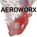
Scenery consist of Updated Terrain Vector data concerning Coastlines, rivers, dams, lakes, streams, roads, traffic, railroads, power lines and extrusion bridges for Southern African countries South of the Equator. Work was done around FAVG (Virginia), FALL (Lydenburg) Airfields and in the areas around Durban, Western Cape and Eastern Cape, With this scenery it is important to install the previous release of "fsxWorx01" and updates 1 to 9 before this file.
| Filename: | Detailed_Terrain_Features_for_Southern_Africa_Upda.zip |
| License: | Freeware |
| Added: | 25th May 2014, 13:07:44 |
| Downloads: | 2,823 |
| Author: | Hannes Steyn, Aeroworx |
| Size: | 4.72 MB |
| Category: Flight Simulator X - Scenery | |
| Denmark V1.4 |
|
Images related to this file:
File Description: FSX Denmark Scenery v1.4 Part Two. The scenery includes a number of airports,
airfields and VFR landmarks throughout the country, with special attention to
the cities Copenhagen and Aalborg. This scenery is compatible with photo
sceneries, "Denmark Map x" and default FSX.

It is recommended to read the wiki:
http://www.fsonline.dk/en/index.php?title=Denmark_Scenery
before installing this package.
| Filename: | Denmark_V14.zip |
| License: | Freeware |
| Added: | 10th November 2012, 16:21:42 |
| Downloads: | 8,888 |
| Author: | The Denmark Scenery Team |
| Size: | 246.75 MB |
| Category: Flight Simulator X - Scenery | |
| RAF Hutton Cranswick |
|
File Description:
RAF Hutton Cranswick opened in January 1942 as a fighter airfield within No. 12 Group RAF. Unusually for the time its three runways were concrete "from new", many airfields (particularly fighter airfields) were initially built with grass runways which were later upgraded to concrete.
Many squadrons rotated through the airfield including 610, 19, 308 (City of Kraków), 316 (City of Warsaw), 195, 306 (City of Torun), 302 (City of Poznan), 315 (City of Deblin), 234, 168 and No. 170 Squadron RAF. From December 1943, the Anti-Aircraft Co-operation 291 Squadron was formed at the airfield for target towing and similar uses.
Whilst in use by 291 other fighter squadrons continued to rotate through including 401, 403, 412, 441, 442, 443 (all flying Supermarine Spitfires) and 439 using Hawker Typhoons. The final unit to operate from Hutton Cranswick was No. 124 Squadron RAF using Spitfire IXs.
The station closed in 1946 and has reverted back to farm land, an industrial site now stands were the tech site was situated and the tower became a house.
Source:Wikipedia
| Filename: | RAF_Hutton_Cranswick.zip |
| License: | Freeware |
| Added: | 27th February 2017, 15:12:55 |
| Downloads: | 125 |
| Author: | Terry Boissel |
| Size: | 4.95 MB |
| Category: Flight Simulator X - Miscellaneous Files | |
| Plan-G data files for New Zealand South Island (NZSI) |
|
File Description:
Plan-G data files for FSX payware Orbx/New Zealand South Island (NZSI).
These PlanG datas display spots of all objects which are provided with the above mentioned software (Points of interest like unlisted airfields, dams, windfarms, lighthouses, huts, etc.) and which are not inserted automatically into PlanG during database re-built. So pick the datas you like to see on your PlanG map and import them into PlanG. For further instructions see the included "readme".
| Filename: | PlanG_data_files_for_New_Zealand_South_Island_NZSI.zip |
| License: | Freeware |
| Added: | 25th March 2012, 21:23:53 |
| Downloads: | 306 |
| Author: | Harald Klose, Dieter Linde |
| Size: | 19.68 KB |
| Category: Flight Simulator X - Scenery | |
| German_UL_Airfields_2 |
|
File Description:
50 UL airfields which are not included in FSX:
Peine, Bisperode, Bueren, Grifte, Warburg, Dehausen, Waldeck, Bad Wildungen, Schwalmstadt, Homberg, Giessen-Wieseck, Butzbach, Braunfels, Asslarer Huette, Hoerbach, Plaetzer, Alsfeld, Uslar, Aue-Hattorf, Burgberg, Hessisch-Lichtenau, Stauffenbuehl, Brakel, Hoppensen, Uehrde, Salzgittersee, Grosse Wiese, Dorstadt, Rote Wiese, Kunrau, Dingelstedt, Moeckern, Woermlitz, Erkelenz, Radevormwald, Waltrop, Dorsten, Emmerich-Palmerswardt, Kerken, Everswinkel, Metelen, Paradiek, Donstorf, Norddoellen, Quakenbrueck, Dankern, Lindlar, Vettweiss-Soller, Morschenich, Linnich-Boslar.
Update for Riesa-Canitz and Mellenthin from German_UL_Airfields_1
| Filename: | German_UL_Airfields_2.zip |
| License: | Freeware |
| Added: | 20th September 2017, 17:41:08 |
| Downloads: | 465 |
| Author: | Juergen Wolf |
| Size: | 35.23 MB |


© 2001-2026 AVSIM Online
All Rights Reserved
Privacy Policy |