
Where Flight Simulation Enthusiasts Gather from Around the World!
AVSIM Library - Search Results

| Category: Flight Simulator 2004 - Scenery | |
| SRTM Mesh for Madagascar Part 2 |

|
File Description:
this is the part 2 of madagascar mesh, it cover the south of island, enjoy
| Filename: | SRTM_Mesh_for_Madagascar_Part_2.zip |
| License: | Freeware, limited distribution |
| Added: | 2nd April 2004, 15:40:35 |
| Downloads: | 10,843 |
| Author: | jean gabriel laurent |
| Size: | 24.21 MB |
| Category: Flight Simulator 2004 - Scenery | |
| Great Falls - Malmstrom Long Range Radar Complex |
|
File Description:
The Great Falls Malmstrom LRR [GFA] sits on Bootlegger Ridge in Montana. The site sits 8 nm northeast of Great Falls International [KGTF]. A short range VOR [108.00] and helipad are included. Scenery sets are provided for the FSGenesis terrain mesh, and the standard fs9 terrain mesh.
| Filename: | Great_Falls__Malmstrom_Long_Range_Radar_Complex.zip |
| License: | Freeware |
| Added: | 19th October 2007, 21:07:22 |
| Downloads: | 572 |
| Author: | Brett Delana |
| Size: | 274.26 KB |
| Category: Flight Simulator 2004 - Scenery | |
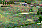
| Beaver Creek CYXQ in Yukon Territory, Canada |
|
Images related to this file:
File Description:
Beaver Creek is located at mile 1202 of the Alaska Highway, just east of the Alaska/Yukon border. The populaton is around 100 and the main employment is with the Border Agency, the White River First Nation, or with local tourist lodges. The airfield is a mile north of the town and close to the Canadian border post, which is included in the scenery. It was built by Jack Stalberg in the 1960's, and I have no further information beyond the fact that he loved to fly. The airport serves as an "airport of entry", though it is restricted in hours of opening and in the size of aircraft that it can handle; up to a maximum of only 15 seats. The single runway is 3,745 feet long and 100 feet wide, gravel, aligned 13-31 in FS9, lit, and with vasi at both ends. Righthand circuits for runway 13. There is a 340 feet threshold displacement to runway 31, which is of course unmarked on a gravel runway. The terminal building was recently reclad; I don't like it, but they didn't consult me. The ai reflects the sort of traffic the airfield gets; ie brief paperwork stopovers for GA or small charter flights into Canada from Alaska, usually in the mornings.I have adjusted the local scenery terrain levels to remove adjacent hills that I believe do not exist in real life but are part of the Northern Canada terrain mesh that I have installed. If you do not have this mesh you may find that the scenery works fine for you without the API flatten that is included here. The airfield is at 2,129 feet ASL.
| Filename: | Beaver_Creek_CYXQ_in_Yukon_Territory_Canada.zip |
| License: | Freeware, limited distribution |
| Added: | 28th January 2019, 06:19:20 |
| Downloads: | 174 |
| Author: | Roger Wensley |
| Size: | 4.68 MB |
| Category: Flight Simulator 2004 - Scenery | |
| SKMZ La Nubia Airport - Manizales, Colombia |
|
File Description:
SKMZ La Nubia airport, Manizales, Colombia. Based on pictures and videos. Use of a mesh (e.g. 2002/2004 Colombia mesh by Raimondo Taburet available at flightsim.com) is highly recommended as the airport is in a mountaineous region and difficult to approach, but scenery should also work with default scenery.
| Filename: | SKMZ_La_Nubia_Airport__Manizales_Colombia.zip |
| License: | Freeware |
| Added: | 4th February 2012, 18:19:18 |
| Downloads: | 1,141 |
| Author: | Detlev J. Rohmer |
| Size: | 16.05 MB |
| Category: Flight Simulator 2004 - Scenery | |
| Polikhnitos |
|
File Description:
The default Polikhnitos airport isn't placed correctly and causes "plateaus" problems with high resolution mesh. A plateaus problems is when you have a default airport badly placed and mesh installed that has a higher resolution than the default mesh you will have airports at the bottom of a crater or on a "Ayers rock". This scenery fixes the problem and allows you to use meshes up to 38m. Not tested with higher resolution, I don't think meshes of 19m exist for that region.
| Filename: | Polikhnitos.zip |
| License: | Freeware |
| Added: | 14th July 2007, 10:20:16 |
| Downloads: | 617 |
| Author: | Jean-paul Marchetti |
| Size: | 896.7 KB |
| Category: Flight Simulator 2004 - Scenery | |
| Guatemala & Honduras SRTM Mesh Part 1 |
|
File Description:
This terrain mesh scenery was made to fit Jozef Kusters' Nicaragua mesh on its south-eastern edges. It covers Guatemala, western & northern Honduras (including Isl de la Bahia - Roatan), Belize and Salvador. Based on SRTM Data (3 arc/sec), generated with Matthew Styles's program "SRTM To BGL v1.04", sampled to LOD9 resolution (76m) with 5 interpolation passes. While tested under Fs2004, this mesh should also run in FS2002.
This part contains Guatemala-S.BGL. See guatemala_honduras_mesh_pt1.jpg for .BGL files coverage.
| Filename: | Guatemala__Honduras_SRTM_Mesh_Part_1.zip |
| License: | Freeware |
| Added: | 30th September 2003, 15:19:59 |
| Downloads: | 6,991 |
| Author: | Yohann Baptiste |
| Size: | 16.92 MB |
| Category: Flight Simulator 2004 - Scenery | |
| Greece SRTM Mesh Part 2 |
|
File Description:
This terrain mesh scenery covers Greece, including all Aegean sea islands, plus most parts of Albania and Macedonia up to 41°50'N. Some parts of Bulgaria and Turkey are also included in northern and eastern boundaries of the mesh. The greek island of Crete isn't part of this mesh because SRTM data isn't yet released for the whole island.
Based on SRTM Data (3 arcsec, 90m), generated with Matthew Styles's program "SRTM To BGL v1.04", sampled to LOD9 resolution (76m). While only tested with Fs2004, this mesh should also run with FS2002.
This part contains all bgl files except Greece-N.bgl, Greece-NE1.bgl and Greece-NE2.bgl. See Greece_Mesh_Part2-1.jpg for details.
| Filename: | Greece_SRTM_Mesh_Part_2.zip |
| License: | Freeware |
| Added: | 10th November 2003, 02:09:45 |
| Downloads: | 10,926 |
| Author: | Yohann Baptiste |
| Size: | 18.54 MB |
| Category: Flight Simulator 2004 - Scenery | |
| Centre Bush Aerodrome - NZCB |
|
Images related to this file:
File Description:
Small New Zealand aerodrome, 22nm north of Invercargill, Southland. Made to fit Christian Stock's NZ 20m mesh.
| Filename: | Centre_Bush_Aerodrome__NZCB.zip |
| License: | Freeware |
| Added: | 17th April 2012, 22:13:32 |
| Downloads: | 161 |
| Author: | Godfrey Tier |
| Size: | 476.1 KB |
| Category: Flight Simulator 2004 - Scenery | |
| Masterton, New Zealand vs.2 |
|
File Description:
Version 2. 07July 08. Added windsocks, radio-controllers meet, aerial & shack, holding points,lights on main taxiway, fence by aero club. This replaces previous version.
Made to fit Christian Stock's NZ 20-mesh and Topo. Don't know what it would be like with the 75-mesh - probably hopeless with default scenery.
| Filename: | Masterton_New_Zealand__vs2.zip |
| License: | Freeware |
| Added: | 6th July 2008, 20:24:15 |
| Downloads: | 557 |
| Author: | Godfrey Tier |
| Size: | 3.54 MB |
| Category: Flight Simulator 2004 - Scenery | |
| Brazil MESH Flatten Correction SBBH |
|
File Description:
Mesh correction at Pampulha Lake at Belo Horizonte SBBH. This Flatten BGL correct aproach at Runway 13, a big slope in front of runway 13. Now you can land safe. Just for use with Brazil Mesh Scenery. Don't use with FS default scenery! Enjoy your VFR flight. By Cesar Marinho
| Filename: | Brazil_MESH_Flatten_Correction_SBBH.zip |
| License: | Freeware |
| Added: | 25th October 2005, 14:03:49 |
| Downloads: | 2,086 |
| Author: | Cesar Marinho |
| Size: | 2.62 KB |
© 2001-2026 AVSIM Online
All Rights Reserved
Privacy Policy |