
Where Flight Simulation Enthusiasts Gather from Around the World!
AVSIM Library - Search Results

| Category: Flight Simulator 2004 - Scenery | |
| Quesnel CYQZ in British Columbia, Canada |

|
File Description:
Quesnel is around 65 miles south of Prince George, at the junction of the Fraser and Quesnel Rivers. It has a population of less than 10,000 and is reliant on the timber industry and tourism (hiking, canoeing, fishing, hunting) in the surrounding area for it's income. The date for this scenery is, once again, around 2010. The airport is on the northern edge of the town and has a runway of 5,500 feet aligned 13-31 with PAPI at both ends. Because of the surrounding terrain runway 13 has a right hand VFR circuit. Parking for GA aircraft is organised by the Quesnel Flying Club in a grassed area adjacent to the concrete and asphalt apron. Also adjacent to the apron is the extraordinary terminal building, and next to that is the comparatively very ordinary building that houses the flying club. There are the usual airfield and plane maintenance buildings, and at the southern end of the runway two private hangars. There is also a Fire Base housing personnel that either drive from the base or fly by helicopter to deal with local forest fires at ground level. The AI included here is for Central Mountain Air and GA. I added to and adjusted the CYXS AI so that there are GA flights between CYXS and CYQZ, so just replace your current CYXS AI with this new one. Please email me if you find faults, such as a plane without textures. Note my newish email address at the end of these notes.
| Filename: | Quesnel_CYQZ_in_British_Columbia_Canada.zip |
| License: | Freeware, limited distribution |
| Added: | 19th December 2022, 19:27:14 |
| Downloads: | 143 |
| Author: | Roger Wensley |
| Size: | 9.49 MB |
| Category: Flight Simulator 2004 - Scenery | |
| CZNL - Nelson - Nelson, British Columbia, Canada |
|
Images related to this file:
File Description:
Nelson is a town with a population of around 10,000, located 250 miles or so east of Vancouver on the southern shore of an east-west offshoot of Kootenay Lake. The surrounding landscape can be described as "steep" without fear of contradiction, and the diagram of arrival and departure routes (included here) shows that straight finals to either end of the runway are non-existant. The airport is right beside the water, with a single runway 3,100 feet long and 75 feet wide, aligned 04/22. The apron is at the western end. There are a number (3?) of helicopter companies based at the western end of the apron, and there is also a terminal building, though there are in fact no regular scheduled flights; there are occasional charters to cater for town events during the summer tourist season. There is no runway lighting, or taxiway or apron lights, so usage is effectively restricted to daylight hours (though not legally stated as such). All circuits are over the water and not the town, though even this means you climb quickly and dog-leg to follow the water until you have gained enough altitude to turn. Winter maintenance is limited. And if all this is not enough you are advised to "watch for wildlife on the rwy". The nature of the surrounding terrain makes AI hit-and-miss; mostly hit. AI Planes will taxi out and then take off, and provided you don't follow them until they fly into a mountain it will all appear normal. Planes that are arriving will appear by magic on their parking spots, as they have crashed before they arrive. To avoid repetitive unrealistic arrivals I have limited the AI to only 3 planes. The scenery includes some of the nearby buidings and landmarks, as shown in the screenshots.
| Filename: | CZNL__Nelson__Nelson_British_Columbia_Canada.zip |
| License: | Freeware, limited distribution |
| Added: | 7th June 2015, 10:23:49 |
| Downloads: | 423 |
| Author: | Roger Wensley |
| Size: | 17.84 MB |
| Category: Flight Simulator 2004 - Scenery | |
| Golden CYGE in British Columbia, Canada |
|
Images related to this file:
File Description:
This airfield is in one of the north-south valleys in the Columbia Mountains (which are part of the Rockies) on the border between BC and Alberta. The town of Golden (population just under 4,000) grew along with the Canadian Pacific Railway and the logging industry, both of which are still the mainstays of the town. Tourism is a more recent development along with the Kicking Horse Mountain Resort, which is only 3 miles to the west of the town. There are occasional flights into CYGE related to the richer echelon of tourist groups for Kicking Horse, particularly at the weekends; three actual such flights are included in the AI. Golden CYGE is immediately to the west of the town beside the Columbia River, with the 4,500 feet of asphalt runway aligned 14-32; right hand circuits for 32. There are no runway lights or landing aids, and no taxiway lights, so this airfield is for daylight use only. There is a helicopter company based on the field (Alpine) and a volunteer search and rescue group, a skydiving operation at the northern end, plus an active club with a long open hangar with a club room. A friendly airfield. The AI helicopter was included in my post of Alma CYTF. The Beaver will not show up unless you have the Aerosoft Beaver installed. I found the other planes without a problem on flightsim or avsim. Due to the surrounding terrain AI aircraft will usually impact high ground before landing and then just show up on their parking spots. A northern wind improves but does not totally solve this.
| Filename: | Golden_CYGE_in_British_Columbia_Canada.zip |
| License: | Freeware, limited distribution |
| Added: | 29th September 2018, 19:26:13 |
| Downloads: | 153 |
| Author: | Roger Wensley |
| Size: | 12.2 MB |
| Category: Flight Simulator 2004 - Scenery | |
| Squamish CYSE in British Columbia Canada |
|
Images related to this file:
File Description:
Squamish is a town with a population of just under 20,000, located at the northern end of Howe Sound where the Squamish River reaches the sea. Howe Sound is 25 miles deep and around 10 miles northwest of downtown Vancouver. It was for years based on the surrounding timber and a pulp mill, but with the closure of the saw and pulp mills now is more tourist oriented and the escape for Vancouver residents looking for (relative) peace and quiet. The runway is 2,400 feet of asphalt aligned 14-32. The buildings are built on differing levels of terrain, and the taxiways are sloped access ramps between the levels. This, of course, cannot be replicated in FS9, but it explains what at first sight appears to be a strange layout. The buildings are fairly well replicated. This is not an airport, it is an airfield meant for summer use as there is no lighting of any sort for runway or taxiways. The AI includes both GA and the helicopter flights by the two companies with bases at Squamish, Black Tusk and Blackcomb, the latter having several bases in this area with a HQ in Whistler. If you have the Vancouver scenery by FSAddon then you will need to move some of their bgl's aside; there are screenshots so that you can see which ones I have relocated. The UT settings are optional; I have been asked for my personal preferences. If you find a defect, email me.
| Filename: | Squamish_CYSE_in_British_Columbia_Canada.zip |
| License: | Freeware, limited distribution |
| Added: | 16th November 2020, 19:15:12 |
| Downloads: | 121 |
| Author: | Roger Wensley |
| Size: | 15.9 MB |
| Category: Flight Simulator 2004 - Scenery | |
| Trail CAD4 in British Columbia, Canada |
|
Images related to this file:
File Description:
Trail is in the valley carved out by the Columbia River, around 7 miles north of the Canada-US border and on both banks of the river. The town has a population of just under 8,000 and the main industry is mining. The airport is around 3 miles south-east of the town and on the east bank, with the runway parallel to the river and aligned 16-34, 75 feet wide and asphalt. There are currently no runway or taxiway lights, though there is an overall improvement programme in place to cope with increasing passenger demand. A new terminal building was recently completed, along with alterations to road access and parking; as I have no information regarding these road changes I have left the original "terminal" building in place and in use by Pacific Coastal, the only airline to fly to Trail. There is a Youtube video which gives a very good idea of the basic facilities, and of the surrounding hilly terrain which is similar to that at Bella Cooola at the far side of Pacific Coastal's coverage area. The original position of the airport in FS9 before I corrected it was best described as "in a hole". The hole remains nearby as there is no easy way to deal with it.
| Filename: | Trail_CAD4_in_British_Columbia_Canada.zip |
| License: | Freeware, limited distribution |
| Added: | 23rd December 2018, 17:27:38 |
| Downloads: | 137 |
| Author: | Roger Wensley |
| Size: | 12.3 MB |
| Category: Flight Simulator 2004 - Aircraft Repaints, Textures and Modifications | |
| Pacific Coastal Airlines Saab 340A |
|
Images related to this file:
File Description:
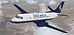
Pacific Coastal Airlines is a well-established name on the Canadian West Coast, operating a total of 13 bases with a fleet of 24 aircraft. For over forty years they have been serving the coastal & interior regions of British Columbia.
| Filename: | Pacific_Coastal_Airlines__Saab_340A.zip |
| License: | Freeware |
| Added: | 13th October 2010, 23:13:33 |
| Downloads: | 317 |
| Author: | Godfrey Tier |
| Size: | 3.15 MB |
| Category: Flight Simulator 2004 - Aircraft Repaints, Textures and Modifications | |
| Pacific Express BAC One-Eleven 200 |
|
File Description:
Formed in 1981 Pacific Express operated seven One-Eleven 200s on lease from British Aerospace pending delivery of BAe 146 eqipment. Beginning services the following year in the West Coast region the airline barely lasted two years before folding. This aircraft was was previously with British United and British Caledonian as G-ASJI. Requires the BAC One-Eleven 200 model by David Maltby.
| Filename: | Pacific_Express_BAC_OneEleven_200.zip |
| License: | Freeware |
| Added: | 24th March 2005, 14:02:13 |
| Downloads: | 287 |
| Author: | Garry Russell |
| Size: | 410.72 KB |
| Category: Flight Simulator 2004 - Scenery | |
| Murcia Region |
|
File Description:
A scenery upgrade for the Torrevieja to Murcia region. Adds detailed coast line, accurate roads and correct landclass textures.
| Filename: | Murcia_Region.zip |
| License: | Freeware |
| Added: | 23rd October 2003, 23:25:48 |
| Downloads: | 2,228 |
| Author: | Daniel Munoz |
| Size: | 495.5 KB |
| Category: Flight Simulator 2004 - Scenery Design | |
| Rwy12 Objects from Ogden Point |
|
Images related to this file:
File Description:

For scenery designers using Rwy12, this release includes two object libraries containing objects used in the Ogden Point Terminal scenery (vicenh04.zip). Objects: boats, boat cradle, fences, intercity bus, park benches, information kiosk, marine lights, a variety of light poles, school bus, security booth with transparent windows, a portable building with deck and coke machine, and a tree planter. Requires Rwy12. Rwy12 configuration by Gary Mills. Objects by Jon Patch.
| Filename: | Rwy12_Objects_from_Ogden_Point.zip |
| License: | Check within download |
| Added: | 31st May 2010, 03:46:44 |
| Downloads: | 5,304 |
| Author: | Gary Mills and Jon Patch |
| Size: | 1.81 MB |
| Category: Flight Simulator 2004 - Scenery | |
| USA Landclass AddOn - Part I V2.1 |
|
Images related to this file:
File Description:
Update: British Columbia, On the way to Misty Fjords,
a supplement for the area around Kewlona, Kamloop to Prinz Georg,
Frazer Plateau until the Borders of Misty Fjords. This is a complete update - no previous Versions are required.
Landclass Improvements for the USA, specialy the western Part of the USA: Colorado, Utah, Yellow Stone, little Part of Idaho, Montana and from LA to Seattle, Bristish Columbia and also some Testscenery's for the eastern Part of the USA (Arkansas KHOT and around KLWB).
| Filename: | USA_Landclass_AddOn___Part_I_V21.zip |
| License: | Freeware |
| Added: | 10th March 2015, 22:48:17 |
| Downloads: | 308 |
| Author: | Markus Balz |
| Size: | 8.2 MB |
© 2001-2026 AVSIM Online
All Rights Reserved
Privacy Policy |