
Where Flight Simulation Enthusiasts Gather from Around the World!
AVSIM Library - Search Results

| Category: Flight Simulator 2004 - Scenery | |
| VFR of Lario, Area C1 - Como lake, Italy |

|
Images related to this file:
File Description:
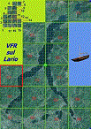
This is the third scenery of the "VFR of Lario" project, with photorealistic terrain and some 3D GMax realistic objects.
Information: this third scenery covers approximately an area of 7.5x6 kmt, from Pellio Intelvi/Ramponio (NW) to Colonno (NE), and from Almanno/Vesbio (SW) to Cavagnola locality (SE) and includes some details (GMax) of Argegno town, as NLC pier, some Holtel and Restaurants, the SS. Trinity church, some bridges and walls on Telo torrent and the cableway Argegno-Pigra (animated); it is also enclosed the unique small museum of financial police and smuggling, on Erbonne.
Contents: GMax objects as above and other buidings, minor piers and boats together with autogen buildings and trees are fully spreaded on the scenery.
| Filename: | lagocomo_c1.zip |
| License: | Freeware |
| Added: | 16th February 2012, 00:17:59 |
| Downloads: | 1,770 |
| Author: | Aldo Della Vedova, Daniele Lanfranchi, Gian Mario Verga e Diego Caligiuri |
| Size: | 13.03 MB |
| Category: Flight Simulator 2004 - AFCAD Files | |
| Fiji Airstrips |
|
File Description:
Afcads and exclude files for 11 airstrips in Fiji that Microsoft omitted from FS9. Made primarily with Ultimate Traffic users in mind, to give full traffic in the Fiji Islands (aircraft assigments permitting!).
The Afcads add runways, aprons and parking spots; the exclude files get rid of the autogen trees. Airstrips built using current data from Australian Defense Force En Route Supplements, so runway locations, dimensions, alignments and elevations are fairly accurate. But aprons and parking spots are entirely fictional! And no airport buildings included!
Tested only with default scenery plus fijifix.zip by Jim Keir (available at avsim) to correct elevation errors in default mesh at Moala.
Includes NFNB Levuka/Bureta, NFCI Cicia, NFKD Kandavu/Namalata, NFNO Koro Is, NFNK Lakeba, NFNH Laucala, NFFO Malololailai, NFMA Mana Is, NFMO Moala, NFNS Savusavu and NFVB Vanuabalavu.
| Filename: | fiji_airstrips.zip |
| License: | Freeware |
| Added: | 4th December 2004, 05:17:19 |
| Downloads: | 1,606 |
| Author: | Adrian Wright |
| Size: | 15 KB |
| Category: Flight Simulator 2004 - Scenery | |
| Sao Luis (Brazil) - Photoreal |
|
Images related to this file:
File Description:
Sao Luis is a Brazilian city, capital of Maranhao state, founded on September 8, 1612. It is located on the island Upaon-Acu (the name was given by the Indians tupinambas meaning "Big Island"), South Atlantic, between the bays of San Marcos and San Jose. It is one of three Brazilian state capitals located on islands (the others are Florianopolis and Vitoria). The scenery contains:
Photoreal of Sao Luis island with hand placed autogen; Marechal Cunha Machado Intl. Airport photoreal in HD; real lighting effect; grass textures; AZL with detailed buildings and hangars; ground support vehicles; detailed terminal with fingers; ships on the coast; Itaqui harbor.
# Courtesy of Marco Santiago (Addons): Bridges Pres. Sarney, Bandeira Tribuzi and the Estreito dos Mosquitos; Terminal de Integracao BR; Alexandre Raposo aerodrome; CAVU aerodrome (Ultralight).
| Filename: | fsbirdhouse-sao_luis.zip |
| License: | Freeware, limited distribution |
| Added: | 4th December 2010, 03:58:01 |
| Downloads: | 2,698 |
| Author: | Jorge Amengol |
| Size: | 62.66 MB |
| Category: Flight Simulator 2004 - Scenery | |
| Tijuana MMTJ / TIJ, version 2.0 |
|
Images related to this file:
File Description:

Thank you for downloading this scenery. This is an extensive upgrade to the default Tijuana Abelardo L. RodriÂguez International airport. There are more accurate terminals, more GA parking, and the huge hangar which is visible from Otay Mesa has also been added. The autogen buildings and trees have been excluded from the north side of the airport to mare accurately represent the area around Brown Field. It is not perfectly
correct or photoreal, but it is a good basic representation.
Update from v1:
The terminal buildings from v1 have been replaced with much more frame rate friendly versions. Frames now hover much closer to my max frame limit. There are some tweaks to the AFCAD to stop arriving AI from jamming up at the east end of the runway.
| Filename: | mmtjv2.zip |
| License: | Freeware |
| Added: | 30th May 2010, 10:33:58 |
| Downloads: | 4,585 |
| Author: | William Morgan, FRFSTUDIO.NET |
| Size: | 2.87 MB |
| Category: Flight Simulator 2004 - Scenery | |
| Terrain Mesh of Glacier National Park |
|
File Description:
New and updated scenery enhancements for the mountain ranges of southeastern British Columbia and parts of the Alberta Rocky Mountains. They require an existing installation of my files bcmesh9d.zip and/or bcmesh9e.zip. Scenery coverage follows the Trans-Canada Highway from Banff National Park to west of Revelstoke (~350km), with accurate transportation network, rivers and lakes, hydro dams, ski hills, glaciers, and landclass/waterclass updates based on satellite imagery. Also, similar enhancements to the parks and towns of the southern Kootenay, Selkirk, and Monashee mountains. The mesh source data are 0.75-arcsec (~23-m) CDED files, compiled at LOD10 (38-m) resolution. Due to significant changes in FS2004 to vector layering and autogen features, the special scenery enhancements cannot be used with FS2002. However, terrain mesh, new lakes and land/waterclass replacements will work well in FS2002.
| Filename: | bcmeshp2.zip |
| License: | Freeware, limited distribution |
| Added: | 18th December 2003, 23:17:35 |
| Downloads: | 8,844 |
| Author: | Holger Sandmann |
| Size: | 12.79 MB |
| Category: Flight Simulator 2004 - Scenery | |
| Himalayan Peaks Volume 2 - Mt. Everest photoreal textures |
|
File Description:
The photoreal textures in this package cover an area of about 100km (E/W) by 60km (N/S) featuring Mt. Everest and several neighboring peaks and are based on a Landsat 7 ETM 15-m multispectral image taken in October 2000. The relatively low resolution of the image makes for pretty grainy textures up close and I did not add any autogen, seasonal textures, or flattened water bodies. Nevertheless, I do believe the photoreal textures do a much better job at showing the grandiose alpine features of this area - rock faces, snow fields, glaciers, and bare ground - than generic landclass textures possibly can. The textures are placed for a best fit with our Mt. Everest area LOD10 terrain mesh, fs_him_01.zip, but probably work OK with the default LOD8 mesh of this area or third-party terrain mesh files.
| Filename: | fs_him_02.zip |
| License: | Freeware |
| Added: | 10th March 2010, 22:27:43 |
| Downloads: | 25,459 |
| Author: | Holger Sandmann |
| Size: | 75.71 MB |
| Category: Flight Simulator 2004 - Scenery | |
| The Greater Toronto Area for Ultimate Terrain 1.2 Part 1 |
|
File Description:
Part 1 of Flight Ontario's scenery for the Greater Toronto Area for Ultimate Terrain. The scenery is bounded by Detroit in the west, Kingston in the east, Huntsville in the north and Buffalo in the south and features: * all-season scenery * custom water textures * completely modelled Toronto Airports...CYTZ (Toronto Island) and CYZD (Downsview-home to Bombardier Aerospace and the Canadair Regional Jet and Dash-8, and the Toronto Aerospace Museum) * Niagara Helicopters CPQ3 (NEW) *custom autogen for the GTA * Custom landclass for southern Ontario * prominent features around Hamilton include the Burlington Skyway,lift bridge and steel mills * the Welland Canal is featured with lift bridges from Pt Weller to Pt Colborne * the Niagara area includes two hydro generating plants with reservoirs * compatibility with SimFlyers CYYZ.
This scenery is downloadable in two parts and both parts are essential.
| Filename: | greatertorontoareautpart1.zip |
| License: | Freeware |
| Added: | 31st December 2005, 18:39:52 |
| Downloads: | 13,862 |
| Author: | Jim Kanold - Flight Ontario |
| Size: | 63.02 MB |
| Category: Flight Simulator 2004 - Scenery | |
| EPGD 2008 - Gdansk Lech Walesa Airport, Poland |
|
Images related to this file:
File Description:

Gdansk Lech Walesa Airport (EPGD) is an international airport located in Gdansk, Poland, not far from the city centers of the Tricity metropolitan area: Gdansk (6.25 miles/10 km), Sopot (6.25 miles/10 km) and Gdynia (14.4 miles/23 km). The airport is named after Lech Walesa, the former Polish president. On the outside wall of the terminal building one can see the logo of the airport, which is Lech Walesa's actual signature, a stylized "W".
EPGD 2008 is the first Polish scenery in this quality. Main features of the scenery are:
-Airport ground high resolution textures - (five seasons + night textures);
-Highly detailed 3D objects, all photo textured;
-Animation vehicles ground services;
-Detailed autogen and photorealistic trees;
-Detail mesh.
For more details please look at the README file attached to the scenery file.
| Filename: | EPGD_2008__Gdansk_Lech_Walesa_Airport_Poland.zip |
| License: | Freeware |
| Added: | 18th May 2010, 10:37:46 |
| Downloads: | 25,710 |
| Author: | Kuba Paczek |
| Size: | 24.06 MB |
| Category: Flight Simulator 2004 - AFCAD Files | |
| Norman Y. Mineta - San José International Airport , California (KSJC) |
|
File Description:
This AFCAD of San Jose's International airport is as accurate as humanly possible given the default FS9 scenery limitations. Five total gates are missing due to lack of space. Two for American, Two for Southwest and One for United. All other gates are present with gate assignments and locations in their proper places. I've also added and colored the proper taxiways (concrete or asphalt) as per the real SJC taxiways. I've lived and spotted in San Jose for 25 years and decided that SJC needed a proper AFCAD. All taxiways, gate locations and assignments are accurate as of Feb. 1st 2005.
Notes: This AFCAD was designed for the autogen static scenery to be set at normal. If set at anything higher, it places unrealistic buildings on the United ramp. Also, there are no GA gates and the GA taxiways (off RWY30L) were disabled. This was intended primarily for jet operation.
| Filename: | af2_ksjc_156833.zip |
| License: | Freeware, limited distribution |
| Added: | 1st February 2005, 21:12:23 |
| Downloads: | 964 |
| Author: | Jaxan Prier |
| Size: | 7 KB |
| Category: Flight Simulator 2004 - Scenery | |
| Kerkira Airport Enhancement |
|
File Description:
This is old scenery which has been updated for FS2004 and enhances the visual environment of Ionian sea island airport of Kerkira, also known as Corfu. Its part of my “Greek Airfields” package that currently is not fully compatible with FS2004 since MS decided to move the airports in Greece and elsewhere to adjacent positions and ASD, which I use for placing these objects, is not compatible with FS2004. Here you will find airport & terrain enhancements for Hellenic airport of Kerkira LGKR that make it look closer to the real one; hotels, runway turning bay, perimeter fences, windsocks, radio antennae, new approach radar antenna to the southwest and most importantly, an exclusion of autogen scenery that is wrongfully generated on each side of the runway. A big difference is attributed to Babis Peribolas’s Kerkira mesh terrain that is included in this scenery. Scenery includes the necessary ASD 2.1 textures.
| Filename: | lgkr04.zip |
| License: | Freeware, limited distribution |
| Added: | 4th September 2003, 02:23:06 |
| Downloads: | 12,147 |
| Author: | Kyprianos Biris |
| Size: | 1.94 MB |
© 2001-2025 AVSIM Online
All Rights Reserved