
Where Flight Simulation Enthusiasts Gather from Around the World!
AVSIM Library - Search Results

| Category: Flight Simulator X - Scenery | |
| OMDB - Dubai Intl Airport - Dubai, UAE |

|
Images related to this file:
File Description:
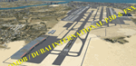
OMDB - GPS-accurate scenery based om Google maps and the FlyTampa base AFCAD (default FSX/P3D AFCAD). Every Runway, Gate and taxiway is right on the actual spot with a very small error margin.
Two types of Jetway structures used for Terminals 1 & 3, and are made by Victor Nauta. The new Concourse-D terminal for airlines other than Emirates is now added, with a basic terminal building design using Google Sketchup for better visuals.
WHAT'S NEW:
- The new Concourse-D terminal east of the existing Terminal 1. Terminal replaces the old Emirates Sky Cargo terminal, and servers all other visiting airlines.
- Apron Q used by FlyDubai is added.
- Extra runway rapid exits added.
- Extra parking gates in the C apron according to the latest charts.
- Extra Taxiways connecting to the runways according to the charts.
- Ground marking for Gates and taxiways! (A, B, C, D and F aprons)
- Aprons G and S are added according to the latest Airport layout and charts.
| Filename: | OMDB__Dubai_Intl_Airport__Dubai_UAE.zip |
| License: | Freeware, limited distribution |
| Added: | 25th July 2016, 20:17:21 |
| Downloads: | 10,980 |
| Author: | Ahmed Abdessalam |
| Size: | 4.16 MB |
| Category: Flight Simulator 2004 - Original Aircraft | |
| Eurocopter Tiger (EC 665) - HAP/HCP, UHT and ARH variants |
|
Images related to this file:
File Description:
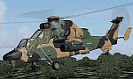
The Tiger HAP/HCP (Helicoptere d'Appui Protection / Helicopter for Close Protection) is a medium-weight air-to-air combat and fire support helicopter built for the French Army. The Tiger HAP is an air-to-air combat and fire support medium-weight (6 tonnes) helicopter fitted with 2 MTR 390 engines. It is daytime and night combat capable and is operable in NBC environments. Three basic parameters were taken into account right from the start of the development phase: low (visual, radar and infrared) detectability, which provides excellent survivability on the battlefield, maximum efficiency of the weapons and the associated fire control systems without heavier workload for the crew, and an optimized logistic concept offering minimum possession costs. The Tiger HAP is fitted with a 30-mm gun turret; 68-mm submunition rockets, and air-to-air Mistral missiles. It also features a firing sight with 3 sensors: infrared, TV camera and direct optical channel. The complete avionics suite includes multi-purpose colour displays and radar/laser warning receivers.
The Tiger UHT (from Unterstuetzungshubschrauber Tiger; Ger. supporting helicopter Tiger) is a medium-weight multi-role fire support helicopter built for the Bundeswehr (German Army).The Tiger UHT is a multi-role fire support helicopter. The Trigat Fire and Forget missiles and/or the Hot missiles it carries offer anti-tank capability, while 68-mm rockets ensure air-to-ground fire support. A 12.7 mm air-to-air gun pod and air-to-air Stinger missiles can also be installed. The helicopter also features a mast-mounted sight with a second-generation IRCCD infrared channel and a TV channel, as well as a nose-mounted IRCCD control FLIR for the pilot. Countermeasures include radar/laser/missiles launch/missile approach warning receivers and decoy launchers.
The Tiger ARH (Armed Reconnaissance Helicopter) is the version ordered by the Australian Army to replace its OH-58 Kiowas and UH-1 Iroquois-based Bushranger gunships. The Tiger ARH is a modified and upgraded version of the Tiger HAP with upgraded MTR390 engines as well as a laser designator incorporated in the Strix sight for the firing of Hellfire II air-to-ground missiles. Instead of SNEB unguided rockets, the ARH will operate 70 mm (2.75 in.) rockets from Belgian developer, Forges de Zeebruges (FZ).
Model, textures by www.afs-design.de - Author: A.Meyer. (Ex-payware package, now released as freeware).
| Filename: | Eurocopter_Tiger_EC_665__HAPHCP_UHT_and_ARH_varian.zip |
| License: | Freeware, limited distribution |
| Added: | 12th January 2013, 19:07:14 |
| Downloads: | 923 |
| Author: | Andreas Meyer |
| Size: | 11.72 MB |
| Category: Prepar3D V1-4 - Aircraft Repaints, Textures and Modifications | |
| North American P-51D 479th FG (J2-K) 'My Pride and Joy' |
|
Images related to this file:
File Description:
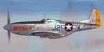
This folder contains a second repaint for the A2A WoP3 P-51D Mustang, in the colors of #44-11755 J2-K "my Pride 'n Joy", which was flown by Lt. Richard Gomez Candelaria of the 435th Fighter Squadron/479th FG. With six aerial victories to his credit, Candelaria was the only pilot in his squadron to make "ace". Most of his victories were achieved on a single mission on April 7, 1945, when he found himself the lone escort protecting a formation of USAAF B-24 Liberators. Candelaria defended the bombers from at least 15 German fighters, single-handedly destroying four before help arrived. He was also credited with a probable victory on an Me 262 during this engagement. Six days later, Candelaria was shot down by ground fire, and spent the rest of the war as a POW. After the war, Candelaria served in the Air National Guard, reaching the rank of Colonel prior to his retirement. His april 7 mission was shown in an episode of "dogfights", which can be seen here: http://www.youtube.com/watch?v=BC_yVzUeIUI
Repaint by Jan Kees Blom, based on the A2A paintkit.
| Filename: | North_American_P51D_479th_FG_J2K_My_Pride_and_Joy.zip |
| License: | Freeware |
| Added: | 3rd November 2018, 23:27:09 |
| Downloads: | 58 |
| Author: | Jan Kees Blom |
| Size: | 12.07 MB |
| Category: Flight Simulator X - Aircraft Repaints, Textures and Modifications | |
| De Havilland DH-98 Mosquito (W4072) 105 Sqn GB-D |
|
Images related to this file:
File Description:
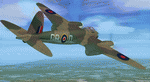
This folder contains a repaint for the DeHavilland DH98 Mosquito by Dave Garwood, in the colors of W4072 GB-D, a B Mk.IV of 105 squadron. On 25 june 1942, while being loaned to 139 squadron, it was being flown by Flt Lt Bagguley on a night attack on Stade aerodrome near Hamburg. He attacked the town of Dorum, near Bremerhaven. On leaving the target, instead of closing the bombdoors, he accidenatly lowered the flaps. These were torn away due to the speed of over 380 mph, and on arrival back at Horsham St Faith, W4072 overshot the runway, with the right undercarriage collapsing in a ditch. W4072 was delivered to 105 sqn on 27 februari 1942, and took part in the first bomb raid carried out by Mosquito's, when sqn ldr Oekeshott took it to Cologne on 31 May 1942. After the prang in june, W4072 was repaired and flew more missions with 105 sqn. Damaged again in March 1943, she passed to 627 sqn (AZ-Q), but crashed in the North Sea returning from a raid on Frankfurt on 8 january 1944. Repaint by Jan Kees Blom, based on the paintkit by Dave Garwood.
| Filename: | De_Havilland_DH98_Mosquito_W4072_105_Sqn_GBD.zip |
| License: | Freeware |
| Added: | 3rd August 2018, 23:43:28 |
| Downloads: | 146 |
| Author: | Jan Kees Blom |
| Size: | 2.77 MB |
| Category: Flight Simulator X - Scenery Design | |
| Animated Flags |
|
Images related to this file:
File Description:
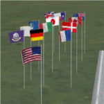
This scenery addon has been developed on Win 7 for FSX Flight Simulator SP1 or SP2. It has also been tested with Microsoft Acceleration, but compatibility is not guaranteed by the author.
The package provides a little collection of animated flags for scenery designers and FS users who do understand the handling of folders and files for FSX. The animated flag models have been developed with GMAX. Along with the textures the package includes the model (mdl) and bgl files. The XML files for the individual placement of a flag into a FSX scenery are included as well.
The documentation contains a step by step description on how to place the flag into the FSX scenery, on a position of your choice. In order to paint your own individual animated flag, the Appendix B of the documentation describes in detail on how to do it. However, a basic experience on how to work with graphical tools like Photoshop, GIMP, Paint Shop Pro etc. is required to paint the extures/colors for a new flag. For credits look at the pdf documentation inside the zip file. By Dietmar Loleit
| Filename: | Animated_Flags.zip |
| License: | Freeware |
| Added: | 17th October 2014, 22:59:25 |
| Downloads: | 661 |
| Author: | Dietmar Loleit |
| Size: | 5.98 MB |
| Category: Flight Simulator 2002 - AFCAD Files | |
| Simflyers KLAX AFCAD 2.1 |
|
File Description:
INSTRUCTIONS AND MORE INFO INCLUDED IN ZIP FILE. INCLUDES 3 OVERLAYS. Hi, I've created these AFCAD files for the Simflyers LAX scenery, as I could not find anything that was truly a; realistic, and b; functioned properly with the MS Fltsim 2002 AI. I've spent many hours testing and tweaking these AFCAD files, so I hope they are perfect enough to be widely used. However, I do stress that some previous experience of using AFCAD and changing aircraft radius sizes will be necessary. Please report any faults which may be discovered! Design tips for the future are always very useful!
WHATS NEW FOR 2.1:
I have changed the direction of takeoff / landing for all of the runways, as the AI appears to behave a lot better this way (less likeliness of aircraft getting stuck!). This has allowed me to move all of the runways used by the KLAX overlay to the north side of the airport, reducing the chances of aircraft landing on top of one another. KLAX also now has some extra Ramp GA Large bays to accomodate for all of the American Eagle Saab 340's! Finally, I have cleaned up the AFCAD removing unecessary nodes etc.
| Filename: | Simflyers_KLAX__AFCAD_21.zip |
| License: | Freeware, limited distribution |
| Added: | 19th July 2003, 01:41:28 |
| Downloads: | 671 |
| Author: | Carl Edwards |
| Size: | 127.41 KB |
| Category: X-Plane - Scenery | |
| Houston Galveston Scenery Package v6.51-7.xxx |
|
File Description:
As promised, here are my Houston-Galveston Scenery Packs. I live in Houston and have been working on these areas for quite some time. Like all of us, we like to make our hometown airports as elaborate and as challenging as possible. Even tho these packs are in no way accurate, they are fun and interesting to fly around and site-see. Being the lazy person I am, no research was done and no claim to RL landmarks are implied.
I have added many objects to the airports and cities including terminals, hangers, buildings, parks, balloons, and other fun and interesting things. All of which were begged, borrowed or stolen from all the wonderful designers in the X-Plane Community such as Dave Spurlock, Christian Franz, Ted Davis, Robert Bunce, Tom Curtis, B. Brooks and all the others who have inspired me.
Like all my scenery packages, the additions to the citys and airports are purely fictional. The airports themselves are unaltered. I have enhanced "George Bush Intercontinental"(KIAH), "William P. Hobby"(KHOU), "Ellington Field Military Base"(KFLD) and "Scholes International" at Galveston (KGLS) airports. Look for the Johnson Space Center too.
| Filename: | Houston_Galveston_Scenery_Package_v6517xxx.zip |
| License: | Freeware |
| Added: | 16th June 2003, 00:51:43 |
| Downloads: | 2,659 |
| Author: | Bill Moore |
| Size: | 23.72 MB |
| Category: Flight Simulator X - Scenery | |
| Mesh South America / MeSA B11 |
|
File Description:
FSX Mesh South America Project:
This terrain mesh file is a part of a whole project covering all the Continent
of South America and some islands, divided in tiles identified in a map by its
column (letters) and rows (numbers).
Those files were multi-LOD compiled from 90m SRTM2 source data, reprocessed
with 3DEM to remove voids and spikes, providing a 76.4m (LOD9) horizontal
resolution topography intended for use only in FSX updated with SP1.
Although not well documented, to improve performance, the updated FSX loads DEM
files in threads and only the closer terrain (about 5-10 NM from the point of view)
is rendered in high detail, while at far distances FSX shows up its default low
resolution mesh, when there is not a third part terrain mesh compiled in all
others intermediate level of details (multi-LOD).
THIS FILE:
FSX_MeSA_B11 (Column B x Row 11)
covers the area inside the boundaries:
N = 39º 22,5' S; S = 45º 0' S;
W = 82º 30' W; E = 75º 0' W;
AUTHORS:
Hely Heck Junior - Magrao ( [email protected] )
and Jose Lobo ( [email protected] )
TerraBrasilis: www.terra-brasilis.org
| Filename: | Mesh_South_America__MeSA_B11.zip |
| License: | Freeware |
| Added: | 11th June 2007, 22:11:28 |
| Downloads: | 1,154 |
| Author: | Hely Heck Jr. and José Lôbo |
| Size: | 1.55 MB |
| Category: Flight Simulator X - Scenery | |
| Mesh South America / MeSA B13 |
|
File Description:
FSX Mesh South America Project:
This terrain mesh file is a part of a whole project covering all the Continent
of South America and some islands, divided in tiles identified in a map by its
column (letters) and rows (numbers).
Those files were multi-LOD compiled from 90m SRTM2 source data, reprocessed
with 3DEM to remove voids and spikes, providing a 76.4m (LOD9) horizontal
resolution topography intended for use only in FSX updated with SP1.
Although not well documented, to improve performance, the updated FSX loads DEM
files in threads and only the closer terrain (about 5-10 NM from the point of view)
is rendered in high detail, while at far distances FSX shows up its default low
resolution mesh, when there is not a third part terrain mesh compiled in all
others intermediate level of details (multi-LOD).
THIS FILE:
FSX_MeSA_B13 (Column B x Row 13)
covers the area inside the boundaries:
N = 50º 37,5' S; S = 56º 15' S;
W = 82º 30' W; E = 75º 0' W;
AUTHORS:
Hely Heck Junior - Magrao ( [email protected] )
and Jose Lobo ( [email protected] )
TerraBrasilis: www.terra-brasilis.org
| Filename: | Mesh_South_America__MeSA_B13.zip |
| License: | Freeware |
| Added: | 11th June 2007, 22:12:07 |
| Downloads: | 1,160 |
| Author: | Hely Heck Jr. and José Lôbo |
| Size: | 1.82 MB |
| Category: Flight Simulator X - Scenery | |
| Mesh South America / MeSA B08 |
|
File Description:
FSX Mesh South America Project:
This terrain mesh file is a part of a whole project covering all the Continent of South America and some islands, divided in tiles identified in a map by its column (letters) and rows (numbers).
Those files were multi-LOD compiled from 90m SRTM2 source data, reprocessed with 3DEM to remove voids and spikes, providing a 76.4m (LOD9) horizontal resolution topography intended for use only in FSX updated with SP1.
Although not well documented, to improve performance, the updated FSX loads DEM files in threads and only the closer terrain (about 5-10 NM from the point of view) is rendered in high detail, while at far distances FSX shows up its default low resolution mesh, when there is not a third part terrain mesh compiled in all
others intermediate level of details (multi-LOD).
THIS FILE:
FSX_MeSA_B08 (Column B x Row 08)
This file covers the area inside the boundaries:
N = 22º 30' S; S = 28º 7,5' S;
W = 82º 30' W; E = 75º 0' W;
AUTHORS:
Hely Heck Junior - Magrao ( [email protected] )
and Jose Lobo ( [email protected] )
TerraBrasilis: www.terra-brasilis.org
| Filename: | Mesh_South_America__MeSA_B08.zip |
| License: | Freeware |
| Added: | 11th June 2007, 22:10:37 |
| Downloads: | 1,208 |
| Author: | Hely Heck Jr. and José Lôbo |
| Size: | 1.51 MB |


© 2001-2026 AVSIM Online
All Rights Reserved
Privacy Policy |