
Where Flight Simulation Enthusiasts Gather from Around the World!
AVSIM Library - Search Results

| Category: Flight Simulator X - Scenery | |
| Arnot Power Station Airfield (FAAP), South Africa |

|
Images related to this file:
File Description:
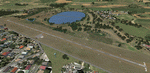
Arnot is situated at an altitude of 5580 ft. It's runway is 1158m long and only 9m wide. The airfield is owned by Escom, the sole producer of all the electricity used in South Africa. The airfield is limited to aircraft with a MAUW of 5700kg or less. The trees just short of the threshold of Runway 13 makes for an interesting approach and you better be sure about your take-off weight when taking off from Runway 31. Runway lights are also available.
Please install fsxWorx01.zip, fsxWorx02.zip and all the updates for these, before this scenery.
| Filename: | Arnot_Power_Station_Airfield_FAAP_South_Africa.zip |
| License: | Freeware |
| Added: | 2nd December 2012, 18:59:48 |
| Downloads: | 2,649 |
| Author: | Kobus van Wyk, Aeroworx |
| Size: | 7.48 MB |
| Category: Flight Simulator X - Scenery | |
| KGTB - Wheeler-Sack AAF - Fort Drum, NY |
|
File Description:
Here is an improved version of the stock Wheeler-Sack AAF. I adjusted and added aprons, roads and
taxiways to more closely match real life. I added Military_combat and Military_cargo parking spaces.
I replaced most buildings and added additional buildings. I replaced and moved the control tower,
added the fire station, parking lots, static vehicles and helicopters, lightpoles, and other objects.
Fort Drum is home to the 10th Mountain Division and it houses an air-to-ground gunnery range which is
used by the 174th Fighter Wing of the NY National Guard out of Syracuse, NY.
| Filename: | KGTB__WheelerSack_AAF__Fort_Drum_NY.zip |
| License: | Freeware |
| Added: | 23rd April 2009, 06:48:06 |
| Downloads: | 905 |
| Author: | Jim Cook |
| Size: | 13.2 KB |
| Category: Flight Simulator 2004 - Flight Plans | |
| RTW-K4-03 |
|
File Description:
An FS2K4 GPS flight and plan by the Ancient Brit and the RTW-K4 Team for the FS2K4 default aircraft (B737-400) and scenery. Depart Sumburgh (EGPB), runway 33, The Orkneys, UK and arrive 51 minutes later at Flesland, (ENBR), Bergen, Norway. The plan is fully flight briefed with Word and text briefings and kneeboard in-flight briefing. A start-up flight that loads the plan, weather and kneeboard flight briefing is included; also a short Finals practise flight is included. This is a short positioning flight featuring snow and an ILS Finals coming through clouds.
| Filename: | RTWK403.zip |
| License: | Freeware |
| Added: | 26th September 2003, 23:38:27 |
| Downloads: | 1,538 |
| Author: | Denis Egan |
| Size: | 57.51 KB |
| Category: Flight Simulator X - AFCAD Files | |
| FXMM - Moshoeshoe I International Airport - Maseru, Lesotho |
|
File Description:
Moshoeshoe I International Airport (IATA: MSU, ICAO: FXMM) is an airport serving Maseru, the capital city of Lesotho. The airport is located in the town of Mazenod, about 18 km (11 mi) southeast of downtown Maseru.
The airport is at an elevation of 5,348 feet (1,630 m) above mean sea level. It has two asphalt paved runways: 04/22 measuring 3,200 by 45 metres (10,499 ft by 148 ft) and 11/29 measuring 1,010 m by 23 m (3,314 ft by 75 ft).
Airport runways were corrected also the aprons and buildinds.
This work is dedicated to West Wind Airlines.
| Filename: | FXMM__Moshoeshoe_I_International_Airport__Maseru_L.zip |
| License: | Freeware |
| Added: | 24th June 2013, 05:16:52 |
| Downloads: | 307 |
| Author: | Anwar Gonzalez |
| Size: | 7.83 KB |
| Category: Flight Simulator 2004 - Aircraft Repaints, Textures and Modifications | |
| KLM Douglas DC-6 |
|
File Description:
Having been an operator of the Douglas DC-2, DC-3, DC-4 and DC-5, it seemed only logical that KLM (celebrating its 90th anniversary in 2009) purchased the DC-6 for its long-haul routes. Seemed, because KLM already operated the Lockheed L-049 Constellation, the DC-6's competitor. Nevertheless, Connie and DC-6 marched on together quite well. Enclosed in this package are five repaints of DC-6's during several stages in their life with KLM. The 1957 livery of PH-DPP was an interim-livery (see the 'old fashioned' white lettering and the early-fifties style cowlings). The 1962 livery of PJ-DPI seems to have been an attempt to fit into the new house style of KLM without having to respray the fuselage, as the DC-6 reached the end of its KLM carreer anyway. These are textures only. You will require Jens B. Kristensen's Douglas DC-6 (dc6_v20.zip). Original textures by Jens B. Kristensen. Repaints by Maarten Brouwer.
| Filename: | KLM_Douglas_DC6.zip |
| License: | Freeware, limited distribution |
| Added: | 7th January 2009, 03:15:13 |
| Downloads: | 628 |
| Author: | Maarten Brouwer |
| Size: | 10.63 MB |
| Category: Flight Simulator 2004 - Gauges | |
| RwyInfo 2 Data Update |
|
File Description:
The purpose of this download is to allow you to update the data used by Ernie Alston's Runway Info gauge (RwyInfo version 2.0, available from http://www.fsbuild.com/rwyinfo/). This is an excellent little gauge that allows you to retrieve, through a gauge on your panel, information for all the runways at an airport (selected by ICAO code), and optionally automatically load frequency and course for an ILS into your NAV1 radio and MCP. However the usefulness of the gauge is somewhat restricted by the fact that it comes with a text database of 'info' to be displayed, and does not include any method for updating this info, other than by going into the text file and typing changes yourself (carefully, character by character). This is not really a practical method of getting the data to match your current FS configuration. What I have done is created a little utility that will create a new text database for the RwyInfo 2 gauge, based on your current scenery configuration.
| Filename: | RwyInfo_2_Data_Update.zip |
| License: | Freeware |
| Added: | 30th October 2011, 21:24:00 |
| Downloads: | 471 |
| Author: | Ken Leedham |
| Size: | 4.39 KB |
| Category: Flight Simulator 2004 - Gauges | |
| RwyInfo 2 Data Update Version 2 |
|
File Description:
The purpose of this download is to allow you to update the data used by Ernie Alston's Runway Info gauge (RwyInfo version 2.0, available from http://www.fsbuild.com/rwyinfo/). This is an excellent little gauge that allows you to retrieve, through a gauge on your panel, information for all the runways at an airport (selected by ICAO code), and optionally automatically load frequency and course for an ILS into your NAV1 radio and MCP. However the usefulness of the gauge is somewhat restricted by the fact that it comes with a text database of 'info' to be displayed, and does not include any method for updating this info. This is Version 2 of this utility - the first version was uploaded a couple of weeks ago. The first version is not required to use this version. This version fixes some problems with the display of new airports and runs much faster than the original version.
| Filename: | RwyInfo_2_Data_Update_Version_2.zip |
| License: | Freeware |
| Added: | 17th November 2011, 07:55:54 |
| Downloads: | 728 |
| Author: | Ken Leedham |
| Size: | 5.73 KB |
| Category: Flight Simulator X - AFCAD Files | |
| Tamchy Airport Kyrgyzstan (UAFL) |
|
File Description:
Tamchy Airport (ICAO: UAFL) is an airport in Kyrgyzstan.
This AFCAD file for FSX adds a taxiway, apron, 3 parking spots and some generic buildings and other airport objects to the standard FSX Tamchy airport.
Although this airport has been designed roughly from looking at Google Earth/Maps, this is by no means 100% realistic. The buildings are all placed randomly by me, just to make it more interesting. Same story for the fuel tanks, trees, and vehicles. However, I did keep the proportions realistic, i.e. you won't land or park an A380 here.
In FSX, this is an awesome airport, right next to the massive Issyk-Kul lake which is one of the largest in the world. The scenery (even the standard FSX scenery) is just awesome. Hop into a turboprop plane, plan a flight between this airport and Bishkek or Almaty, and off you go.
This airport is served by Central Asian Airlines VA - www.flycentralasian.com
| Filename: | Tamchy_Airport_Kyrgyzstan_UAFL.zip |
| License: | Freeware |
| Added: | 22nd March 2012, 04:07:05 |
| Downloads: | 254 |
| Author: | Peter Wouters |
| Size: | 3.41 KB |
| Category: Flight Simulator X - Scenery | |
| SLET - El Trompillo Airport - Santa Cruz de la Sierra, Bolivia |
|
File Description:
El Trompillo Airport (IATA: SRZ, ICAO: SLET) is located in the south part of Santa Cruz de la Sierra, Bolivia, about 2 km (1.25 miles) away from the central plaza. Airport type:(Public / Military).
After a series of improvements, in June 3, 2014 Airport regained its status as an international airport by converting to Santa Cruz de la Sierra in Bolivia the only city with two international airports, international airport suitable as retention and/or support times of high demand in the Viru Viru Airport (ICAO: SLVR) can not supply completely.
The airport operates 24 hours and resides at an elevation of 1,371 ft (418 m) above mean sea level. Have one runway designated 15/33 with an asphalt surface measuring 8,967 by 114.82 ft (2,733 m by 35 m), El Trompillo Tunnel for vehicles, passes under the runway and connects the 4th ring (considered the most important highway in the city).
Compatible with both FSX and P3D.
| Filename: | SLET__El_Trompillo_Airport__Santa_Cruz_de_la_Sierr.zip |
| License: | Freeware |
| Added: | 19th November 2015, 09:49:14 |
| Downloads: | 1,850 |
| Author: | Marcos A. Rivas Torrez |
| Size: | 16.68 MB |
| Category: X-Plane - Scenery | |
| WAJW Susi Air Wamena Airport v1.0.0 |
|
Images related to this file:
File Description:

This is an X-Plane 11 scenery for Wamena Airport (WAJW) in Wamena, Papua, Indonesia. Wamena Airport (Indonesian: Bandar Udara Wamena) (IATA: WMX, ICAO: WAVV), is an airport serving the town of Wamena, Puncak Jaya Regency, Papua Province, Indonesia. The airport also serves the neighboring Lanny Jaya Regency and Tolikara Regency. It is currently the only airport in the highland region of Papua that can accommodate narrow-body aircraft such as the Airbus A320, Boeing 737 and C-130 Hercules. The airport also serves as the entry point to the Baliem Valley. This is one of the destinations for "PT ASI Pujiastuti Aviation", operating as Susi Air, an Indonesia airlines established in late 2004 by Mrs. Susi Pudjiastuti. This scenery was tested and is operational (as of January 12, 2017) in "X-Plane 11 Public Beta #5 64 bit", Windows 10 Home. It was also tested and is operational (as of January 12, 2017) in "X-Plane 10.51 64 bit", Windows 10 Home.
| Filename: | WAJW_Susi_Air_Wamena_Airport_v100.zip |
| License: | Freeware |
| Added: | 12th January 2017, 20:08:45 |
| Downloads: | 86 |
| Author: | Rui Mesquita |
| Size: | 4.07 MB |


© 2001-2026 AVSIM Online
All Rights Reserved
Privacy Policy |