
Where Flight Simulation Enthusiasts Gather from Around the World!
AVSIM Library - Search Results

| Category: Flight Simulator 2004 - Scenery | |
| CJS4 Moose Jaw Municipal Airport, Saskatchewan, Canada, Version 2 |

|
Images related to this file:
File Description:

Moose Jaw Muni is located 13 km northeast of the city of Moose Jaw, Saskatchewan, Canada. The airfield is a small general aviation airport and hub in the summer for agricultural aircraft. CJS4 Moose Jaw Muni was constructed using GMAX and includes all the airport buidings,signage, fencing, custom ground and runway textures, and lighting. The scenery replicates the pilot activated ARCAL lighting of the airfield approach lights, edge lights, runway and taxiway lights.
This is an update to the July 2007 version of the scenery, which was lost in the AVSIM hack. This is a complete revision of the airport includng new hangars so if you have the orginal file please delete and replace with this version 2 of CJS4 Moose Jaw Municipal airport.
| Filename: | CJS4_Moose_Jaw_Municipal_Airport_Saskatchewan_Cana.zip |
| License: | Freeware |
| Added: | 5th January 2011, 14:55:31 |
| Downloads: | 1,162 |
| Author: | Gregory Putz |
| Size: | 20.36 MB |
| Category: Flight Simulator 2004 - Scenery | |
| Gjoa Haven CYHK, on King William Island, Nunavut, Canada, |
|
Images related to this file:
File Description:
Gjoa Haven is a village of 1,200 or so inhabitants at N 68 38 W 95 51 on the southeast corner of King William Island, around 155 miles north of the Arctic Circle. It's Inuit name is Uqsuqtuuq; the Gjoa Haven name was given by the Norwegian explorer Roald Amundsen when he spent two years there from 1903 to 1905 during his exploration of the northwest passage from east to west. His boat was called Gjoa and the cove was named Gjoa Harbour, in Norwegian. The village has been added in this scenery with approximately the right shape; though the coastline with Ultimate Terrain does have the small cove that serves as a harbor the coast shape is wrong. The airfield runway is 4,400 feet of gravel 100 feet wide at 154 feet above sea level. There is no LL100 available, only JetA1, delivered once a year by ship along with all the other requirements of the town. There is also a nearby CAM-B remotely operated defence radar station with its three protective domes. The old terminal building is still there, albeit repainted and spruced up, along with the far larger and newer one alongside it.
One of the screen shots shows Gjoa Haven as it appears for at least 8 months of the year, with snow on the ground and sea ice all around. If you want the ice then download my recent post of All Canada frozen lakes, rivers, and the northern seas, reversible with an untick in the FS scenery library.
| Filename: | Gjoa_Haven_CYHK_on_King_William_Island_Nunavut_Can.zip |
| License: | Freeware, limited distribution |
| Added: | 19th February 2011, 15:42:51 |
| Downloads: | 551 |
| Author: | Roger Wensley |
| Size: | 2.68 MB |
| Category: Flight Simulator 2004 - Scenery | |
| Nanisivik CYSR and Arctic Bay CJX7 in Nunavut, Canada |
|
Images related to this file:
File Description:
Nanisivik is an airfield in the north of Baffin Island, 470 miles north of the Arctic circle. It was built to service a zinc and lead mine that was opened in 1976 as Canada's first Arctic mine, now closed and dismantled. The deep water Strathcona Sound has been ear-marked by the Canadian government for development as a naval base, so I have left the large ore storage shed and the jetty in place. The airfield is at 2,106 feet on the top of the Borden Peninsula hills with a lighted 6,400 feet of 150 feet wide gravel runway runway aligned 11/29. There is a terminal and other maintenance buildings, and First Air have a building there from when the mine generated a lot of traffic and jets were used. Arctic Bay is a village 11 miles west of Nanisivik airfield with a population of around 690 which also uses the Nanisivik airfield. There is another gravel strip much closer to the village that is called Arctic Bay CJX7, but this is smaller with only 1,500' of 50' wide gravel and has no facilities of any sort. The village is partly dependent on visiting sports hunters and other limited tourist visits. At almost 73 degrees north the average year will have only four or even three months where the average high is above freezing. The buildings on the field have been modelled specifically for this scenery, and as in real life there is only JetA available. The AI visiting aircraft are a Kenn Borek Twin Otter and a First Air 42-300. As Nanisivik is in the "Northern Domestic Airspace" the runway is signed in "true" bearings and not magnetic as magnetic compasses become unreliable close to the magnetic pole.
| Filename: | Nanisivik_CYSR_and_Arctic_Bay_CJX7_in_Nunavut_Cana.zip |
| License: | Freeware, limited distribution |
| Added: | 28th May 2011, 19:59:18 |
| Downloads: | 496 |
| Author: | Roger Wensley |
| Size: | 2.64 MB |
| Category: Flight Simulator 2004 - Scenery | |
| Arctic Runway Signs in the "Northern Domestic Airspace", Canada |
|
Images related to this file:
File Description:
These are scenery bgl's to replace those previously posted for Cape Dorset, Gjoa Haven, Igloolik, and Whale Cove. All of these airfields are within what is marked on the chart as "Northern Domestic Airspace" and their runway signage is not given as a magnetic bearing but as a true bearing. This is because at those latitudes, close to magnetic north, the magnetic field is more vertical than horizontal and magnetic readings become unreliable. Planes report their course as a true course, and fly at a height that reflects their true course instead of their magnetic course. The picture shows the runway sign for Qikiqtarjuaq CYVM (which used to be called Broughton Island) which I am working on right now, and I realised that my training was so far behind me that I had forgotten all of the above. The boundary line of the two air spaces is not a straight line; the furthest south it reaches is on the west coast of Hudson Bay just north of Churchill. To the east it passes through the southern end of Baffin Island, and to the west it is north of the coast at the Alaskan border, and there is an illustration included here.
| Filename: | Arctic_Runway_Signs_in_the_Northern_Domestic_Airsp.zip |
| License: | Freeware, limited distribution |
| Added: | 11th June 2011, 03:06:36 |
| Downloads: | 308 |
| Author: | Roger Wensley |
| Size: | 1.21 MB |
| Category: Flight Simulator X - Aircraft Repaints, Textures and Modifications | |
| Air.Australia de Havilland Canada DHC-6 Twin Otter 300 |
|
File Description:
Air.Australia is a small virtual airline. This file contains three separate texture folders which only differ in the aircraft reg tail letters. You must own a copy of the Aerosoft Twin Otter payware to use these textures.The FSX Aircraft.cfg entries are included in the attached Readme file
| Filename: | AirAustralia_de_Havilland_Canada_DHC6_Twin_Otter_3.zip |
| License: | Freeware |
| Added: | 10th November 2011, 08:22:10 |
| Downloads: | 233 |
| Author: | John Jobber |
| Size: | 3.11 MB |
| Category: Flight Simulator 2004 - Aircraft Repaints, Textures and Modifications | |
| Air Canada Boeing 777-333/ER "C-FRAM" Update |
|
Images related to this file:
File Description:

Requires the linked download file. The package also contains new .air file and Aircraft.cfg for Project Opensky Boeing 777-300/ER package. Just download and replace. Thanks for downloading & Happy flying.
| Filename: | Air_Canada_Boeing_777333ER_CFRAM_Update.zip |
| License: | Freeware, limited distribution |
| Added: | 23rd January 2012, 15:04:57 |
| Downloads: | 1,431 |
| Author: | Abdullah Rahman / Project Opensky |
| Size: | 7.87 MB |
| Category: Flight Simulator X - AFCAD Files | |
| CYQT - Thunder Bay International Airport / Thunder Bay, Ontario, Canada |
|
Images related to this file:
File Description:
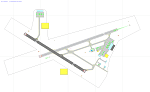
CYQT - Thunder Bay International Airport / Thunder Bay, Ontario, Canada
This airport update was made with the latest version of ADE (Airport Design Editor) and made for FSX as a replacement for the stock (default) airport. I found that most stock airports in FSX lack a decent amount of character and realism and I've tried to fix that a little bit. This airport in particular had no commercial aircraft parking at all. I have also added the missing main terminal building with gates including the two jetways the real CYQT has. A number of spots for general aviation aircraft has also been added. A few small touches like cars in the parking lot and some birds near the airport were added as well.
I hope to do a few more of these as time permits, hope you enjoy!
| Filename: | CYQT__Thunder_Bay_International_Airport___Thunder_.zip |
| License: | Freeware |
| Added: | 11th July 2012, 04:04:09 |
| Downloads: | 1,036 |
| Author: | Jaison Diaz |
| Size: | 8.34 KB |
| Category: Flight Simulator 2004 - AI Aircraft | |
| Air Canada Jazz OC BAe-146-200 - 3 Colors |
|
Images related to this file:
File Description:

Flightplans may be available on AVSIM/Flightsim.com.
This works for both FS9 and FSX. Tested in FSX. FS9 model used.
For FSX users make sure you have UNCHECKED "Aircraft casts shadows on the ground" under the Aircraft - Exterior Settings in FSX to make any FS9-based model visible during the day!
Texture quality; FSX Native: DDS DXT5 with alpha. FS9 Native: BMP DXT3 with alpha.
FSX Light Fix included in the DDS night texture.
Custom Light Map. Custom Shadows, Highs, Weathering as usual...
Included repaint is for the following model; AI Bae 146-200 from FMAI
Model is available on AVSIM, FlightSim.com or on the author/developers site.
You need the basekit for this to work!!
Do make sure you copy the texture folder(s) in the respective folder.
| Filename: | Air_Canada_Jazz_OC_BAe146200__3_Colors.zip |
| License: | Freeware, limited distribution |
| Added: | 12th August 2012, 14:43:21 |
| Downloads: | 308 |
| Author: | Stephan Faessler / ImpulseAI |
| Size: | 3.61 MB |
| Category: Flight Simulator X - AFCAD Files | |
| CYXE - John G. Diefenbaker International Airport / Saskatoon, Saskatchewan, Canada |
|
Images related to this file:
File Description:
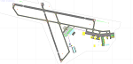
CYXE - John G. Diefenbaker International Airport / Saskatoon, Saskatchewan, Canada
This airport update was made with the latest version of ADE (Airport Design Editor) and made for FSX as a replacement for the stock (default) airport. I found that most stock airports in FSX lack a decent amount of character and realism and this area in particular was dreadful! The stock airport was rather inaccurate. I've made several additions to the airport which are listed below. All these enchancements are as close to the real airport as I can get with stock library objects. I've used satellite images, terminal photos and maps throughout the whole process so building locations are as accurate as possible. Happy landings in the beautiful Canada!
Features:
*Expanded parking apron
*Main terminal building with its jetways and regional jet parking area
*Seperate parking aprons for GA traffic
*Hangars and other airport buildings added
*Airport vehicles and objects throughout the airport
*Parking lots with static vehicles
*Airport fire station with fire trucks/ambulance
*De-icing ramp with static de-icing vehicles/runway plows
*Cargo ramp
| Filename: | CYXE__John_G_Diefenbaker_International_Airport__Sa.zip |
| License: | Freeware |
| Added: | 25th July 2012, 06:29:06 |
| Downloads: | 1,304 |
| Author: | Jaison Diaz |
| Size: | 152.47 KB |
| Category: Flight Simulator X - Aircraft Repaints, Textures and Modifications | |
| RNZAF de Havilland Canada DHC-6 Twin Otter Srs100 |
|
Images related to this file:
File Description:
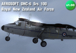
For the Aerosoft DHC-6, a Srs100, in natural metal finish - in the colors of the RNZAF.
| Filename: | RNZAF_de_Havilland_Canada_DHC6_Twin_Otter_Srs100.zip |
| License: | Freeware |
| Added: | 31st December 2012, 18:34:09 |
| Downloads: | 311 |
| Author: | Tom Weiss |
| Size: | 4.72 MB |


© 2001-2026 AVSIM Online
All Rights Reserved
Privacy Policy |