|
AVSIM Library - Search Results
|
|
Login | Register | About logging in and out
|
|
Searching for: 'military bases' in Microsoft - Flight Simulator 2004 and below.
|

|
|
|
|
|
|
Images related to this file:
|
File Description:
AFCAD2 file for Kheria Airport, Agra (India). It is a military airbase and public airport serving the city of Agra. This air force station is one of the largest air bases of Indian Air Force (IAF). Agra is also known for the famous landmark, Taj Mahal.
|
| Filename: |
viag.zip |
| License: |
Freeware |
| Added: |
28th April 2010, 13:49:16 |
| Downloads: |
1080 |
| Author: |
Deepak Blassi |
| Size: |
92kb |
|
|
File Description:
Kindley Field, on the British Overseas Territory of Bermuda, was built as a joint RAF/USAAF facility during the Second World War. Subsequently the RAF area became the civilian terminal while Kindley Air Force Base was operated by the USAF between 1948 and 1970. It was primarily a staging post between the US and Western Europe for land-based planes unable to cross the Atlantic non-stop, very like Ernest Harmon in Newfoundland and the civilian Gander, and like Harmon it closed when the jet age made such bases redundant. Prior to that it hosted no combat units, but the 59th and then 53rd Weather Reconnaissance Squadrons, the 'Hurricane Hunters', were based there, and also from 1 February 1956 to 15 June 1963 the 303rd ARS Stratotankers were present to support Strategic Air Command and other refueling requirements. After 1970 it became a US Navy facility primarily concerned with tracking Soviet submarines, and was closed at the end of the Cold War. This scenery represents Kindley between 1955 and 1962 and has custom made scenery by Dan French and ai military traffic by Al Von Pingel to add to the downloadable California Classic civilian and MATS traffic available at Tom Gibson's site. Like Harmon and Gander, it was one of the most important airfields of its time.
| Filename: |
txkf_kindley_field_1955-1962.zip |
| License: |
Freeware |
| Added: |
3rd December 2022, 13:10:38 |
| Downloads: |
110 |
| Author: |
Ken Lawson, Al Von Pingel, Dan French |
| Size: |
32359kb |
|
|
|
|
File Description:
This package contain 25 Libya military airport scenery. For fully functionality you need some object libraries (listed inside).
You can download Libyan AI repaints, and flightplans, from this site and from www.militaryaiworks.com.
Inside: HL0M AL BUMBAH NORTH, HL0O AL JUFRA, HLLB BENINA [Benghazi], HLLQ EL BEIDA [LABRAQ], HL0L GAMAL ABD EL NASSER [Tobruk], HLTD GHADAMES EAST, HLGT GHAT,HL0B MARTUBAH, HL0V MISURATA, HLLM MITIGA [UMM AITIQAH], HL0W OKBA IBN NAFA, HLLS SEBHA, HLGD SIRTE [Ghurdabiya-Sirte], HLLT GAMAL ABDEL NASSER, HL0E MATAN AS SARRA.
|
| Filename: |
laraf_scenery.zip |
| License: |
Freeware |
| Added: |
20th March 2011, 20:25:45 |
| Downloads: |
1686 |
| Author: |
Luciano Franchini |
| Size: |
3192kb |
|
|
File Description:
Military AI Works in cooperation with World of AI brings you the first part in a multipart series covering the Peruvian Air Force. This part depicts the units of three major Peruvian Air Force bases, La Joya, Lima-Callao and Piura. Credits: Models by Fernando Martinez (Mirage 2000), Pascal Suls (A-37B, with FDE work by Mike MacIntyre), Henry Tomkiewicz (L-100), Dee Waldon (DC-8) and AI Aardvark (B737) Repaints by Graham King and Dan Bourque, AFCADs and Flightplans by Dan Bourque. IMPORTANT! You need the World of AI Installer to make this package work! (WOAINS24.zip)
| Filename: |
woamil26.zip |
| License: |
Freeware |
| Added: |
31st May 2007, 11:04:13 |
| Downloads: |
14311 |
| Author: |
Dan Bourque, Military AI Works/World of AI |
| Size: |
8131kb |
|
|
File Description:
Military Base Tour � Pacific Rim (MFPR) contains 21 Flight Plans (.PLN) for flights to various military air bases along the Pacific Rim, across the Pacific to CONUS and ending at Andrews AFB/NAF where the Military Flights Series began. It is the continuation of Military Flight Plans (MF) (mf_flights.zip) published in Avsim on 29th March 2004, Military Flight Plans � Europe (MFE) (mfe_flights.zip) published in Avsim on 17th June 2004 and Military Base Tour � West Asia (MFWA) (mfwa_flights.zip) published in Avsim on 6th August 2004 and Military Base Tour � South Asia (MFSA) (mfsa_flights.zip) published in Avsim on 20th November 2004. There are a total of 128 flight plans in this Military Flight Series - Round the World Tour of Military Bases. (See Military Flights Master Itinerary� included in this .zip.) The itinerary contains a list of all the plans in the five uploaded files.) There are Briefing documents for each flight in Microsoft Word (.doc) and Text (.txt). The Flight Plans use the autopilot from takeoff to landing. The speed, altitude, weather, radios and various other controls are the pilot�s responsibility. Many landings are IFR and all are under the control of the autopilot. It is suggested that the pilot set up a separate Folder (�MFPR Flights� for example) and unzip this file there to store the .PLN and Briefing files. The .PLN can then be copied to the �Flight Simulator Files� and used to set up the flight and the Briefings printed and available for quick reference during the flight.
| Filename: |
mfpr_flights.zip |
| License: |
Freeware |
| Added: |
9th April 2005, 04:39:05 |
| Downloads: |
1376 |
| Author: |
John Resch |
| Size: |
283kb |
|
|
File Description:
RSFlightSim Shop presents you:
Military FAP AI Package
This package was created based on direct observation, the air force web site, and photos. As you understand, creating AI flightplans isn't an accurate science, so these flightplans are semi-fictional, however, they are taking in consideration the Air Force's hubs, and bases, and regular operations. Enjoy
| Filename: |
mili_fap_ai.zip |
| License: |
Freeware |
| Added: |
25th October 2007, 01:45:26 |
| Downloads: |
814 |
| Author: |
Ricardo Sousa, RSFlightSim Shop |
| Size: |
45kb |
|
|

|
File Description:
The Freightshifters 2013 brings you 9 AFCAD's for Nicaragua for FS2004 - Included in this pack are AFCAD's based on Google Earth images where possible and best guess interpretation of most of the obscure Airfields and Dirt Strips listed in FS2004. They include basic Parking, Traffic Comm's frequencies and a tower view point for all AFCAD's, also included are minor Airports and Military Bases, more Info in the Readme.
|
| Filename: |
fskm_nicaragua_afcad_pkg.zip |
| License: |
Freeware, limited distribution |
| Added: |
4th October 2013, 02:46:26 |
| Downloads: |
330 |
| Author: |
Kevin McCarthy - Freightshifters 2013 |
| Size: |
18kb |
|
|
Images related to this file:
File Description:
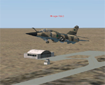
This is the final version, complete in itself and incorporating the two modifications posted separately. King Salmon is a town with a population of just under 400, on the north bank of the Naknek River and 15 miles from the sea. The airport is adjacent to the town and was originally an airforce base; the military hangars on the airport are still usable. The airport, with its long runway (11-29 and 8,500 feet with an ILS, and a second runway 18-36 and 4,000 feet) is a transportation hub for the area in general and in particular for the salmon industry. Along the Naknek River there are numerous canneries and there are also fishing lodges on the river and nearby lakes; to speed up transportation to the lodges there are float bases on the river to the south of the airport. King Salmon has three tiers of scheduled flights: Alaska Air direct from Anchorage in a 737 (passengers and cargo), PenAir (Saab turboprop) as part of their flights up and down the peninsula, and Grant Air serving nearby small towns. There are also PenAir flights, both scheduled and unscheduled, in smaller aircraft (Piper Navajo for instance) to smaller airports for the fishing season, plus cargo flights in larger aircraft by the lowest bidder (Everts and Northern). To complete the mix the AI includes a pair of F15s. The runways cross (see the airport diagram) so read the notes re long taxi routes. There is AI for PAKN, plus revised AI made for Dutch Harbor which includes flights by PenAir to King Salmon, plus revised parking for Dutch Harbor with new replacement bgls to cater for more flights. There is also AI for the float bases on the river; I have made two runways separated into two float bases for river AI, called King Salmon Floats and King Salmon River; more AI for these will be added when other scenery along the river is made. Just land according to the wind and taxi to whatever dock takes your fancy.
| Filename: |
king_salmon_v1.zip |
| License: |
Freeware, limited distribution |
| Added: |
11th April 2015, 06:20:40 |
| Downloads: |
471 |
| Author: |
Roger Wensley |
| Size: |
25090kb |
|
|
File Description:
This file contains AFCAD II for all twelve Air Mobility Command "hubs" in the continental US. They can be used alone, but are the foundation for a network of growing military AI traffic developed by Project Airlift. Plenty of parking exists for all the particular aircraft stationed at each base and plenty of parking for various sizes of visiting military traffic from other bases. All have realistic taxiway designators, but mostly fictional parking designators (based on where the parking is located relative to the reference point; e.g. northeast, south, etc.).
| Filename: |
af2_amc.zip |
| License: |
Freeware |
| Added: |
20th November 2005, 17:39:55 |
| Downloads: |
1320 |
| Author: |
Michael Hartshorn |
| Size: |
64kb |
|
|

|
File Description:
The Freightshifters 2013 brings you 32 AFCAD's for the Republic Of Congo for FS2004 (Not to be confused with the Neighbouring Democratic Republic of the Congo) - Included in this pack are AFCAD's based on Google Earth images where possible and best guess interpretation of most of the obscure Airfields and Dirt Strips listed in FS2004. They include basic Parking, Traffic Comm's frequencies and a tower view point for all AFCAD's, also included are minor Airports and Military Bases, more Info in the Readme.
|
| Filename: |
fskm_congo_afcad_pkg.zip |
| License: |
Freeware, limited distribution |
| Added: |
4th October 2013, 02:47:01 |
| Downloads: |
546 |
| Author: |
Kevin McCarthy - Freightshifters 2013 |
| Size: |
28kb |
|
  |


