|
AVSIM Library - Search Results
|
|
Login | Register | About logging in and out
|
|
Searching for: 'alaska' in Flight Simulator X - Scenery and below.
|

|
|
|
|
|
|
Images related to this file:
File Description:
The airport islocated southeast of the central business district of the vellage of Nightmute.Nightmute is located on Nelson Island near Toksook Bay. The two villages connect by snowmachine trail in winter.
Runway 2/20 was changed to 3/21. Changed the length of Runway 3/21 from 50 feet wide and a legth of 1,600 feet to 75 feet wide and 3,200 feet long.Added Runway 11/29 along with custom models.Changes are based on construction plans dated 2005.
Created with Airport Design Editor by ScruffyDuck Software using current FAA documentation and Google Earth's measurements, this package offers a replacement for FSX's stock airport. All these enhancements are as close to the real airport as I can get with stock library objects and custom buildings.
| Filename: |
igtairport.zip |
| License: |
Freeware |
| Added: |
3rd February 2015, 09:12:14 |
| Downloads: |
650 |
| Author: |
Wayne Roberts |
| Size: |
220kb |
|
|
Images related to this file:
File Description:
Koliganek Airport (IATA: KGK, ICAO: PAJZ, FAA LID: JZZ) is a state-owned, public-use airport located one nautical mile (1.85 km) east of the central business district of Koliganek,in the Dillingham Census Area of the U.S. state of Alaska. Scheduled airline service to Dillingham Airport is provided by Peninsula Airways (PenAir).The airport opened in 1997.
Increased length of runway 9/27 from 3,000 feet to 3,300 feet.Added runway 17/35 (3,300 feet and 75 feet wide). Changes were based on 2011 construction plans.
Created with Airport Design Editor 9x by ScruffyDuck Software using current FAA documentation and Google Earth measurements, this package offers a replacement for FSX's stock airport. All these enhancements are as close to the real airport as I can get with stock library objects and custom buildings.
| Filename: |
jzzairport.zip |
| License: |
Freeware |
| Added: |
25th December 2014, 01:15:29 |
| Downloads: |
580 |
| Author: |
Wayne Roberts |
| Size: |
230kb |
|
|
|
File Description:
KAUS Austin-Bergstrom International Airport. Austin, TX. Corrected all gate numbers and airline parking for Southwest, American, Delta, Jet Blue, Continental, Frontier, Alaska, United and U.S. Airways. All scenery is visible and all Jetways work. Extras added to enhance airport. All gates are correct acording to KAUS website.
| Filename: |
kaus_282220.zip |
| License: |
Freeware |
| Added: |
11th November 2010, 00:53:33 |
| Downloads: |
1791 |
| Author: |
Rob Touchtone |
| Size: |
108kb |
|
|
Images related to this file:

|
File Description:
Kavik River Camp is a remote outpost in north Alaska. Approximately 170 miles north of the Arctic Circle, the camp caters to hunters, scientists and thrill seekers during the summer months, and during winter, owner Sue Aikens upholds and maintains the site. Kavik was featured on National Geographic's "Life Below Zero".
|
| Filename: |
kavik_river_camp_x.zip |
| License: |
Freeware |
| Added: |
7th January 2016, 17:54:24 |
| Downloads: |
1000 |
| Author: |
Mark Piccolo - Soarfly Concepts |
| Size: |
4143kb |
|
|
Images related to this file:
File Description:
Kavik airstrip is part of the "Dew Line" set up as a defensive radar line in Alaska to counter the threat of a U.S.S.R attack. Made famous by the TV series "Flying Wild Alaska" and with a population of one! Completely custom built airport and objects, and even comes with a outhouse ! If you have Ultimate Terrain Alaska installed just remove the file called "cvxKAVIC_RIVER.bgl" from your scenery folder.
| Filename: |
kavik.zip |
| License: |
Freeware |
| Added: |
4th March 2011, 17:54:50 |
| Downloads: |
2044 |
| Author: |
Frits Beyer, Jacques Botha |
| Size: |
529kb |
|
|
Images related to this file:
File Description:
King Cove Airport (IATA: KVC, ICAO: PAVC, FAA LID: KVC) is a state-owned public-use airport located four miles (6 km) northeast of the central business district of King Cove, a city in the Aleutians East Borough of the U.S. state of Alaska.
King Cove Airport has one runway (7/25) with a gravel surface measuring 3,500 x 75 ft. (1,067 x 23 m). For the 12-month period ending December 31, 2005, the airport had 1,030 aircraft operations: 71% air taxi and 29% general aviation.
Changes: Increased parking apron and turn arounds at both ends of the runway. Also added additional parking and custom models. Changes were based on 2014 construction plans.Created with Airport Design Editor 9x by ScruffyDuck Software using current FAA documentation and Google Earth measurements, this package offers a replacement for FSX's stock airport. All these enhancements are as close to the real airport as I can get with stock library objects and custom buildings.
| Filename: |
kvcairport.zip |
| License: |
Freeware |
| Added: |
20th December 2014, 00:02:03 |
| Downloads: |
821 |
| Author: |
Wayne Roberts |
| Size: |
458kb |
|
|
Images related to this file:
File Description:
Kwethluk Airport has one gravel surfaced runway (18/36) measuring 3,198 by 75 ft. (975 by 23 m). The airport was relocated from its former site at coordinates 60°48.26'N 161°26.72'W which had a 1,750 by 35 ft runway (6/24) and a 5,000 x 500 ft seaplane landing area. The construction plans for 2005 moved the aircraft parking area to Runway 18/36 and removed runway 6/24.
Created with Airport Design Editor 9x by ScruffyDuck Software using current FAA documentation and Google Earth measurements, this package offers a replacement for FSX's stock airport. All these enhancements are as close to the real airport as I can get with stock library objects and custom buildings.
| Filename: |
kwtairport.zip |
| License: |
Freeware |
| Added: |
31st December 2014, 01:32:07 |
| Downloads: |
567 |
| Author: |
Wayne Roberts |
| Size: |
251kb |
|
|
Images related to this file:
|
File Description:
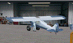
Welcome to beautiful Yakima Washington, and KYKM/McAllister Airport. For 35 years CubCrafters has been pushing the envelope
for the Piper Cub. Here in Alaska the cub is the most prized bush plane around.Be sure to stop by the factory and see what
they are working on in the hangar. Visit the McAllister Museum of Aviation, and then grab a quick bite to eat at "Reno's on
the Runway".
All runways and taxiways conform to the current FAA Airport Diagram (copy included). Some hold shorts at Runway 22 have been adjusted to conform to FSX requirements.
All the structures are new.
Thanks to Jim Dhaenens for the ASR9 radar!
|
| Filename: |
kykm.zip |
| License: |
Freeware, limited distribution |
| Added: |
26th April 2020, 02:30:36 |
| Downloads: |
326 |
| Author: |
Brett Delana |
| Size: |
5929kb |
|
|
Images related to this file:
File Description:
This scenery upgrades Koyukuk, Nulato, Kaltag and McGrath airports in Alaska. Mostly fictional additions like airport buildings, hangers, aircraft and ground vehicles and many other objects. Some taxiways were created or corrected and the larger airports recieved a new helipad with a start point and perimeter fencing. Designed to enhance adventures in Alaska. Please read the text file for installation instructions and most of all enjoy. Thank you for your interest. By Savageagle.
| Filename: |
kyu-nul-kal-pamc_upgrades.zip |
| License: |
Freeware |
| Added: |
27th November 2011, 20:08:15 |
| Downloads: |
1189 |
| Author: |
Tim Durham |
| Size: |
805kb |
|
|
File Description:
FSX Scenery - Loney's Alaska for FSX. This is a compilation of my Alaskan scenery series. This download is a rendering of 20 Alaskan airports. Some of which include, English Bay (KEB), Boswell Bay (AK97), Minchumina (PAMH), Buck Creek (AK98) and Ft Yukon (PFYU). Created with EZ Scenery, Rwy_12 and FSDS2. Please read the readme file for important information about the scenery and textures. By John B.Loney, Jr.
| Filename: |
lakfsx1.zip |
| License: |
Freeware |
| Added: |
4th January 2007, 01:03:52 |
| Downloads: |
5166 |
| Author: |
John B. Loney, Jr. |
| Size: |
1946kb |
|
  |


