
Where Flight Simulation Enthusiasts Gather from Around the World!
AVSIM Library - Search Results

| Category: Prepar3D V1-4 - Scenery | |
| Arecibo Observatory, Puerto Rico N18.20.39 W66.45.09 |

|
Images related to this file:
File Description:
Arecibo Observatory, Puerto Rico N18.20.39 W66.45.09 also known as the National Astronomy and Ionosphere Center,
National Center for Astronomy and the Ionosphere), is located about 15 km south-southwest of Arecibo, island of Puerto Rico.
It operates through Cornell University under a cooperative agreement with the National Science Foundation (a US government agency). NAIC refers more specifically to the organization that directs both the observatory and the associated laboratories
and the offices of Cornell University. The observatory is equipped with a radio telescope consisting of a 305 meter diameter
single-aperture antenna, the largest in the world up to the entry into service, in September 2016, of the 500 meter FAST radio telescope, located in the province of Guizhou. in China (soon to be realized).
It is mainly used for three large research areas: radio astronomy, atmospheric physics (using both the radio telescope and the observatory Lidar function) and the radar observation of objects in the solar system.
The telescope received further international recognition in 1999, when it began collecting data for the SETI project.Important VFR point for approaching airport of Rafael Hernandez TJBQ and airport Eugenio Maria De Hostos TJMZ.
Within the downloaded package you will find readme files for scenery installation. Good fly VFR. Pasquale Marrulli.
| Filename: | Arecibo_Observatory_Puerto_Rico_N182039___W664509.zip |
| License: | Freeware |
| Added: | 19th December 2017, 00:35:59 |
| Downloads: | 278 |
| Author: | Pasquale Marrulli |
| Size: | 1.15 KB |
| Category: Prepar3D V1-4 - Scenery | |
| Guizhou Observatory Cina N25.39.10 E106.51.23. |
|
Images related to this file:
File Description:
Guizhou Observatory Cina N25.39.10 E106.51.23. The Five-hundred-meter Aperture Spherical radio Telescope Cina, is a radio telescope located in the Dawodang depression, a natural basin in Pingtang County, Guizhou Province, southwest China. It consists of a fixed 500 m (1,600 ft) diameter dish constructed in a natural depression in the landscape. It is the world's largest filled-aperture radio telescope, and the second-largest single-dish aperture after the sparsely-filled RATAN-600 in Russia (soon to be realized). It has a novel design, using an active surface made of metal panels that can be tilted by a computer to help change the focus to different areas of the sky. The cabin containing the feed antenna suspended on cables above the dish is also moved using a digitally-controlled winch by the computer control system to steer the instrument to receive from different directions. Important VFR point.
Within the downloaded package you will find readme files for scenery installation. Good fly VFR. Pasquale Marrulli.
| Filename: | Guizhou_Observatory_Cina_N253910_E1065123.zip |
| License: | Freeware |
| Added: | 19th December 2017, 18:05:32 |
| Downloads: | 129 |
| Author: | Pasquale Marrulli |
| Size: | 1.38 KB |
| Category: Prepar3D V1-4 - Scenery | |
| Palmanova Friuli Udine N45.54.17 E13.18.37. |
|
Images related to this file:
File Description:
Palmanova Friuli Udine N45.54.17 E13.18.37. City fortress planned by the Venetians in 1593, is called the "starred city"
for its polygonal star-shaped plan with 9 points. Since 1960 the historic city is a national monument. Since 9 July 2017
the fortress of Palmanova has become part of the Unesco world heritage. In 1866 Palmanova was annexed to the Kingdom of Italy. During the First World War the fortress was a sorting and supply center for the troops on the Isonzo, as well as a field hospital. After the route of Caporetto Palmanova it was set on fire by the retreating Italian troops. At the end
of the Second World War, the inhabitants of Palmanova with the help of the Curia made the retreating Germans withdraw from the decision to make the deposits of ammunition and explosives shine, an operation that would probably have caused the destruction of much of the city. By decree of the President of the Republic in 1960 Palmanova was proclaimed a national monument. Important VFR point for approaching airport Trieste Ronchi dei Legionari (LIPQ).
Within the downloaded package you will find readme files for scenery installation. Good fly VFR. Pasquale Marrulli.
| Filename: | Palmanova_Friuli_Udine_N455417_E131837.zip |
| License: | Freeware |
| Added: | 20th December 2017, 16:43:45 |
| Downloads: | 270 |
| Author: | Pasquale Marrulli |
| Size: | 4.25 KB |
| Category: Prepar3D V1-4 - Scenery | |
| Udine Friuli Venezia Giulia Italy N46.3.85 E13.14.19. |
|
Images related to this file:
File Description:
Udine Friuli Venezia Giulia Italy N46.3.85 E13.14.19. The city is located in the center of the Friuli region. It is just over 20 km from Slovenia and about 54 km from Austria. This puts it in a strategic position, at the intersection of the East-West European Corridors (Corridor V or Mediterranean) and North-South (Via Iulia Augusta, now recognized by the European Union as part of the Baltic-Adriatic Corridor) , on the way to Austria and to Eastern Europe. It rises in the high plains, around an isolated hill (according to the legend built by Attila to admire the fire that he himself caused to the city of Aquileia, but in reality is formed by conglomeratic rocks more than 100,000 years old), on top of which the castle is located, a few kilometers from the hilly belt, and is bordered by the Cormor torrent to the west and the Torre torrent to the east. Important VFR point for approaching airport Trieste Ronchi dei Legionari (LIPQ) and airporto Udine Boscomantico (LIPD).
Within the downloaded package you will find readme files for scenery installation. Good fly VFR. Pasquale Marrulli.
| Filename: | Udine_Friuli_Venezia_Giulia_Italy_N46385_E131419.zip |
| License: | Freeware |
| Added: | 21st December 2017, 17:40:48 |
| Downloads: | 261 |
| Author: | Pasquale Marrulli |
| Size: | 3.11 KB |
| Category: Prepar3D V1-4 - Scenery | |
| Bethlemme Palestine N31.42.15 E35.12.24 |
|
Images related to this file:
File Description:
Bethlemme Palestine N31.42.15 E35.12.24 For the anniversary of the Holy Christmas I wanted to create the scenery of the city of Bethlehem with the Basilica of the Nativity and the square in front of the basilica where it is possible to land with a elicopter. Within the downloaded package you will find readme files for scenery installation. Good fly VFR. Pasquale Marrulli.
| Filename: | Bethlemme_Palestine_N314215_E351224.zip |
| License: | Freeware |
| Added: | 22nd December 2017, 18:14:20 |
| Downloads: | 122 |
| Author: | Pasquale Marrulli |
| Size: | 1.36 KB |
| Category: Prepar3D V1-4 - Scenery | |
| EBBL Kleine Brogel AB v4.2 for P3Dv4_UPDATE |
|
File Description:
This is an UPDATE for my EBBL Kleine Brogel v4.0 for P3Dv4 .
| Filename: | EBBL_Kleine_Brogel_AB_v42_for_P3Dv4_UPDATE.zip |
| License: | Freeware |
| Added: | 24th December 2017, 18:07:00 |
| Downloads: | 589 |
| Author: | Peter ZIEGLER |
| Size: | 5.32 MB |
| Category: Prepar3D V1-4 - Scenery | |
| X3TN RAF Watton (P3D V4) |
|
File Description:
This is the P3Dv4 scenery of X3TN RAF Watton .
Merry Christmas and HappyNewyear
| Filename: | X3TN_RAF_Watton_P3D_V4.zip |
| License: | Freeware |
| Added: | 25th December 2017, 19:37:43 |
| Downloads: | 374 |
| Author: | Peter ZIEGLER (ZZIP) |
| Size: | 2.89 MB |
| Category: Prepar3D V1-4 - Scenery | |
| Skellig Islands N51.46.13 W10.32.16 |
|
File Description:
Skellig Islands N51.46.13 W10.32.16 consists of 3 islets the largest named Michael is located about 17 km from the coasts of Kerry, Ireland, is a place of considerable importance both in terms of landscape and nature, but especially for the presence on the its summit of an extraordinary as inaccessible monastery of Christian origin built in 588 and became a UNESCO World Heritage Site in 1996.The island also has a small (EISK) heliport and seaplane approac which you will find in the package.
Important VFR point for approaching airport Ireland from Atlantic Ocean.
Within the downloaded package you will find readme files for scenery installation. Good fly VFR. Pasquale Marrulli.
| Filename: | Skellig_Islands_N514613_W103216.zip |
| License: | Freeware |
| Added: | 30th December 2017, 19:11:38 |
| Downloads: | 146 |
| Author: | pasquale marrulli |
| Size: | 2.53 KB |
| Category: Prepar3D V1-4 - Scenery | |
| Grise Fiord Airport (CYGZ) N76.25.34 W82.54.36 |
|
File Description:
Grise Fiord Airport (CYGZ) N76.25.34 W82.54.36 is located in the Qikiqtaaluk Region of the territory of Nunavut, and is one of the northernmost inhabited settlements of Canada and the whole world. The scenario shows the airport infrastructure and the small town not far from the airport. This scenario goes to fill the absence of scenarios towards the North Pole. The airport is open only in the mei that go from August to October where it is practically possible to land considering also the proximity of mountains remains one of the most difficult and dangerous airports.
Within the downloaded package you will find readme files for scenery installation. Good fly VFR. Pasquale Marrulli.
| Filename: | Grise_Fiord_Airport_CYGZ_N762534_W825436.zip |
| License: | Freeware |
| Added: | 30th December 2017, 19:14:28 |
| Downloads: | 149 |
| Author: | Pasquale Marrulli |
| Size: | 2.97 KB |
| Category: Prepar3D V1-4 - Scenery | |
| KCIR, Cairo Regional Airport |
|
Images related to this file:
File Description:
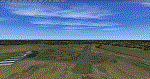
KCIR is a public use, two runway airport located 4 miles NW of Cairo, IL. Runway 14/32 is an asphalt runway 4001x100 feet long and Runway 2/20 is an asphalt runway 3200x60 feet long.
| Filename: | KCIR_Cairo_Regional_Airport.zip |
| License: | Freeware |
| Added: | 1st January 2018, 03:12:21 |
| Downloads: | 339 |
| Author: | Shannan Landreth |
| Size: | 44.28 MB |


© 2001-2026 AVSIM Online
All Rights Reserved
Privacy Policy |