
Where Flight Simulation Enthusiasts Gather from Around the World!
AVSIM Library - Search Results

| Category: Flight Simulator X - Scenery | |
| VTBS - Suvarnabhumi Intl - Bangkok, Thailand **Custom Airport Background** |

|
Images related to this file:
File Description:
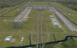
Provided is an airport background for Ray Smith's VTBS - Suvarnabhumi Intl - Bangkok, Thailand airport. This custom background can be easily added without disturbing the original airport, and it will also resolve water canal scenery conflicts for FTX Vector users. This background should work for all users, but it is optimized to take advantage of FTX Vector, and the airport road/highway system is now connected with all of the FTX Vector roads. Scenery was created using SBuilderX 3.13 and the FSX Object Placement Tool.
This scenery requires Ray Smith's VTBS - Suvarnabhumi Intl "fsx_vtbs_v1.5_rs.zip".
| Filename: | VTBS__Suvarnabhumi_Intl__Bangkok_Thailand_Custom_A.zip |
| License: | Freeware |
| Added: | 5th January 2015, 00:31:57 |
| Downloads: | 5,464 |
| Author: | Carlyle Sharpe |
| Size: | 1.32 MB |
| Category: Flight Simulator X - Scenery | |
| Inezgane Air Base (GMAA) |
|
File Description:
Inezgane Airport or Agadir Inezgane Airport (ICAO: GMAA) is an airport in Agadir, the capital city of the Souss-Massa region in Morocco. The airport is located approximately 14 km (9 mi) northwest of Agadir's Al Massira Airport.After being replaced by the Al Massira airport for civilian service, it is now a Royal Moroccan Air Force air base. This scenery is been made as part of the Moroccan Project, an endeavour launched by the Moroccan Virtual Air Association with the purpose of representing a realistic Morocco on your personal Flight Simulator. For more information visit vamaroc.com
| Filename: | Inezgane_Air_Base_GMAA.zip |
| License: | Freeware |
| Added: | 29th December 2021, 04:12:54 |
| Downloads: | 285 |
| Author: | Moroccan Virtual Air Association |
| Size: | 14.9 MB |
| Category: Flight Simulator X - Scenery | |
| GMAD - Hassan I Airport |
|
File Description:
Hassan I Airport (Spanish: Aeropuerto de el Aaiun, French: Aeroport de Laayoune) (IATA: EUN, ICAO: GMML/GSAI) is an airport serving El Aaiun, the capital city of Western Sahara. The airport is named for Hassan I of Morocco.
It is operated by the Moroccan state-owned company ONDA. Due to the particular political situation of Western Sahara, this airport appears in the Moroccan AIP as GMML and in the Spanish AIP as GSAI.
This work is dedicated to West Wind Airlines.
| Filename: | GMAD__Hassan_I_Airport.zip |
| License: | Freeware |
| Added: | 23rd March 2013, 00:01:39 |
| Downloads: | 4,357 |
| Author: | Anwar Gonzalez |
| Size: | 12.11 MB |
| Category: Flight Simulator X - Scenery | |
| GMTT, Tangier Ibn Batouta Airport, Morocco |
|
Images related to this file:
File Description:
New detailed setup with ADE. Only tested in FSX.
Tangier Ibn Batouta Airport is named after Ibn Battouta (1304–1368), a Moroccan traveler and scholar who was born in Tangier. A new airport terminal was opened in 2008 to provide for more flights and increased passenger capability, as Tangier has grown rapidly and modernised. The airport is certified by ISO 9001/2000 quality standards. The airport handled over 856,818 passengers in the year 2015.
| Filename: | GMTT_Tangier_Ibn_Batouta_Airport_Morocco.zip |
| License: | Freeware |
| Added: | 15th October 2017, 17:45:24 |
| Downloads: | 2,310 |
| Author: | Tim van Ringen |
| Size: | 165.75 KB |
| Category: Flight Simulator X - Scenery | |
| Morocco VFR - Terrain Mesh SRTM 1 Arc/Sec version 3 - Volume 01 |
|
Images related to this file:
File Description:
Enhanced Terrain Mesh from data souce SRTM 1 Arc/Sec (30 meters) version 3 at LOD 11 (19mt meters/pixel). Coverage: Lat 31 to 37. Fully compatible also with P3D.
| Filename: | Morocco_VFR__Terrain_Mesh_SRTM_1_ArcSec_version_3_.zip |
| License: | Freeware |
| Added: | 22nd March 2015, 00:24:59 |
| Downloads: | 2,303 |
| Author: | Giovanni Miduri |
| Size: | 415.75 MB |
| Category: Flight Simulator X - Scenery | |
| Morocco VFR - Terrain Mesh SRTM 1 Arc/Sec version 3 - Volume 02 |
|
Images related to this file:
File Description:
Enhanced Terrain Mesh from data souce SRTM 1 Arc/Sec (30 meters) version 3 at LOD 11 (19mt meters/pixel). Coverage: Lat 27 to Lat 31. Fully compatible also with P3D.
| Filename: | Morocco_VFR__Terrain_Mesh_SRTM_1_ArcSec_version_3_.zip |
| License: | Freeware |
| Added: | 22nd March 2015, 17:54:09 |
| Downloads: | 1,675 |
| Author: | Giovanni Miduri |
| Size: | 279.12 MB |
| Category: Flight Simulator X - Scenery | |
| GMFO_Oujda_2025 |
|
File Description:
FSX Scenery GMFO_Oujda (MAROCCO) (created with ADE & SketchUp 2017)
This scenery was built from the official maps for the runway and taxiways with Google Maps as a background image as support. The different signs were positioned without any documentation or references.
| Filename: | GMFO_Oujda_2025.zip |
| License: | Freeware |
| Added: | 4th February 2025, 20:00:45 |
| Downloads: | 135 |
| Author: | Serge Libon |
| Size: | 6.28 MB |
| Category: Flight Simulator X - Scenery | |
| Melbourne Airport, also known as Tullamarine Airport - YMML - Victoria, Australia |
|
Images related to this file:
File Description:
This is a reasonably accurate and up-to-date version of Melbourne Intl airport with two optional files and made only for FSX users, do not use in P3D: There is one version with the Crosswind runway operating where both runways will be used for takeoff/landing and one version as the default airport runway operation, all terminals and their piers rebuilt with something better than the stock airport, assigned parking as per their website with extra parking, all taxiways and taxi signs updated to the latest charts, new control tower, fire training ground also included, support vehicle roads rebuilt, extra fuel trucks and many other scenery improvements and objects added, airport views are from the roof the new control tower (when in tower view) please view the readme before installation.
| Filename: | Melbourne_Airport_also_known_as_Tullamarine_Airpor.zip |
| License: | Freeware, limited distribution |
| Added: | 26th February 2020, 18:04:36 |
| Downloads: | 42,425 |
| Author: | Ray Smith |
| Size: | 3.33 MB |
| Category: Flight Simulator X - Scenery | |
| MYSM - San Salvador, The Bahamas |
|
Images related to this file:
File Description:

This airport is convenient to Club Med and the site where Christopher Columbus came ashore in the new world in 1492. The scenery includes custom scenery objects, placement of library objects and landclass changes. Scenery is based on Google Earth, Bing Maps and photos taken locally, and it is optimized for use with UTX-TAC. If you have Jim Dhaenens' lightobj.bgl installed, apron lighting will be included.
| Filename: | MYSM__San_Salvador_The_Bahamas.zip |
| License: | Freeware |
| Added: | 4th September 2013, 20:20:04 |
| Downloads: | 1,651 |
| Author: | Art Poole |
| Size: | 1.22 MB |
| Category: Flight Simulator X - Scenery | |
| MYLS - Stella Maris Airport - The Bahamas |
|
Images related to this file:
File Description:
Stella Maris is the northernmost of two airports on Long Island served by Bahamas Air, Southern Air, Pineapple Air and others. The scenery includes custom scenery objects; placement of library objects and landclass changes. Scenery is based on Bing Maps and photos taken locally, and it is optimized for use with UTX-TAC.
| Filename: | MYLS__Stella_Maris_Airport__The_Bahamas.zip |
| License: | Freeware |
| Added: | 8th May 2013, 21:16:44 |
| Downloads: | 1,066 |
| Author: | Art Poole |
| Size: | 1.38 MB |


© 2001-2026 AVSIM Online
All Rights Reserved
Privacy Policy |