
Where Flight Simulation Enthusiasts Gather from Around the World!
AVSIM Library - Search Results

| Category: Flight Simulator X - Scenery | |
| MPTO - Tocumen Intl Airport - Panama City, Panama |

|
Images related to this file:
File Description:
This airport update is for MPTO and made only for FSX: assigned parking now updated as per their website with extra parking, the main terminal completely rebuilt including the new northern terminal with 12 additional gates, the cargo ramp updated, helipads with start location, taxiways and taxi signs updated to the latest charts, extra fuel trucks, support vehicle roads rebuilt and many other scenery improvements, airport views are from the roof of the control tower (when in tower view) please view the readme before installation.
| Filename: | MPTO__Tocumen_Intl_Airport__Panama_City_Panama.zip |
| License: | Freeware, limited distribution |
| Added: | 2nd January 2016, 14:15:56 |
| Downloads: | 18,366 |
| Author: | Craig Scott |
| Size: | 1.35 MB |
| Category: Flight Simulator X - Scenery | |
| PAFA Fairbanks International |
|
Images related to this file:
File Description:
Completely re-done. Photo-textured custom terminal and tower. Custom buildings and ground markings. Rwys 1x/19x updated to rwys 2x/20x. The float plane pond is well stocked.
| Filename: | PAFA_Fairbanks_International.zip |
| License: | Freeware |
| Added: | 17th September 2016, 04:37:28 |
| Downloads: | 2,127 |
| Author: | Sidney Schwartz |
| Size: | 14.26 MB |
| Category: Flight Simulator X - Scenery | |
| CYBA - Banff Airfield |
|
File Description:
Welcome to Beautiful Banff - CYBA :)
Banff is the largest town in Banff National Park, in Alberta's Rockies, Canada. It is also the first incorporated municipality located within a national park in Canada. At 1,463 m (4,800 ft), it is the town with the highest elevation in Canada.
It is surrounded by mountains, notably Mount Rundle, Sulphur Mountain, Mount Norquay, and Cascade Mountain and situated above Bow Falls near the junction of the Bow and Spray Rivers. Banff is located 126 km (78 mi) west of Calgary and 58 km (36 mi) east of Lake Louise, on the Trans-Canada Highway. The Town is a member of the Calgary Regional Partnership.
I have put a little " winter life" in this awesome airfield. 2 fuel parking, Helipad and more....
Hope you'll enjoy the scenery on final landing! ;)
No A.I set up!
| Filename: | CYBA__Banff_Airfield.zip |
| License: | Freeware |
| Added: | 11th March 2009, 01:08:10 |
| Downloads: | 1,846 |
| Author: | Daniel Louvet |
| Size: | 384.91 KB |
| Category: Flight Simulator X - Scenery | |
| Project OTHH - Hamad International Airport (New Doha), Qatar |
|
Images related to this file:
File Description:
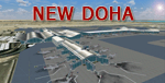
Hamad International Airport (New Doha). Ground surrounding is photoreal captured with FS Earth Tiles. It includes GMAX Main terminal, Concourses A, B, C, Tower, biggest hangars. All additional objects have been placed with Instant Scenery 2 from (Flight 1). Airport ground textures are made with SBuilderX & FS Earth Tiles. Dedicated AFCAD is set to "OTBD" ICAO to use actual AI Flightplans. Include official OTHH ATC frequencies, rwy lightning, runway settings, ILS, and approaches and many other surprises... Visit my web site www.christophebouville.com
| Filename: | Project_OTHH__Hamad_International_Airport_New_Doha.zip |
| License: | Freeware, limited distribution |
| Added: | 5th October 2013, 18:28:56 |
| Downloads: | 42,630 |
| Author: | Christophe Bouville |
| Size: | 54.41 MB |
| Category: Flight Simulator X - Scenery | |
| Mitiga International Airport HLLM for FSX |
|
File Description:
This Addon for FSX, Currently the most realistic and best addon for MAITIGA airport.
Changes:
- APT position aligned.
- Correct Taxiway designators.
- Corrected stands and thier positions.
and many...
[email protected]
| Filename: | Mitiga_International_Airport____HLLM_for_FSX.zip |
| License: | Freeware |
| Added: | 12th February 2019, 15:47:59 |
| Downloads: | 615 |
| Author: | Hamza Aswaid |
| Size: | 58.28 MB |
| Category: Flight Simulator X - Scenery | |
| FAOR - Johannesburg Intl Airport, South Africa |
|
Images related to this file:
File Description:
This scenery is a very accurate version for O.R.Tambo Intl airport and created only for FSX: all terminals and gates bought up to date to reflect todays situation, assigned parking as per their website, taxiways and taxi signs updated to the latest charts, extra fuel trucks, support vehicle roads rebuilt and many other scenery improvements and objects added, airport views are from the roof the control tower (when in tower view) please view the readme before installation.
| Filename: | FAOR__Johannesburg_Intl_Airport_South_Africa.zip |
| License: | Freeware, limited distribution |
| Added: | 3rd June 2017, 02:33:51 |
| Downloads: | 38,795 |
| Author: | Ray Smith |
| Size: | 1.66 MB |
| Category: Flight Simulator X - Scenery | |
| Western Sahara VFR - Terrain Mesh SRTM 1 Arc/Sec version 3 |
|
Images related to this file:
File Description:
Enhanced Terrain Mesh from data source NASA SRTM 1 Arc/Sec (30 meters) version 3 at LOD 11 (19mt meters/pixel). Coverage: Lat 28 to Lat 20. Re-design coastline of the Western Sahara and replaced Dakhla Airport (GMMH). Fully compatible also with P3D.
| Filename: | Western_Sahara_VFR__Terrain_Mesh_SRTM_1_ArcSec_ver.zip |
| License: | Freeware |
| Added: | 27th April 2015, 12:58:28 |
| Downloads: | 924 |
| Author: | Giovanni Miduri |
| Size: | 373.13 MB |
| Category: Flight Simulator X - Scenery | |
| DAAE - Bejaia, Algeria - VFR |
|
Images related to this file:
File Description:
fly one of the most beautiful coast in the East part of Algeria.
This scenery has a High resolution ground texture.
The city of Bejaia
West part (Yemma gouraya - Cap Carbon - Pic des singes - zegwatt creeq)
to the East (Touristic zone Capritour) - Tichy - Aowkas - souk ett'nine and Malbou Beach
Includes also night texture
| Filename: | DAAE__Bejaia_Algeria__VFR.zip |
| License: | Freeware |
| Added: | 25th April 2013, 20:35:00 |
| Downloads: | 4,005 |
| Author: | Zoheir BENMERADI |
| Size: | 97.76 MB |
| Category: Flight Simulator X - Scenery | |
| Charles-De-Gaulle Intl Airport (LFPG) Paris, France |
|
Images related to this file:
File Description:
This is an accurate and up-to-date version of Charles De Gaulle Intl Airport and made only for FSX, do not use in P3D: All terminals and jetways now updated to reflect today's situation, assigned parking as per their website with extra parking including many gates for the A380, taxiways and taxi signs updated to the latest charts, updated approaches where needed, extra fuel trucks, the strangely textured building at the south cargo apron N has now been replaced, support vehicle roads rebuilt and many other scenery improvements and objects added, airport views are from inside the control tower (when in tower view) please view the readme before installation.
| Filename: | CharlesDeGaulle_Intl_Airport_LFPG_Paris_France.zip |
| License: | Freeware, limited distribution |
| Added: | 13th April 2018, 05:34:15 |
| Downloads: | 53,263 |
| Author: | Ray Smith |
| Size: | 5.63 MB |
| Category: Flight Simulator X - Scenery | |
| LOXA Aigen im Ennstal |
|
Images related to this file:
File Description:
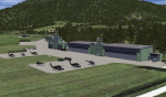
The military airport Aigen im Ennstal is a base of Austrian Airforce. It is primarily a base of Military helicopters.
Also, however, this airstrip is also used by the GRIMMING flight group.
I tried to reproduce the character of LOXA as well as possible.
The surroundings are adapted by landclasses. Aigen, surrounding villages and important roads are built-in.
The airport has a photo background in four variants, each adapted to the four seasons spring / summer, autumn and winter.
The buildings in this scenery are quite similar to the originals. I used the beautifull objekts of Kalle, who already designed this airport for XPlane in a very nice way.
| Filename: | LOXA_Aigen_im_Ennstal.zip |
| License: | Freeware |
| Added: | 17th December 2016, 07:52:44 |
| Downloads: | 1,489 |
| Author: | Wolfgang Allers |
| Size: | 236.7 MB |
© 2001-2026 AVSIM Online
All Rights Reserved
Privacy Policy |