
Where Flight Simulation Enthusiasts Gather from Around the World!
AVSIM Library - Search Results

| Category: Flight Simulator X - Scenery | |
| ACG RAF Wattisham 1991 - Seasonal Edition |

|
Images related to this file:
File Description:
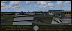
Seasonal version of our RAF Wattisham 1991 scenery. This version is only compatible with Orbx FTX England, it is not compatible with the default FSX seasons but can still be used if one wishes. It is also (with a bit of work) compatible with FSX Steam Edition and P3D V2.1.
Free 3rd party software called SODE is 100% required for seasonal changes, it will not function without it.
This is a full scenery the Wattisham we released in January is not required.
| Filename: | ACG_RAF_Wattisham_1991__Seasonal_Edition.zip |
| License: | Freeware, limited distribution |
| Added: | 14th June 2015, 18:53:13 |
| Downloads: | 1,149 |
| Author: | Pete Beeby, John Young, Stephen Legg, Airfield Construction Group |
| Size: | 342.2 MB |
| Category: Flight Simulator X - Scenery | |
| FSX Grand Junction Airport [KGJT] |
|
Images related to this file:
File Description:

Welcome to Grand Junction Colorado Regional Airport (KGJT) for FSX!
All the structures are custom. Airport vehicles use
the proper vehicle paths and do not use taxiways.
As with all my work the structures are original work.
Three scenery complexity levels are used (normal,dense, and very dense). More eye candy appears with each
increase.
| Filename: | FSX_Grand_Junction_Airport_KGJT.zip |
| License: | Freeware, limited distribution |
| Added: | 27th March 2020, 19:53:29 |
| Downloads: | 481 |
| Author: | Brett Delana |
| Size: | 3.42 MB |
| Category: Flight Simulator X - Scenery | |
| KHIB - Range Regional (Hibbing) Airport - Hibbing, Minnesota |
|
Images related to this file:
File Description:
FSX Scenery - Range Regional Airport (IATA: HIB, ICAO: KHIB, FAA LID: HIB) is a public use airport located four nautical miles (5 mi, 7 km) southeast of the central business district of Hibbing, in Saint Louis County, Minnesota, United States. It was formerly known as Chisholm-Hibbing Airport or Chisholm-Hibbing Municipal Airport. The airport is mostly used for general aviation but is also served by one commercial and one charter airline. Scheduled passenger service is subsidized by the Essential Air Service program. Created for your flying pleasure by John B. Loney, Jr.
| Filename: | KHIB__Range_Regional_Hibbing_Airport__Hibbing_Minn.zip |
| License: | Freeware, limited distribution |
| Added: | 29th July 2014, 11:43:33 |
| Downloads: | 498 |
| Author: | John B. Loney, Jr. |
| Size: | 15.58 MB |
| Category: Flight Simulator X - Scenery | |
| FSX - Barnstable Municipal Airport KHYA |
|
Images related to this file:
File Description:
FSX Scenery - Barnstable Municipal Airport (IATA: HYA, ICAO: KHYA, FAA LID: HYA), also known as Boardman/Polando Field, is a public airport located on Cape Cod, one mile (1.6 km) north of the central business district of Hyannis, in Barnstable County, Massachusetts, United States. This airport is publicly owned by the Town of Barnstable. It is Cape Cod's major airport as well as an air hub for the Cape and the Islands (Martha's Vineyard and Nantucket). The airport is served by scheduled commercial flights as well as charters and general aviation. This is a total re-do of my FS9 scenery. For you flight sim flying pleasure by John B. Loney, Jr.
| Filename: | FSX__Barnstable_Municipal_Airport_KHYA.zip |
| License: | Freeware, limited distribution |
| Added: | 19th March 2017, 18:23:44 |
| Downloads: | 673 |
| Author: | John B. Loney, Jr. |
| Size: | 36.46 MB |
| Category: Flight Simulator X - Scenery | |
| cyvc Barber Field Airport La Ronge , Canada |
|
File Description:
Located in the northen Part of Saskatchewan This airport is postion to bing maps cord also comes with a updated airport chart for taxing and runway. custom building some made by me a few from greg-fs2004 scenery cant remeber his last name sorry. This is V1.1 release please read the readme for install and for extra information regarding scenery
| Filename: | cyvc_Barber_Field_Airport_La_Ronge__Canada.zip |
| License: | Freeware |
| Added: | 12th January 2020, 05:18:12 |
| Downloads: | 274 |
| Author: | James Charles |
| Size: | 24.07 MB |
| Category: Flight Simulator X - Scenery | |
| Lafayette Louisiana USA Regional Airport |
|
Images related to this file:
File Description:
Lafayette Louisiana USA Regional Airport for FSX. Several improvements have been made to the default airport. The default terminal building has been replaced with a custom building created in FSDS; aircraft gates have been correctly coded using Airport Design Editor 1.70.6042; a new airport vehicle network has been built to prevent airport vehicles from entering the taxiways; extra fuel trucks have been added throughout the airport; the tower view has been changed to display from the roof of the control tower; static FedEx and UPS scenery objects have been placed throughout the airport; all taxiway signs are correctly placed and all taxiway designators are correctly named; there is the option to open both runways to AI traffic; the ILS for Runway 4R has been added; optionally, a set of GA flight plans is included using all default FSX aircraft to liven up the GA area; and Jim Dhaenen's excellent ramp lights are also included. Please read the README.txt file to insure proper installation of all files.
| Filename: | Lafayette_Louisiana_USA_Regional_Airport.zip |
| License: | Freeware, limited distribution |
| Added: | 2nd November 2017, 17:58:44 |
| Downloads: | 693 |
| Author: | Patrick Finch |
| Size: | 3.09 MB |
| Category: Flight Simulator X - Scenery | |
| KLAW - Fort Sill Regional / Lawton Muni - Oklahoma, USA |
|
Images related to this file:
File Description:
FSX Scenery - Lawton Fort Sill Regional Airport (IATA: LAW[2], ICAO: KLAW, FAA LID: LAW) is a city owned airport two miles south of Lawton, in Comanche County, Oklahoma. It is used for military aviation from nearby Fort Sill and Sheppard Air Force Base and is served by American Eagle. Allegiant Air runs occasional charters to various destinations in the western United States. The National Plan of Integrated Airport Systems for 2011-2015 categorized it as a primary commercial service airport. Federal Aviation Administration records say the airport had 77,533 passenger boardings (enplanements) in calendar year 2008, 71,389 in 2009 and 68,054 in 2010. The 2013 Federal sequester will result in the closure of the airport's control tower and will require pilots to rely on air traffic controllers from other area airports. For your flying pleasure by John B. Loney, Jr.
| Filename: | KLAW__Fort_Sill_Regional__Lawton_Muni__Oklahoma_US.zip |
| License: | Freeware, limited distribution |
| Added: | 19th August 2015, 20:58:38 |
| Downloads: | 600 |
| Author: | John B. Loney, Jr. |
| Size: | 12.61 MB |
| Category: Flight Simulator X - Scenery | |
| Lewiston-Nez Perce County Airport [KLWS] |
|
Images related to this file:
File Description:
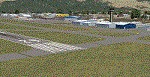
Welcome to the Lewiston-Nez Perce County Airport in northern Idaho [KLWS] for FSX!
I have added the new tie-down area, taxiways (Z,Z1, and Z2), and the new Airport Operations
Facility located south of runway 08/26.
All the structures are custom. Airport vehicles use
the proper vehicle paths and do not use taxiways.
I have included a Traffic bgl that will add a number of AI flights into and out of Lewiston to other nearby
destinations. If you don't want that feature just delete the KLWS Traffic.bgl file in the scenery folder.
As with all my work the structures are original work.
Three scenery complexity levels are used (normal,dense, and very dense). More eye candy appears with each
increase.
| Filename: | LewistonNez_Perce_County_Airport_KLWS.zip |
| License: | Freeware, limited distribution |
| Added: | 10th April 2020, 15:46:08 |
| Downloads: | 185 |
| Author: | Brett Delana |
| Size: | 3.64 MB |
| Category: Flight Simulator X - Scenery | |
| KMMH, Mammoth Yosemite Airport |
|
Images related to this file:
File Description:
Complete new setup, framerate friendly from top-down images and with default objects. The airport is seven miles east of Mammoth Lakes and is mainly used for general aviation, but also for some scheduled passenger flights.
| Filename: | KMMH_Mammoth_Yosemite_Airport.zip |
| License: | Freeware |
| Added: | 30th December 2017, 19:17:08 |
| Downloads: | 551 |
| Author: | Tim van Ringen |
| Size: | 239.56 KB |
| Category: Flight Simulator X - Scenery | |
| KMOT, Minot International Airport, North Dakota USA |
|
Images related to this file:
File Description:
Complete new setup, done with ADE, from top-down images. Minot International Airport is a non-hub primary public airport. The Airport is owned and operated by the City of Minot.
| Filename: | KMOT_Minot_International_Airport_North_Dakota_USA.zip |
| License: | Freeware |
| Added: | 4th December 2017, 14:50:12 |
| Downloads: | 631 |
| Author: | Tim van Ringen |
| Size: | 173.44 KB |


© 2001-2026 AVSIM Online
All Rights Reserved
Privacy Policy |